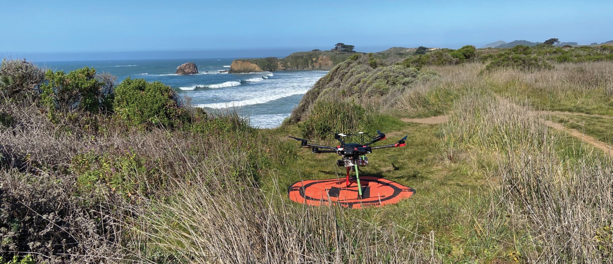
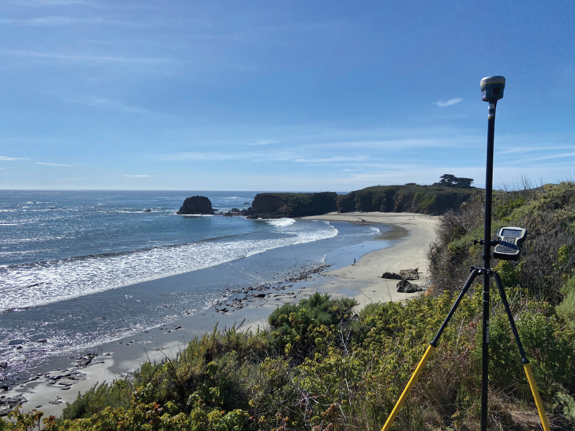
I know it sounds like the start an old Victorian Era novel, but it really was a cold, overcast morning, much like most mornings along California’s central coast. There was a light wind as we stood at the edge of the cliff side looking down on the crashing waves. If today was going to be like it was yesterday, we would need to get the drone in the air or we would have no chance against the strong gusts that would come mid-day. The top of the hill where we stood perched had a great view of Andrew Molera State Park and the Big Sur River. A grove of Eucalyptus some 2,400 feet could be seen across the thick brush below, hiding Cooper’s Cabin, the oldest building on the Big Sur area of the California coast. The trees were a visual waypoint for what was the far extents of the area to be flown. Matrice 600 heavy lift drone with the Riegl Mini-VUX would be barely visible that far away, but visible none the less. We had already covered approximately half of the total 160 acres we were sent out to collect. With my trusty visual observer ready, we took to the sky and began collecting data. This quiet park, known for its beautiful landscapes and history was about to be buzzing with the sound of 6 propellers chopping through the sky.
Why were we there to disturb the peace and beauty of the Big Sur? Well, it was because of Mother Nature herself. Right in the middle of Andrew Molera State Park is the Big Sur River, draining from the coastal mountains just to the east and right into the Pacific Ocean. This made the park a “must-go” camping location. Campsites were originally set at a safe distance from the river. At least until Mother Nature decided to up and move the river. A series of heavy winter storms had recently avulsed the river almost 250’ from its original location and the erosion was starting to become an issue with the campsites. A plan would be needed to keep the river from further causing campers to lose their coveted spots forever. Environmental engineers would need to evaluate both where the river had been, and where the river was going in order to create solutions to arrest the movement.
When dealing with the river, it was not just the immediate area surrounding it that would need to be mapped. The engineers would need mapping of the entire watershed around the area. This would expand the survey limits to almost 160 acres of heavily vegetated, sloping terrain. Conditions that would heavily favor a drone LiDAR system. With the area set, it was time to collect the data.
The park is about 22 miles south of the City of Monterey, along the winding coastal road of California Highway 1. Chock full of some of the most iconic viewpoints, bridges, and cliffsides of the whole west coast. This would be one of the best commutes to a job site we had ever experienced. Everyday there was something new to see. Unfortunately, we would finally reach the park and have to work, but the park offered just as much beauty and views as the drive to it. The park was part of the historic land settled by Frances Molera and grandfather of the park’s namesake Andrew. This land was granted to Frances as part of the Rancho El Sur land grant granted in 1834. The park was not only beautiful, but had a rich history behind it as we would later find out while working there. Fun fact, Andrew Molera is credited with popularizing the artichoke in California, convincing farmers in the nearby town of Castroville to grow it and it becoming a major crop in the Salinas Valley. Anyway, back to the story. We would set up a GNSS base station in the most open area of the park, which happened to be a near the historic barn. Much of the park was on the other side of the Big Sur River, which had no bridge to cross it. Having had no recent winter storm causing high raging river conditions, we could forge the river just like the pioneers did back in the day, only we had our 4-wheel drive work truck to do it. After that we would drive along the hiking trail until it was too narrow for our modern-day prairie schooner. From there it was a hike carrying our gear until we came to the exact spot where we needed to set our removable drone flight control panels. After all the panels were set, it was time to fly.
The Riegl Mini-VUX is capable of collecting 100,000 points per second as it flies. With a low above ground level (AGL) of 50 meters, and slow speed of 3 meters per second, we were able to collect rich data of the ground. LiDAR is able to reach anywhere that light penetrates. It also is able to collect 5 discreet returns per pulse. This means that for every one of those 100,000 laser pulses being sent out, it can get a return off of the leaf, the branch, the grass and eventually the ground. The vegetation is then filtered out. With all this ground data, a precise digital terrain model could then be created. We also collected ground check shots conventionally and when compared with the LiDAR point cloud we found the RMSEz to be 0.14’. This was more than accurate enough for what the data would be used for. Along with the native ground we were able to easily identify the old river channels and the small drainage swales within the park.
With the job complete, our time along the coast was done and we had to head back to reality. It’s not every day the office becomes a cliff overlooking the Pacific Ocean and your lunch break becomes a hike but I sure wish it was. ◾
Note: A special thanks to Carl C. de Baca, PS for the excellent title to the article. Somehow, I did the survey and wrote the article and the phrase “Big Sur(vey)” never hit me.
Jed Gibson is a licensed Professional Land Surveyor in California, Nevada, and Washington. He is the Chief sUAS/Geospatial Specialist at David Evans & Associates headquartered in Portland, OR. He has been surveying since 2014 and has an extensive background in remote sensing, land surveying, and large-scale topographic mapping projects, including the Oroville Dam, the tallest dam in the United States.

