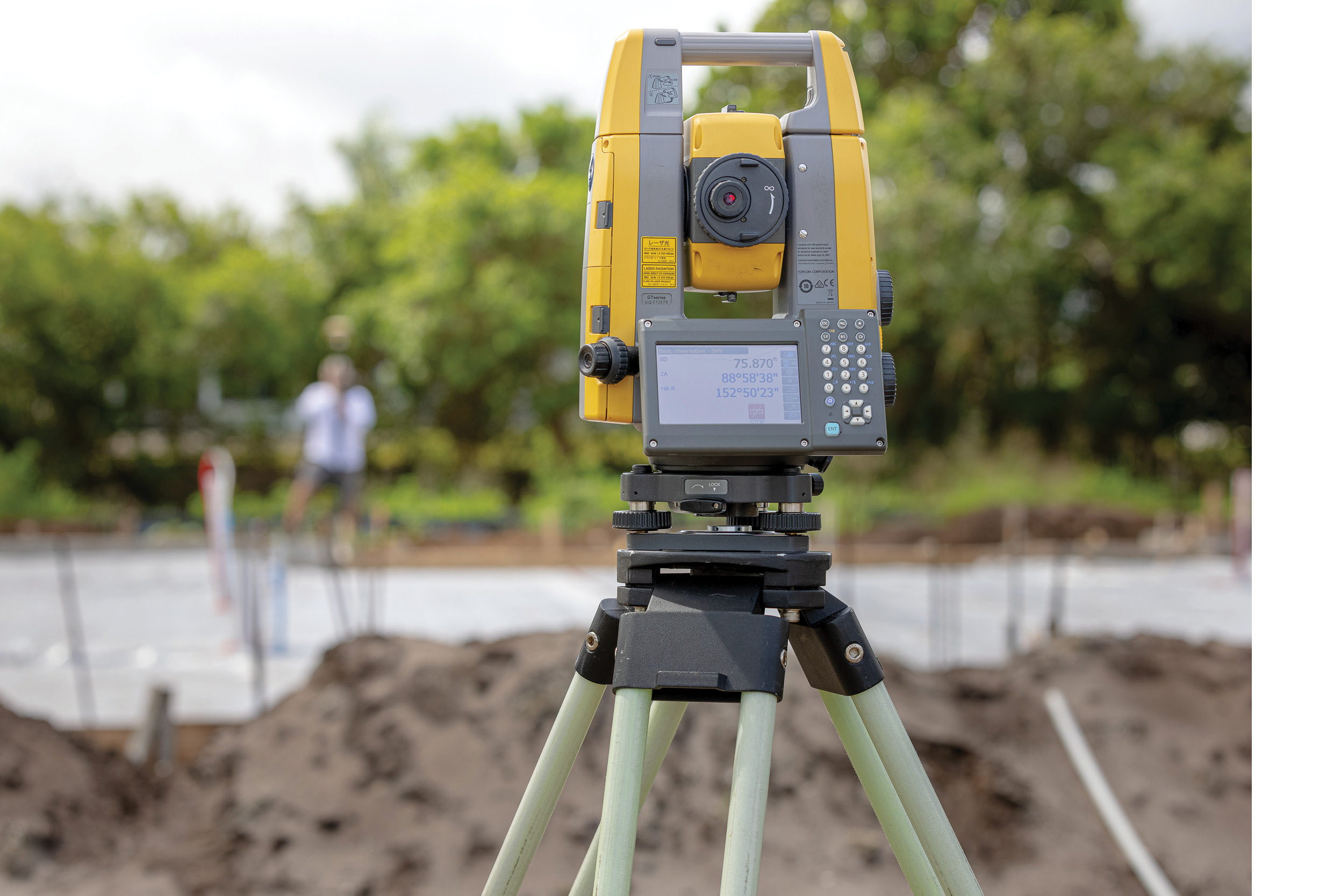
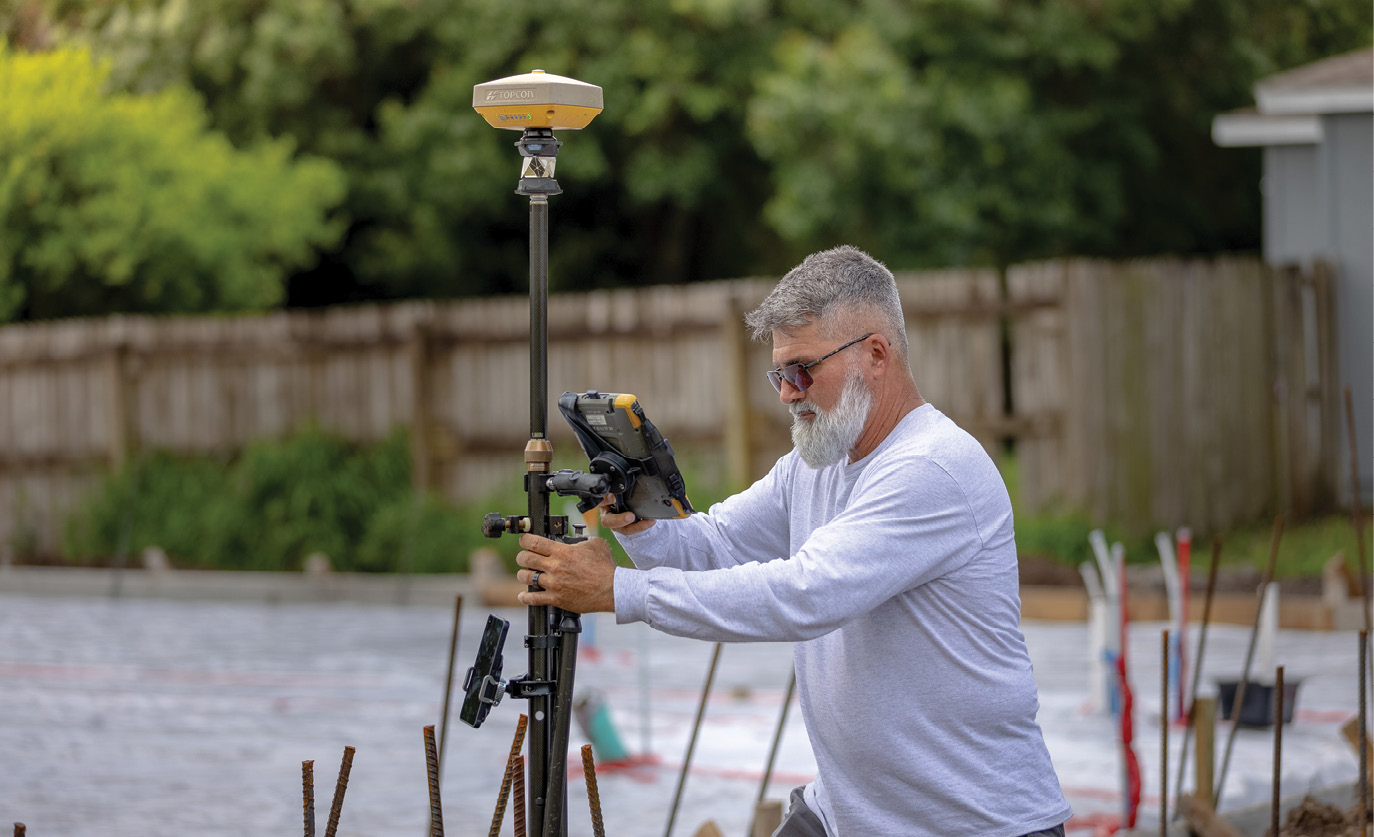
One-half of the Topcon Hybrid Positioning system, Cesiro’s GT-503 total station, has helped the Florida surveyor thrive in a challenging industry and market. The solution allows him to work conventionally, using the total station, then utilize GPS when needed.
The notion of someone starting a business and growing it into a mammoth enterprise is part of the fabric of the American success story. Who, after all, does not want to be the biggest, the leader in their field, the benchmark against which all others are measured? The answer to that rhetorical question is, Jim Cesiro. The owner of Atlantic Land Design did his time with a large engineering company and even subsequently grew his own business to a decent size before the Great Recession brought its woeful reality to bear. Today, Cesiro runs a lean operation with three employees and has used technology to manage a workload that would tax many other, more heavily staffed survey firms. One component of that technology mix—a Topcon hybrid surveying solution—has turned this one-time techno-skeptic into one of its biggest proponents. Finding a way to do a lot with a little? Maybe the best part of the American success story.
A PDF of this article can be found HERE
Felt it Coming
Based out of Jensen Beach, Florida, Atlantic Land Design (ALD) specializes in lot and block surveys, providing title companies, banks, and mortgage companies with the land verification needed to secure titles. According to Cesiro, after fronting his own survey company for a few years, he worked for the original owner of ALD, purchasing the business after that owner’s untimely passing in 2000. Today, in addition to the services described above, the company also provides survey support for several smaller home builders in the area.
The flexibility of the GT-503 to switch from robotic prism to prismless allows Cesiro to jump behind the instrument and collect data in a more conventional manner. Being able to switch from GPS to robotic to prismless means obstacles are no longer a concern.
“We are the little guys, the ones that everyone at the PLS continuing education class swears they’d never want to be, preferring instead huge projects, massive subdivisions,” he said. “And I had similar aspirations in the early 2000s as well, tackling some very sizeable projects. At that time, we augmented the use of a total station with HP calculators then moved on to using several different iterations of handheld computers—even outfitting one of our crews with a Topcon HiPer Lite rover and a network subscription. But in the months leading up to the housing crash, things began slowing down and some staff began moving on, perhaps sensing what was coming. The actual crash—which hit this area hard—was tough; we went from 25 employees to just me. I worked solo for quite a while, eventually shelving the rover and network subscription as I tried to keep things afloat.”
Life Takes a Turn
Working alone, Cesiro continued his reliance upon the total station, feeling that a GPS solution was overkill for what he was doing. Years later, a keen eye on the part of Brent Hays—sales engineer from Lengemann—and a quick U-turn, changed all that.
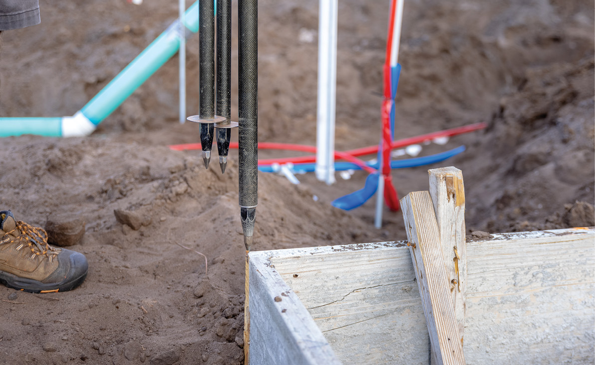
Form board surveys, like the one shown here, have been dramatically simplified with the use of the robotic solution.
“It was a real stroke of luck,” said Hays. “I was doing GPS training for another customer down the street from Jim’s office in Jensen Beach. I was headed back and saw the ‘Atlantic Land Design’ sign and was intrigued. I turned around and went in to introduce myself, then proceeded to show him all that a GPS solution could do for him and his operation; I think it was a great move for both of us.”
Cesiro would be inclined to agree, admitting that downplaying the need for GPS probably cost him business and revenue. “Although I do have some larger projects going on, I am generally a block surveyor,” he said. “I used to joke that using GPS for my line of work was like taking a bazooka out rabbit hunting—I see now that was a foolish way of thinking. I’ve been using my Topcon HiPer VR for a little over three years and I’m still seeing the potential it offers. Among its other obvious productivity-based benefits, right now I’m building GIS maps—I have entire sections of this town in CAD. So, should anyone come to me saying they have a survey-related issue, I have all that data available. I wish I’d done this sooner, for sure.”
Best of Both Worlds
If realizing the potential of GPS was a watershed moment for Cesiro, what was to come next could only be described as the proverbial—often cliché—“game changer.” Once again, the result of a visit from Lengemann’s Hays, ALD’s owner was about to gain what he half-jokingly calls “superpowers.”
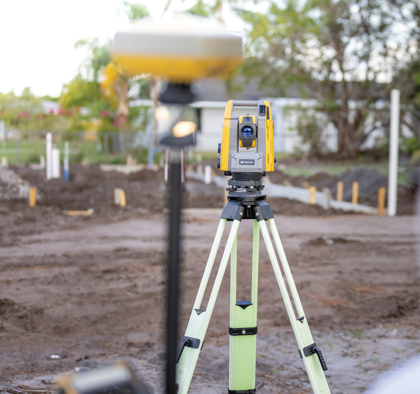
The ability to pick up more points on the site with the robotic solution is important to Cesiro’s work—having a better picture of what he’s done in the field and not missing critical points on a survey. “You can do everything at once and that is key.”
“It started with Brent stopping by the office and asking me to come down to the parking lot,” said Cesiro. “There, armed with a used robot and my HiPer VR receiver, he gave me a crash course in what hybrid technology could do for me. I’d heard about it, of course, but didn’t think it would be a good fit for a small operation like mine—I could not have been more wrong. The hybrid solution is perhaps the best answer for a firm like mine, one that’s seeking ways to keep manpower size and costs down without sacrificing productivity. I was sold on it there in that parking lot and made the purchase shortly afterward.”
A hybrid solution, by way of an explanation, is the consolidation of GNSS and robotic technology on one pole. The Topcon Hybrid Positioning system which won over Cesiro that afternoon features a lightweight GNSS receiver atop the prism (in this case, his HiPer VR), enabling the system to reacquire targets even in challenging conditions. Cesiro said that seamlessly switching over to GNSS to deal with canopies and other obstructions, while huge, only scratches the surface for what hybrid positioning brings to his jobsite.
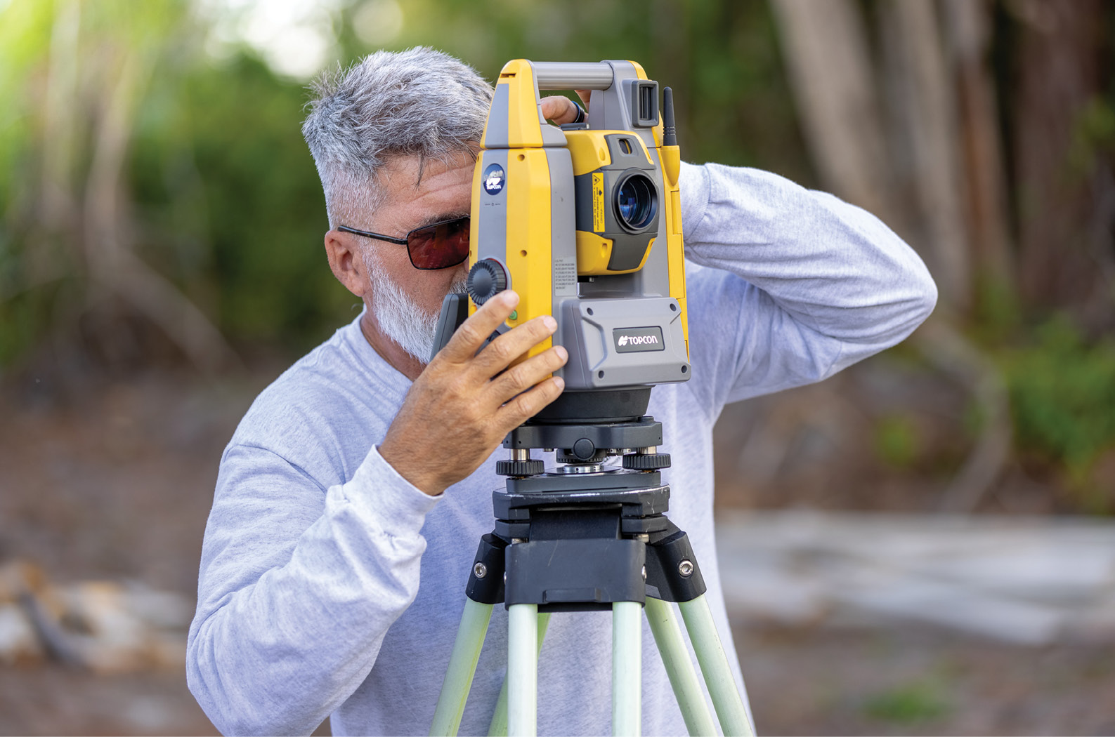
“In our work, we are always dealing with the need for repetitive shots,” he said. “With this solution, I can set robot up, localize it and then start banging out shots. Working alone, I can do 100-200 shots in no time—the speed of it is amazing. In the old days, if we would get 150 shots in a full eight-hour day, we felt we were killing it. Now, I can do that in an hour before lunch. Using this technology, not only am I a one-man crew, I can accomplish things I never dreamed possible.”
De-laboring a Point
By now it should be clear that Cesiro’s needs are predicated on two things: doing things efficiently and keeping crew size down. With only himself and three others on staff, he is contracting out more work than ever, meaning the second part of that equation is heavily dependent on the first.
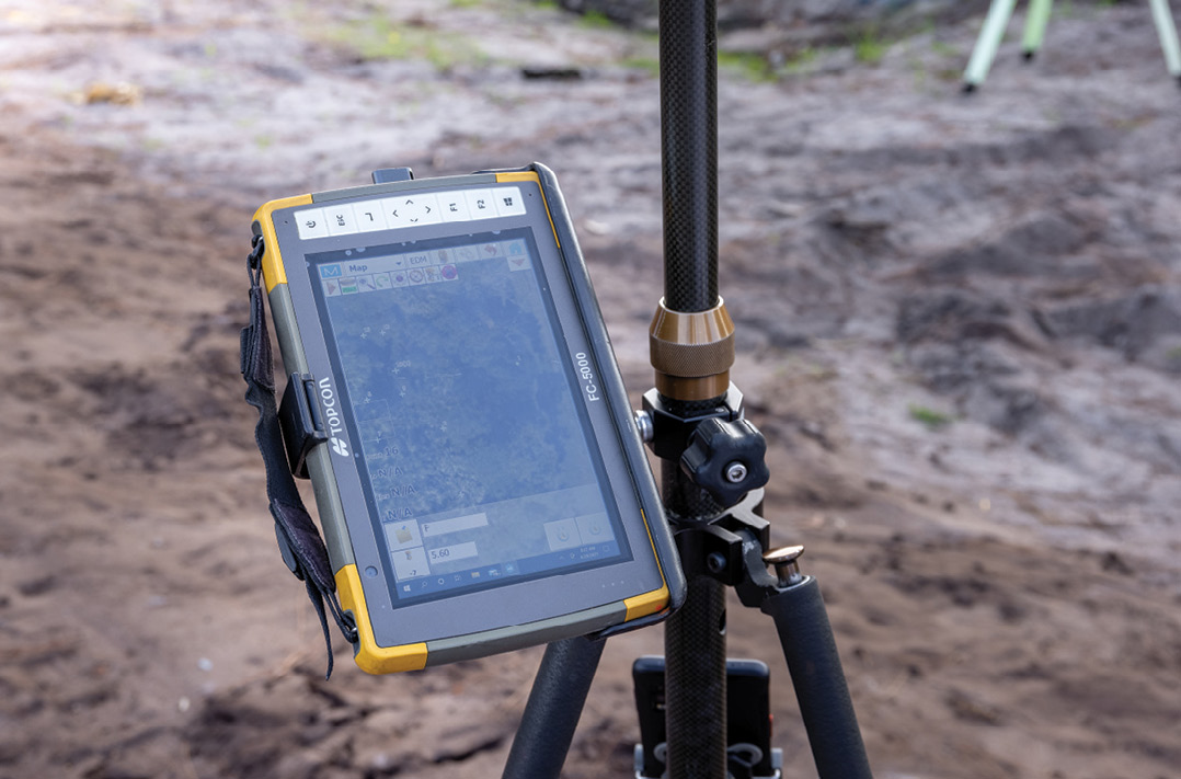
Atlantic’s teams use Topcon FC-5000 field computers for on site data entry and transfer. Cesiro says the unit—which features front- and rear-mounted cameras—has made that facet of the job fast and easy.
Cesiro said that one of the first jobs he booked after acquiring the hybrid solution was from a title agent asking him to conduct a three-acre survey, on the riverfront—and do it quickly.
“This property consisted of a house and fences with a wooded area that fronts the river and backs up to the railroad,” he said. “Arriving at the site, I knew I GPS alone wouldn’t work, so I set the robot up under the tree canopy, stayed in the open, got it localized and let it do its thing. I was able to get the front corners, then disconnect from it, switch back to GPS and calculate where the back corners were supposed to be. That got me within a foot of where I thought they were, and the metal detector did the rest.”
Returning to the front of the property, Cesiro located the house, the detached garage, the driveway, etc., then switched back to the hybrid operation, set up the robot in the best location to allow it to see everything, localized it once again and . . . was further surprised.
“This was one of the most impressive things I discovered—in addition to the hybrid solution advantages, I was also able to go prism-less,” he said. “So, I got behind the gun and started shooting everything I could see with it. And, as quickly as I could shoot, it collected everything on state plane coordinates just as if I was using GPS. I came back to the office, downloaded it to all CAD and pulled up the points. It was just a seamless workflow; everything came together beautifully. I got the customer their deliverable when they needed it and did it all by myself.”
Make the Move
Because they are limited in staff—having downsized from as many as 25 people, down to four—Cesiro felt the hybrid solution could be a huge time saver for his operation. He said it has not disappointed.
Because his is a smaller operation, Cesiro said he has to be budget-conscious when making decisions regarding major purchases. He is, however, keenly aware when a purchase generates a return on its investment and both GPS and the hybrid solution have met that goal. The savings, in fact, go far beyond simply monetary gains.
“Since adding the hybrid solution, we’ve turned out the same amount of work we did in that 2008 to 2009 time frame and are doing it with half the staff,” he said. “The GPS paid for itself in less than the first year, both through increased productivity and by nature of not having to add an employee. Looking at it from that same perspective, the robot paid for itself in about five months, maybe less. The point is, despite a small staff, we are extremely productive, and our clients know that. Anyone who is on the fence about whether or not to embrace this technology needs to make the move—and do it today.”
When people talk to Cesiro about how difficult it currently is to fill surveying slots, he has to agree with them—that’s just the reality of the situation today. However, he is also pragmatic about the situation, adding: “Good people might be in short supply, but good robots are easy to find.”
Spoken like a true visionary.
A PDF of this article can be found HERE