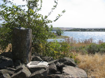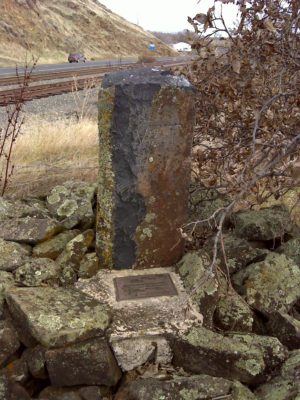
The Initial Point marked by a Basalt Stone as set by Rollin J. Reeves on August 7th, 1873 next to the Commemoration Plaque as set by LSAW in 1998.
In the October 2017 issue we studied the Texas Oklahoma State Line. We also learned how it was eventually surveyed by the State Line Boundary Retracement Specialist Samuel Stinson Gannett and ruled upon by the U.S. Supreme Court. This time we travel to the Idaho Washington State Line and learn about Sam’s role in the Pacific Northwest.
The area in discussion was originally all part of the Washington Territory as established on March 02, 1853. Ten years and one day later on March 03, 1863, the Idaho Territory was formed and thence created the common line. Washington became the 42nd State on November 11, 1889 and Idaho became the 43rd State on July 03, 1890. Amazingly, the two states shared a common description for their common boundary.
The description for Washington states “… thence down the main channel of Snake River to the mouth of the Clearwater River; thence north on the meridian which passes through the mouth of the Clearwater to the boundary line between the United States and the British possessions…” This line was originally surveyed by General Land Office Deputy Surveyor Rollin J. Reeves in 1873. His contract was dated June 06, 1873. His instructions were simple– survey from the Snake River on a Meridian to the Canadian Border. Unfortunately for Reeves though, it was anything but simple.
Technically he was instructed to determine the position “in the middle channel of Snake River, opposite the mouth of the Clearwater, as it existed March 3, 1863”. Reeves struggled immensely to ascertain this position. He spent a solid week floating various buoys tied to weights trying to find the main channel of the two rivers. He even tried a beer keg tied to weights with ropes but the current was so strong it drug the weights down the smooth bottom of the river. Eventually he settled on a position and with peer approval he set an initial point 32.32 chains due North of the “imaginary buoy” that so quickly floated away.
Reeves said “This was an indefinite point to ascertain, a position admitting of various interpretations and the selection of which gave me the greatest solicitude and anxiety.” Reeves went on to say that “After trying for a week, with all the assistants and appliances we could secure or invent, we were constrained to adopt an approximate location”.
The initial point was much more permanent than the floating keg though. It was constructed in a safe position outside of the high water mark on the North side of the rivers. It was a dug pit 2 foot deep and 2 foot square filled with charcoal and charred wood. In the middle of the pit was a “…shaft of basaltic stone, in dimensions more than 6 feet long by 8 inches wide and 8 inches thick, smoothly and evenly dressed and engraved in characters cut plainly and deeply in the stone near its top…” The 6 foot tall Stone was then firmly packed with earth and other stones, large and small, to form a massive cairn 7 foot in diameter at the base and 3 feet high. Additional pits were dug in cardinal directions 3 foot deep and 3 foot square. This was all done on August 7, 1873.
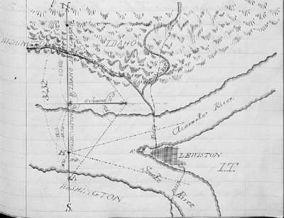
Field Notes from Rollin J. Reeves detailing the Initial Point as set in 1873. Courtesy BLM—Oregon State Office
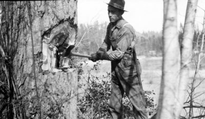
From this initial point Reeves and crew marched North on the Meridian Line. The crew consisted of 17 men and 45 horses. The terrain was rough and rugged to say the least. They set posts every mile and blazed trees as they marched north. It was late November when things turned for the worst for Reeves and crew. At mile 172, 172 miles from the initial point, Reeves was getting tired from the terrain–he writes “The work is of the most discouraging character imaginable”. By the time they reach mile 175 snow had fallen and the terrain continued to get worse. Reeves writes in his field book “Numerous logs, stumps, and large bowlders [sic] are crossed every few chains; these together with the abruptness of the grade, loose stones, thick underbrush, snow, cold, and general exhaustion, have rendered the establishment of this mile one of the most difficult, tedious, and painful of the entire boundary”.
By November 25th when they reached the 176th mile it snowed an additional 4-6 inches. The crew continued to push their bodies to their limit as they set a Post at mile 176 ½. At this point they were out of food, cold, wet and miserable. To make things worse the scouting crew that was sent ahead to find the international border at the 49th parallel came back empty. The 60 foot wide cleared path that was promised to be there did not exist, putting salt into an already festering wound.
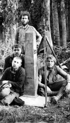
International Boundary Monument No. 195 with 1909 Survey Crew. Courtesy USGS Photographic Collection
Furthermore they were awake all night long trying to determine their latitude, but the conditions were so poor they were unable to with any amount of accuracy. They had no choice but to retreat to their base camp. Reeves wrote “By this time we were thoroughly convinced that to have remained only a day or two longer in endeavoring to push the work to its completion would have been fatal”. The crew eventually made it back to the initial point where they went their separate ways. It was not until 1908 that it was realized that Reeves was within a mile of the 49th parallel and subsequent completion.
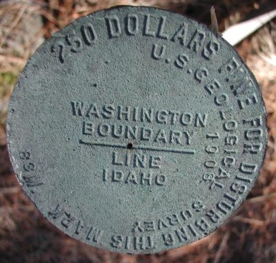
This meridian lay incomplete until 1908 when Samuel Stinson Gannett was given the task of retracing Reeves. When I use the words “State Line Boundary Retracement Specialist” there is no better example than the line between Washington and Idaho. Initiated by an Act of Congress dated May 27th, 1908, field work didn’t actually begin until July 11th of the same year. Congress approved $25,000 for the work equating to $135.13 per mile.
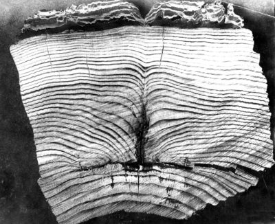
Cross Section of a Witness Tree from the 1873 Survey verifying its age. Courtesy USGS Photographic Collection
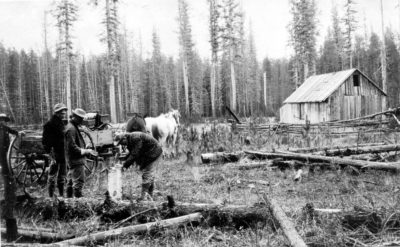
Gannett, along with assistant C.L. Nelson, started at the found initial basaltic stone monument as set by Reeves. After testing equipment they decided to use stadia for their measurements. They split into two separate camps running random lines sometimes going north and sometimes going south. The final notes were written on the True Line heading north. To prevent errors on this random approach Gannett and Nelson made constant Solar Observations on the corners. The crews worked hard retracing until October 09, 1908 when heavy rain and then snow hit. They put the survey supplies in storage at the hands of a local rancher and the crews went their separate ways until they re-organized on May 01, 1909.
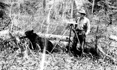
The demise of a black bear that temporarily held up the crew in the 1909 Gannett Survey. Courtesy USGS Photographic Collection
Up to this point the terrain was not really that bad. The North end however was everything as difficult as Reeves stated in his notes. The crew now had to minimize and leave the wagons and heavy equipment below. They entered the wilderness deliberately during the best part of the year so they could complete the survey. The terrain was so rough they boarded a barge and steamer on Priest Lake. The crew along with pack animals, equipment and monuments were taken to the north end of the lake. They then randomly went into the woods looking for blazes to try to find the old line from 1873.
Sure enough, upon examination of found blazes to be exactly 36 years old, they were back on the line near Mile Post 156. After being held up by a large bear for a while the crew continued north all the way to the International Boundary. Gannett and crew found almost all of Reeves original posts, witness trees and blazes along the line. Even if they didn’t find the Post at the surface, they would often find it upon excavation of the new monument. Their measurements were spot on each other.
A good example of their retracement is the notes of Mile Post 149 as written in Bulletin 466 from 1911, titled Retracement of the Boundary Line Between Idaho and Washington. It read “Iron post 6 feet long, 4 inches in diameter, filled with concrete, stamped “1909 149 M”, set in place of old milepost 149, which was found, as were all the old bearing trees, in good condition. Post stands on North Slope of mountain in open timber. About 151.5 links east of the old milepost was found an old camp of the party of 1873, with a blazed cedar tree at the camp site, marked “Saturday Camp Oct. 9, 1873.””. This example was typical of the entire line.
Gannett replaced the old rotten wood posts with the before said Steel Posts, from St. Louis, filled with Concrete. Every five miles though Gannet set granite monuments 6 foot long with the top 18 inches smoothly dressed from Medical Lake, Washington at a cost of $17 apiece. The weight of these behemoths was 800 pounds and it was quickly determined that it was not practical to set them on the most Northerly part of this survey. On August 29, 1909 they intersected the International Boundary where they built a custom monument of random flat rocks cemented together with a bronze disk on the top. After the lines were determined an additional crew followed behind them to then survey the topography of the land along this line–all ending in October of 1909.
I encourage everyone to read Bulletin 466 to see the full detail of his retracement. I also wish to thank Denny DeMeyer for his aid in my research on this topic. Next up we will travel back in time to 1896 and travel across the panhandle of Idaho to study the work of Gannett on the Idaho Montana State Line.
