Amidst a global effort to inspire the next generation of young professionals to become land surveyors, mappers, and geospatial experts, DRMP is doing its part by investing in STEM education and proactively participating in community outreach.
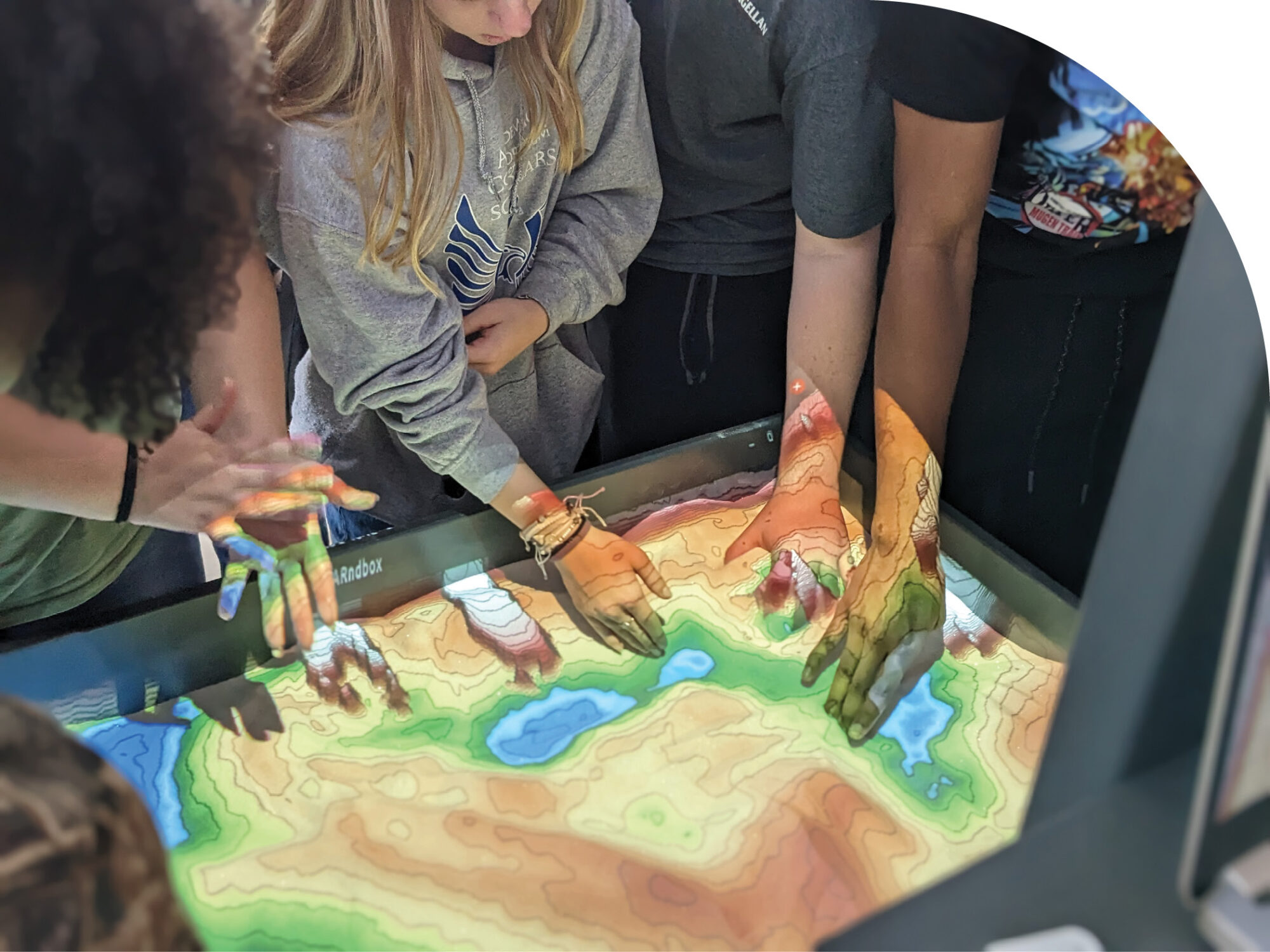
High school students attending Construction Career Days at the Central Florida Fairgrounds in Orlando, Fla., got a hands-on experience with DRMP’s Augmented Reality (AR) sandbox.
DRMP Geospatial Services Department Manager Brent Bass, PE, SIT, is reaching students through interactive, hands-on technology, while DRMP Survey Analyst Melissa Padilla Cintron, SIT, became a volunteer Brand Ambassador for Get Kids into Survey—a Manchester, England-based global initiative to attract students to the land surveying profession.
Bass Uses Augmented Reality Sandbox Workshop to Inspire Students
To spark interest in surveying, my team and I researched, developed, and built an Augmented Reality (AR) sandbox to teach students about the profession with the support of DRMP’s Mapping/Geospatial Director.
I had the opportunity to recently introduce this workshop to 3,200 students who attended the annual Construction Career Days in Orlando, Fla. Our Survey presentation focused on surveying as a competitive job in our industry and how DRMP invests in its employees and technology. We explained our branch of surveying (LiDAR) and helped students understand what it is and how we do it.
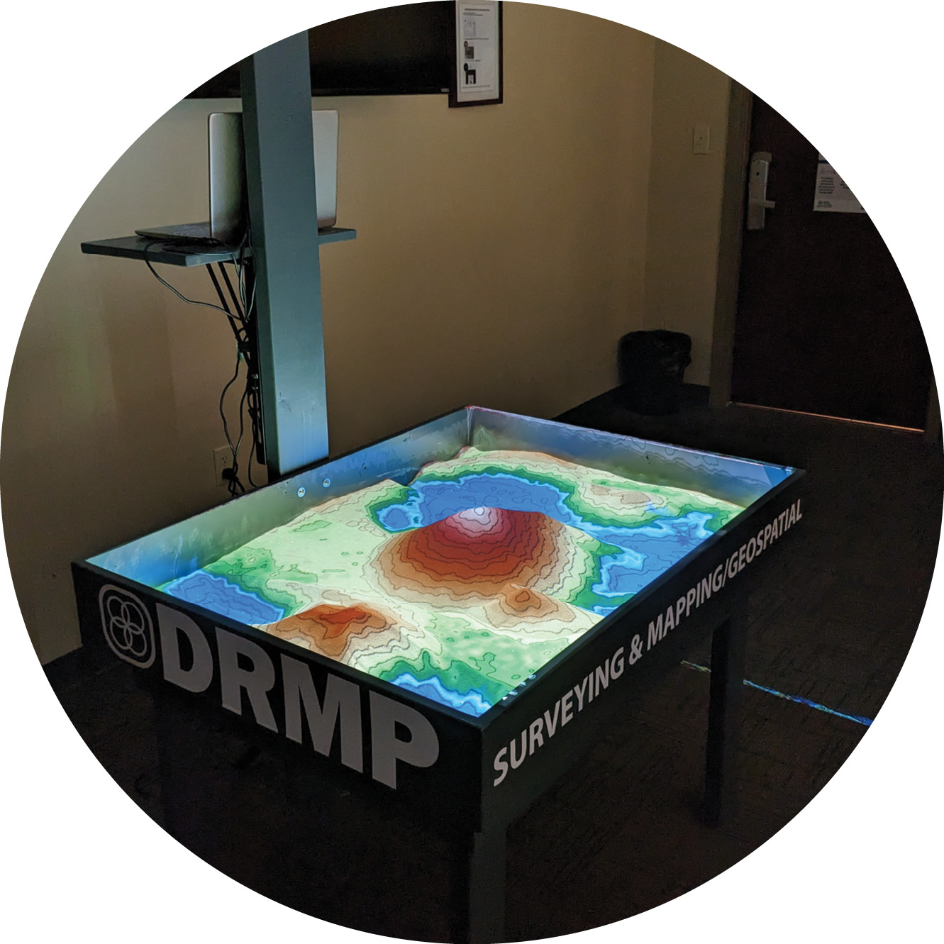
DRMP’s Augmented Reality (AR) sandbox allows users to create topography models by shaping real sand, which is then augmented in real-time by an elevation color map, topographic contour lines, and simulated water.
The sandbox is a 3D, interactive educational tool that allows users to create topography models by shaping real sand, which is then augmented in real-time by an elevation color map, topographic contour lines, and simulated water.
The primary purpose of DRMP’s AR sandbox is to educate students and interns about surveying and mapping, as well as use it as a cross-training tool for DRMP employees. The plan is to use the AR sandbox for survey training, high school STEM nights/Career Days, and college intern recruitment.
The AR sandbox works by using a combination of a real sandbox, a Kinect 360 camera, sandbox visualization software, and a short throw projector. DRMP’s AR sandbox used about one hundred pounds of special indoor sand that’s free of silica and safe to use.
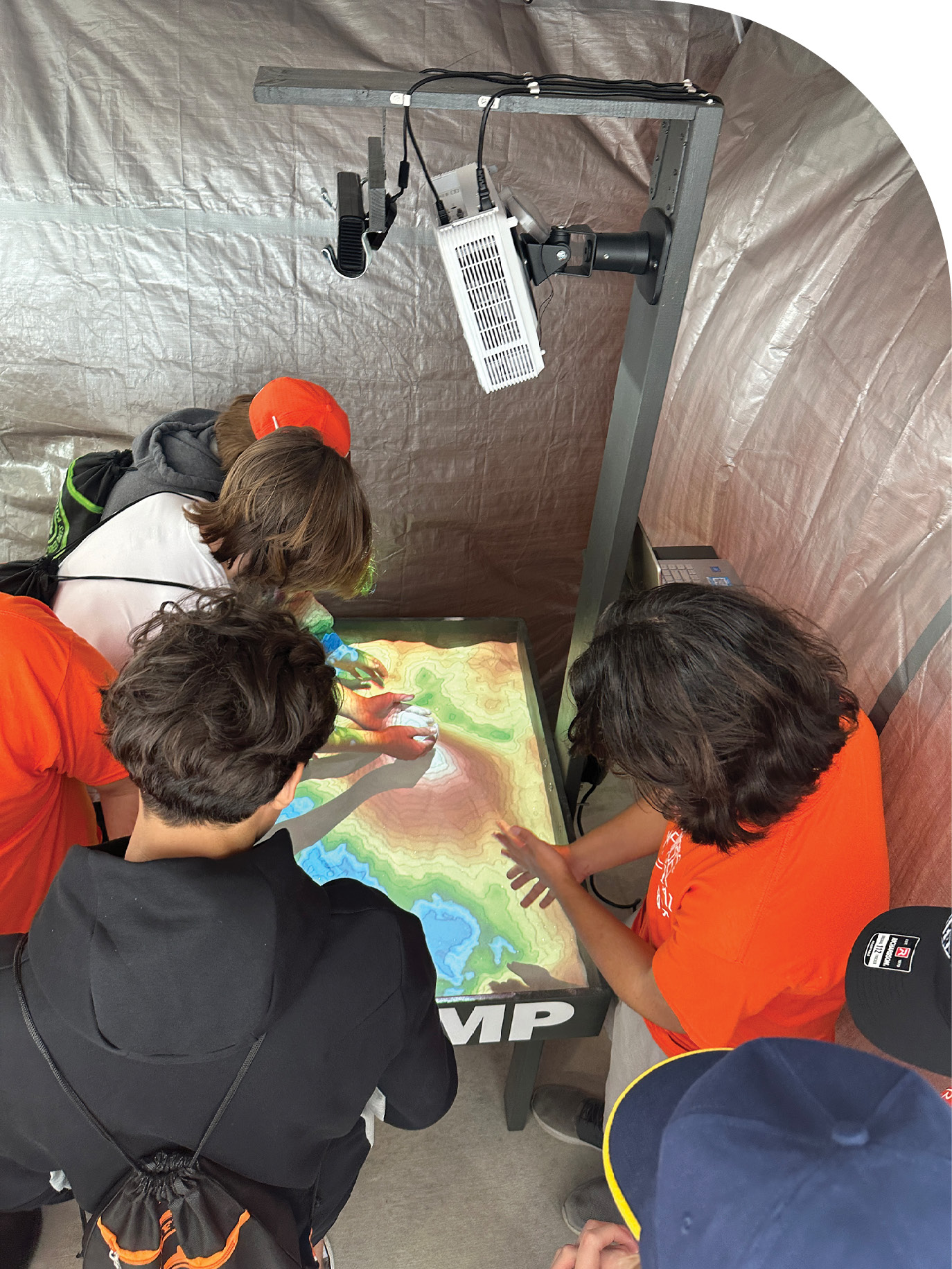
High school students explore DRMP’s Augmented Reality (AR) sandbox at Construction Career Days in Orlando, Fla. The annual event introduces students to the surveying profession.
The AR sandbox uses the Kinect camera to check the depth changes of the sand. Every second it updates and refreshes the visualization on the computer. Then the latest changes are projected onto the sand creating the effect of changing contour lines.
Near the end of the presentation, we talked about the final product of a design survey, which is terrain models and contours. Then we had the students come over to the AR sandbox and manipulate the sand to see how contours work and how they can be affected if we change the terrain. The students seemed to really enjoy this part, and you could see their faces light up with excitement. You could almost see lightbulbs going off that they “get it” now. Some of the students had seen an AR sandbox before, but a majority had not. By having them move the “Earth” with their own hands really helps to explain what and why we do what we do.
Some of our survey staff have already used the sandbox to explain how we could locate ditches and swells better in the field to represent the terrain more accurately in their final models.
It has such a wow factor in educating that we wanted this to be something we use to teach and spark some interest in young people for surveying.
The idea of the AR sandbox was perfected by the University of California, Davis, in 2012, which helped create an open-source option for groups to build their own sandbox.
At some point we would like to test other software and possibly use the AR sandbox for subsurface utility education and LiDAR visualization.
Padilla Cintron Becomes Brand Ambassador for Get Kids into Survey
Get Kids into Survey launched in 2017 in response to a shortage of skilled young surveyors in the United Kingdom. The United States also is experiencing shortages as industry experts reach retirement age with no one to fill the void of training the next generation of land surveyors. Changes in education and licensing qualifications for surveyors have also created recruitment barriers.
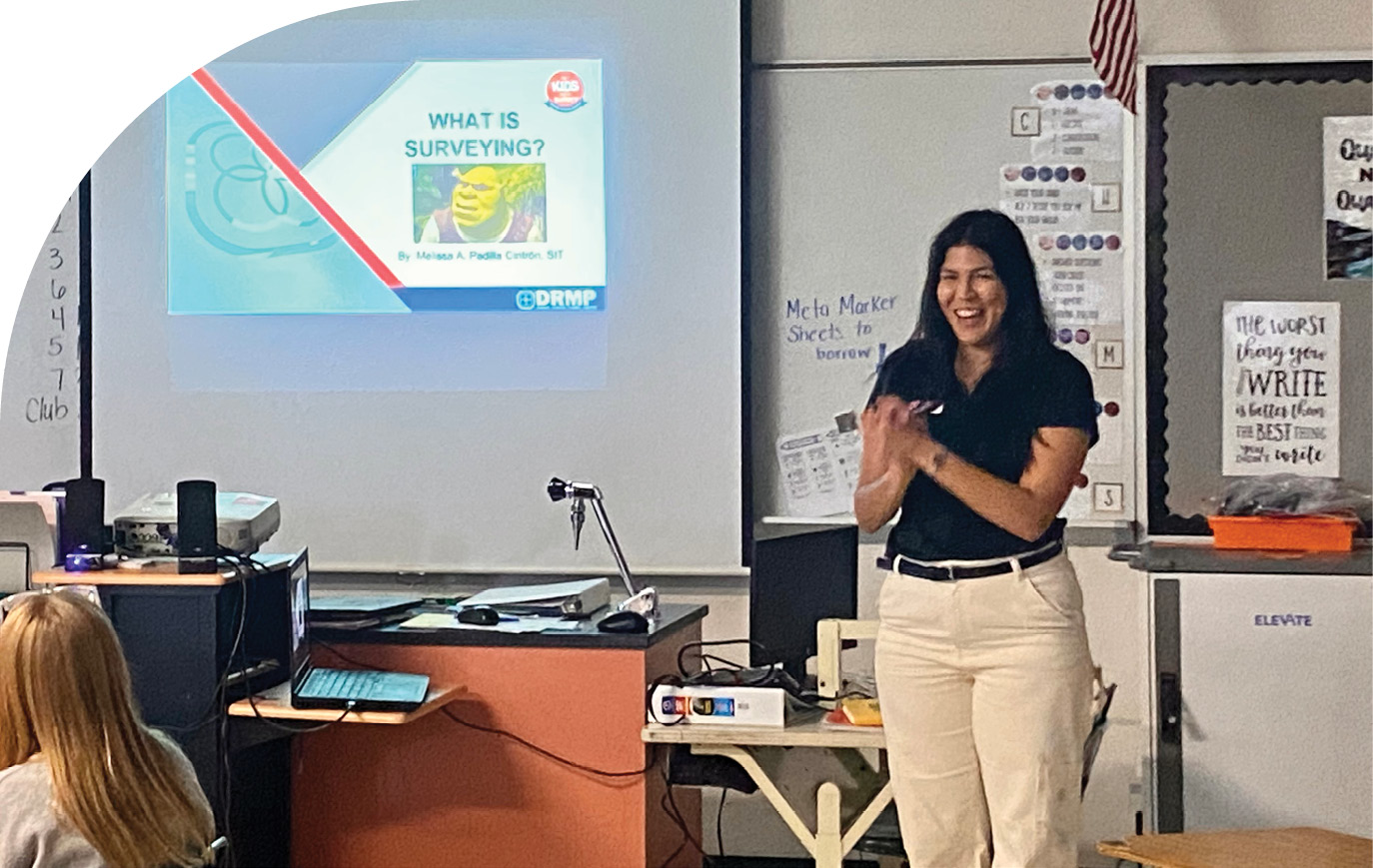
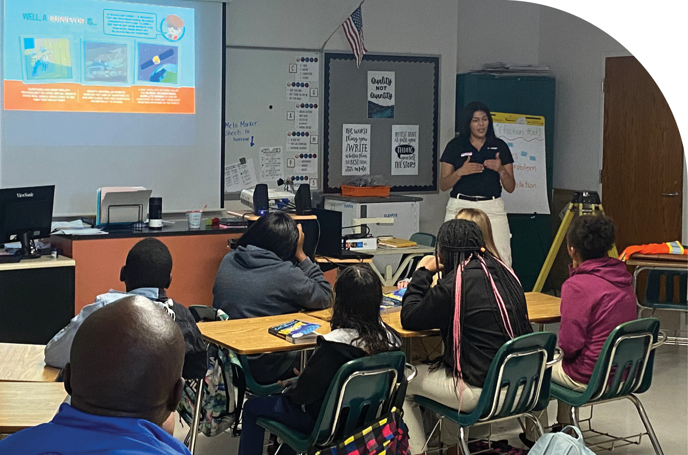
Tampa, Fla., elementary school students learn about surveying during an interactive presentation taught by Melissa Padilla Cintron, SIT, a DRMP Survey Analyst and Brand Ambassador for Get Kids into Survey.
My goal is to help inspire students to consider the land surveying and mapping profession through interactive school presentations and resources, such as comic books and posters supplied by Get Kids into Survey.
I joined the organization as a brand ambassador in 2022 and represented DRMP and Get Kids into Survey at the Great American Teach-In in November of that same year. I conducted a surveying presentation at Liberty Middle School in Tampa, Fla., and brought a total station, data collector, and rod, into the classroom to demonstrate to students how surveying works.
I did a dynamic presentation combining hands-on experience using the posters the Get Kids into Survey provided and showed students different types of instruments and their function on a job site.
We also measured around the classroom the distance from one point to another to show students how surveying equipment works. They loved it. Some of them said they had seen us with our equipment on the side of the road, but they didn’t understand what we do.
One female student said she wanted to be a surveyor in the future. I told her we needed more women in the industry because female surveyors are not common.
In March, we held a workshop at Construction Career Days in Tampa during National Surveyors Week. Along with bringing equipment for a demonstration, I reached out to a Geomatics Program Specialist from the University of Florida to attend the event with me to talk to students about the university’s surveying program opportunities.
I think it’s important we are getting involved with the community and using technology, such as the AR sandbox to explain our profession. I think we are impacting students and encouraging them to explore surveying as a career option.
The global and local efforts to close the gap in the shortage of surveying professionals are being taken seriously. Salaries have gone up in recent years to attract applicants, and projects like Get Kids into Survey have been organized internationally and locally to engage the next generation of young professionals.
DRMP will continue to look for opportunities to shine a spotlight on the importance of the profession through investment in technology, talent acquisition, STEM education, and community outreach.
Brent Bass, PE, SIT, is Geospatial Services Department Manager in DRMP’s Surveying and Mapping/Geospatial Department.
Melissa Padilla Cintron, SIT, is a Survey Analyst in DRMP’s Surveying and Mapping/Geospatial Department.
