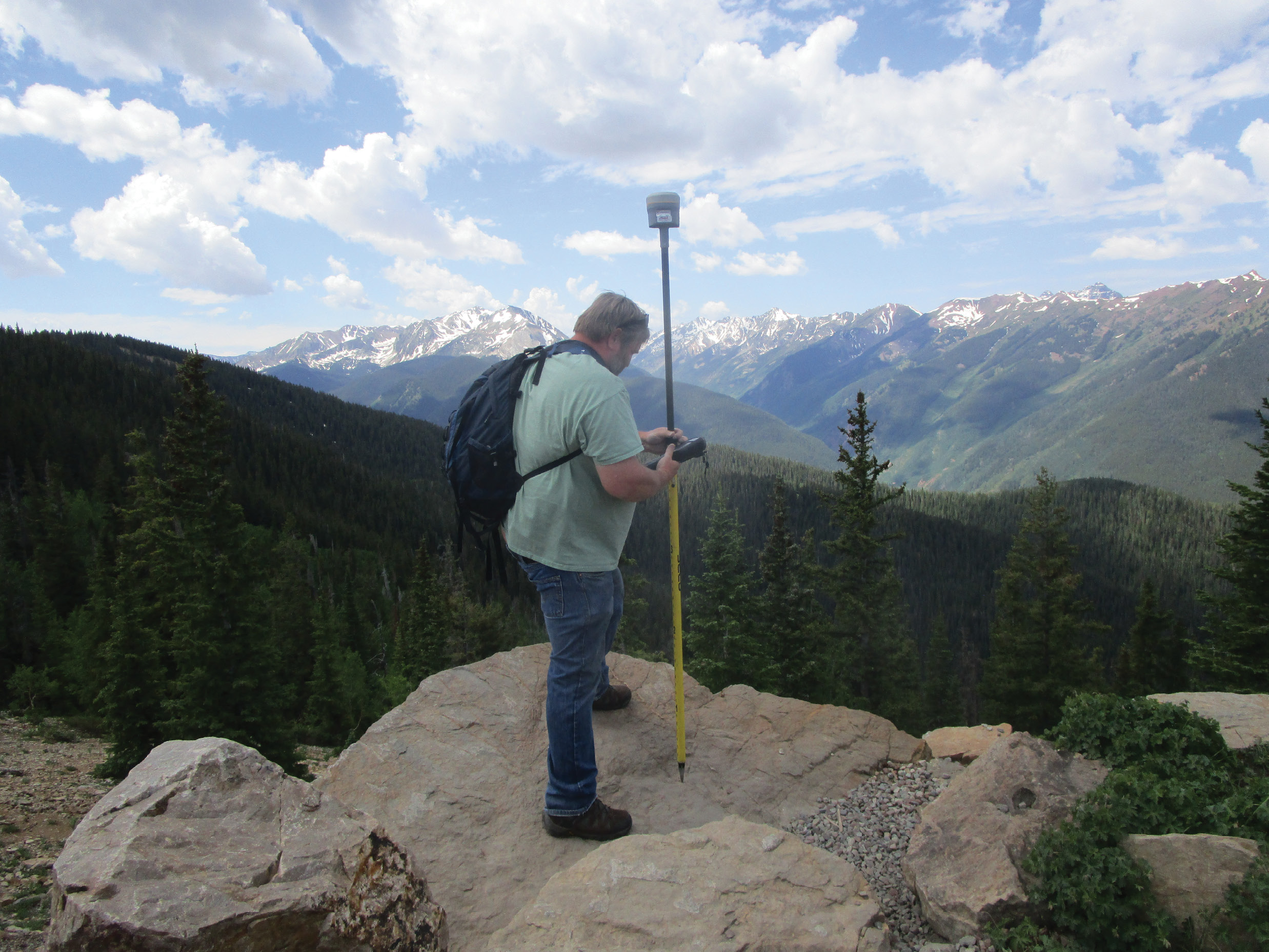
Far removed from the Nebraska plains, Kenna uses a Trimble R10 and CenterPoint RTX for a real-time survey in the Colorado mountains. Satellite-delivered correction data ensures accurate results anywhere on Earth.
Kevin Kenna has surveyed more than 20,000 miles of power lines in his career so a project of 10,000 square miles is not unusual for him. He has lots of experience with GNSS and major projects for utilities, government agencies and large area mapping and he’s used GPS and GNSS for more than two decades. Kenna’s recent work involves establishing ground control for a series of aerial lidar mapping projects in Nebraska. He’s establishing checkpoints that are used to determine and correct any vertical bias in the airborne measurements.
An array of sensing technologies, including digital imaging and lidar, are used when creating accurate maps over large areas. To ensure accurate georeferencing of the sensors, Kenna uses GNSS to provide precise positioning data. When working on projects covering large areas, real-time GNSS can be limited, so Kenna’s firm, Denver-based Merrick & Company, switched to RTX.
Remote work often requires high accuracy in the vertical component, one of the most challenging aspects for GNSS surveyors. CenterPoint RTX delivered the accuracy Kenna needed along with the flexibility he wanted to move about freely.
In general, the work requires high accuracy in the vertical component—one of the most challenging aspects for GNSS surveyors. And it often takes place in isolated areas where conventional RTK isn’t practical and VRS is not available.
Before employing RTX for their use, the firm conducted extensive tests to confirm that the solution could produce reliable results. They chose Trimble’s CenterPoint RTX correction service to test for accuracy and high productivity.
Accurate in adversity
GNSS guidance enabled efficient flight paths for lidar surveys while RTX-PP provided precise positioning to produce accurate, high-volume terrain mapping.
On a recent project covering 8,000 square miles in remote northeast Nebraska, Kenna captured roughly 350 points for aerial lidar. Solo. Quality control terms of the contract required 50 percent of the points to be measured twice, with the two measurements agreeing to within 5 cm vertically.
Kenna completed the field work in roughly three weeks, alone. The project also included additional points to improve redundancy in the checkpoints as well as ties into NGS control three times in each county, with a minimum of five minutes of data at each occupation. Kenna used a GNSS receiver with a controller running a special software. The receiver collects the RTX correction data directly from communications satellites and produces real-time positions accurate to 2cm horizontal and 5cm vertical. The software monitors each observation and displays information that enables Kenna to assess the accuracy at every point. At the end of each day in the field he compiled the measurements in a special software and produced results in the coordinate system specified by the client.
Easier Logistics for Aerial Surveys
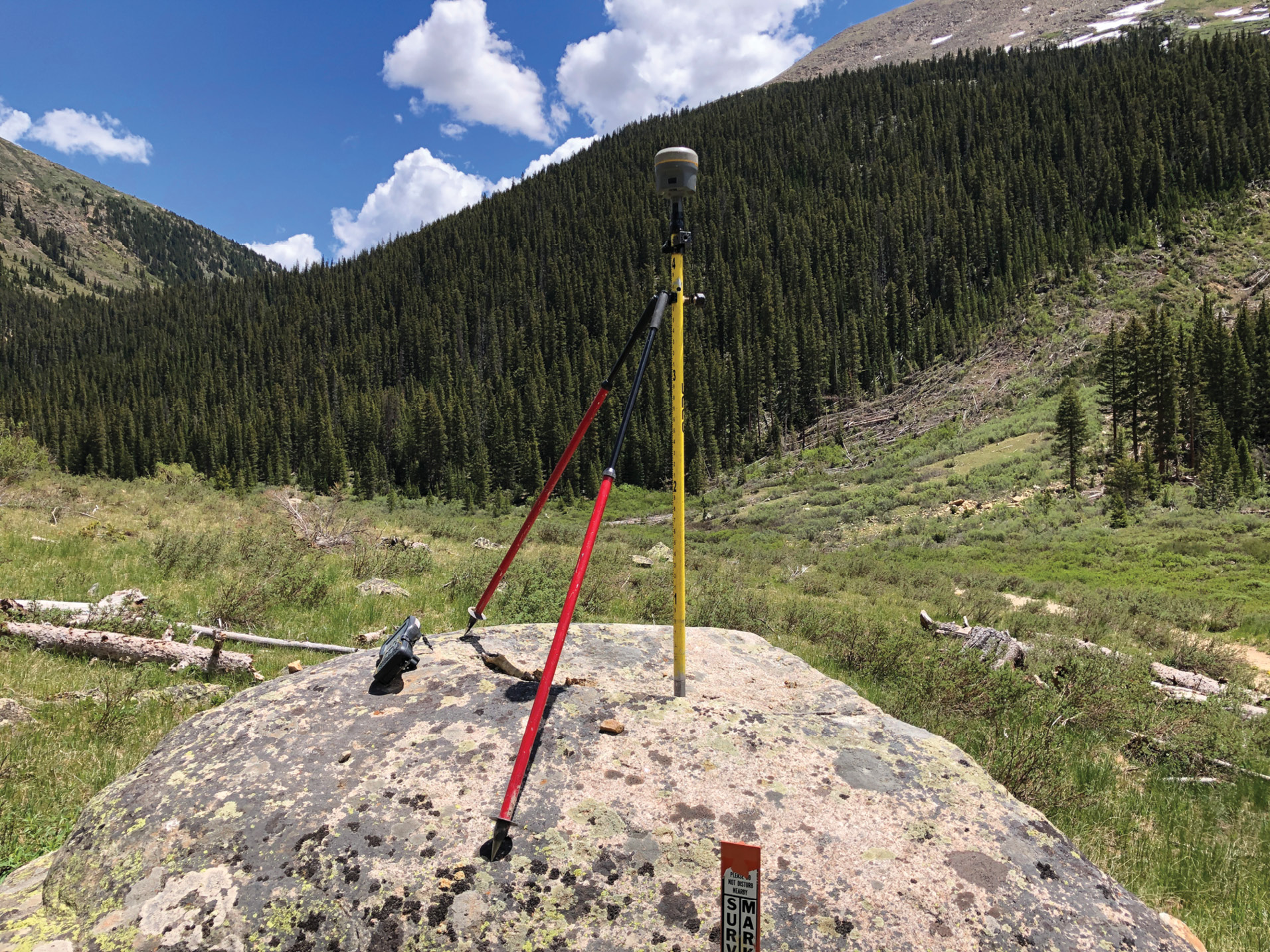
A Trimble R10 GNSS receiver uses CenterPoint RTX to produce precise position data. RTX enabled efficient real-time measurement without need for base stations or cellular connections.
For years, serial mapping has required terrestrial base stations to provide reference points for post-processed kinematic (PPK) measurements to establish ground control points as well as base stations for precise GNSS positioning of the airborne sensors. The approach required base stations to be not more than 20 miles apart. The switch to RTX removed those constraints and provided a significant increase in flexibility. Merrick uses Applanix POS AV systems in its fixed-wing and helicopter surveys and processes the data in POSPac MMS software and RTX-PP post-processing.
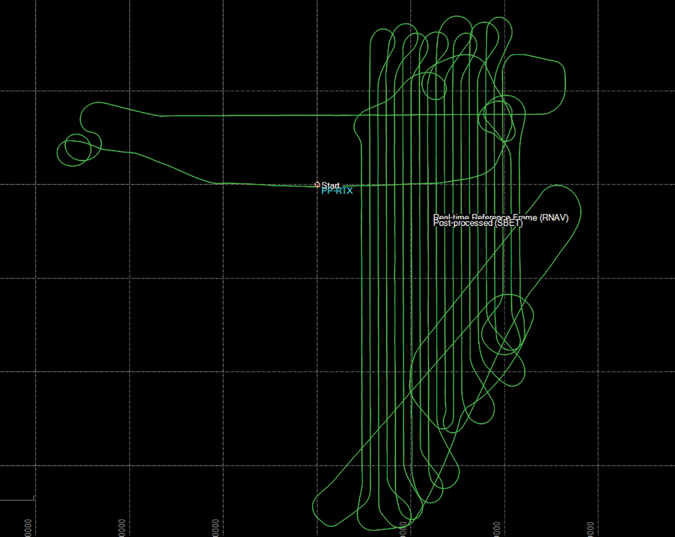
Matt Bethel, Merrick’s director of operations and technology, sees two improvements resulting from RTX: “Historically on larger projects we would target what we felt to be the portion of a block with the best flying weather for a given day and set bases up there. If the weather changed and affected visibility from the air then we would be forced to stop flying for the day. It’s really nice to have the flexibility to move freely around projects without concern about base stations and CORS locations. Secondly, the plots show us that the lidar data is as good as, or maybe slightly better than, previous methods of single-base GNSS. Therefore, we didn’t sacrifice any accuracy while gaining the ability to move freely around large projects and save time that was historically spent setting up bases.”
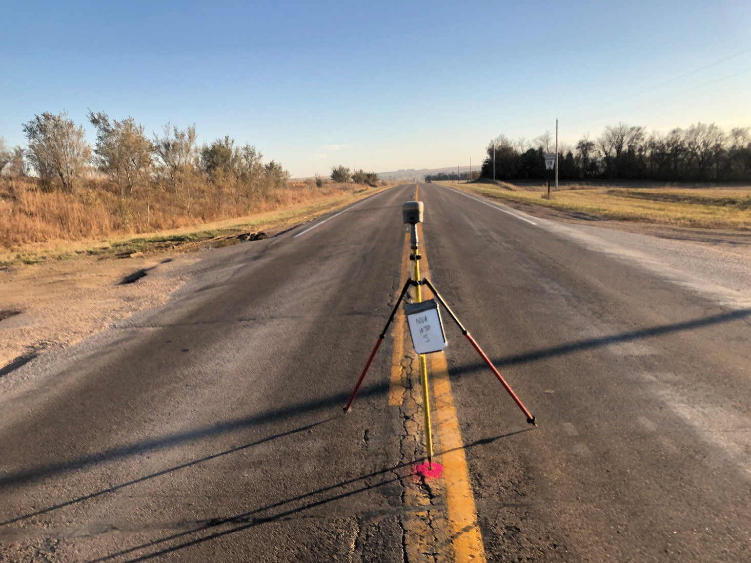
A GNSS receiver and RTX capture precise data while Kenna collects photos to documents the site. The site identifier written on the whiteboard ensures the data and images are linked to the correct location.
RTX also eliminates the need for fixed base stations or ties to terrestrial GNSS networks, which often require access to cellular communications. This gives Bethel and Kenna flexibility in planning and executing their projects while maintaining confidence that their results will meet even stringent accuracy requirements. “Not needing to set up base stations in the morning and go back and pick up at the end of the day is a huge advantage from the way it used to be,” Kenna said. “Now, as technology advances, things become more efficient, and we get a lot more production.”
John Stenmark is a writer and consultant working in the geospatial, AEC and associated industries. A professional surveyor, he has more than 25 years of experience in applying advanced technology to surveying and related disciplines.
The Evolution of RTX
The advent of GPS in the 1990s enabled crews to establish control in remote locations, but they still needed total stations for topography and stakeout. The big breakthrough came with RTK GPS and GNSS, which allowed for centimeter accuracy in real time. It didn’t take long for RTK to push the use of total stations aside for most electric line surveying.
Both RTX and RTK provide good accuracy, but RTK relies on a GNSS base station and radio data links to send data from the base to the rover. Although RTK is far more productive than total stations, when compared to RTX, RTK comes with lots of added costs and logistical headaches.
A similar comparison can be made between RTX and real-time GNSS networks (RTN). RTN is fast and convenient, but only when you are in a specific geographic area served by the RTN—accuracy quickly degrades as soon as you move out of the coverage area. Furthermore, RTN is dependent on cellular communications, which are often nonexistent in remote areas. In the utility fields where projects extend over enormous distances, RTX eliminates both the geographic and cellular dependencies of RTN.