Modern platforms for image management and analysis leverage high-precision data to deliver comprehensive information for managing public assets.

Mobile mapping provided the City of Detroit with accurate, cost-efficient data for municipal planning.
Around the globe, organizations are using street-level imagery as a tool for municipal planning and asset management. With access to a library of images, these organizations can analyze existing and previous conditions to get a good overview of a situation, especially when rebuilding after natural disasters or other catastrophes. However, creating and maintaining a library of up-to-date images can tax internal resources. Mobile mapping technologies are helping mitigate that challenge.
A mobile mapping system is the fusion of multiple technologies for high-accuracy data acquisition and processing. The technique combines high-resolution cameras and, in some applications, laser scanners with precise positioning. Typically mounted on a car, truck, boat or railcar, the system captures images and 3D points as the vehicle moves through the area of interest. At each exposure, the location and orientation of the camera (and scanner) is recorded.
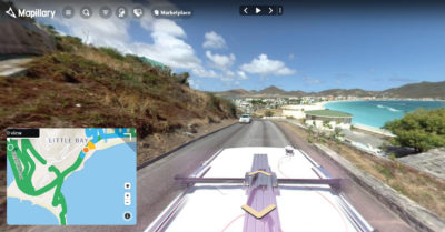
 World Bank uses mobile mapping to support its disaster resilience efforts. In Guatemala and Saint Martin, for example, the Bank used street-level and drone imagery to assess how areas may be vulnerable to damage. Aerial imagery provides a good understanding of slopes and roof materials, while street-level imagery validates the aerial data and adds other information on building use and access.
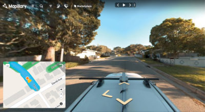
To gather the data, technicians used a Trimble MX7 mobile imaging system to capture 665,000 high-resolution 360-degree images along streets and roads. The images were uploaded to Mapillary, a web-based platform for management and analysis of georeferenced street-level images that enables users with varying needs and technical abilities to access and utilize the imagery. By simply driving through a neighborhood with a mobile mapping system on the roof of a car and uploading the images to Mapillary, technicians could easily map the entire area, including automatic detection of image features.

iWorQ has captured nearly one million 360-degree and high-precision images with the Trimble MX7 as part of their partnership with Mapillary.
The time and cost savings provided by automated image management are significant. World Bank estimates that using 360-degree street-level imagery reduced by 90 percent the number of building units that engineers needed to visit. Using mobile mapping technology in combination with Mapillary, teams captured high-accuracy imagery that enabled World Bank to make accurate assessments and data-driven decisions.
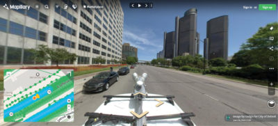
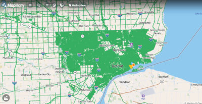
The ability to access up-to-date street imagery is especially valuable for municipalities. The City of Detroit recently created a comprehensive, citywide map as part of its revitalization efforts. Detroit used a Trimble mobile imaging system to capture 3.2 million 360-degree images of city streets and uploaded them to Mapillary. Using the browser-based viewer, any department can access and use the images to get an overview of the streets and potential problems.
Expanding Options
When a mapping task requires high-precision data, it’s important to choose a platform that supports professional mobile mapping systems in capturing large volumes of high-resolution, precisely georeferenced imagery.

The World Bank works with street-level imagery to undertake resilience assessments, like here in Saint Martin.
For example, the Trimble MX7 uses GNSS and inertial technologies to provide georeferencing accurate to a few centimeters. The resulting imagery can be uploaded to Mapillary where it can be displayed using its map-based viewer and further processed to extract features such as road signs.
In the U.S., iWorQ, a provider of software for municipal asset management, teamed with Mapillary to help agencies gain a better understanding of their streets and street assets. Working over the course of three months, iWorQ technicians used a Trimble MX7 to capture roughly 900,000 images in 20 cities, enabling iWorQ to deliver reliable, high-quality information to its clients.
Until recently, access to complete, current and high-precision map coverage of an area was a luxury, and hosting it incurred significant costs. Modern solutions, however, combine data acquisition, analysis, management and delivery of geospatial data, hosted at no cost. Ultimately, this enables municipal asset managers to make timely, informed decisions cost-effectively.
Muthu Sampath is GIS Technical Sales Manager at Mapillary