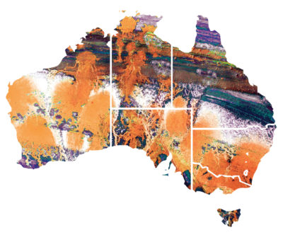
 Australia’s largest state, Western Australia (WA), occupies an entire third of Australia, a land mass that totals the combined land area of the three largest US states: Alaska, Texas and California. Considered the resource-rich engine room of Australia, WA contributes an estimated 58 percent of Australia’s Mineral and Energy Exports, according to the Department of Mines and Petroleum, and provided 25 percent of the world’s iron ore extraction in 2012.
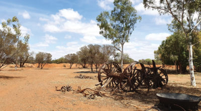
With 92 percent of its 2.6 million inhabitants living in the southwest corner, home to the state capital Perth, the rest of WA is reminiscent of the “Wild West”—sparsely populated towns with little infrastructure, rugged terrain and a kaleidoscope of reds, greens, coppers and browns that stretch into the horizon. In short, when someone pictures the Australian outback, they’re picturing WA.

Phil Richards stands on a drill pad and prepares to collect drill collar measurements at one of the 2019 prospect sites. The grey material is drilling spoils. Phil Richards
That same wild beauty and remoteness can also make surveying a less-than-beautiful experience.
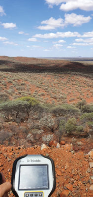
Drill collar numbers and recorded RTX 3D positions are saved in a Trimble TSC3 controller. Phil Richards
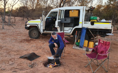
“The outback of WA is a real test on my adaptability and logistics skills,” says Phil Richards, a professional surveyor and associate director with Perth-based RM Surveys. “It can take 1.5 days to get to your first site and once there, you’re totally isolated with no resources—and climate conditions that can range from 0 to 50 degrees Celsius. The sparse, rugged road systems make navigating anywhere a long journey. And if the weather turns bad on your job and you didn’t plan well, you could be completely stranded.”
In addition to the natural unpredictability of the outback, there are significant technological challenges that add to the complexity: limited mobile phone service, time-consuming RTK base station set ups, inconsistent RTK cellular or radio communication, and geodetic control points that are difficult to access.
Advances in precise point positioning (PPP) technology, however, have been helping to resolve these obstacles and enable surveyors to optimize their real-time productivity without sacrificing accuracy. For Richards, who specializes in remote surveying work, this modern GNSS enhancement has helped bring a little tameness to the wilds of WA, enabling him to increase data collection efficiencies, reduce costs and boost the company’s bottom line.
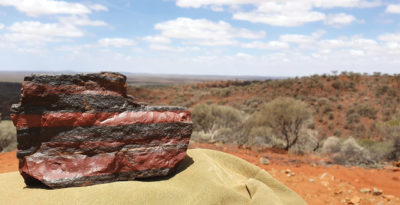
A chunk of banded iron stone. Western Australia has some of the biggest deposits of banded iron formations in the world. Phil Richards
The case for a new approach
With his aptitude for remote surveying, much of Richards’ project work in WA has been in support of heavily active mining companies. For example, for the past 15 years, one iron ore producer has contracted him to travel more than 600 km from Perth to measure exploratory drill hole collars. Drill collars, the remnants of drilling activity, are 3-mm-thick segments of PVC, about 150 mm in diameter, which protrude about 300 mm out of the ground at typically a 60-degree angle. Measuring the center of that above-surface collar is a crucial stage in the exploration process to enable the client to develop a geological model of their mineral resource underground.
Managing ten prospect sites across 300 km, the number of drill holes could vary from year to year, but often they would have up to 100 holes spread out over a few prospects at a time. Since 2007, Richards has been using Trimble® R8 and, more recently, Trimble R10 GNSS receivers and RTK technology to acquire the drill collar measurements.
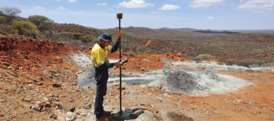
Holding the Trimble R10 and Trimble TSC3 controller, Phil Richards captures an RTX 3D position of a drill collar for the 2019 campaign. Phil Richards
On average, each prospect is 5 km by 2 km and has its own coordinate network. Depending on the number of collars and distance to each, Richards would set up an array of RTK base stations (between two and nine) on known control points to set project control. Using his Trimble GNSS receiver, he’d either drive or walk to each drill collar, set the foot of the range pole on the center of the collar at ground level, take a reading and record the measurement in Trimble Access™ field software on a Trimble TSC3 controller. Although the need for multiple base stations had added hours onto the projects, the RTK method consistently provided the needed accuracy.
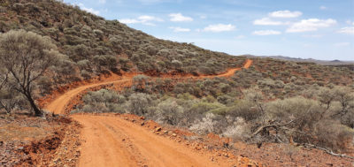
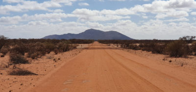
A typical road in the WA outback. Given the rough terrain, even short distances can take hours. Phil Richards
X hits the spot
In 2015, the iron ore company restructured its mineral exploration program. Rather than drill large numbers of exploratory holes across a few prospects, the new focus was to drill a fewer number spread over the entire project area. That was going to be problematic for Richards’ traditional RTK routine.
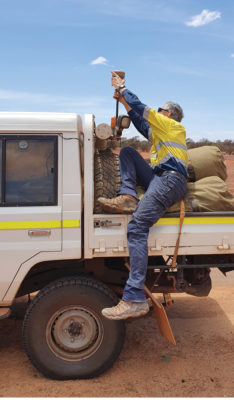
Phil Richards carefully removes the Trimble R10 GNSS receiver from his truck. Richards would use the drive time to the site to initialize the CenterPoint RTX positioning solution. Phil Richards.
“Previously, when it was predominantly surveying and less traveling, the RTK approach worked well for the project, even though setting up base stations is time consuming,” says Richards. “But when that switched to less surveying and more traveling, continuing with RTK was going to increase costs because each time I have to set up my base station, that’s an extra hour. If I have 10 drill-collar zones, that’s 10 hours. And if my base station is 10 minutes away, it adds more time and expense if I have a problem with it, or I can’t get a reliable signal, and I have to travel back to it to fix it or move it. The reduced number of collars and the increased distances between them required a more efficient method to make the project profitable.”
Richards’s ideal solution was one that would enable him to use a single GNSS receiver system, much like working within the VRS networks available in the more populated areas of Australia. The approach would give him mobility and flexibility in the field and consistent real-time GNSS measurements.
He began testing other solutions, including Trimble’s CenterPoint® RTX correction service. CenterPoint RTX is built on a network of GNSS tracking stations around the world that stream multi-frequency, multi-constellation data to the company’s network control centers. Advanced data processing algorithms analyze the three main error sources: satellite orbits, clock offsets and atmospheric effects and develop models and correction data. This information is delivered to GNSS rovers via L-band satellite communications. The rover combines the correction data with its own satellite observations to produce accurate positions.
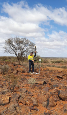
With the CenterPoint RTX solution ready, Phil Richards uses the Trimble R10 GNSS and Trimble TSC3 controller to calibrate project control with existing control. Phil Richards
Richards ran five trials in conjunction with varied exploration surveys to test the reliability, efficiency and accuracy of the RTX approach as a viable alternative to RTK. Choosing different test sites across 1,000 km of terrain, he took RTX measurements of survey control points with his R10 and compared them to the same positions acquired with RTK. Although the CenterPoint RTX can take up to 15 minutes to reach sub-2 cm horizontal accuracy in WA, Richards says the technology regularly delivered on performance. Most importantly, this technique would enable him to work without a base station and obtain real-time GNSS positions with centimeter accuracy anywhere—even in isolated WA.
Based on the trial results, he adopted Trimble’s CenterPoint RTX technology to integrate into his survey workflows.
Into the outback
Secured in time for the 2015 drill collar project, the R10 and CenterPoint RTX technology have been Richards’ core technology for each campaign since.
“With Trimble RTX, I can get right to work as soon as I reach my first drill collar site,” says Richards. “I don’t need to spend time with a base station so I’m much more mobile and that alone can save me a whole day’s work. I’m not limited by distance or the base station’s signal. It’s a brilliant tool and it’s a game changer for remote surveying.”
In 2017, Richards was contracted to survey 40 drill collar holes dotted around all ten of the client’s prospects. Richards and his colleague mounted the R10 GNSS receiver on their vehicle and set out for the first site at sunrise on a September morning. About 30 minutes from arriving on site, they activated the CenterPoint RTX and monitored the initialization via Bluetooth from inside the cab. With the RTX solution initialized and ready to go, Richards carefully dismounted the R10 and set the range pole onto a control point he previously established to calibrate site control. He navigated to the first stake indicating a collar, verified the collar number given, set the R10 on the center of the collar and via the TSC3’s Trimble Access software he entered the collar number and recorded the RTX 3D position. He then moved on to the next stake and followed the same routine, repeating it 39 times over 2.5 days.
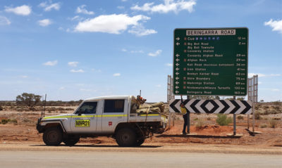
A road sign indicates the way to Cue, a small town 700 km northwest of Perth and the starting base for the 2019 campaign. Phil Richards
“With the distances involved and the large area we’re working in, the RTX really comes into its own for this project,” Richards says. “If I had had to use an RTK approach, and set up multiple base stations 10 different times, it would’ve added at least another day to the job. If you take all the driving out of it, we reduced 10 hours work of actual surveying time to one hour. That savings not only pays for my yearly CenterPoint RTX subscription, it’s a smart way to increase your profit line.”
They processed the data back in their office in Perth. The measurements were verified and input into a spreadsheet for the client.
For the 2019 campaign, Richards and a colleague were contracted to acquire accurate 3D positions for 13 drill collar holes stretched across two major prospects that are about 150 km apart. Their area of interest (AOI) was about 700 km northeast of Perth.
Starting from the small WA town of Cue, they drove to the first prospect about 60 km away, using the travel time to initialize the CenterPoint RTX positioning solution. Within the 15-km-wide area, they had to acquire measurements for eight drill collar holes. They calibrated the R10 receiver to the nearest control point to tie into the site’s coordinate system and moved through the area, methodically recording positions of each collar hole. Despite the relatively few collars to measure, it took Richards and his colleague about five hours to collect the data because the rough terrain made the site difficult to navigate.
With daylight still in their favor, they drove to the next prospect, which contained five holes at significant distances apart. By the time they reached the site, they could only complete one hole, so they camped out on site and measured the remaining four holes the next day. All told, they finished both prospect sites in 1.5 days—a project that would have taken 2.5 days had they used RTK.
“Given the project format, with so much travel time and less surveying time, RTX is really the only way to do it,” says Richards. “It’s far quicker than setting up base stations—I saved 50 percent of the time using RTX on this campaign. I am more efficient; I’m able to keep costs down; and I have the confidence in the system that I know I’ll deliver on accuracy. It’s hard to justify using any other method.”
Indeed, while there is little Richards can do to reduce travel times in the remote areas of WA, venturing into the wild with a proven and cost-efficient tool that can produce real-time, centimeter-accuracy positions in seconds is a reassuring advantage for staying competitive.
Editor’s note: According to Richards, there have been no adverse effects of the bushfires in this area to date.
Michael Bruno is the Market Manager for Trimble Advanced Positioning.
