In September 2024, the map of Western North Carolina changed.
Roadways disappeared. River channels shifted. Slopes failed. Bridges that had connected mountain communities for generations were damaged, destroyed or left inaccessible. In some places, the landscape no longer matched the records, drawings or maps that had defined it only days before.
Before Hurricane Helene reached the mountains, Western North Carolina had already experienced days of heavy rainfall. Saturated soil and swollen rivers had primed the region for flooding and landslides. When Helene made landfall in Florida on Sept. 26 as a Category 4 hurricane and tracked inland, it carried an extraordinary amount of moisture into the southern Appalachians.
Within roughly 24 to 36 hours, the storm fundamentally altered the region. Rivers rose to record levels, roads washed away, bridges failed and communities became isolated. Interstate closures along I-40 and I-26 severed major transportation routes, while floodwaters and landslides reshaped the terrain itself.
State estimates placed Hurricane Helene’s impact at more than $59 billion in damages and recovery needs. More than 6,000 miles of roads and over 1,000 bridges and culverts were damaged, illustrating both the scale of the disaster and the magnitude of the recovery effort that would follow.
As floodwaters receded, emergency response transitioned into long-term recovery. Recovery begins with assessment. Before roads could be rebuilt, bridges redesigned or utilities restored, engineers first needed accurate existing conditions. Existing plans, previous survey data, and historical mapping no longer reflected the reality in the field.
Recovery Starts with Assessment
Construction cannot begin without understanding existing conditions. After Hurricane Helene, establishing those conditions became one of the first and most critical steps in recovery.
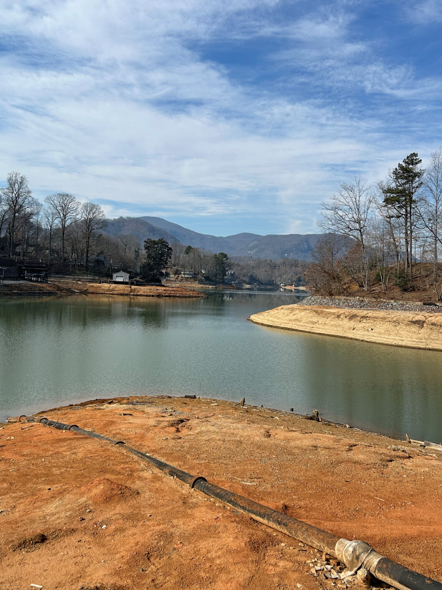
Unlike conventional projects where existing conditions are largely known, post-disaster surveys often begin without reliable assumptions about access, terrain or even the condition of existing infrastructure. Roads may no longer exist where mapping indicates, waterways may have shifted, and decades-old survey control may require verification or re-establishment before fieldwork can proceed.
For McKim & Creed’s survey teams, the challenge extended well beyond collecting measurements. Project sites were often difficult to access, with damaged roads, unstable slopes, debris-filled corridors and altered waterways creating hazards that required careful planning before fieldwork could begin.
Assessment became as much about planning as measurement.
“Every site presented a different set of challenges,” said Chad Burchette, McKim & Creed’s Mid-Atlantic Survey Director. “Before we could collect a single point, we had to evaluate how the storm had changed access, identify potential hazards and determine the safest way for our crews to work. That assessment became the foundation for everything that followed.”
Before field crews could begin collecting data, McKim & Creed teams evaluated site access, verified whether existing survey control remained usable and determined where new control would need to be established. Each site presented different challenges. Some required coordination with transportation agencies to access damaged corridors, while others demanded careful consideration of unstable embankments, active waterways, or ongoing cleanup operations.
Every project required surveyors to evaluate safe access, identify potential hazards and coordinate with owners, engineers, and public agencies to determine how and when data could be collected safely. Communication became equally important. Conditions evolved daily, multiple crews often worked simultaneously across numerous sites, and information collected in the field needed to move quickly to design teams responsible for rebuilding critical infrastructure.
Establishing clear communication channels between field personnel, project managers and design teams ensured changing site conditions, access constraints and survey findings could be shared in near real time. This allowed field activities to be adjusted quickly while providing engineers with the information needed to begin design as soon as survey deliverables became available.
Technology also played an essential role. Rather than relying on a single data collection method, McKim & Creed surveyors integrated conventional field surveying with terrestrial LiDAR, airborne LiDAR, hydrographic multibeam surveying and georeferenced imagery to efficiently capture accurate existing conditions while minimizing risk to personnel and reducing unnecessary disturbance to recovering environments.
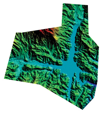
LiDAR data collected over the Lake Lure project area helped surveyors document terrain and topographic conditions following Hurricane Helene.
Three projects completed during the recovery effort illustrate how McKim & Creed applied these approaches to support transportation, rail, and utility infrastructure reconstruction.
Rapid Assessment in Challenging Conditions
Among the most visible impacts of Hurricane Helene were the bridges that no longer connected Western North Carolina’s communities.
Working for the North Carolina Department of Transportation (NCDOT), McKim & Creed survey teams documented five bridge sites in Buncombe County that had been destroyed or severely damaged by flooding. Engineers needed comprehensive existing conditions information quickly to begin evaluating replacement options, yet reaching many of the sites presented challenges of their own.
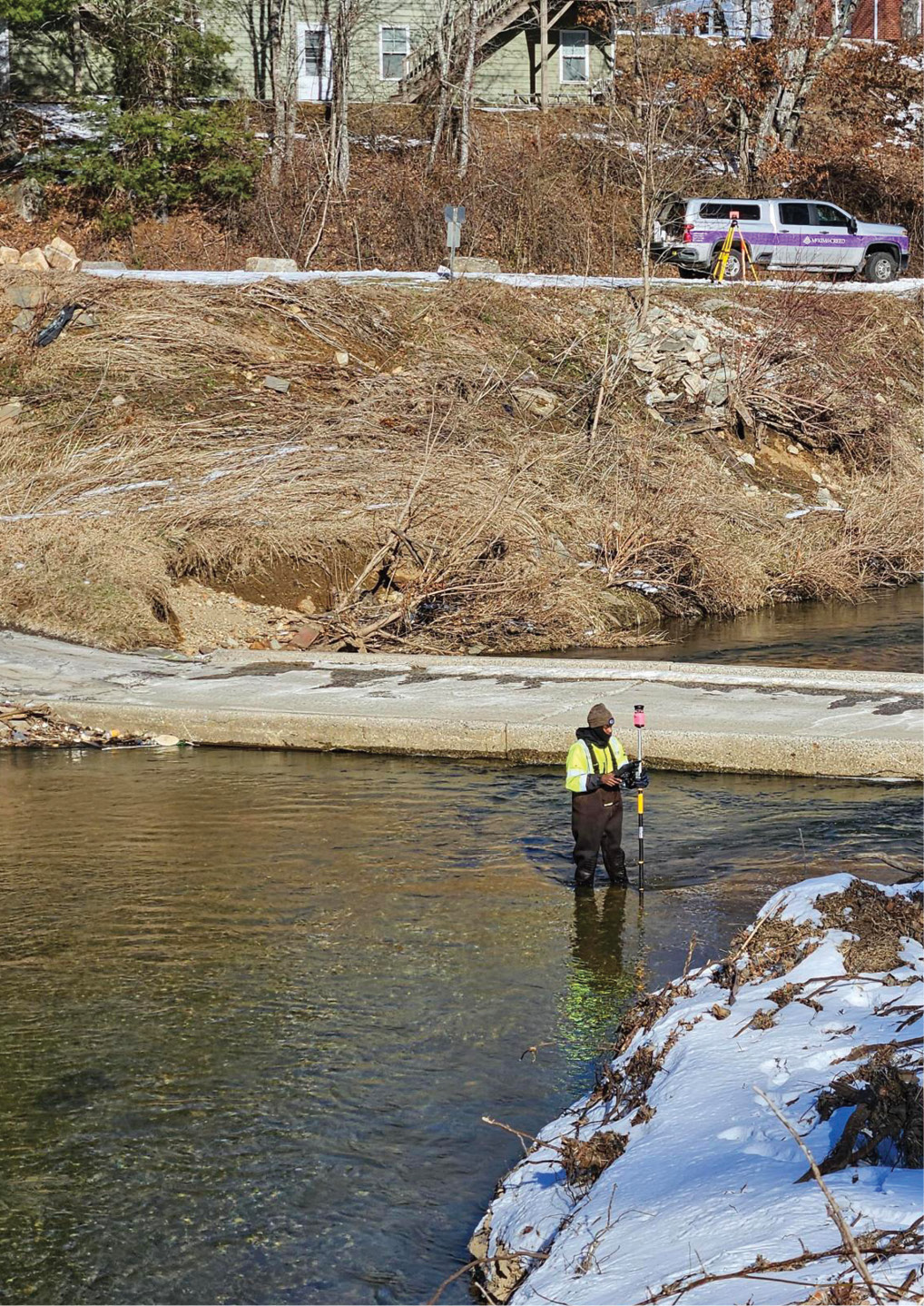
Recovery couldn’t wait for warmer weather. Just months after Hurricane Helene, McKim & Creed survey crews were in the field establishing the existing conditions needed to advance infrastructure repair and reconstruction.
Flood-damaged roadways, debris, and unstable terrain required deliberate access planning before field crews could safely begin work. At the same time, a one-month project schedule demanded rapid mobilization.
Multiple survey crews were deployed simultaneously across the five bridge locations, allowing data collection to proceed in parallel despite difficult winter conditions that included snow and freezing temperatures. Careful coordination among field teams ensured consistent data collection while maintaining flexibility as site conditions evolved.
The resulting survey data established the foundation engineers needed to begin bridge replacement design, demonstrating how rapid assessment can accelerate infrastructure recovery when time is critical.
Reality Capture at Corridor Scale
While bridge reconstruction focused on individual structures, restoring rail service required understanding an entire transportation corridor.
Following Hurricane Helene, Norfolk Southern initiated repairs along approximately 15 miles of railway between Old Fort and Black Mountain, encompassing 93 individual repair locations affected by flooding, erosion, and slope instability.
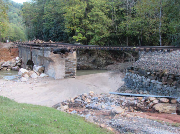
Damaged bridges, washed-out approaches and unstable terrain were among the conditions McKim & Creed survey teams encountered while documenting five NCDOT bridge sites in Buncombe County following Hurricane Helene.
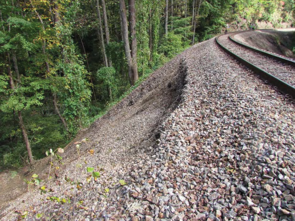
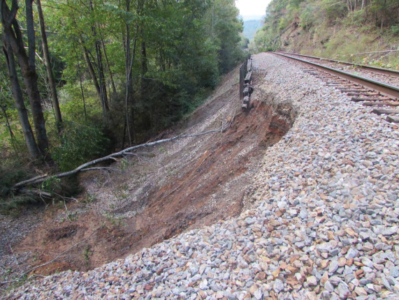
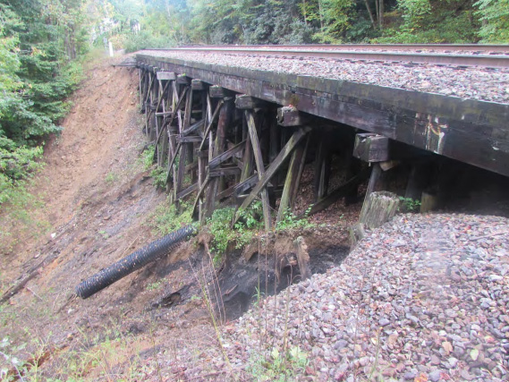
Rather than treating each location as an independent project, McKim & Creed established a comprehensive survey control network referenced to NC Grid (NAD83) and NAVD88. GPS control, terrestrial scanning targets, and precise level ties created a consistent geospatial framework across all 93 repair locations, allowing designers and contractors to work from the same survey-grade reference throughout the corridor.
Using a RIEGL VZ-600i terrestrial laser scanner, McKim & Creed captured high-resolution three-dimensional point clouds and imagery documenting track alignment, bridges, culverts, drainage infrastructure, and surrounding slopes. The data was processed in TopoDOT and MicroStation to extract engineering features, develop digital terrain models and produce base mapping, including breaklines and volumetric calculations to support earthwork verification. Deliverables, including registered LAS point clouds, LiDAR calibration reports and DGN files, provided designers with accurate existing conditions while reducing the need for repeated field visits and supporting efficient coordination throughout reconstruction.
For a project spanning dozens of repair locations, reality capture significantly improved efficiency. Designers, contractors, and owners could reference the same survey-grade digital information, reducing uncertainty and supporting coordinated reconstruction efforts across the corridor.
Integrating Geospatial Data for Utility Recovery
Hurricane Helene’s impacts extended well beyond transportation infrastructure.
In Lake Lure, flooding completely destroyed the wastewater treatment plant’s influent pump station and approximately 4,000 linear feet of the town’s century-old sewer system. Additional portions of the system sustained damage during both the storm and subsequent cleanup operations, requiring engineers to rethink significant portions of the utility network.
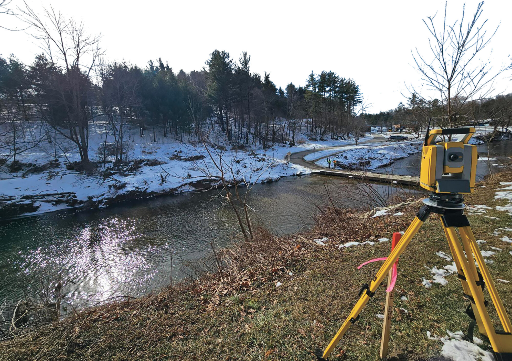
When disaster reshapes the landscape, recovery begins with understanding it. Across Western North Carolina, surveyors provided the accurate geospatial data needed to help turn assessment into design and reconstruction.
Capturing existing conditions required a more comprehensive approach than conventional land surveying alone.
Working alongside LaBella Associates, McKim & Creed’s survey teams integrated airborne LiDAR, georeferenced shoreline imagery, and conventional survey methods to develop a comprehensive dataset supporting the redesign of critical wastewater infrastructure. Previously collected hydrographic survey data for Lake Lure also provided an important pre-storm baseline, allowing project teams to better understand how the landscape had changed and helping inform recovery planning.
Conventional surveying established the project control framework that unified all datasets into a common coordinate system while providing supplemental measurements in areas where additional field verification was required. The team also prepared subdivision and easement plats to support the design of new electrical lines, sewer lines, and lift stations.
To document existing shoreline conditions, McKim & Creed captured georeferenced imagery using a vessel-mounted camera system. Delivered through an interactive GIS-enabled viewer, the imagery allowed engineers and stakeholders to virtually navigate the shoreline, assess site conditions, and make informed design decisions without repeated field visits.
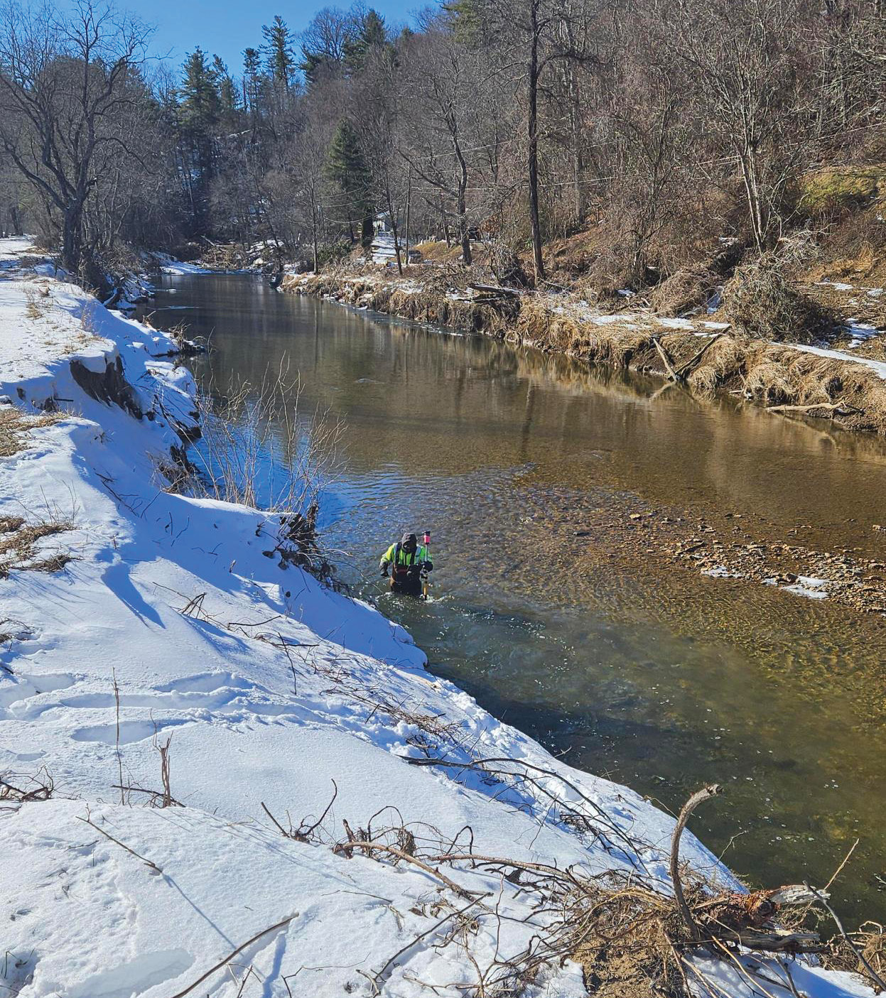
Flooding from Hurricane Helene reshaped river channels and surrounding terrain throughout Western North Carolina, requiring surveyors to document conditions that in many locations no longer matched pre-storm mapping.
Airborne LiDAR rapidly documented the project area following a planned 30-foot drawdown of Lake Lure, exposing terrain that would normally remain submerged. Using a RIEGL VQ-1560 II and a PhaseOne IXM-RS150F sensor simultaneous Lidar and imagery were acquired, the survey captured high-density topographic data across approximately eight square miles. The resulting dataset supported detailed planimetric mapping and one-foot contour generation from the water’s edge to the 995-foot contour, providing engineers with an accurate representation of post-storm conditions.
“Each technology contributed to a different piece of the puzzle,” said Rob Crawshaw, McKim & Creed’s Director of Aerial Mapping. “Conventional surveying established the control framework, LiDAR documented the terrain and infrastructure, imagery provided visual context, and our existing hydrographic data offered a valuable pre-storm baseline. Integrating those datasets gave engineers a complete understanding of existing conditions, allowing them to make more informed decisions throughout the recovery process.”
Together, these integrated surveying methods—and the ability to compare newly acquired information with existing hydrographic data—provided engineers with the high-resolution geospatial information needed to redesign critical wastewater infrastructure while minimizing environmental disturbance and reducing the need for repeated site access.
More than Measuring
Hurricane Helene reinforced the evolving role of the surveying profession in disaster recovery. As extreme weather events become more frequent and infrastructure systems face increasing demands, surveyors are being called upon not only to document existing conditions, but to establish the geospatial foundation upon which recovery depends.
That responsibility extends beyond collecting accurate measurements. It requires evaluating safe access, coordinating with multidisciplinary teams, selecting the appropriate technologies for each environment, and delivering reliable information under compressed schedules. Whether documenting damaged transportation infrastructure, restoring rail corridors or supporting utility reconstruction, surveyors are often among the first technical professionals on site, and among the last whose data continues to inform design and construction.
No single technology solved the challenges presented by Hurricane Helene. Instead, recovery demonstrated the value of integrating conventional surveying with terrestrial and airborne LiDAR, hydrographic surveying, and georeferenced imagery to create comprehensive, survey-grade datasets tailored to each project’s needs.
The strength of a multi-platform approach lies not in the individual technologies, but in how they complement one another. Conventional surveying establishes the control framework that ties every dataset to a common coordinate system. Airborne LiDAR rapidly captures terrain across large areas, terrestrial LiDAR documents complex infrastructure with exceptional detail, hydrographic surveys provide critical information below the waterline, and georeferenced imagery adds visual context for engineers and stakeholders. When integrated into a unified geospatial model, these datasets provide a more complete representation of existing conditions than any single method could achieve, improving design decisions, reducing repeat field visits, and enabling project teams to work from a common source of truth throughout recovery.
Hurricane Helene changed Western North Carolina’s landscape in a matter of days. Rebuilding the area will take years. Throughout that process, the surveying profession will continue to provide what every recovery effort depends upon: an accurate understanding of the landscape as it exists today and the geospatial framework needed to design the resilient infrastructure of tomorrow.
David Jones, PLS, CFS, is senior vice president of geomatics at McKim & Creed. A professional land surveyor and certified floodplain surveyor, he has more than 40 years of experience leading complex surveying, hydrographic and reality capture initiatives, with expertise in applying integrated geospatial technologies to support infrastructure planning, disaster recovery, and water resource management.