In August 2026 it was my privilege to interview Kenyon Mossberg with the Ontario Police Department, and Octave Intelligence Vice President Ben Ernst about Ontario’s implementation of Octave’s dispatch solution for public agencies. It’s an interesting and important location-based project successfully deployed in a major North American city, and parts of the fascinating conversation are excerpted below:
Please introduce yourselves.
Ben: I’m a vice president in Octave’s North America public safety business. Our solution helps provide the necessary information so that Ontario public safety professionals can launch drones and assist with response actions.
Kenyon: I’m a Senior Real Time Information Center operator and pilot here with the Ontario Police Department. Our primary role is to not only gather intelligence based on the calls that are coming in through Octave’s platform, but also to respond with our drones to the field to get on scene to see what’s happening.
What’s new and interesting about the Ontario project?
Ben: There’s a couple things. From an organizational perspective, Octave’s goal is to help organizations turn complex operational data into actionable intelligence. In this specific case, we are really taking the information from that 911 call for service and providing the necessary details to the drone platform so then it can perform its function. And so, you know, really at a very high level without getting into the details, our platform is connecting the people, the processes, and that real world data that’s coming from those callers to help improve the performance and reduce the risk for for the city of Ontario.
Then what happens?
Kenyon: Once our dispatch center takes that initial call and enters a call for service into the Octave platform, the direct API between Octave and SkyDio (AI-powered flight software) drops that call for service with the incident number, the location, basic information such as the call type and the phone number of the person who’s calling right onto a map for us to be able to either click on it on the map or on a list. The system will then select the closest drone and we hit launch and respond, the drone will then launch from the dock and fly there autonomously without us having to control it in any way and is on scene in less than ninety seconds from the time we hit that button.
How does location serve as the organizing principle for drone dispatch in Ontario?
Ben: I would say really location is the common language for this workflow implemented here . And so if you think about it, every emergency starts with a location. Every resource that the city of Ontario has starts with a location. Every drone flight has a location. Every responding unit has a location. And so as that call for service comes in from someone in the public, one of the primary pieces of information that is ultimately transmitted or integrated over to the SkyDio drone platform is the location of that call for service. And so that is why the mapping, the mapping integration and sending those coordinates to the drone platform are so critical because that is the primary input, not the only but the primary input that the SkyDio platform is looking for to ultimately launch the drone to that location.
Kenyon, from your point of view, what is better about this system compared to your previous ways of doing business and how do you measure that?
Before we went live with Octave, we were having to go through multiple steps of launching a drone, whether it was manually typing in the address, zooming around on the map, trying to see exactly where the emergency is located that way and clicking to start a drone, or being reliant on our CAD system talking to a third party, which then was importing data into SkyDio, which, if that third party was down, now we’re not giving the calls for service, versus that direct API connection that is drastically cutting down the time that it takes for us to launch a drone, to the point where, over the last 30 days, we’ve had about 440 drone flights initiated by calls for service. And of those, 83% of the time we’ve been on scene before a ground unit was able to get there, even to the point where we’re able to clear about thirty percent of those calls without a ground unit at all.
Are there privacy concerns or ethical guidelines for drone deployment?
Kenyon: As far as when to deploy and when not to deploy, there’s really no set standard. What there is a set standard for is when we’re actually recording with video. All of our flights, whether recording with video or not, are tracked and logged. And really that’s not so different than a helicopter flying over on a routine patrol. If one of our drones is over flying over the street on its way to a call or if we’re doing a training flight or a testing flight, there’s an operational need for that drone to be in the air. We’re not putting it up just to say, hey, we’ve got a drone up in the air.
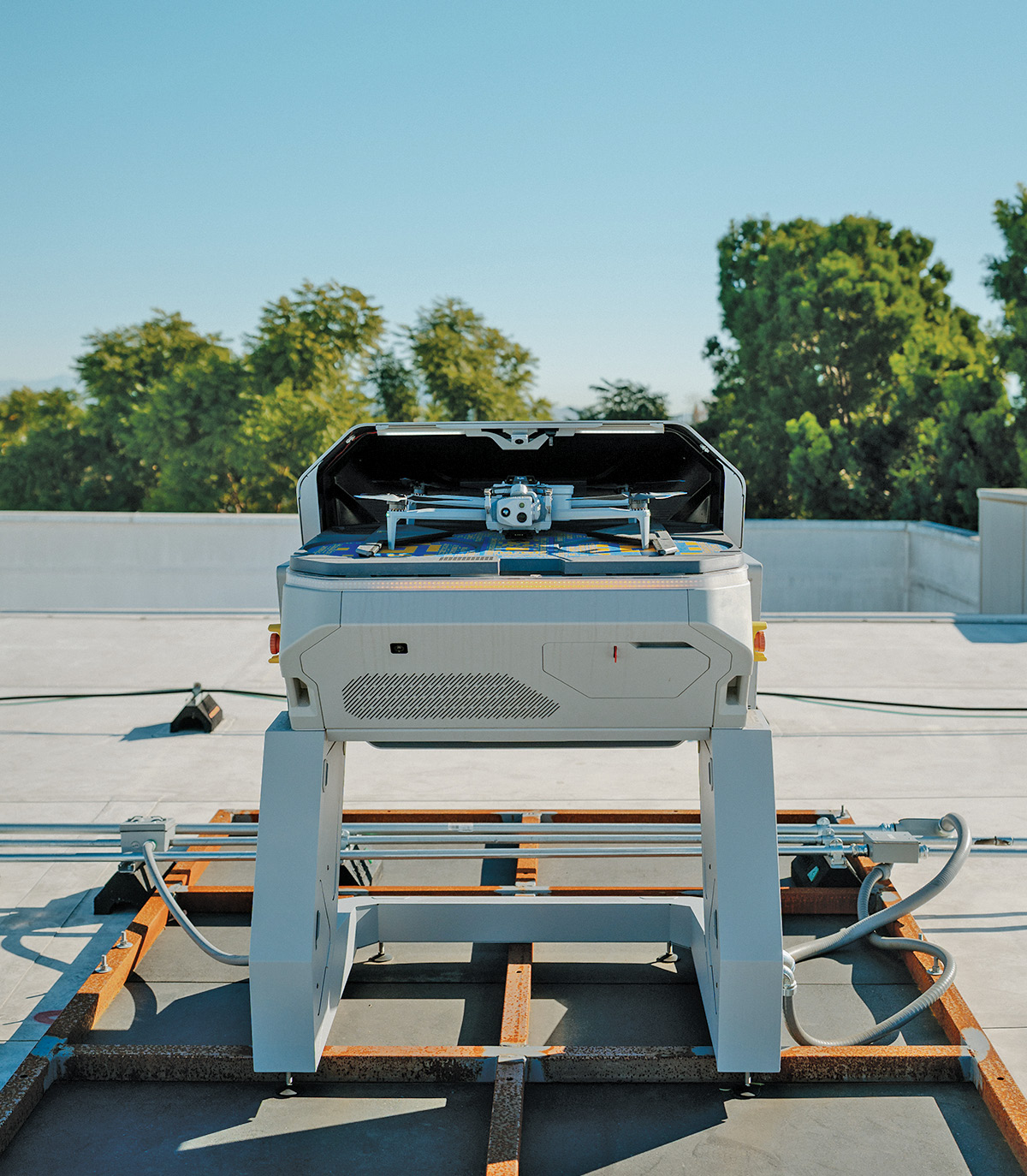
Every emergency starts with a location. Upon receipt of coordinates, the city of Ontario’s fully integrated SkyDio platform launches a drone into service.
What’s a specific example showing how use of drones gave you a material advantage in responding to an emergency?
Kenyon: Good question; so we had a short pursuit that a subject was on a motorcycle riding away from our officers, pulled into an apartment complex and went running on foot. That apartment complex backs up to an elementary school. Once the subject was running through the complex, we immediately launched not one but two different drones to respond to that location and begin helping to assist in searching for those suspects. And we were able to quickly clear the entire property of the elementary school and then continue working into the complex to ensure that our suspect was not at that school, potentially endangering children. And then we were able to systematically sweep the complex with the officers on the ground without them going behind a building and then coming onto an opening where a suspect could be hiding, waiting for them. We’re able to be that extra set of eyes so our supervisors in the field are able to actually live stream that drone and see what we’re seeing as well, which gives them a huge tactical advantage.
Are these special for drones for law enforcement use?
Kenyon: These drones actually would be considered stock consumer models. Okay. They have a 1080p camera. They can fly at about forty-five miles an hour and can stay in the air for twenty-five to thirty minutes roughly. There are a lot of private agencies, a lot of utility companies that are using the exact same drone for utility line inspections. So these are no different than what they would be using. All these drones have parachutes attached to them, so should there be some kind of malfunction midair the drone is able to come down safely.
Is this a mature technology?
Ben: It’s a fairly mature technology, Angus. You know, public safety agencies all across North America have invested heavily in sensors, drones, GPS, mapping systems, other types of communication tools. And so really the challenge is no longer collecting that information. It’s it’s really about getting the right information to the right person at the right location at the right moment.
If you think about the scenario that Kenyon walked us through a minute ago, getting that aerial video, that situational awareness if you will, to the first responders is so important to not only help reduce the risk to the officers or in some cases firefighters as well, but also reduce the risk to the public. And so the ability to gather and collect all of that information can be so valuable for the safety of everybody involved in the city. And so back to your your question, really, you know, Ontario’s deployment, in my opinion, really demonstrates how agencies and law enforcement and and firefighting and EMS can really move beyond what I’ll call traditional dispatch of 911 services and operations towards a much more connected, geospatially aware response ecosystem of taking all of these inputs and providing it into a single picture so cities and agencies can respond in the most effective way.
Angus Stocking is a former licensed land surveyor who has been writing about infrastructural and geospatial topics since 2001. As host of The American Surveyor’s Everything is Somewhere podcast, he regularly discusses geospatial technology, culture and philosophy with guests such as Ben and Kenyon. Access full audio and video episodes via www.amerisurv.com/podcast.