It’s finally happening. After decades of hand-wringing and despair, the survey replacements are showing up. A new cadre of registered Land Surveyors are appearing at the various Recorder’s Offices and filing their Records of Surveys. And just in time too. But there is a fly in the ointment, or, as Chris Cruze says, “I really like these people. I really do. But then they start talking. And breathin’. And stuff. I don’t like that.”
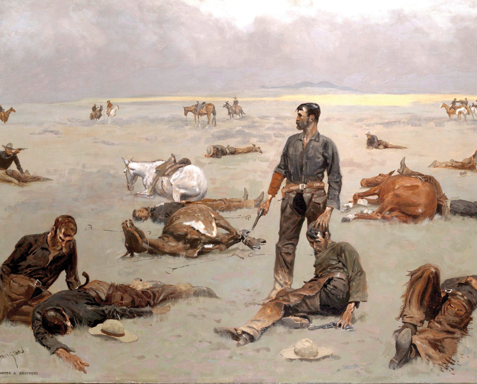
What an Unbranded Cow Has Cost., Frederick Remington, 1895,
What would you say to the youngster who boasts in his Corner Record that his proportioned ¼ corner monument is only two feet away from an ancient north-south fence? This is 1980’s and 1990’s stuff. Stuff that we got over almost 30 years ago. We would say, again,“Fences don’t prove a proportioned point. A proportioned position proves the fence position, never visa versa.” Clark says, in his 7th edition of Surveying and Boundaries at chapter 15.10: “The courts consider the evidence of fences more significant than any other form of evidence.”
We would ask, “Do you know what a property corner is? And how it is created?” A property corner is created when the buyer and seller agree on a point, mark it and convey to it. The numbers on the plat, or the deed, do not determine the point; these numbers must give way to what is found on the ground (evidence). This leads to THE declaration:
Surveyors are not professional mathematicians. Sure, we use math. If our tools were golf clubs, the one most called for would be labeled “math” and therein lays the confusion. Ever since England adopted Quia Emptores and Quo Warranto in 1290, land ownership has been a matter of law and is enforced by law. Now, an owner of land in Idaho need not hold off claim jumpers at the point of a gun. He can reside in New York and know that his land is secure. Secured by the force of law. In the United States, if there is a dispute over an ambiguous land description, the dispute is resolved in court. Period! Ultimately, Land Surveyors do not resolve boundary disputes. Neither do attorneys. Judges do, and they use either legal precedence or they establish new precedence. Land surveyors who attempt to assist in resolving boundary disputes based upon numbers, while ignoring the law and evidence, are short-cutting charlatans.
From beginning to end, land ownership is about law and is defined by law. In Canada, so we have been informed, Land Surveyors are informally known as “attorneys of the land.” Just so, in the United States it would be more appropriate if Land Surveyors were licensed under the State’s Supreme Court, rather than under a bunch of Mathematicians (Engineers) whose sincere belief mirrors that of the Greek Philosophers: “All things can be described by numbers and numbers are the ultimate reality”. That’s typical Greek self-delusion babble. Such weaknesses led to the Greek’s subjugation by the more practical Romans.
Numbers are primal for building bridges but not for resolving land disputes. Absolute reliance upon numbers should be foreign to the world of Land Surveyors, but instead, this condition describes our college courses, continuing education and to a great extent, the BLM manual. Contrarily, great surveyors like Jeff Lucas, and now BLM’s own Monty King, understand and practice the supremacy of law and evidence over mathematics.
Monty King, BLM Cadastral Surveyor out of the Boise, Idaho Office included this wisdom in his Report of Investigation dated December 5th 2022 addressing Section 1 and 12 of T33N, R3E, B.M.: “According to evidence recovered I am in the opinion that most of Group 501 (1985) will need to be canceled along with a large part of Group no. 1023 (2005)….Most landowners have ignored the BLM resurvey monumentation and typically occupy to the old fence lines. (Rather than ignoring the 1877-1893 allotment surveys)…it should be considered to view the allotment surveys through the title lens. 1. The Allotments were surveyed and assigned via the Indian Agent’s authority. Title (was) acquired through Indian Agent authority, not necessarily GLO. 2. The allottees were shown their surveyed boundaries and were directed to occupy to said boundaries. 3. All of the title was held by the Indian Agency in trust for the Tribe, no patents had been issued prior to the allotment surveys, therefore the allotments would be the senior title…
We, and BLM, or so I thought, got over the 1973 BLM Manual’s demand that evidence must be beyond a reasonable doubt (BARD), decades ago. BLM’s POST 1973 practice had been that, lacking BARD evidence, restoration of corners must conform to the numbers of the Field Notes. Such foolishness, when the best of GLO’s surveys had a radius error of 20 feet, for both bearing and distance.
In 2025, BLM’s answer to Monte King’s astuteness in 2022 was to issue King’s report with all of King’s wisdom redacted!
Is our profession like the dog that returns to its vomit?
Everyone says, “A proportioned position is the last resort, when there is NO other credible evidence.” In 1985, in Kamiah, Idaho, in Sections 1 and 12 of T33N, R3E, B.M., the BLM filed retracement Field Notes that conformed to the 1973 manual but amounted to 76 pages of self-confessed malfeasance. This was in fact an illegal Independent Resurvey. Sixty-three times the BLM established proportionate positions from which they gave ties to conflicting fence corners and/or street centerlines and even private survey monuments. Most of these fences date from the Indian Allotments of the 1870-1890’s.
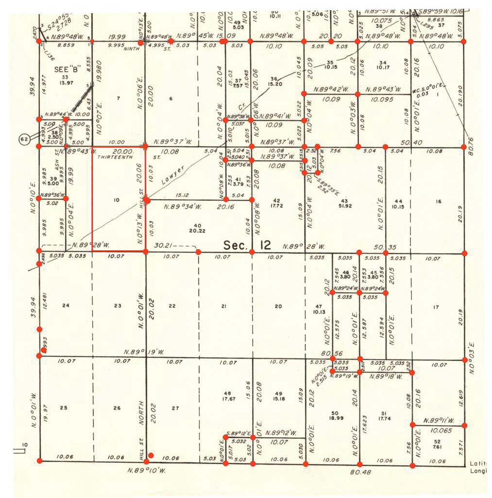
Annotated snapshot of sheet #2, 1985, T33N, R3E Plat showing the location of questionable proportionate corners.
BLM is aware of the problems in Sections 1 &12 but hide from them by redacting its own reports. We’re running out of barf bags.
The only evidence that can be B.A.R.D., the highest standard for evidence, is a bearing tree. It is reasonable to suspect that even a found original, upright, and secure GLO stone might have been moved, first by the following Indians, and second by conniving ranchers/homesteaders. BLM belatedly changed that standard in its 2009 Manual.
In our younger years we once assumed that an upright and secure original GLO stone that we found was incontestable, and accepted it, and this though it was 34.5 feet away from a fence corner. After all, the stone had a set of BTs all painted red with BT tags. (A previous private surveyor had also accepted the stone and established the new BT’s before we got there.) We didn’t bother measuring the B&D’s. That was an expensive mistake.
A later surveyor was more diligent and found another set of rotted original BT evidence, confirming the fence corner. The stone was indeed 34.5 feet out of position. When confronted, the rancher/owner boasted of how carefully he had moved and re-set the stone.
As a caution, we would say, “Use the Golf Bag parable. It is not wise to rely upon only one club. Eventually your pride will trip you up, be it fences, proportioning, stones or manuals. A good surveyor must know how to use each club, when not to use a particular one, make those decisions quickly, accurately and to be prepared to competently defend them in court.”
We would say to the young, new surveyors, “Welcome aboard. Keep it ship shape and Bristol fashion and keep the barf bags handy.”