It’s hard to talk of Tombstone, Arizona and not immediately picture the great shootout at the O.K. Corral. A town filled with dusty boardwalks and rolling tumbleweeds and the epic battle between the law and the criminal Cowboy gang, known for their red sashes. A shootout that was so great, it was heard about around the world. Even so much so that railroad investors like the Rothschilds were getting cold feet. What followed was one of the cleverest court cases following the shootout that saw the Earp Brothers and one, John Henry Holliday, more affectionately known as, “Doc,” are often left out of the great movies such as the 1993 classic Tombstone or the slightly more realistic, but lesser appreciated Kevin Costner film, Wyatt Earp.
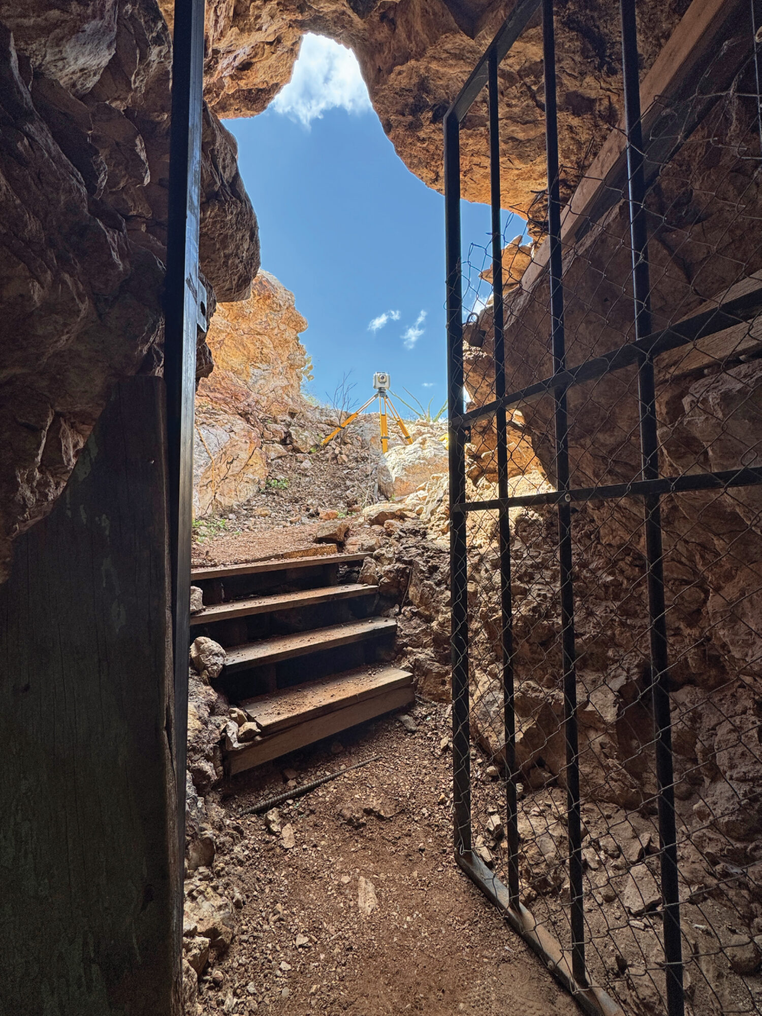
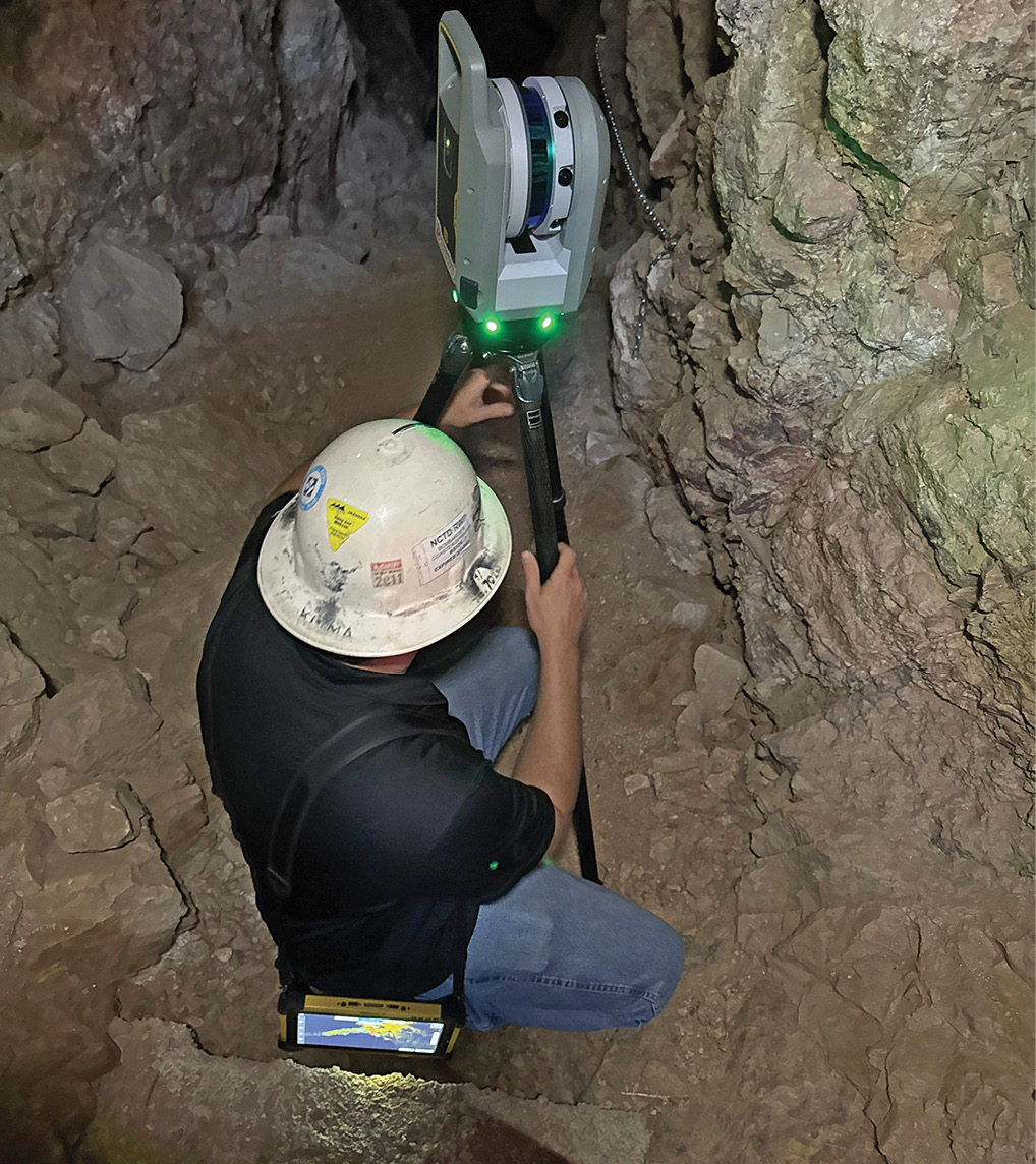
Photo from inside the entrance to the Good Enough Mine and the start of Azysn’s 2025-26 project.
As well as his time before and after Tombstone. For a time, Wyatt Earp served as a hunter working with a survey crew. In Tombstone, he surveyed his own claim, on which he and his brothers built their homes. Some of the monuments and reference points still exist today. Should you feel the desire to search, the Bureau of Land Management still has a folder of PDF’s online containing the Earp land grant and survey notes. Compete with the signature of Earp and Holliday. Swearing testimony to do their best to act in the betterment and interests of the public.
Much of Tombstone’s incredible history hides in the shadows of the Earp and Cowboy war. However, the town that’s “too tough to die,” has a great history, filled with other strange and bright individuals, beautiful architecture, and some of the best bars in southern Arizona. But few bother to stop and ask why the town is called Tombstone? That was thanks to Mr. Ed Schieffelin. The former army scout who patrolled the area for Apache war bands discovered an area where the silver was literally sticking out of stone outcroppings. When he told everyone he was traveling to the area they told him, “The only thing you’ll find out there is your tombstone.” When Schieffelin hit it big, to spite the nay sayers, he named the town “Tombstone.” His top two earning mines raked in a whopping $50,000 per month (around 1.5 million today). Schieffelin did ultimately find his tombstone in Tombstone. Buried approximately 2 miles northwest of the town, the “Schieffelin Monument”, a cone like pyramid of stones with a plaque, is still available to visit. Travelers beware though, Tombstone is not the place for uncharted nature walks, as there are some few hundred mine shafts unaccounted for. One wrong step and you may very well be a permanent resident.
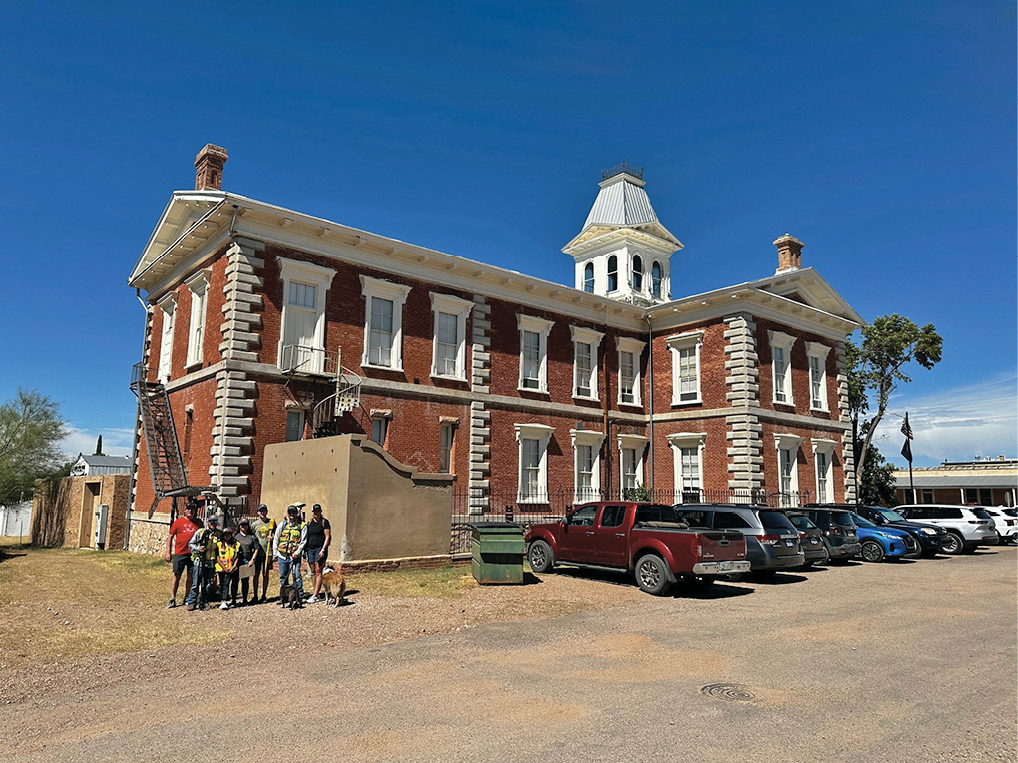
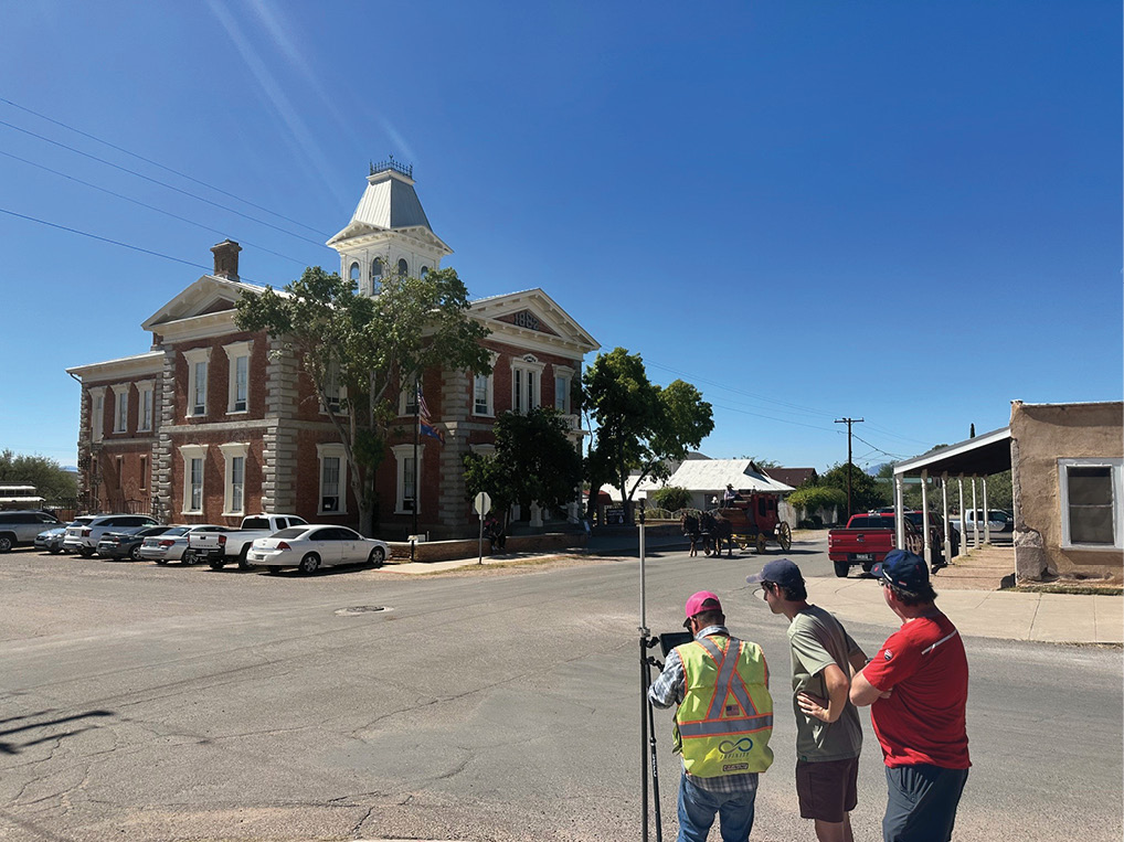
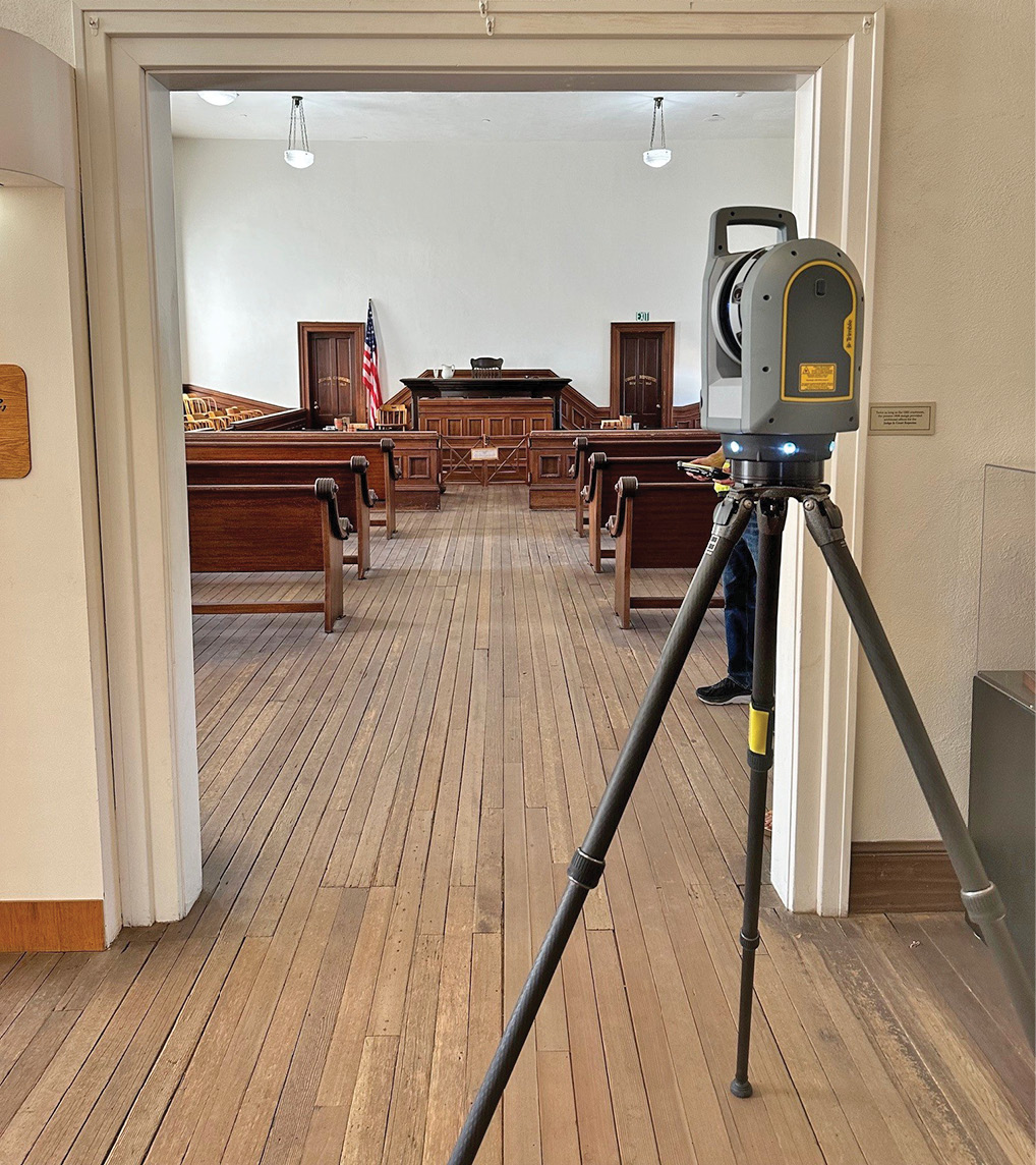
A combination of GNSS control and scan data was used for the courthouse and mine.
Once word of Schieffelin’s finds got out to the world there was a mad rush to Tombstone. By 1883 Tombstone had telephones, two gas companies, three water companies, five ice cream parlors, the first swimming pool in the state (territory at the time) a horse track, and a baseball team that played until 1929. So, by no stretch was Tombstone a backwater mining camp. It was a buzzing metro and a gem of the Arizona territory.
So, what does this have to do with surveying? Well, that’s where the Arizona Young Surveyors’ Network steps in. The Arizona Young Surveyors’ Network was formally established in 2023 as a subchapter of the state organization (Arizona Professional Land Surveyors) and a branch of the national YSN; a subchapter of NSPS. The Arizona Young Surveyors’ Network was informally active prior to 2023 operating at outreach operations in the local schools, conferences, and career fairs, but wanted to be a larger presence and make impacts within the professional communities like other Young Surveyors’ Networks were doing in the west.
Within the first meetings the newly founded board, comprised of Will Wing, Davis Borrego, Tate Childers, Farrah Etcheverry, and myself, wanted to find a way to get other young surveyors involved in such a manner that was enjoyable, educational, and gave back to the community that we work in. Inspired by the historic preservation efforts of the Notre Dame Cathedral that ended up saving original architecture after burning in 2019, the group decided we wanted to do some form of historic preservation of our own. In this fashion, we could cover basic principles of surveying practices but do so in a fun place. Upon completion our state would have something tangible and useful that would keep our historic site intact for generations to come.
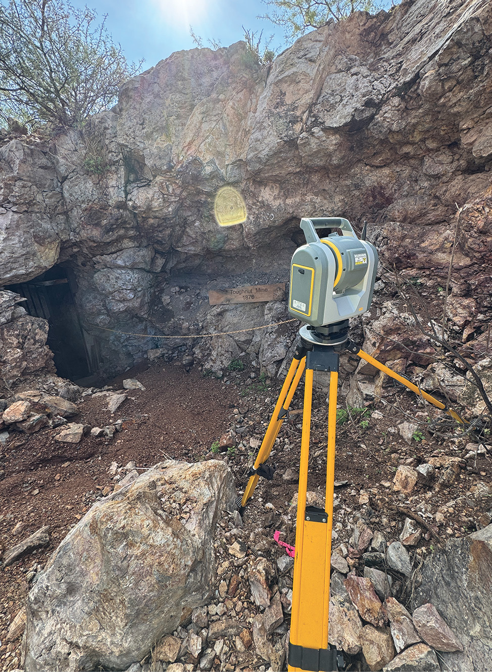
It didn’t take long before we settled on the idea of doing some kind of survey in Tombstone since it was one of the first places most individuals thought of when you discuss historic Arizona. We were quickly in contact with the State Parks Department and discussed a boundary and external scan of the courthouse. The Tombstone Courthouse State Park made sense to us because not only was it in Tombstone, but it was the first state park to actually open in Arizona.

Data from year 1 of the courthouse project. Data procured using Trimble R8’s and an sx10 only. X9’s were used the following year and registered to this cloud.
With a few phone calls and meetings with the park and a virtual handshake, Will and I got down to work on pulling surveys and research for the area. One of the first things you’ll notice surveying in the area is unlike most places that were laid out using the public lands system, is that the streets of historic Tombstone do not run north and south, east and west. Again, it must be remembered that Tombstone was founded prior to Arizona becoming a state, and the Public Land Survey System wouldn’t arrive for a few years. The original streets therefore are laid out parallel with and perpendicular to the railroad.
While not a particularly difficult thing to adjust to by any stretch of the imagination, the junior and senior rights battle with the Tombstone Courthouse and their neighbor was a challenge. After learning of this, the formal boundary survey idea was quickly scrapped. The group resolved that we would recover any boundary pertaining to the courthouse, as well as some centerline street monuments simply for the sake of experience for those attending, as well as ties for the external scan.
Among the survey problems we were faced with admin problems regarding lodging and dinner. Tombstone has many bed and breakfasts, smaller inns, but only one large hotel. After contacting them and receiving an unfavorable rate comparative to the standard rate, the board decided to leave it to the individuals showing up to find lodging. Worrying that this may dissuade some groups attending. Additionally, only one restaurant would allow for large group reservations. If we chose to pass up on taking that, we’d be at the whim of the crowds. To the surprise of the board, however, everyone was perfectly happy with both conditions and has remained that way for all three years that the Arizona Young Surveyors’ Network has held this event.
The day of the first trip we had just eight individuals show up. Not a huge turnout, but a solid start for the board to figure out the shortcomings and “lessons learned” for the trip. The positive of the small group, however, was hands-on time for our newest aspiring surveyor. Matt, now a student at Northern Arizona University, decided that he was interested in the field and wanted all experience he could get.
He had his first real intro to surveying when we realized the point on top of the courthouse was missing. This point had been used as a local benchmark for many years but was taken down just a few years prior to our survey. The group decided we’d use an assumed elevation until we could get to the top of the highest hill in town where the “COMSTOCK” NGS point was located. To our surprise, however, the park ranger pointed out that there was a benchmark located right on the face of the courthouse near the entrance.
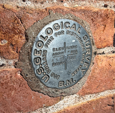
Benchmark in face of county courthouse.
Once we had found several initial centerline monuments and were properly elevated, we were able to start hunting for the courthouse monuments. To our joy, nearly all monuments were recovered in their described condition. Including a “drill hole in wall footer,” that was a particular challenge to dig up.
Once boundary was located, control was set and the Trimble SX10 was deployed. This was the longest portion of the survey. Still, the time from start to finish for a full exterior scan (gallows included) only took around three hours. After which, the director of the state park asked if we would be able to do an internal scan of the courthouse the following year. To which we emphatically said, “Yes!”
Year one’s success was largely thanks to the work of Will Wing (past VP and Current VP of APLS). Will Wing’s company, Infinity Land Surveying, donated the equipment, money for shirts for the event, time and research, and dinner (also the time to commemorate the drown that flew away and crash landed somewhere in the desert. Regrettably, finding its tombstone in Tombstone like Mr. Schieffelin).
The second year we switched over from the SX10 to not one, but two Trimble X9’s. We originally had planned on only having one X9 that Diamondback Land Surveying allowed us to use, but Allterra Central also showed up with a second. Thinking that we’d be done with time to spare, we set off to work. One X9 upstairs in the courthouse, and one downstairs. After an hour or so of scanning we learned that this was going to take significantly more time than we thought. The amount of display cases, doorways, and halls made for a ton of setups. Running two scanners, we might be done in the scheduled time, but we’d be sliding into the finish line with mere seconds to spare. In total, we had 130+ scans for the inside alone. The benefit to so many setups, of course, was a great deal of overlap and point cloud density.
Once complete we were able to deliver two thumb drives and a cloud data file (file sat at 76GB and change) to the Tombstone Courthouse State Park. Ensuring that multiple copies exist so should anything happen, the building can be restored. This was the first time in the park’s history that they had a planimetric file that showed the whole courthouse. News of the project spread, and we returned this past year to start a whole new project — the Good Enough Mine.
The entrance to the Good Enough Mine.
Under the presidency of Nathan Robinsnon, the event has swelled to over twenty people who traveled from New Mexico, California, and Utah. Additionally, the outpouring of support and donations from our local Arizona firms has helped grow our program and make our projects become reality. We are eternally grateful. With the project not completed in 2025, the Arizona Young Surveyors will be returning to finish the Good Enough mine, as well as potentially a second nighttime project. Due to the popularity of the event, the Arizona Young Surveyors have added an event and will be holding a workshop at Taliesin West, one of Frank Lloyd Wright’s homes sometime in the early new year (2026).
The overall project was a tremendous success and has started a new tradition in the great state of Arizona. Everyone involved benefits from this event. Our surveyors gained experience, the state park received a service they normally couldn’t afford, and the public gained insurance and protection of state and US history. Additionally, we grew awareness with the public, as many stopped to ask exactly what we were doing. It happened so much so on the first year that one of us took over the position as “public liaison,” answering questions so that our newest member could focus on working and learning the equipment.
Our main hope by sharing this nationwide with the American Surveyor is to encourage other existing Young Surveyor groups to set up similar events in their states. And further, in the states that don’t have a Young Surveyors’ Network yet to go out and get involved and be the leader your state needs. We hope to see many of you travel to Arizona for future events!
William Wing, Infinity Land Surveying, LLC, is a seasoned Registered Land Surveyor in AZ and NM with over fifteen years of experience. Upon graduation in 2003, William moved to Phoenix, Arizona where he continued steadily progressing his career in the Survey profession. At the launch of Infinity Land Surveying, LLC, in 2017, William now serves commercial, private, and public sector clients throughout Arizona and New Mexico.
Dustin Gardner is a fourth-generation land surveyor working for Diamondback Land Surveying. A University of Nebraska – Lincoln and Idaho State University alumni. Outside of work he is a father, folklorist, and author.