This is not the article I had intended to write for this issue. But I can no longer restrain my frustration with what has been happening nationally regarding floodplain management over the last several months. It is time and past time for surveyors, engineers, planners, and every design professional to step up and fill the gaps that have been left as a result of changes downgrading the functional abilities of the Federal Emergency Management Agency.
While FEMA has always experienced problems (like any governmental agency), this year’s cuts to staffing and resources present new threats to preparation before floods, search, and rescue efforts during and after floods, and recovery after floods.
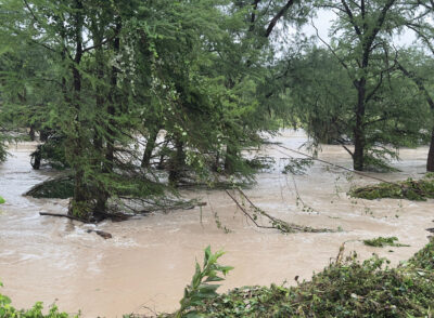
Astoundingly, search and rescue operations in the wake of Texas floods were delayed by days while waiting for the head of Homeland Security to approve any expense over $100,000, presumably to save taxpayer dollars. What about lost taxpayer lives?
Frustratingly, programs to help communities plan ahead and build or retrofit for resiliency have been gutted. The difficulty with assessing the value of pre-disaster mitigation is in measuring the dollars NOT spent after a flood occurs because a community was able to survive an event due to proper preparation.
Inexplicably, various state governors’ requests for Presidential declaration of disaster after a flooding event (required before any federal assistance can be made available) don’t seem to have been treated equally. Why was West Virginia’s request granted while next door Mayland’s was denied? The cost of rebuilding homes, businesses, roads, and infrastructure is far beyond local ability and state resources. The cost in lost lives is incalculable.
This is where we as design professionals must step up to fill the gaps left by reduction of FEMA’s programming, staffing, and resources.
Design professionals need to understand the land: the soils, slopes, erosional stresses, and the cumulative effects of every bit of additional impervious surface. Such surfaces are not just pavement. Unless of the “green” vegetated variety, rooftops are impervious surfaces. There has always been a section in the National Flood Insurance Program regulations addressing cumulative effects of development (44 CFR 60.3(c) 10), but I rarely see it enforced.
We need not go above and beyond the basic minimum standards of floodplain management to protect the public (although those may soon also be under scrutiny by the current administration). It only makes sense to pay attention to the identified flood risks on a site and to advise clients of the hazards of ignoring them.
If the ground on a site is only a tenth of a foot above the identified Base Flood Elevation but the original mapping was to two foot contours (meaning 95% of spot shots are within a half contour interval), maybe the contract with the client to apply for a Letter of Map Amendment to remove the site from the Special Flood Hazard Area should contain warnings and advisories about remaining flood risks. Yes, a little CYA, but also important for the client to understand fully. And better to have provided unwelcome information upfront than be sued later on the basis of “I never would have built or bought if I had known.”
Pay attention to the prior condition of the land. Is the site “legacy sediment:,” the soil that fills in mill ponds or behind an old dam over years? If so, that soil is unstable and is prone to washouts and erosion. There are numerous sets of historic aerial imagery freely available, whether from state or local geographic information systems or Google Earth. Are there underground streams that could come pushing up through the soil? In Philadelphia (and in my neighboring 120-year-old development), many such waterbodies were buried well over a century ago. The fill material was not always the best, sometimes just fly ash left over from coal production, not mixed with anything as is done now to create concrete. In multiple areas this has caused surface and building collapses, not even requiring heavy rains. The stormwater and water departments have maps. Consider other factors: are soils clay or sandy loam, and what is the normal height of the water table? The US Department of Agriculture and various GIS sources can provide some of this information.
But what about the other aspects of floodplain management, preparing for post-flood? Just as we do for development plans that clients present, we can advise our communities if a plan for a storm shelter is suitable for the proposed site. Elevation might help, but other times better advice might be to change the orientation or location on site or even warn against anywhere on that particular property. Just because something can be built does not mean that it should.
Don’t forget that there are things we can do as individuals that don’t involve our professional backgrounds. We can volunteer to be part of search and rescue teams (after proper training). We can gather food and clothing for the recently unhoused. We can be caring and compassionate in the face of post-disaster hardship.