“Therefore, these organizations hereby create and institute a ‘Public Land Survey System Foundation’ (PLSSF) for the improvement of the surveying and mapping professions as they relate to the Public Land Survey System (PLSS) and boundary surveying in general.”
![]()
With those words, a new era of cooperation between the government and the private sector was born to address the need for improving surveying within the PLSS.
Based on a September 2008 memorandum of agreement between the Department of Interior, Bureau of Land Management, and the American Congress on Surveying and Mapping (now the National Society of Professional Surveyors), and chartered in August 2009, the PLSSF is approaching its 16th anniversary. A renewed focus on the PLSSF’s mission, an updated website, greater functionality, and new materials commemorate this milestone.
Created initially to help transition to the BLM 2009 Manual of Surveying Instructions, including promotion and sales, its charter encompasses much more, explicitly providing additional opportunities to educate the survey profession in proper legal procedures in retracing PLSS surveys and other federal boundaries. Further, it assists BLM in its mandated mission of protecting and maintaining the PLSS. Closely following the creation of the Certified Federal Surveyor (CFedS) on September 2nd, 2008, it was viewed that these closely related programs would work in tandem with each other to benefit all surveyors operating within the PLSS.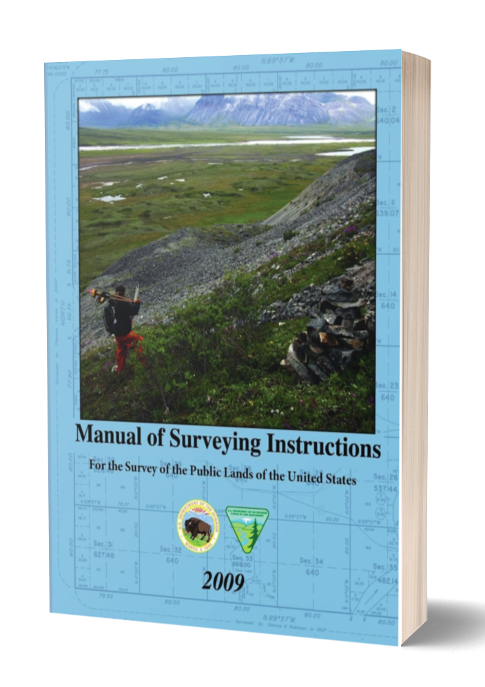
An administrative panel oversees the foundation’s work. Comprised of a diverse group of survey-related professionals, the panel guided the foundation’s future direction last year to reenergize its core mission by completely rebuilding its website, www.plssfoundation.org. However, the most popular things remain, such as the video vignettes introducing the 2009 Manual, various informational PDFs, and contact listings for panel members.
Initial sales of the 2009 Manual were quite robust. Still, as one might expect, sales have precipitously declined in the intervening years, particularly since the manual is now available online in PDF format. Most surveyors still prefer a hard copy on their reference shelf.
What is new is that three water courses have been developed with the Certified Federal Surveyors (CFedS) program. These mutually funded courses on accretion, reliction, and avulsion are the same as those found on the CFedS site and are excellent treatments for the topics. While not intended to supplant state society conference offerings or compete with other presentations offered through related sites such as those provided by the Western Federation of Professional Surveyors, they do cover lightly treated topics from the PLSS perspective and come highly recommended to those surveyors who frequently encounter water boundary issues.
Since its inception, PLSSF has awarded scholarships to promising surveying students of two-year and four-year institutions. In doing so, the foundation fulfills part of its core mission to advance surveying education. This effort continues with additional PLSSF/CFedS scholarships contemplated. This scholarship would focus on providing funds to offset the CFedS program cost to promising students who have passed their FS exam and will graduate, or have recently graduated, from a surveying educational program.
What does the future hold for the PLSS Foundation?
A key question is: “What does the future hold for the PLSS Foundation?” While predicting what will happen over the next 5 or 10 years is impossible, the foundation board can establish a positive direction. The initial consideration should be whether the purpose has changed over the past 16 years, and if it has, what new purpose can be established while still adhering to the guidelines of the original charter. I believe that much can be done to expand the development of educational offerings that do not conflict with existing ones. As examples, while there are links to the decisions of the Interior Board of Land Appeals (IBLA), the Interior Board of Indian Appeals (IBIA), and solicitors’ opinions, there is no particular focus or synthesis on their impact on everyday boundary issues. This section can provide additional commentary. A PLSS discussion forum will also be established where surveyors can discuss issues specific to working within the PLSS
A quarterly newsletter is also contemplated, providing updates on issues affecting the PLSS surveying community. The newsletter will advertise job openings, relay information about technological advances and PLSS methodology, and exhibit interesting problems with solutions.
Another area where the PLSSF may assist concerns the NCEES PLSS exam module, which is currently under development, with its introduction contemplated for 2027. PLSS state licensure boards will have this option as part of their licensing requirement. While final specifics have not been established as of this writing, many boards are expected to require this module as part of the licensing process. The NCEES PLSS exam module assesses fundamental competency, while the CFedS program provides surveyors with comprehensive knowledge of the complexities associated with federal boundary surveys.
This exam module will test PLSS procedures in much greater depth. Like the current FS and PS practice exams, a practice exam is being developed. We are in discussions with NCEES, and it is hoped that they will also allow this practice exam to be offered on the PLSSF site.
A stronger, more direct bridge between the PLSSF and the CFedS program can be developed that will facilitate those surveyors interested in gaining a greater depth of knowledge of the PLSS and transitioning into the CFedS program.
The aim is for these related educational organizations to collaborate to benefit the surveying community, especially PLSS surveyors. This can be accomplished by considering each as a steppingstone, climbing higher, and enhancing the overall profession. Think of it as a collective of information. The CST program consists of four levels and provides training to assist a technician in preparing for professional growth if desired. The PLSSF can provide them with guidance in all things PLSS. These collaborative efforts may ultimately lead to certification through the CFedS program. But it doesn’t end there. Working with these educational platforms, surveyors can sharpen their skills, learn of new IBLA and court case decisions affecting policies, and be exposed to unique situations others have encountered in surveying the PLSS. The point here is that the PLSS is not static. It is still evolving. IBLA, IBIA, Solicitor opinions, and court decisions affect the system’s dynamics.
The PLSSF can provide guidance for boundary retracements, resurveys, fee-to-trust transactions, or simply calculating a mean bearing at a specific latitude. This won’t happen overnight. It will take a concerted effort by many involved. However, the work has begun, starting with the website redesign. The site will become a proper learning management system, not in competition with state-society efforts but in conjunction with these various entities. The future is bright. The task at hand is essential. The need is great.