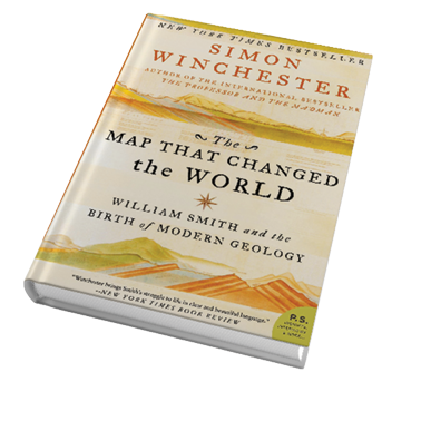
In March of this year, Doug Burgum, the newly appointed head of the US Dept. of Interior, invited all, in order to understand the coming events of that department, to read the book “The Map that Changed the World”, by Simon Winchester.
Do you know something that no one else knows? From your hard work in practical application of your science have you discovered a revolutionary principle? You want to tell but no one will listen? Have you struggled to publish but have met with great resistance, even ridicule and harassment? Have you been attacked and your ideas ridiculed and then stolen by plagiarism, maybe even stolen by the very society that you are advancing? If your answer is “Yes”, then this book is for you.
William Smith (1769-1839), Practical Surveyor (yes that was his title), overcame jealousy, interest, and ignorance among the learned and “gentle”. His story is an inspiration and encouragement for all us practitioners smothered by dilettantes and officious fools. Think Mathematicians smothering Theoretical Physicists or Engineers jealously dominating Surveyors. Just so, William Smith’s discoveries in Geology were smothered, hindered, and then jealously plagiarized by the Geological Society of London, resulting in Smith’s financial collapse and imprisonment in a debtor’s prison and Smith’s eventual justification and recognition in old age.
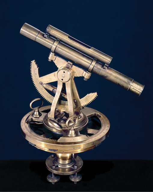
Early day theodolite
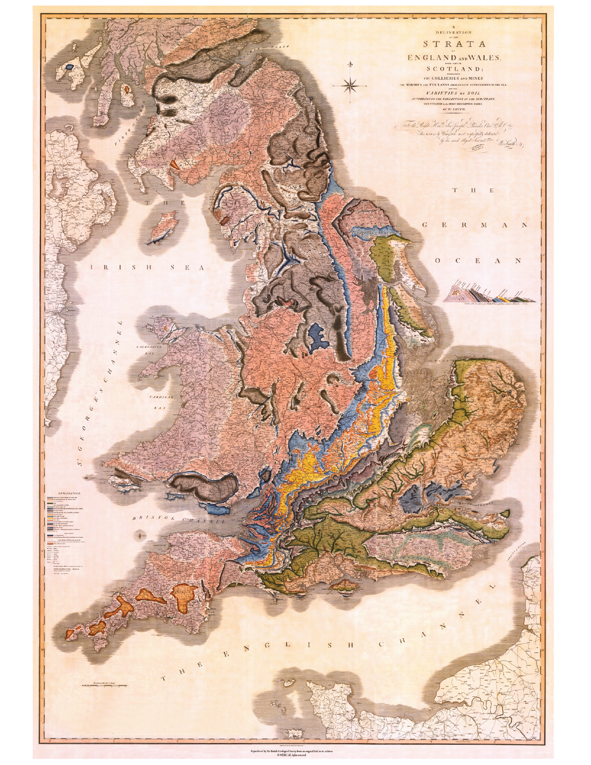
William Smith was first and foremost a Practical Land Surveyor whose exposure to geological strata and fossils in route surveying and mine surveys gifted him with an original epiphany: he could perfectly differentiate, identify, date, and predict land strata by the fossils contained therein. Smith called this “Faunal Succession”, which is foundational to the later Theory of Evolution.
Faunal Succession led to the realization that the older the strata the less the fossils conformed to contemporary flora and fauna; think “extinctions”. Extinction was a then revolutionary, even heretical, thought. Smith used this insight to postulate coal and lead prospects, select strata that would seal navigation canals, and drain bogs into porous strata. Smith designed, drafted, and innovated the world’s first Geological map. Others would later use Smith’s insights to advance the Evolution Theory, challenge church dogma and, in an absolute parallel, prospect for oil. The latter being the purpose of Secretary Burgum’s advocacy of The Map That Changed the World.
William Smith (1769-1839) schooled himself with a book by Daniel Fenning1, The Young Measurer’s Complete Guide, 1772. An epiphany comes on page A2 of that book, where the then common term “Practical Surveyor” is equated to our term “Land Surveyor”. The term “Practical Surveyor”, as used in the past, has been confusing for contemporary Americans. For instance, the UK 1725 book, “The Practical Surveyor” by Samuel Wyld”, was reviewed in a 2008 survey article but the article failed to clarify this point.
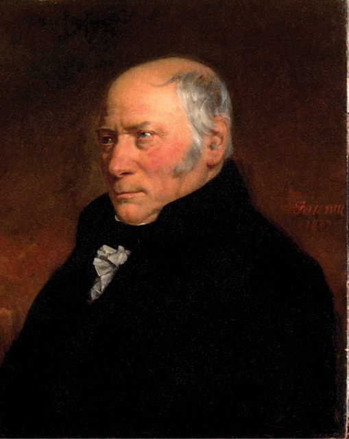
William Smith – Geologist by Hugues Fourau (1803-1873).
Even now, in England the term “Land Surveyor” equates with a Land Appraiser, just as Marine Surveyor still equates with “boat appraiser”. Land Surveyors there were Practical Surveyors. Thus, when old U.S. texts refer to George Washington, Abraham Lincoln, Thomas Jefferson, and others as “Practical Surveyors”, we can understand them to be the equivalent of modern U.S. “Land Surveyors”. So, let it be clear from the outset that William Smith, the subject of The Map that Changed the World, was a Land Surveyor in the modern sense. Though William Smith was also involved in engineering of canals, the inventor of Faunal Succession and Innovator of Geological Maps, he was first and foremost, a Land Surveyor.
The other subject to be clarified before reading “The Map that Changed the World” is the meaning of “Theodolite”. Our first four years of surveying was made with chain and transit, but the then new and much more precise instruments in use were called “Theodolites”, which were basically glorified transits with enclosed standards. This is confusing because before transits there were many generations of rudimentary survey instruments also called “theodolites”. The “theodolite” used by William Smith was likely a 3rd generation theodolite smiler to the one shown to the left, above.
William Smith’s first entrance into land surveying was as a teenager laying out “homesteads” in England. Though these were called “Enclosures”, they amounted to the same thing as American Homesteads, both being examples of a congress disposing of “common” land to private ownership.
 That being said, The Map that Changed the World is an appropriate and timely read for us latter-day Land Surveyors. Some of us will be involved in the discovery and mapping of new Natural Resources. If we were young, in our 20’s or 30’s, we might now be moving to Greenland, as we did to Alaska in the 1970’s. In Burgum’s words from the New York Times, “Map, baby map”.
The Ericksons spent years in Scotland, followed the Surveying Profession to Alaska where they remained for 12 years, and have now returned to the mountains of Idaho. Chad has been licensed since 1984 as a surveyor in Alaska, Idaho and Arizona.
- 1 https://archive.org/details/bim_eighteenth-century_the-young-measurers-com_fenning-daniel_1779