The year 1964 was a big one and full of firsts. Americans took their first bite of an Arby’s sandwich, while sitting in the first version of the Ford Mustang with the Beatles playing in the background. Television was popular with the first Jeopardy episode, Mary Poppins hitting the screen, as well as the first running of the one hour stop motion holiday film Rudolph the Red Nosed Reindeer. We were also introduced to the overly clumsy Bob Denver and the cast of Gilligan’s Island (to this day we will never understand why the crew couldn’t simply fix the hole in the side of the boat).
Politically the scene was hot with violence along the Panama Canal and the signing of the Gulf of Tonkin Resolution after two destroyers were attacked, starting our involvement into the Vietnam War. The Cold War continued as well as the Space Race. Ethically, the death of Kitty Genovese sparked the bystander effect also known as the Genovese Syndrome, of which I often speak about across the Country. The Civil Rights Act of 1964 (abolishing racial segregation) was signed by President Lyndon B. Johnson after President John F. Kennedy was assassinated the previous year.
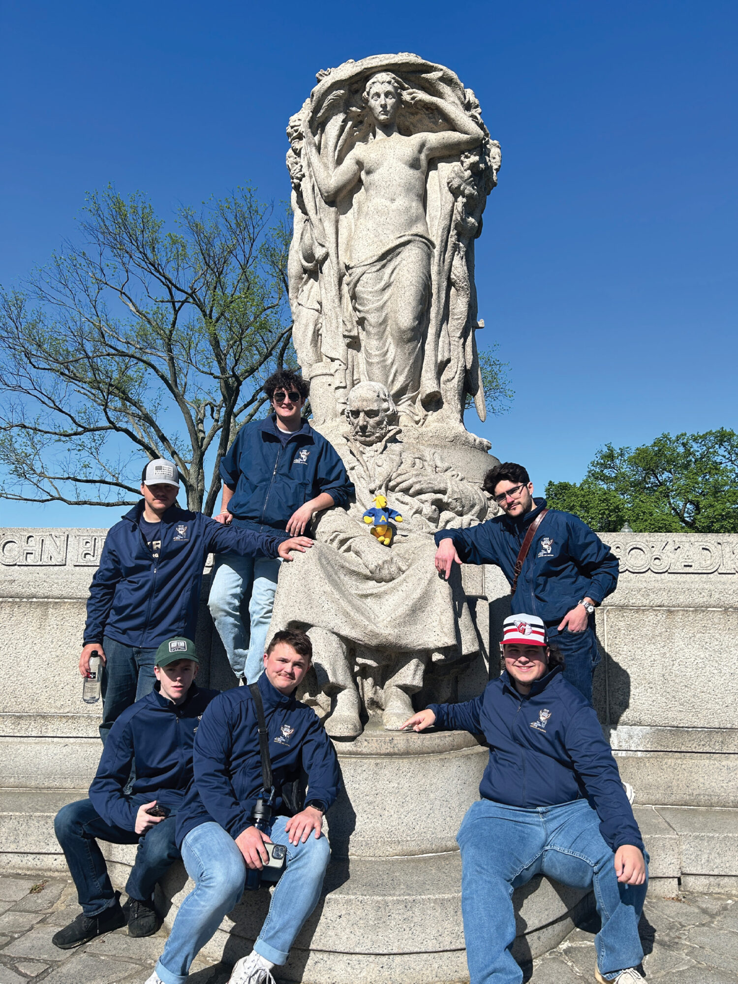
Akron student Ashton Schonauer points to the toe of famed innovator John Ericsson. The spot marks a first order NGS vertical monument, designation Ericssons Toe, PID HV1860. The students would continue finding monuments over the next 6 hours and traversing the District over 15 miles on foot.
Martin Luther King Jr. won the Nobel Peace Prize, being the youngest recipient ever. Notable births in 1964 were Michelle Obama, Urban Meyer, Kamala Harris, and a handful of celebrity greats like Nicholas Cage, Courtney Love, Stone Cold Steve Austin and the duo of David Spade and Chris Farley (my personal favorite actor). Former President Herbert Hoover passed away in 1964 as well as the famed environmentalist Rachel Carson.
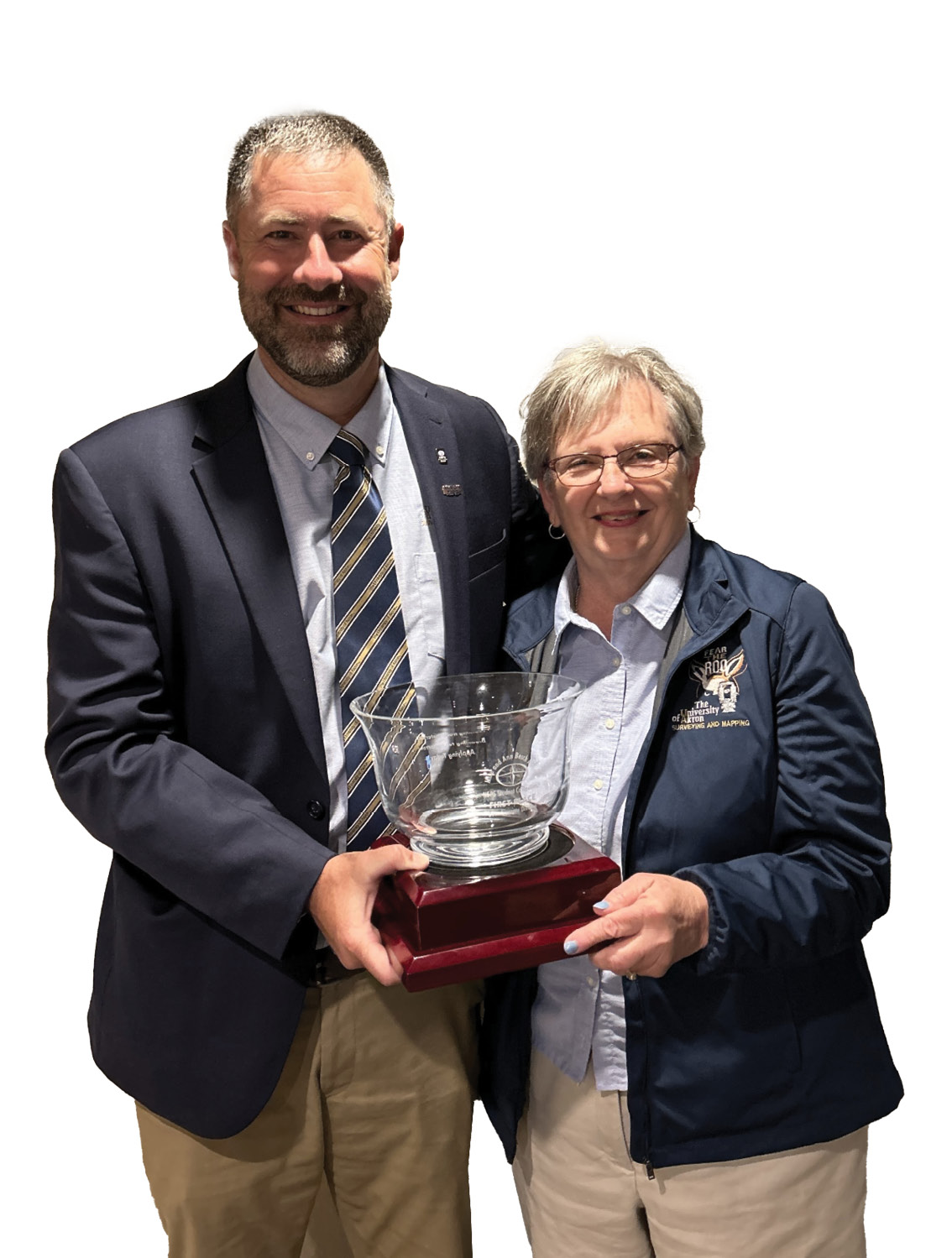
The author and Ann Besch, PS hold the winning trophy for 2024, rightfully named the Mike and Ann Besch Award.
In Northeast Ohio, however, 1964 was the start of something great. It was the start of a small College Program that would grow to one of the nation’s largest and most highly respected. Since 1964 there have been 916 associate degrees, and another 332 baccalaureate degrees awarded, with more coming every year from the University of Akron, Ohio Surveying and Mapping Program.
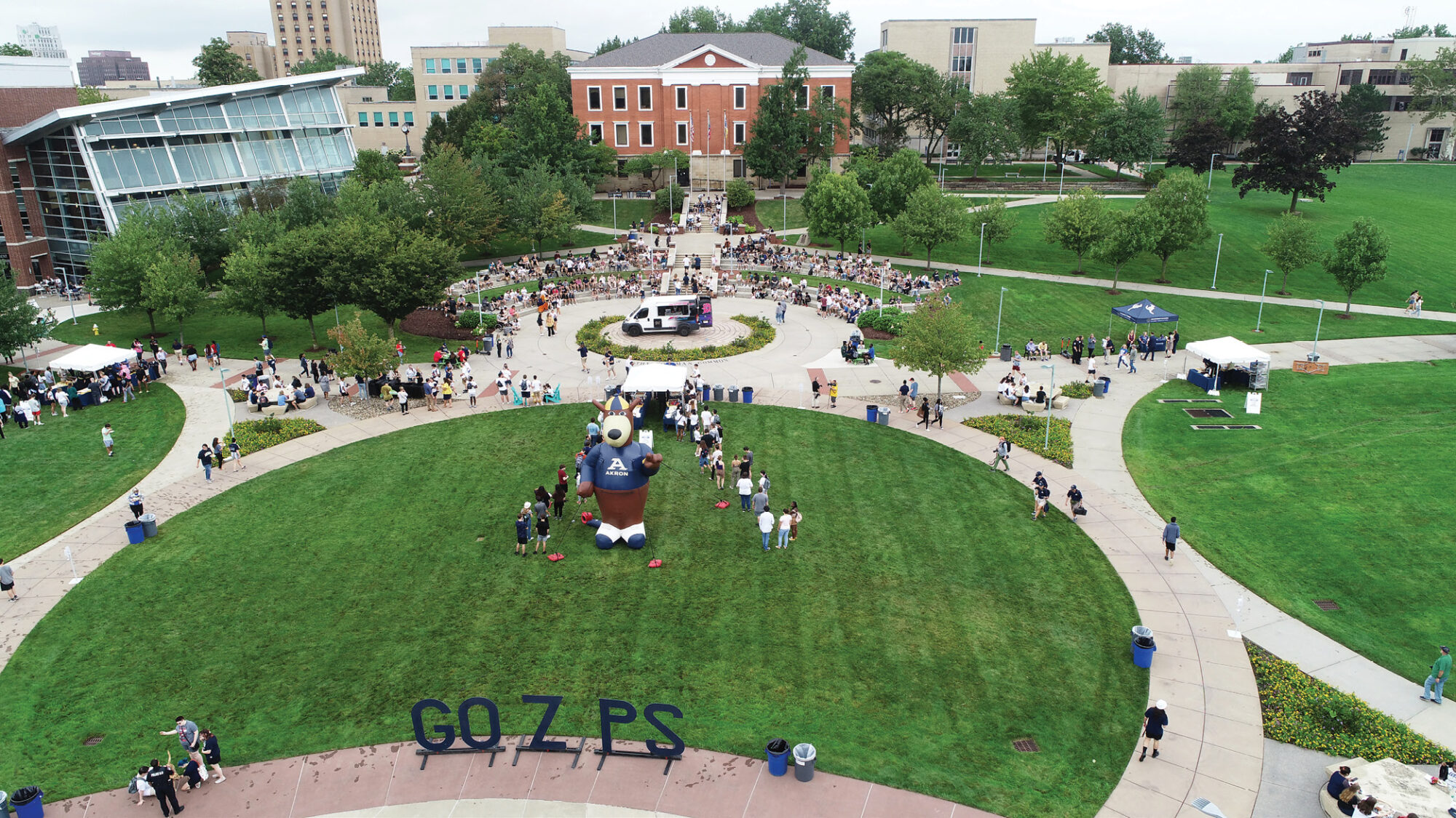
The beginning of each Fall semester marks RooFest on campus. Students have the opportunity to be the “I” in “ZIPS”. Photo courtesy of the University of Akron.
The University of Akron (formerly called Buchtel College) was founded by industrialist John R. Buchtel in 1870. The early college followed the principles of the Universalist religion, but by 1907 it became a private, non-denominational school. In 1913 the College was transitioned into a municipal University as the trustees of the early Buchtel College transferred the institution, and all its assets, to the City of Akron. There were 198 students in 1913. The University was initially assisted by the State in 1963 and by 1967 it officially became part of the State of Ohio University system.
The University of Akron Surveying Land Lab in the background.
With “I Want to Hold Your Hand” playing in the background, there were 10,000 students at the University of Akron in 1964. This number continued to grow to over 25,000 in 2015. Massive restructuring happened to the University of Akron during the Covid pandemic and the former College of Applied Science and Technology (formerly Summit College from 2014) was merged with the College of Engineering and Polymer Science. The Surveying and Mapping Program now lies within this College under the Department of Civil Engineering.
On January 01, 1993, a big change happened to the Ohio Revised Code, Chapter 4733. This change required the educational background of either a full baccalaureate degree in Surveying or 16 semester hours of surveying education plus a baccalaureate degree in Civil Engineering. By 1998 the Ohio Board of Regents approved the new baccalaureate degree in Surveying and Mapping from the University of Akron. I was personally one of the first graduates in the Spring of 2000 after transferring from Hocking Technical College with an associate’s degree in GeoGraphics (GIS/GPS). My class size was small, but we were sure proud to be Zips.
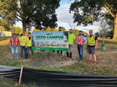
Members of the senior capstone course stand at the site of the newly developed SEED Campus in Kent, Ohio.
I vividly remember sitting across the desk from Thomas (Mike) Besch in 1998 as I enrolled. I was scared. Mike was a retired U.S. Army Artillery Surveyor from the Vietnam and the Cold War era and a former Geodetic/Topographic Chief Warrant Officer who managed operations in Operation Desert Storm. He was also an Ohio Professional Surveyor, Professor and the Program Director for the Surveying and Mapping Program and am imposing figure of a man. Mike served this roll, graduating hundreds of students until his untimely death in November of 2016. His obituary read “Mike was fully committed to his country and to developing soldiers, students and surveyors who would serve their communities with intelligence and integrity.”

Senior capstone students launch a UAS with a lidar sensor for a flight over the heavilty wooded portion of the Surveying Land Lab.
I now proudly occupy Mike’s desk and work hard to pass on his long-standing tradition of excellence. After Mike passed Professor Gary Schuller, PS took over as Program Director until last year. Our Program currently is running strong with fully accredited AAS and BS degrees in Surveying and Mapping as well as 3 certificates, two of which fulfill education pathways toward survey licensure in Ohio (and beyond). We graduate about 22 students per year (not counting certificates) with a total student population of around 110 students (counting certificates). The Program is staffed by three full-time professors (Joseph D. Fenicle, PS, Joshua Carpenter, PS and Gary A. Schuller, PS) and up to fifteen adjuncts each year (all licensed surveyors and alumni). One of those adjuncts is recently retired Professor Ann Besch, PS who continues to teach classes and help train students for the National Society of Professional Surveyors (NSPS) student competition.
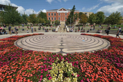
The labyrinth with Buchtel Hall in the background on the University of Akron campus. Photo courtesy of the University of Akron.
The Program has a strong history of success in the NSPS student competition with first place wins in 2016, 2019 and 2024. There was a solid team built in 2022, after the pandemic, but University travel restrictions limited the ability of the team to compete. A new team was then again built in 2023, working hard all semester. The team did their best but did not place leaving with not a trophy but with lots of memories and new friends from across the Country. With three returning team members (and three new freshman) the UA team came back strong in 2024.
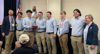
The winning results during the awards ceremony on April 24, 2024.
As was done previously in 2022 and 2023, a specialized 2-credit class was created to prepare for the events. The author met with the class early in the semester and discussed the strengths and weaknesses of the team. Sub-groups were then created based on their interests and assets. For example, an upper classman was paired with a freshman who showed interest in running the Wild T2.

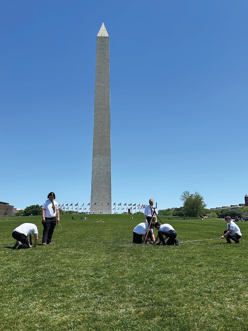
A view of NGS designation Washington Monument, PID HV4442, through the lens of a Wild T2.
When the competition came the pair was repeating angles within seconds forward and reverse. This gave peace of mind and needed redundancy for the calculations, which were performed by a different pair who were strong, fast, and confident in mathematical computations. These two, while the other practiced field techniques, would run traverse and resection calculations in the classroom.
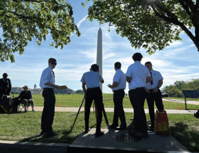
Akron student Zac Clevenger dials in a Wild T2 on the tip of the Washington Monument during the triangulation exercise.
Other team members paired up to master the dumpy level and practiced repeatedly on simulated level loops. As a team they worked on the chain and compass traverse and pacing for leveling and blunder detection. In between meetings the students were given historical articles to read about Washington DC. We would discuss common sense and safety protocols while traversing the District during the Monument Scavenger Hunt.
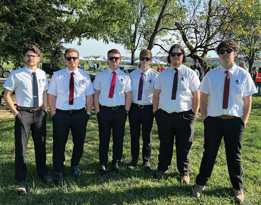
The student competiton team dressed as the “Boomers” with matching pocket protectors and ties that were once worn by the late Mike Besch.
The training paid off as the Wild T2 angular duo returned identical results in the triangulation exercise and the calculation duo independently came up with the same calculated values. The dumpy level loop closed within 0.025’ and the resection values were off by hundredths. The monument scavenger hunt was also a huge success with the most monuments found of any other team. The team was confident of a “W” and was proud to be interviewed by Joe Paiva after the awards luncheon.
You can’t have all work with no play though. The team enjoyed some quality food at Rocklands BBQ as well as historic Gadsby’s Tavern where George Washington, Thomas Jefferson and John Adams dined. The team also toured Mount Vernon as they walked around and pondered our first President and early surveyor. None of this would have been possible without the financial support of the Professional Land Surveyors of Ohio (State and Local), proud alumnus who were past team members, as well as award money from the NCEES Surveying Education Award. After returning home all students submitted a reflection essay about not only their experience, but also to document how to improve the experience for the next team.

The student competion team always enjoys a historical dinner at Gadsby’s Tavern in Alexandria.
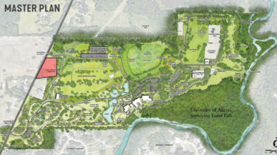
The Program is constantly looking at ways to grow and prosper and last Fall a huge opportunity was made available. The Program was approached by Davey Resource Group (a subsidiary of the Davey Tree Expert Company, Kent, Ohio) to form a partnership. After getting past some lengthy legal paperwork, we thought a great way to kick start the research would be with our senior capstone class. After some restructuring to get classes to properly follow their course sequence, we had a smaller capstone class than normal (the previous class was over 20 students).
A proud alumnus of our Program, Jeremy Sack, PS, came in and pitched a plan to the students. The plan was instantly sold as their minds began to grow wild at the possibilities of the agreement. Davey broke ground on their own Science, Employee Education, and Development (Seed) Campus in 2022 with anticipated completion in 2025. After acquiring the former Oak Knolls golf course as well as the former Franklin Elementary School, the Kent campus grew by almost 200 acres.
Kent has been the home of Davey since it was founded by John Davey in 1880. Currently Davey is Ohio’s largest employee-owned company and one of the top ten largest companies in the nation with over 12,000 employees and a total annual revenue of more than $1.6 billion. The goal of the partnership is to track like-minded Davey employees to the Davey Resource Group (DRG) subsidiary as well as give the University of Akron Surveying and Mapping Program a Surveying Land Lab in a safe and restricted space. The Davey employees could be trained on site and then finish their formal higher education at Akron promoting their Company, the Survey Program, and the Surveying Profession as a whole.
DRG specializes in Environmental Consultation as well as Consultation in Asset and Vegetation Management, Comprehensive Mitigation Solutions and Services in Communications Construction and Surveying and Civil Engineering. The initial offer was for the Surveying Program to have exclusive access to an undeveloped, heavily wooded, riparian area of about 27 acres. This would be used for real life traverse scenarios as well as more advanced terrestrial and aerial lidar scans through the dense vegetation.
As the capstone course evolved the scope was expanded to ground topo, bathymetric data on the Cuyahoga River and establishment of simulated cadastral corners with pits, mounds and bearing trees. The scope then grew to the entire campus and included surveying the newly constructed de-energized utility grid, control monuments, ground penetrating radar testing site as well as high accuracy three wire leveling from nearby National Geodetic Survey monuments.
Offsite work would be done on chain of title, corner research and processing of the publicly available 3D Elevation Program (3DEP) lidar data. The 2024 Capstone course was able to successfully dig and pour two control monuments, complete the chain of title, run a large portion of the vertical control, and process the 3DEP data as well as process data from an independent lidar flight. This site will provide research opportunities for decades to come in various classes throughout the Surveying and Mapping Program.
The future is strong at the University of Akron and the class sizes in the Surveying and Mapping Program are currently at maximum capacity. The Program is poised for success with a solid generational lineage between Professors Schuller, Fenicle, and Carpenter. The alumni are our best marketing team, and their success breeds our success. With a growing market area, more online offerings and a new certificate towards licensure, the University of Akron continues to graduate a new batch of real world, application-based surveyors. And with partnerships like that of Davey Resource Group the numbers of surveyors will continue to grow.
Joseph D. Fenicle, MS, PS is the Program Director and Professor at the University of Akron for its award-winning Surveying/Mapping program. Immediately prior, he was the Chief Surveyor at the Office of the Fulton County Engineer in Wauseon , Ohio for 15 years. He also owns Angular By Nature, LLC, a company specializing in Continuing Education for Surveyors and Engineers across the Nation. Joseph has a MS from the University of Maine, a BS in Surveying/Mapping from the University of Akron and an AAS in GIS/GPS from Hocking College. He is currently working on his Doctorate at the University of Maine as well as his CfedS—Certified Federal Surveyor Certification.