When faced with mapping over 10,000 linear feet of utility tunnels, with some portions located five stories underground, Colliers Engineering & Design (CED) customized their approach by applying advanced 3D scanning technology. Rather than relying on traditional surveying methods that would have required months of manual measurements, the team used a variety of scanning systems, including the Trimble X7, NavVis VLX and Leica RTC 360.
Managing Aging Utilities
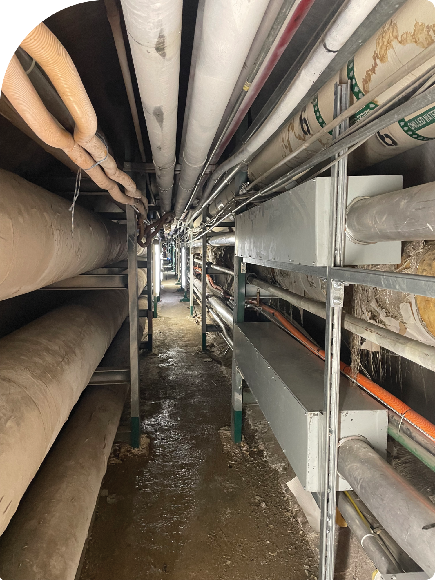
A network of 100-year-old underground passageways containing heating systems, electrical wires and other utilities in upstate New York was starting to show its age. Without existing paper or digital documentation and access by third parties restricted for security reasons, conducting maintenance, and making repairs on the aging network presented a real challenge.
Capturing detailed 3D data of aging utilities provides critical information for future maintenance.
To enhance efficiency, administrators believed an accurate 3D model that showed sizes, locations, and spatial relationships of everything in the system would be a key part of the solution. A comprehensive digital model of the infrastructure would help identify areas requiring attention and pre-plan work in the office to limit the time spent by contractors in the tunnels.
After considering all options, CED experts chose to leverage the power of 3D scanning technology to complete this project in a fraction of the time compared to conventional methods.
“Without scanning, we would have relied heavily on hand sketching and manual measurements, then an office person would have tried to combine all the parts into a map,” said Lucas Boyer, geographic discipline leader survey, CED. “The process would have been very difficult, and time consuming given the wide variety of utility infrastructure and space constraints in some areas.”
Multi-tool Approach
The team at CED employed a multi-tool approach, utilizing a variety of scanning solutions to capture the most comprehensive and accurate data possible. The Trimble X7, a high-speed 3D laser scanner that delivers a very dense 360-degree point cloud and panoramic color images, was central to their strategy. In addition, CED employed a NavVis VLX backpack scanning system, which excelled at capturing a large volume of data while walking, as well as a Leica RTC 360 scanner used by a subcontractor.
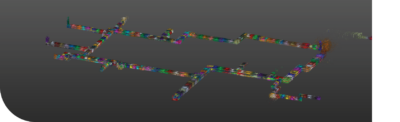
Three scanning techniques were combined to produce a highly detailed 3D model of a complex tunnel network. Colliers Engineering & Design
Although originally planning to use the NavVis SLAM technology for the majority of data capture, the team made adjustments after gaining a better understanding of the conditions. After conducting tests, they determined the VLX was most suitable for large/long square areas, collecting up to 100,000 square feet in 20- to 30-minute scans. The X7 collected a significantly denser point cloud from stationary spots in four-minute scans, successfully capturing small details like valves and elbows and filling in gaps in the VLX data.
Establishing accurate control was not straightforward given that the project was underground and a mechanical room in the middle of the tunnels prevented traversing directly from end to end. Instead, they began at one end in a parking garage and did traverse work going five stories down along the ramps, setting control points above ground using the Trimble R12i GNSS receiver, and below ground with a Trimble S7 robotic total station with a Trimble TSC7 data collector and a Trimble DiNi digital level. At the opposite end, the team descended through a building, running a traverse through multiple narrow hallways and then up through a doorway. Trimble Business Center (TBC) was used to process the GPS and traverse work, which was then exported as a CSV file and brought into Trimble RealWorks.
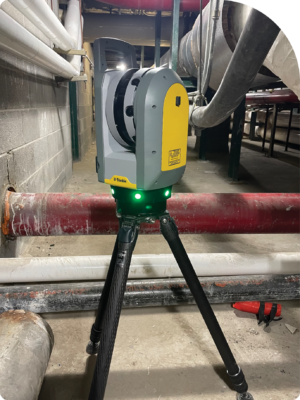
The Trimble X7 3D laser scanner, purchased from Waypoint Technology Group, collects comprehensive point clouds faster than traditional surveying tools. Colliers Engineering & Design
CED adapted their methodology to overcome unique obstacles, such as temperatures exceeding 100 degrees in some sections and small underground spaces where conventional equipment couldn’t operate effectively.
The Trimble X7’s automatic self-leveling, a feature that helps ensure accurate data collection even in challenging environments, proved invaluable for the project. “We found it really made a difference in the tight, confined spaces of the tunnels when capturing precise details of valves, elbows, and other critical infrastructure components,” Boyer explained.
Complete Picture with Integrated Data
Due to the large volume of data, CED first registered the data sets separately, then divided the data into project sections, such as hot and cold tunnels, before integrating the data from all the scanning systems. The ability to blend data from a variety of sources into a single point cloud offered them the flexibility to apply the scanning tool most suitable for each given space and environment.
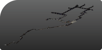
Another view of the tunnel network 3D model. Colliers Engineering & Design
Ultimately, fieldwork required two-and-a-half weeks to collect scans, rather than two to three months recording manual measurements, and two weeks for traverse, plus two weeks for registering and processing survey data.
The data from three different scanning technologies was combined with extremely accurate control network data to produce a single, congruent, cohesive recreation of the real world.
“Managing such a large volume of data presented a significant challenge—we’re talking about 609 individual scans and over one terabyte of data in a single project,” said Boyer. “But the software made it possible to process and integrate everything, giving us an incredibly detailed and accurate 3D model of the entire tunnel system.”
The LAS 3D point cloud containing over 26 billion points was delivered to the client with the free Trimble RealWorks Viewer, which allows even non-technical stakeholders to visualize each set-up. The level of detail provides insight into the condition and layout of the utilities without having to physically access the tunnels.
Using 3D scanning technology, CED delivered a comprehensive digital model that provides both immediate benefits and long-term value for future maintenance and renovation for this complex underground utility system.
Note: This article originally appeared in Utility Contractor
Linda Duffy is a freelance writer and market researcher at Apropos Research, an independent firm providing marketing services to the geospatial and remote sensing community since 2003. Contact: lduffy@aproposresearch.com.