In June of 2023, I began research for a lengthy, multi-part article dealing with the boundary line with our neighbors to the south, Mexico. True, thorough research requires seeing one’s subject with one’s own eyes, experiencing the weather, the food, and the culture.
A little history about the origins of that boundary line. Mexico and the United States fought a war between 1846 and 1848. On July 4, 1848, the hastily arranged Treaty of Guadalupe-Hidalgo was signed by both parties. The Mexicans got peace, and the United States got all of California, Navada, Utah, New Mexico, Arizona and portions of Wyoming, Colorado, Kansas, Oklahoma, and Texas. The price was $15 million, the same amount Thomas Jefferson had paid for the Louisiana Purchase.
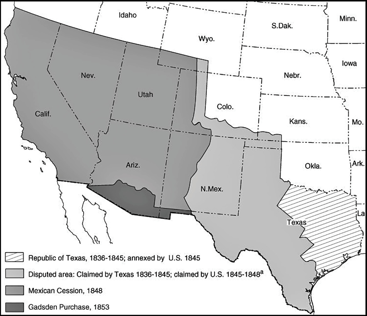
The land cession from Mexico was the largest to the United States since the Louisiana Purchase. The United States now stretched from ocean to ocean. Map courtesy of the General Accounting Office.
The description for the new property was horrendous. The parties relied on sketchy information about the tract and an out-of-date, highly inaccurate map. As historian Leon C. Metz put it “an interesting case of sign now and worry later.”
It was agreed that any discrepancies would be resolved in the field by the respective commissioners while conducting the survey. Where the lines were understood to be straight-forward intentions, the surveyors did outstanding jobs marking the line. However, many vague words caused much to be unresolvable.
Brickwood Saloon, Nogales, Arizona/Mexico. The front wall was situated right on the boundary line. Purchase whiskey in Arizona, no Mexican taxes. Purchase a cigar in Mexico, no Arizona taxes.
Another treaty and purchase were arranged in 1853. Besides clearing up some boundary issues, the important thing was that the United States purchased a practicable railroad route to California that was overlooked in the earlier treaty. This became known as the Gadsden Purchase, and it described the internationally recognized lines that we now see on our maps.
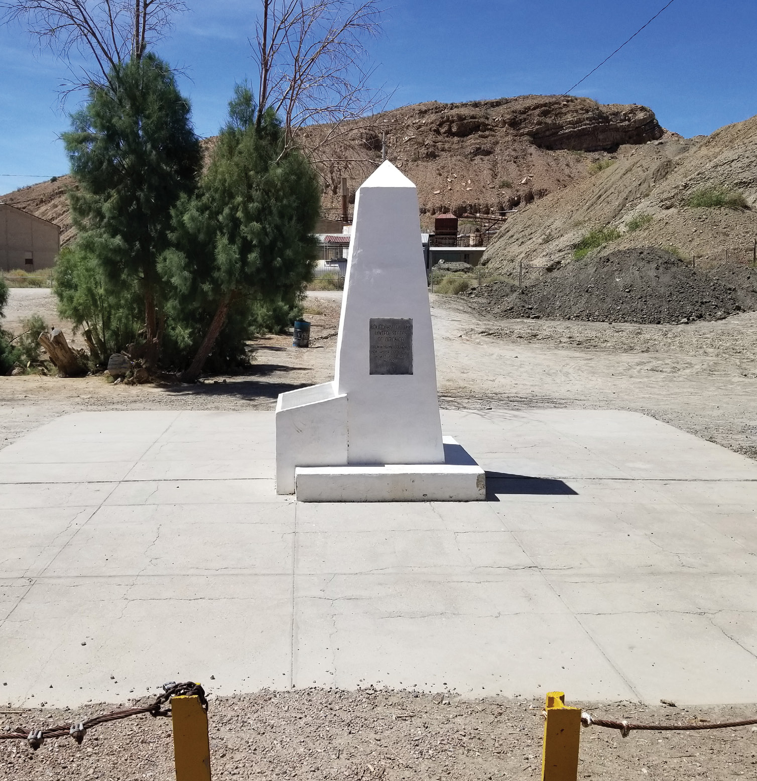
The treaties of 1892-1899 included a resurvey of the line. No portion of the line could be moved or altered in any way. Mostly what these surveys did was provide 258 additional solid, substantial, and more visible physical monuments. It was these monuments I wished to witness with a recconnaissance trip to the border.
In 1848, to go out west, prior to the transcontinental railroad, one either went by wagon, by boat and overland via the Isthmus of Panama or by boat around the horn of South America. Well, I did the Drake Passage off the southern coast of Argentina a few years back and have traveled cross country by air and auto, but I’d never experienced the Panama Canal.
So, I booked a cruise ship for April 2024 from Fort Lauderdale to San Diego via the Canal. I then took a rental car from that place to El Paso, Texas. I wanted to find as many of the 1890’s monuments as I could find. The Rio Grande portion of the boundary will be for another day and another story.
The Canal is an interesting place. It takes about 12 hours to make the full, mostly north/south traverse. To look at the locks, you see mostly early 20th century technology and construction. There are now three sets of locks. Sometime in the 2010’s a monster was constructed to accommodate modern container ships. Until then, the maximum width was 108 feet. All of the warships we set afloat had a maximum 106-foot width at canal level. From the Atlantic side, the locks take you up on about a 25-meter ride vertically into Gutan Lake. This is a man-made reservoir, with its dam supplying all of the electricity for the lock system. One then enters the cuts. These cuts are the engineering marvels that broke many a country and company that attempted to build the original canal. Exiting the cuts at Panama City, again, you are locked down to the Pacific Ocean.
After stops in Guatemala, Costa Rica, and Mexico, we finally arrived at the Port of San Diego. I tell you I was anxious to leave the sea and hit terra firma. I was looking forward to visiting Monument 258, the last on line at the edge of the Pacific Ocean. The original 1840’s era monuments were numbered from west to east, with San Diego being number 1. The later surveys altered this to number 1 being in El Paso and 258 being in San Diego. The monuments are not evenly spaced. The distances between them range from 0.14 miles to 4.91 miles.
Looking south, Marker 40, very remote. It’s a favorite road trip for land surveyors in New Mexico and Texas.
I found conflicting information online about accessing #258. Most of the sites I visited said that access was closed because of high water and raw sewerage in the Pacific. A couple of sites implied you could go in on Saturdays and Sundays. I tried on a dusty and dry Sunday and failed horribly. Within ½ mile of the monument, the road was barricaded and there was no way in, even on foot. Man, was I bummed. 258 was a major goal for this expedition.
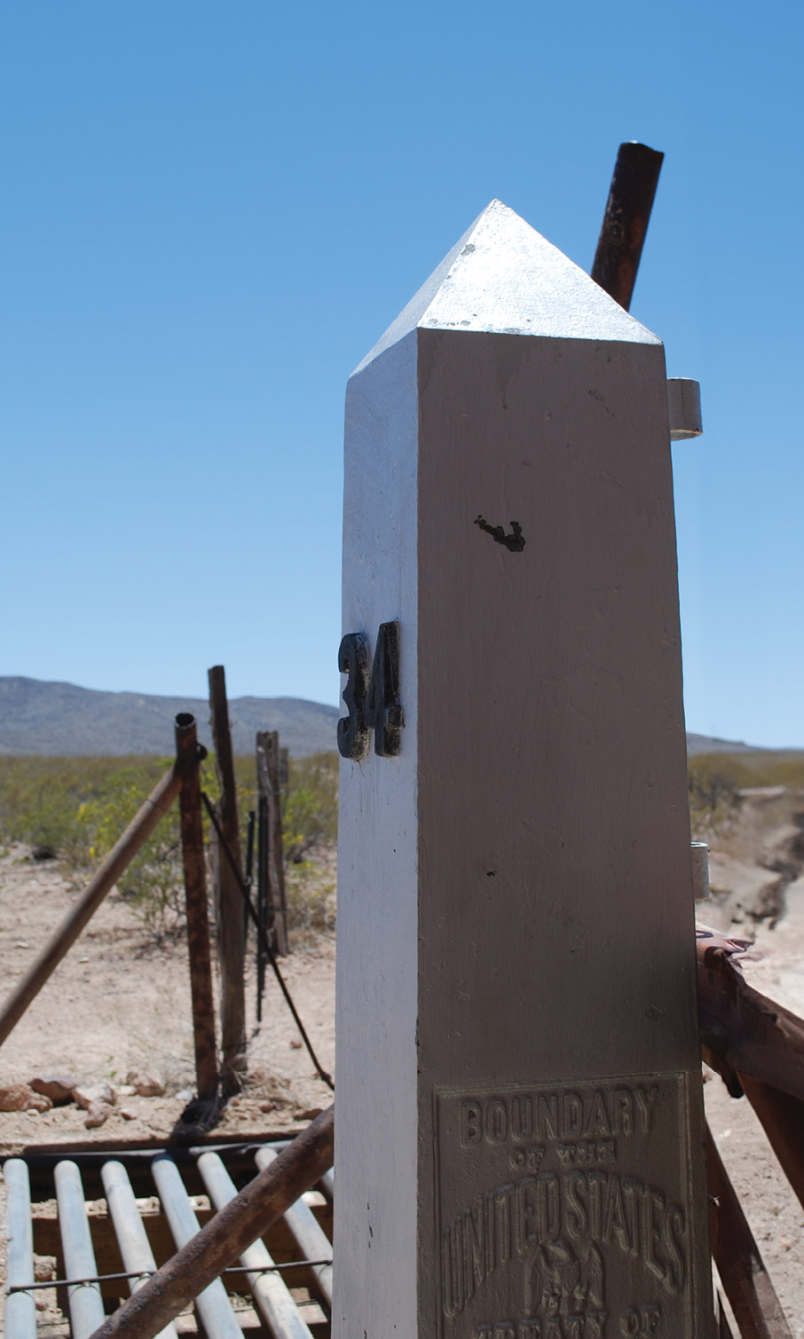
Marker 34, a corner between two tracts in Mexico. This marker is nearly identical to the majority on the line.
Dejected, I headed east to Yuma, Arizona. Yuma is where the Gila River and the Colorado River meet. This was an important clause in the description of the original 1848 treaty. The 1853 Gadsden Treaty vastly altered the description. However, no matter the description, I still had not logged a single monument in my field book. I headed due south toward Mexico.
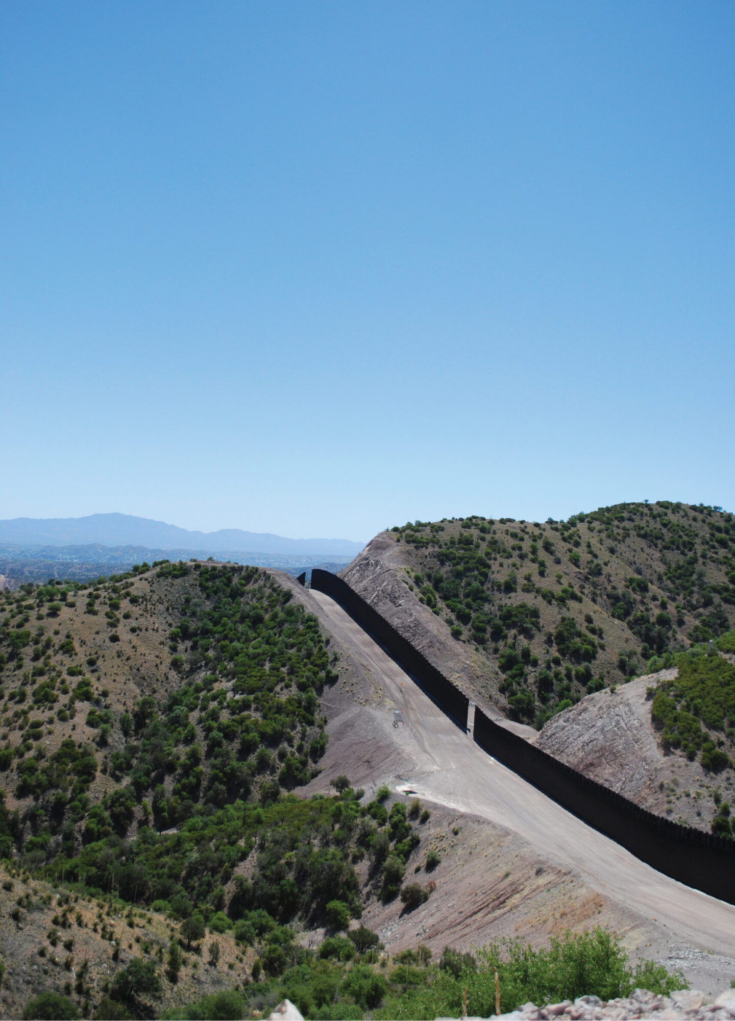
At the crossing, a Post Office that backs up to the border was labeled “Gringo Pass, Arizon” (sic). The maps call the place Lukeville. I got some great sights of the “wall” but still no monuments logged.
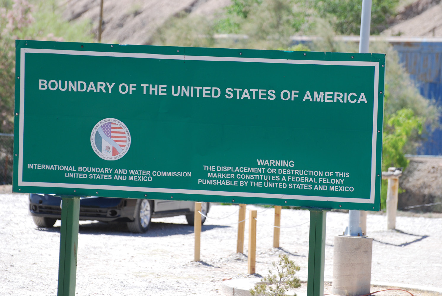
El Paso, where the line leaves the Rio Grande River and heads west. To disturb a marker, one is violating both United States law and Mexican law.
East to Tucson, then south toward Nogales. Outside Nogales, while gassing my vehicle, I spotted two U.S. Border Patrol fellows stopping to get something to eat. Parole evidence. I received quite a lesson in my brief conversation. Border Patrol guys, just by simple appearance, all must be in some sort of physical conditioning. To the man, all were so healthy to make an old man like me wince. Another thing I learned is absolutely no one I spoke with other than the Border Patrol had any idea what I was talking about when I mentioned monuments. They knew. And most importantly, all of them are quite friendly and helpful, especially when someone shows an interest in their border. Every day, they risk their lives protecting that boundary.
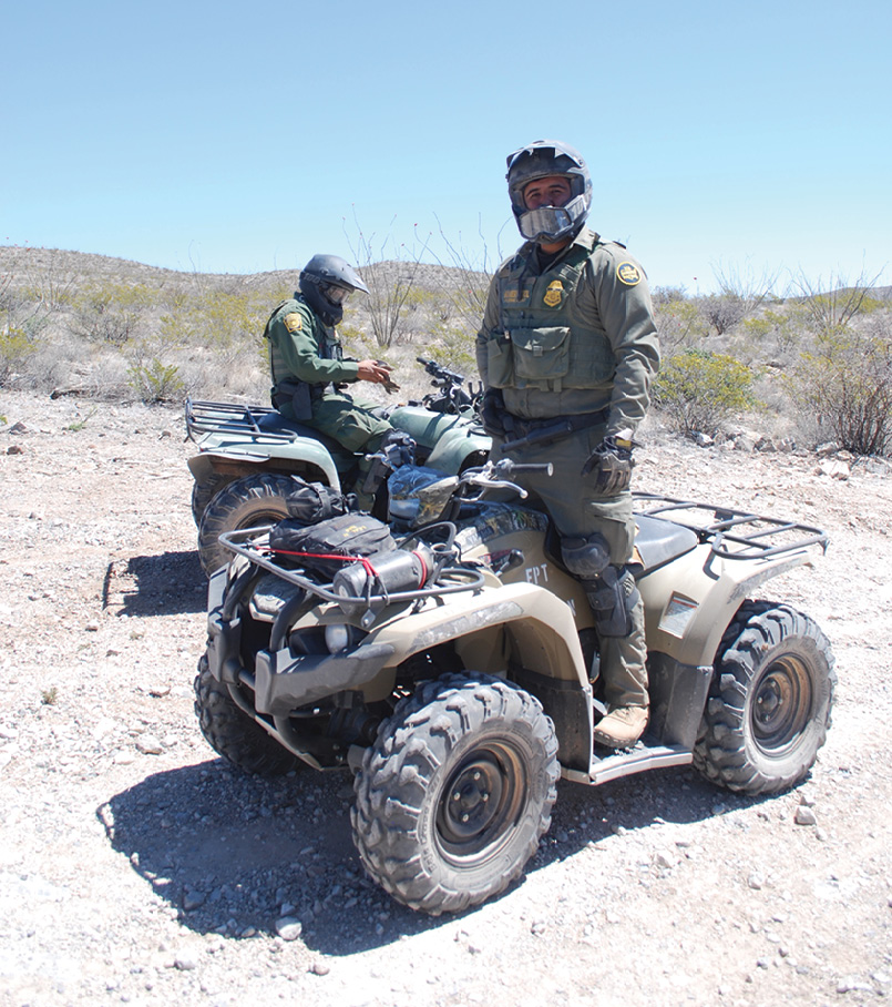
If you make it to the border, make it a point to meet some Border Patrol Agents. When it comes to line monumentation, they most likely are the only people that can answer your questions.
I asked where I might find monument number 127. He told me about an access road that started about 7 miles north of #127. Now reader, look at a map. The border leaves El Paso, goes west a few hundred miles, takes a sharp left, and goes south about a hundred miles. Then it goes west again and when it intersects the 111-degree meridian, it makes a northwesterly bend to Yuma. Monument 127 marks this intersection at the 111th.
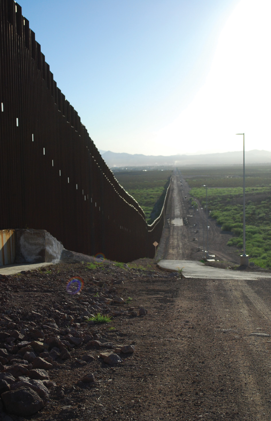
Looking west toward Yuma and San Diego. The United State maintains a fairly decent “road” parallel to the wall. However, most of it requires a four-wheel drive vehicle.
As I approached, the “wall” was obvious mostly because it was in a cut that would rival any Interstate Highway in West Virginia. There were enormous fills of wasted materials. At the end of the road, was a construction site. I found a guy driving a water truck, him being the only guy I saw on site. The first thing he asked was if I had a safety vest. His radio crackled and in Spanish was told to run me off the site. We talked for a while and he took me to his boss, running an end loader. His boss told me to leave. I was not about to leave until I saw 127 and I told him that. They pointed it out, high atop a cut slope about a quarter mile away. I was warned that there were “Boy Scouts” right on the other side of the “wall” that were constantly watching them. I realized they were talking about the cartel or possibly smugglers. By the way, the “wall” ended on site, nothing beyond to the west. Finally, the guy relented somewhat and said I could take pictures, to watch out for the Boy Scouts and then get the hell out of there. I got my pictures of 127.
Marker Number 1, the beginning of the line, El Paso. If you’re lucky, you can look at it between an 8” gap between wall sections. Otherwise, it’s locked behind a steel gate. Photo courtesy of Dean Van Matre, Texas RLS
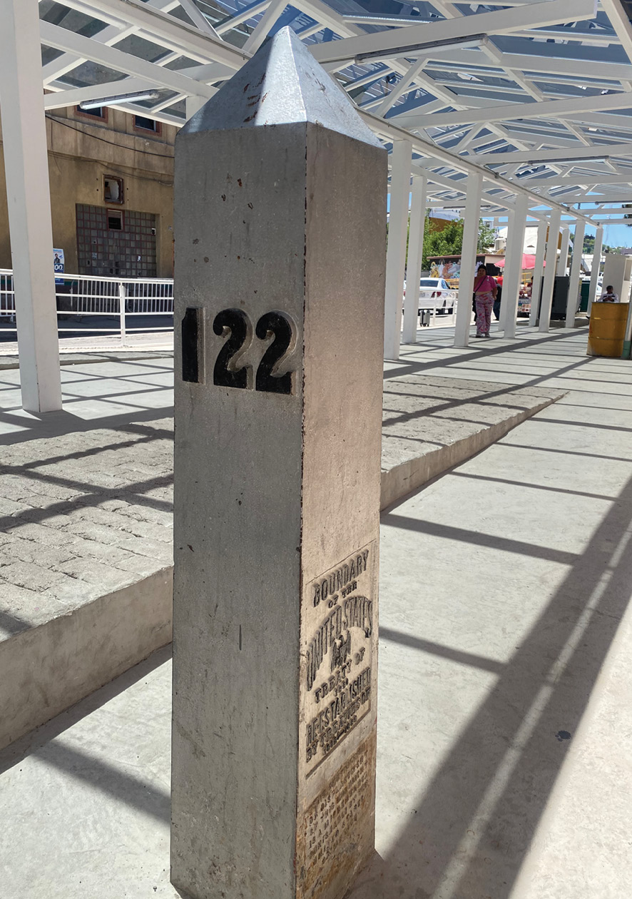
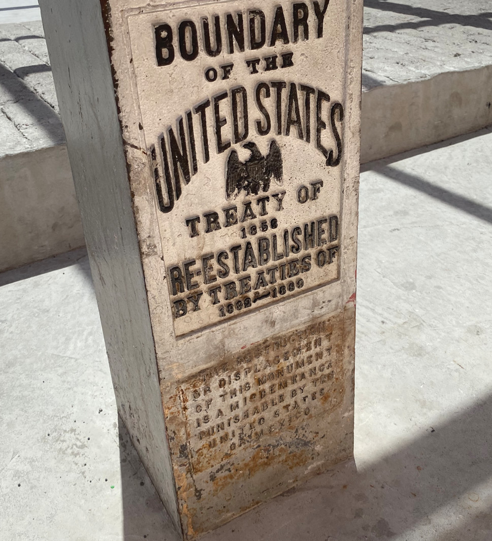
My luck appeared to possibly be changing. I headed toward Nogales. Nogales is somewhat unusual in that it is a joint city that just happens to have a steel “wall” running right through the middle of it. Visiting the Pimeria Alta Museum, often cited in the many histories I’ve read, I had perhaps the greatest find of my trip. Christine Courtland is a volunteer and retired teacher there. We talked and she said that a monument was within a block, just on the other side of the “wall.” “Come with me.” She walked right through the border security with little vetting (she does it nearly every day) and personally took photos of Monument 122.
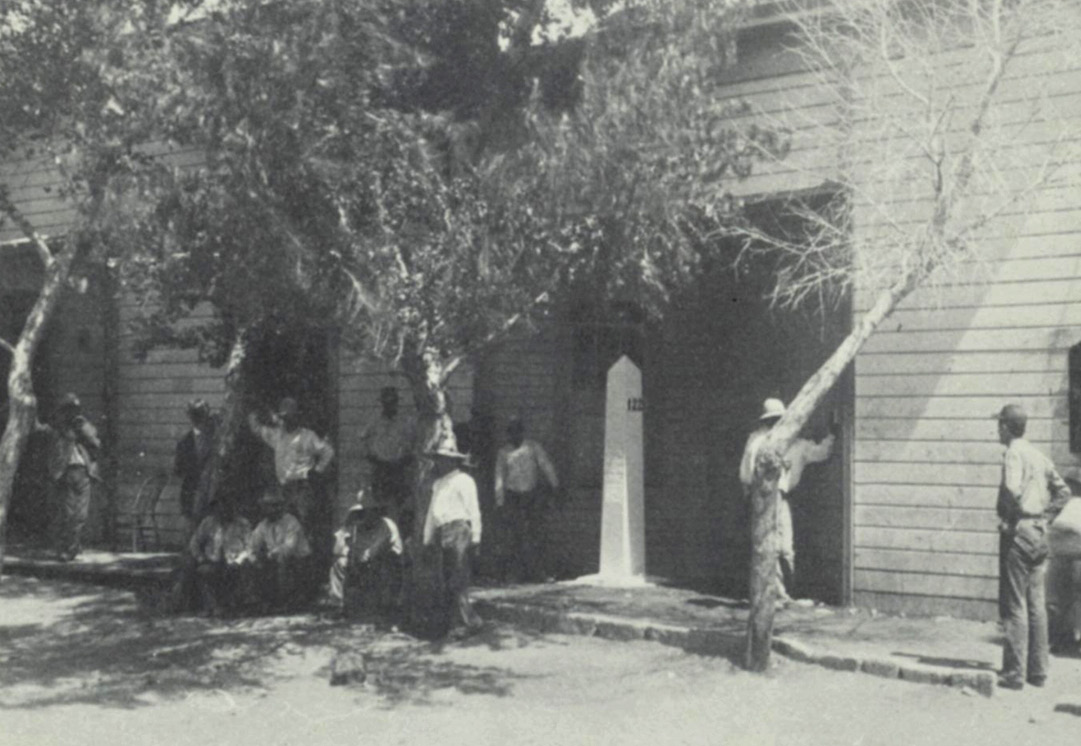
Monument 122 has some notoriety. In earlier years, a fellow named Brickwood opened a saloon with its south wall running right with the border. Monument 122 was located at the southeast corner of the saloon. One would go in and pay for a cigar and go out on the porch and get it out of the box, saving on U.S. tobacco taxes.
Christine has been a treasure. We have kept up a correspondence via email.
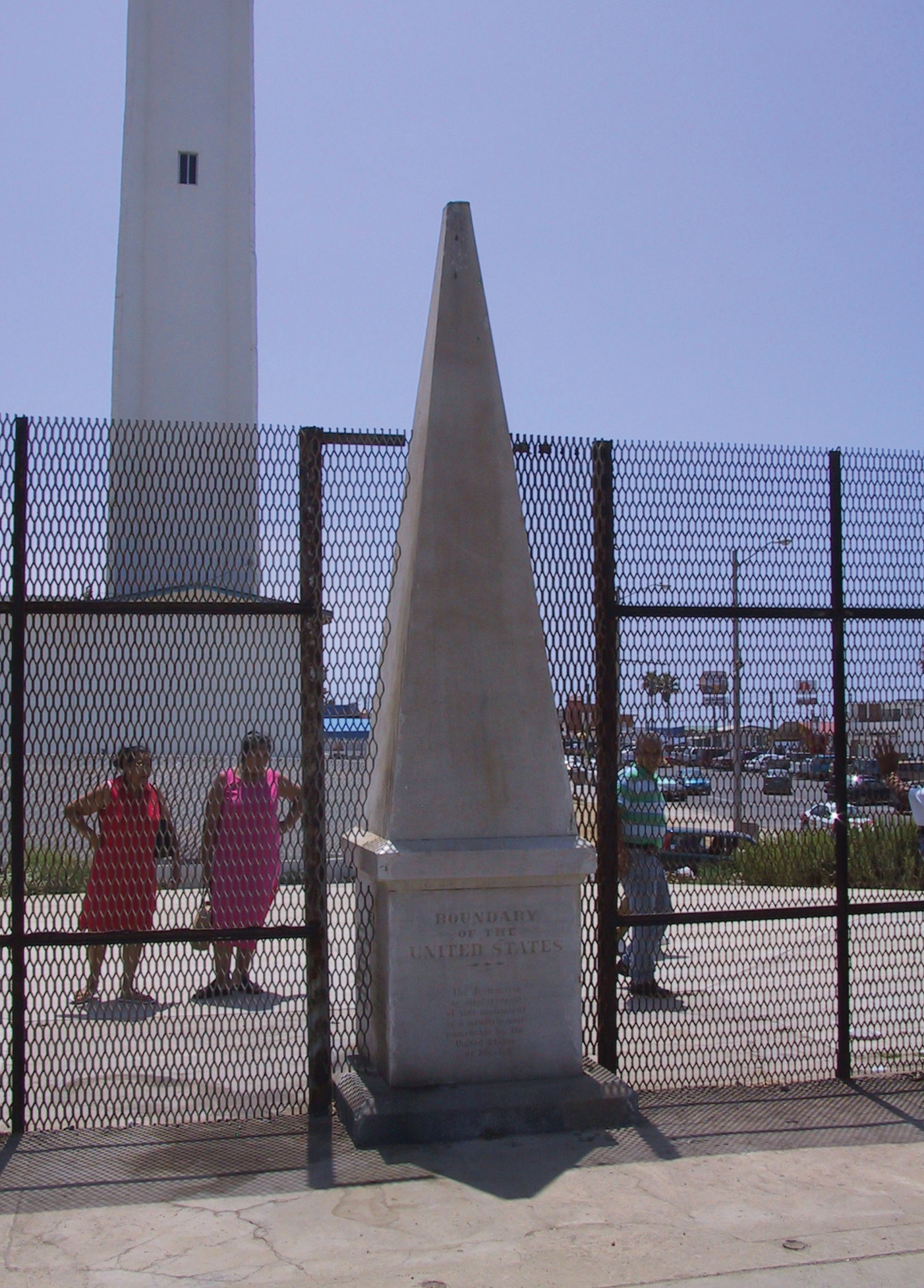
Number 258, the end of the line, on the edge of the Pacific Ocean. The City of San Diego has blocked all access to the monument as well as Friendship Park. Photo courtesy of the the Historical Marker Database.
After a short stop in Tombstone, I headed for the crossing at Douglas, Arizona and probably the worst hotel room I’ve ever experienced. When I went up to the desk to request a washcloth I was told “We don’t have washcloths, people just flush them down the toilet.” It was that bad.
But Douglas proved to be a gold mine. Driving down to the “wall,” I immediately spotted a monument, just on the other side. I spotted a Border Patrol truck and stopped and talked with them for a while. They said it was OK to ride along the “wall” road. They would radio ahead and notify the other Border Patrol agents. Jackpot! I was able to locate 79-83.
Contemporary look at the same monument that used to be in the front wall of John Brickwood’s saloon. Now, it is completely on the Mexico side, not accessible unless you cross the border. Photo courtesy of Christine Courtland, Pimeria Alta Museum.
Just a word about the Mexican people. One has to do with the quality of the Mexican Commission surveyors that participated with the American Commission on the original survey. All held credentials equivalent or surpassing any of the Americans. They just did not have the funding or technology.
The other thing I’d like to point out is the condition of each monument I witnessed. The Mexicans pride themselves in this boundary monumentation (all of them fall on the Mexican side of the “wall”). They keep them maintained and spotless. On the American side I don’t believe it is unfair to say they would most likely be vandalized and tagged with spray paint. It’s always a good thing to have good neighbors just on the other side of your common boundary, contrary to what all the politicians are doing and the results flowing from that.
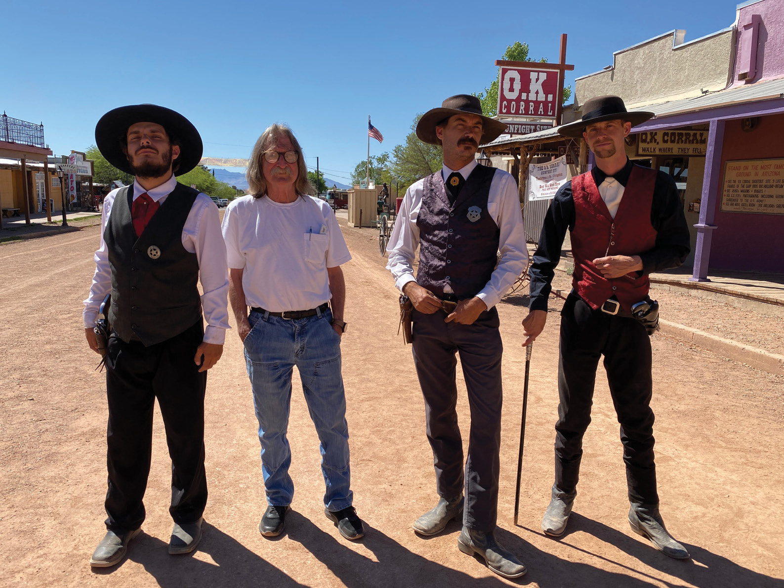
It’s a good idea to meet some of the locals so they can watch your back in Tombstone, Arizona. Photo courtesy of Virgil Earp.
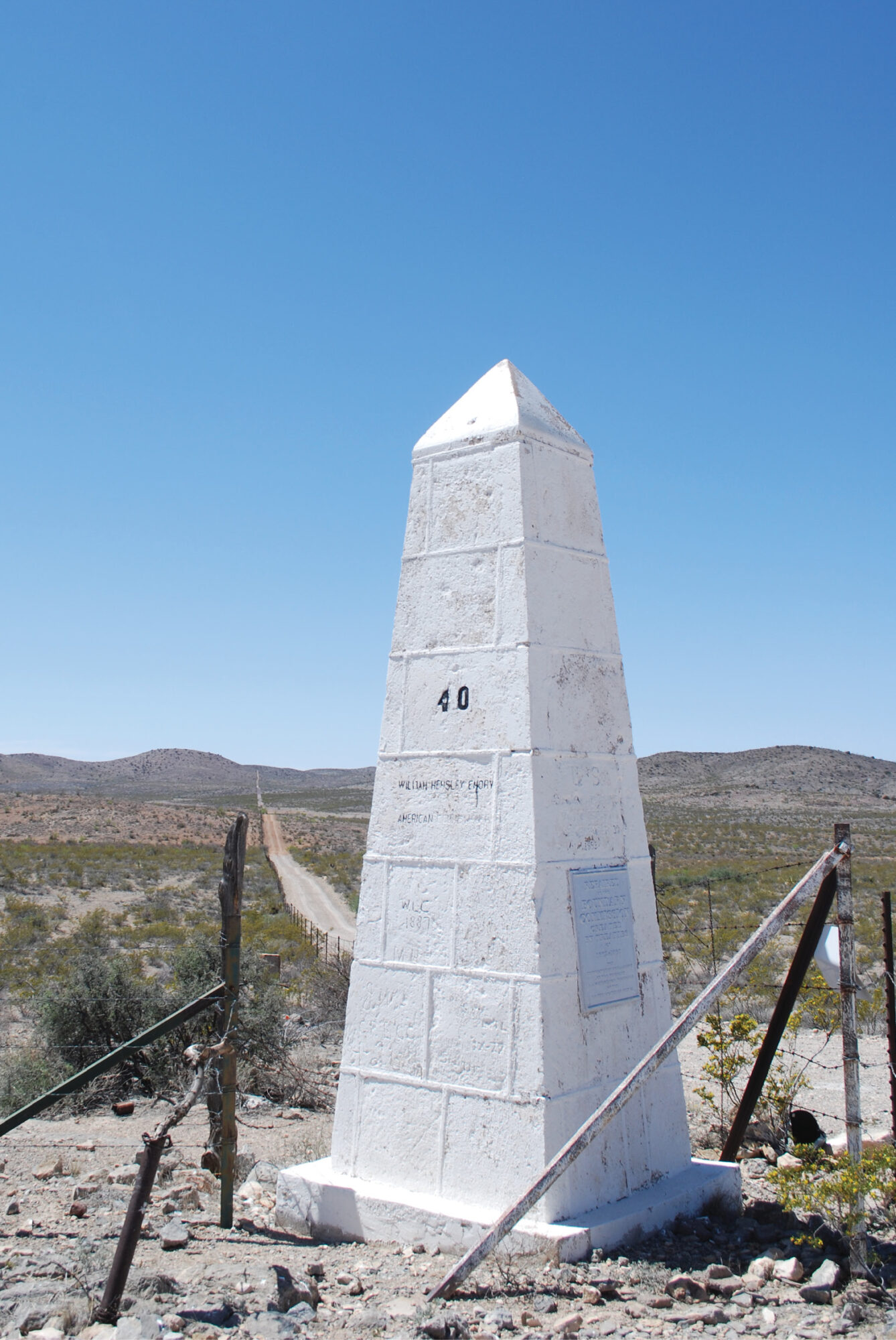
Crossing into New Mexico, I headed for Hachita. Two surveyors, one in private practice (Dean Van Matre) and the other, a surveyor (Sydney Rouch) with the International Boundary and Water Commission both had written to me about monuments just west of El Paso. I simply could not miss seeing Monument 40.
Monument 40 is where the line follows the south line of New Mexico heading west and then makes that sudden turn to the south. Monument 40 marks this “bend”.
Monument 40 is impressive to say the least. It is approximately three times larger than any monuments I had seen to date. It is in great shape, no damage, and no graffiti. At this point on the line, the “wall” has been replaced by a simple five-strand barbed wire fence. I could not see anything indicating human life to the south and I drove 12 miles in from the north through what can only be termed as desert. Yes, a barbed wire fence should do it.
Driving east from 40, I eventually found the end of the “wall”. Proceeding east, I spotted monuments 33-37, all in remarkable condition.
I had been told that the line could be a little dicey in southern New Mexico. Following a lunch of burritos at the border crossing town of Columbus, I hit the highways and headed to El Paso to wind this reconnaissance down. I was headed to Monument Number 1, ending the line where the line begins.
About mid-morning on the last full day of my trip, I headed for Brickland Road (dead ending at the border). The first stop was my friendly border patrol truck on Brickland. It turned out the occupants weren’t Border Patrol but wore US Army fatigues. I assumed they were National Guard. They had no idea about Number 1 but got on their radio and summoned a Border Patrol agent.
When he showed up, we talked for a while. He was a little reluctant. Finally, he said to follow him. For an unknown reason, he stopped right in the middle of the road. We got out and talked for a while and while he was pointing toward Number 1, a family of three came out from the bushes on the south side of the road. Running to his truck, he told me to stay right here, now with gravel slinging from his truck wheels.
Well, I’ll be here a while and then I spotted Number 2, high on the highest hill around to the west. It is obvious this site was chosen for an astronomic observatory sometime in the 1890’s. Too remote to walk up to closely. An empty Border Patrol van drove past and returned with the family. Shortly, the original Border Patrol agent showed up and explained he didn’t have time, which I understood. He was on the job.
He pointed and gave vague directions to the monument and said I couldn’t get in to it. It was now behind a locked gate and to be extremely careful because there were gaps in the “wall” just west of #1. I found it, got out of the vehicle, spent some time photographing it through the “wall,” attempted to get to #2, failed and headed out.
While in that neighborhood, being not a mile away, I headed to Rosa’s Cantina (yes, the original) in the west Texas town of El Paso. A pleasant way to end a journey with a couple of cerveza, a couple of tacos and a guaca tostada at Rosa’s.