Probably the majority of American land surveyors know of the Jefferson Pier’s existence, while at the same time having only hazy and subtly incorrect ideas about how and why it was created and the scale of Thomas Jefferson’s ambitions when he personally did the surveying calculations and fieldwork that established its location. These misapprehensions are likely due to the relative paucity of relatively available information on the Pier Stone—i.e., information that is online and ‘googleable.’
Here, for example, is part of what Wikipedia has to say about the Pier:
“L’Enfant planned Washington (D.C.) around a right triangle, having its 90° vertex at the Washington Monument, its eastern vertex at the Congress House, and its northern vertex at the President’s House, now called the White House. The west side of L’Enfant’s triangle forms a natural prime meridian passing through the President’s House.”
“L’Enfant” here is Major Pierre Charles L’Enfant, American-French military engineer (and stone cold architectural genius) who in 1791, when he was just 37, was entrusted by President George Washington and Secretary of State Jefferson with the overarching design and layout of a brand new nation’s brand new capitol city, to be built from scratch on mostly barren swampland. It is difficult, even in retrospect, to appreciate the magnitude of what L’Enfant what was being asked to accomplish—suffice it to say that never before or since has an urban planner been asked to somehow embody the democratic, egalitarian ideals of a new nation in the civic design and architecture of a new city being intentionally built-to-purpose as that nation’s first capital.
L’Enfant, though, was supremely conscious of the honor and opportunity bestowed upon him and seems to have considered the assigned task as something nearly sacred. He began by establishing and monumenting (Andrew Ellicott and self-taught mathematical genius Benjamin Banneker did the actual survey work) the congressionally allotted 10 square miles of the Capital District on an exactly cardinal basis—thus creating the famous ‘diamond’ shape of our capital city—then located the Capitol Building, Supreme Court Building, and “Presidential Palace” on a cardinal right angle according to principles deemed auspicious in sacred geometry, and then proceeded to layout the major governmental, commercial, residential and recreational districts and avenues, also according to sacred geometry principles such as the Golden Ratio—thus incorporating Fibonacci numbering and phi into the plan—and, yes, a multitude of pentagrams.
And herein is one source of the “subtly incorrect ideas” generally held regarding the Pier Stone, for contrary to the assertion that L’Enfant intended his “natural prime meridian” to pass through (what came to be called) the White House, he instead placed his intended new zero meridian in the Capitol Building, apparently as a nod to political power in the United States not arising from a king or president residing in a palace but from the democratically elected representative body residing in the Capitol Building. It was Jefferson, of all people—Jefferson, who more or less immediately objected to the president’s house being called a ‘palace’ and who was a prime mover in the creation of a national constitution that limited and balanced presidential power—who modified the L’Enfant plan so that the new nation’s prime meridian would be ‘monumented’ by the White House.
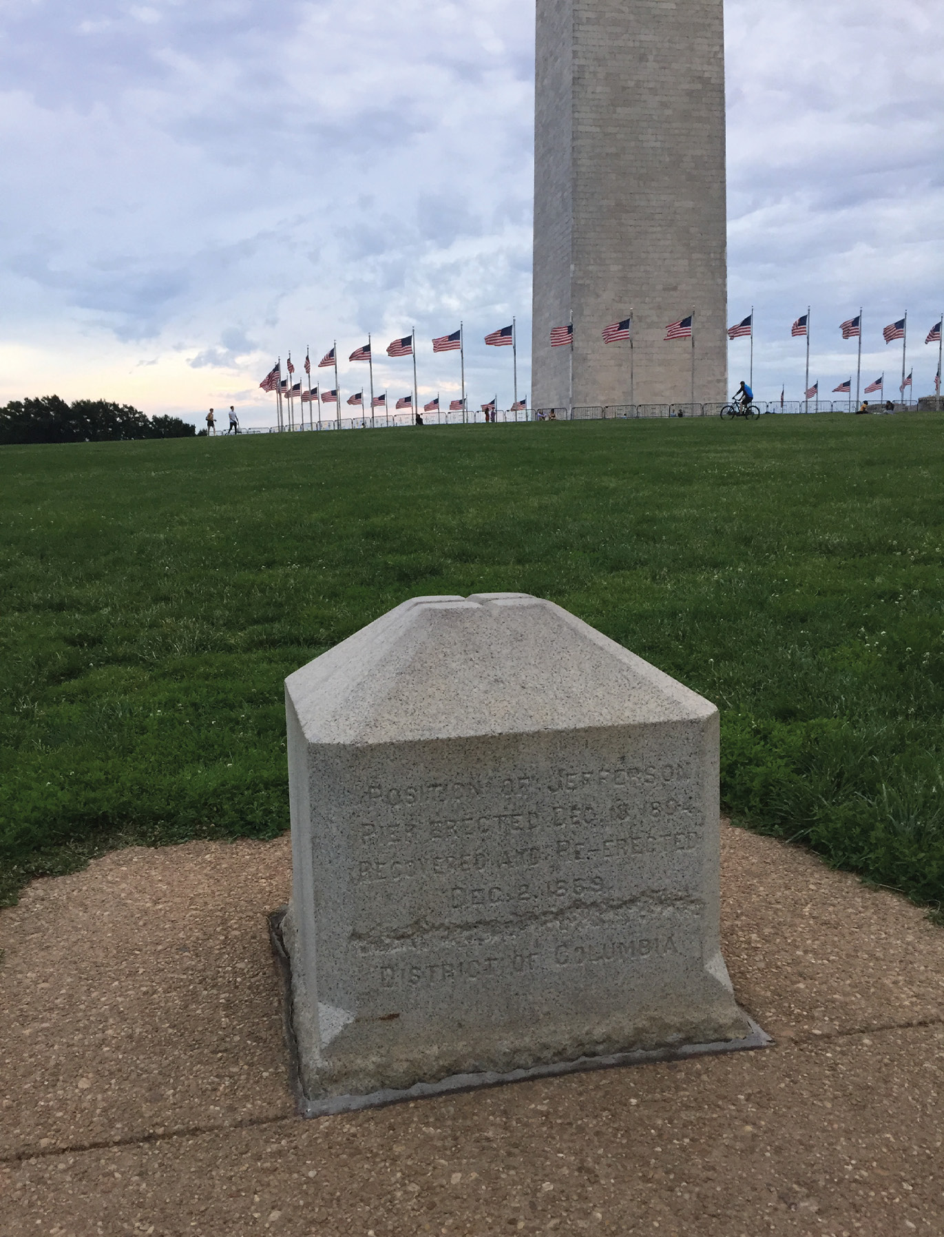
In his remarkable and immaculately researched little book The Sacred Geometry of Washington D.C., Nicholas R. Mann says, “I was particularly taken aback when I learnt that, in the winter of 1793, L’Enfant’s intended zero meridian through the Capitol was abandoned and a new zero meridian was established through the White House, along 16th Street. Thomas Jefferson personally surveyed and marked the new meridian with a wooden post at the point where it intersected the east-west axis of the city. He replaced this post in 1804, during his term as President, with a monument known as the Jefferson Pier… In effect, Jefferson removed the markers for the prime, zero-degree, north-south meridian from the Capitol and placed them on the new line of longitude through the White House.”
A Grand Vision
Jefferson’s grand vision then was for the White House, and thus the President (which at the time was, well, Jefferson himself) to be, effectively, the center of the globe, that is, the starting point for all coordinate location of points on the planet. Put this way, his vision seems impossibly, even comically, grandiose. But keep in mind that, in contrast to the certainty of the zero-degree line of latitude—which is established by the Earth’s rotation and allows for no dispute over the equator’s location—longitude is more like a number line where the zero origin point can be placed at any arbitrary point on Earth. In the event, of course, the United States fell in line with the rest of the world and legally adopted, in 1912, the Greenwich (England) Meridian as the basis of global location and, effectively, timekeeping.
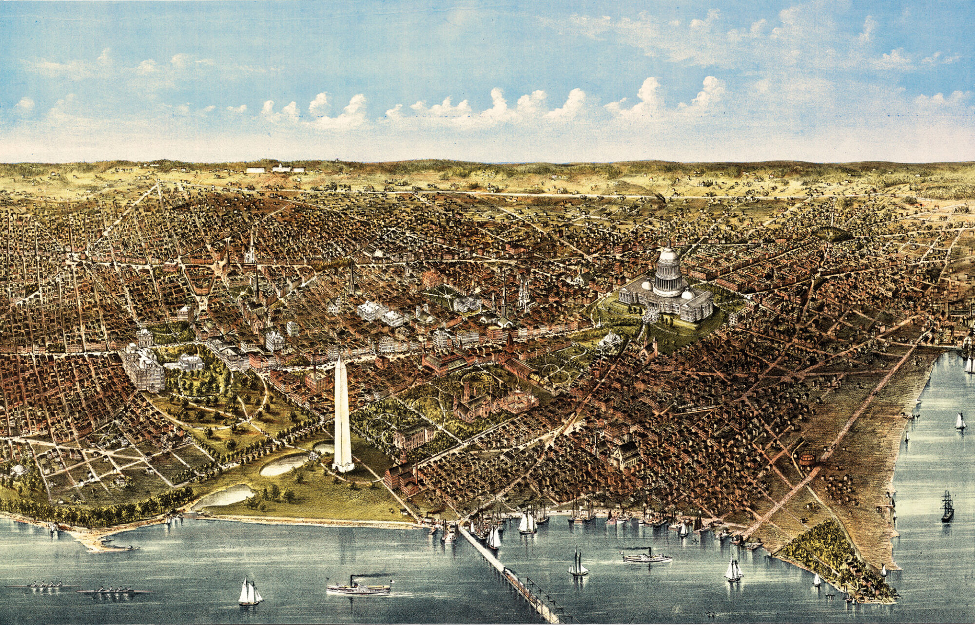
Washington Old aerial view from the Potomac. Currier & Yves, New York, 1892
I argue that the adoption of the entirely arbitrary Greenwich Meridian was a big deal indeed, and a staggeringly huge propaganda coup for the U.K. and, by extension, the Western world. It can be compared to the adoption of Anno Domini (AD) and Before Christ (BC) as the dating system origin point for all the world, so that—regardless of an individual’s or country’s actual religious beliefs (or lack thereof)—when the date of any historical event is established, Christian belief is inevitably referenced. Please note, I am not here arguing for or against Christianity, I am simply pointing out that it is considerably advantageous for Christendom (considered as a belief system striving for global preeminence) that something so fundamental as the calendar—the location in time of everything and everyone—is based, de facto, on the birthday of its eponymous prophet.
In the same way, it’s my belief that the magnitude of the symbolic and tangible effects on the world, deriving from the globally adopted spatial location system being centered in the West, can hardly be overstated. I further believe that President Thomas Jefferson, in seeking to establish a new Prime Meridian specifically originating in the White House, was fully aware of the magnitude of these effects and was doing his best to make the U.S. President the symbolic center of the world.
Jefferson as Geomancer
The son of a talented surveyor and explorer, Jefferson’s own career as a land surveyor is a decidedly mixed bag of accomplishments; on the one hand, he did not register a single complete survey during his brief stint as County Surveyor of Albemarle, Virginia but on the other hand it was he who ensured that the best (and most expensive) maps available be provided to the Lewis and Clark expedition, attempted the audacious change to the global positioning system described above, and it was his early, strong, and unflagging support for a consistent method of survey of public lands that led to the rectangular survey system and the then revolutionary notion of surveying lands prior to sale and occupation that may well have been the single greatest factor affecting America’s Western expansion.
My very first Everything is Somewhere column, which appeared 20 years ago (oy) in the very first issue of American Surveyor, was titled “A Surveyor’s Own Conspiracy Theory” and had to do with what I saw as the undeniably Kaballistic, esoteric nature of Jefferson’s rectangular survey system, pointing out that:
“… the GLO township is a boustrophedonic numerological magic square, very similar to squares associated with the Kaballah and used in Western occultism for hundreds of years. In fact, it is similar to the magic square considered the most powerful. In a major feat of surveying, it has been stamped across much of the United States. The sum of its individual squares is 666, a number of apocalyptic significance to many.”
And I concluded the article by saying:
“But since the 6×6 square is a solar device, a fascinating–and, yes, nutty and conspiratorial–possibility comes to mind. There is the interesting, unlikely, crazy possibility that some person or group manipulated the choice of GLO township layout in an attempt to cast a Kabbalistic spell over an entire nation… and there is the disturbing possibility that it worked.”
For better or worse—mostly worse I fear—that article set the tone for much of my professional writing in the 20 years since (again, oy) and I guess I’ll compound my public nuttiness by pointing out that if Jefferson actually intended that the White House be the symbolic center of the world, and if he was largely responsible for esoteric, magical properties I descry in the rectangular survey system that radiated from that center like a spider’s web that shaped the American empire, and the world… well then, the Wizard of Monticello (as he was sometimes called even in his lifetime) was not so much a land surveyor or lawyer or president as he was a supremely capable geomancer, working with “the placement of objects and buildings in the landscape” in order to control the flow of subtle forces and (successfully?) shape a nation, and the world, according to his inscrutable whim.
It’s interesting to think about anyway.
Angus Stocking is a former licensed land surveyor who has been writing about infrastructure since 2002 and is also the host and producer of the podcast Everything is Somewhere.