The latest issue of our sister publication, LIDAR Magazine, recently contained an article that caught my eye. While the article is ostensibly about evaluating lidar and photogrammetry map accuracies, the author, Dr. Qassim Abdullah, directly speaks to surveyors. Dr. Abdullah is the Chief Scientist for Woolpert, a multi-discipline company headquartered in Dayton, and he most definitely has the qualifications to address the topic.
I’m sure some of you will groan when you see all the formulas in the article, but if you can see past the formulas you will note that the article begins with an indictment: surveyors still don’t understand survey accuracies, especially when it comes to GPS. It hasn’t been that long since a major freak out was caused by the adoption of positional tolerance. The survey publications beat the subject to death. Because I was fortunate to have started using least squares adjustments in the early 90s, the term was already familiar to me.
But what jumped out of Dr. Abdullah’s article was his use of the term absolute accuracy. As surveyors we understand that a certain amount of error will always be present in our measurements, and the concept of absolute doesn’t compute. The article does an excellent job as a primer on statistical terminology and by now, all surveyors should be able to keep up with the explanations.
The point of the article is that unless the ground control is accurate, the subsequent mapping will be inaccurate. The article lays the responsibility for providing this absolute information at the feet of the equipment manufacturers, but also calls for all the organizations involved to join in. We have scheduled a meeting with Dr. Abdullah for later this month to discuss the issue and shed more light on what this means to surveyors.
Also in this issue
Lloyd Pilchen educates us again, this time on an interstate compact that affected an industrial project and how it made it all the way to the Supreme Court. Martin Gutoski continues with his efforts to use old equipment to shoot Polaris. Carl DeBaca regales with a humorous tale of how things could be in the surveying world. Wendy Lathrop shows us what can happen when you alter the course of a river. Angus Stocking continues with his exploration into the mystical aspects of the layout of Washington, DC. And finally, Richard Radke provides advice on selling a business.
In other news
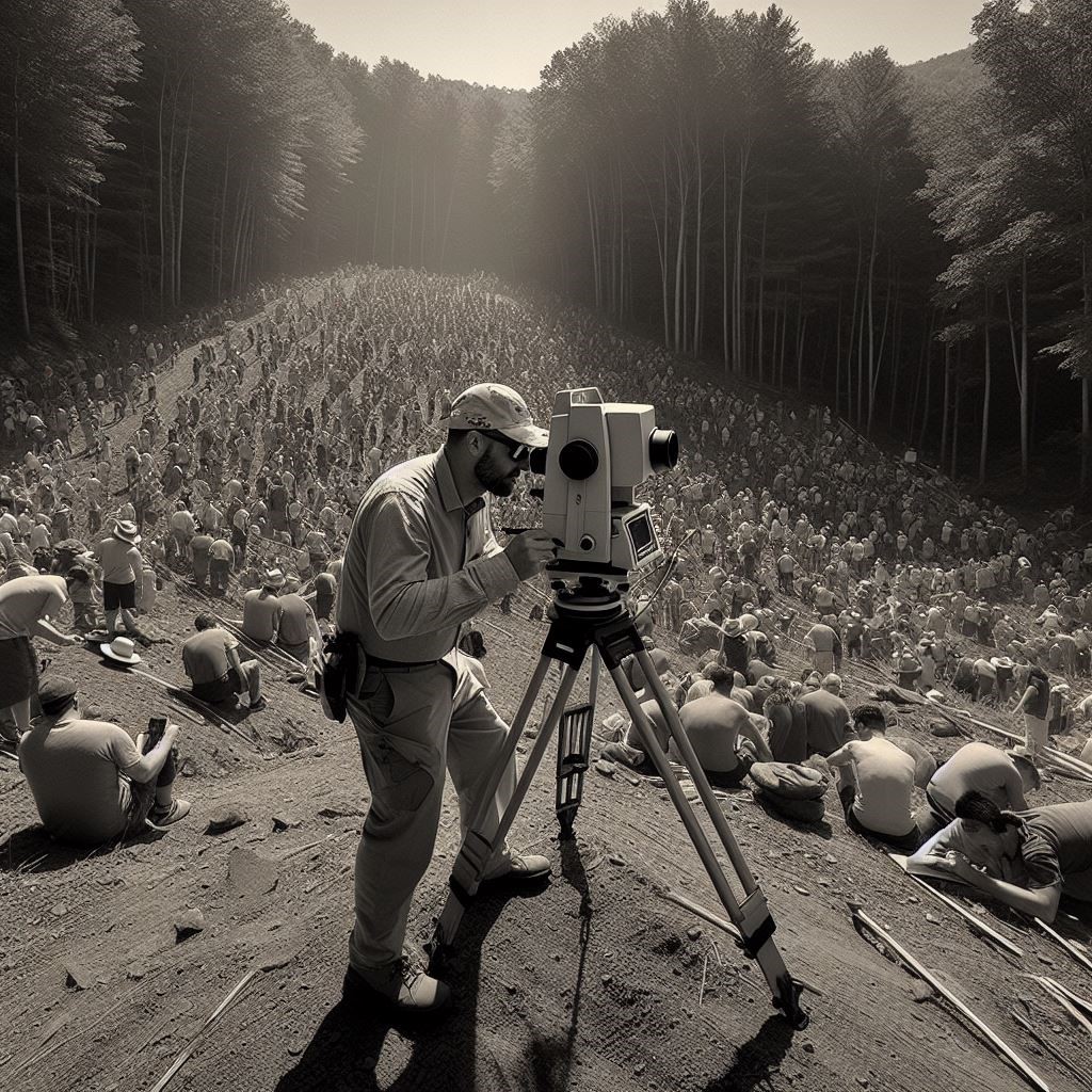
One of the state newsletters I receive is the New Hampshire TBM and the May issue contained this pic. New Hampshire LLS, Chris Rollins, queried Artificial Intelligence to create an image of a Land Surveyor trying to do his work in the New Hampshire woods among people gathered to watch the solar eclipse.