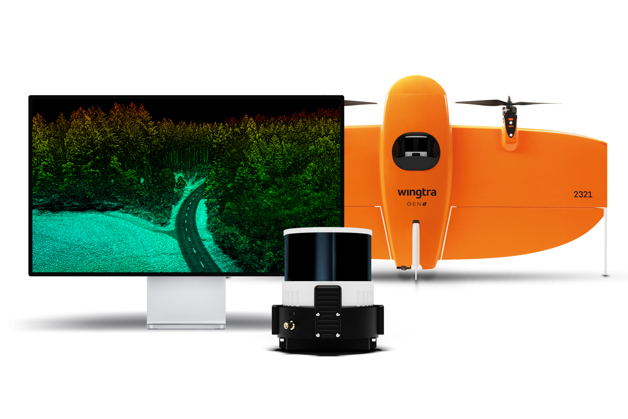
Zurich – Wingtra, a leader in drone technology, is excited to announce the launch of its innovative LIDAR drone solution, a significant advancement in drone LIDAR technology. The new Wingtra LIDAR payload integrates the efficiency, ease of operation, and high accuracy of the WingtraOne GEN II drones with a state-of-the-art Wingtra-engineered LIDAR sensor, setting a new benchmark in the industry.
Julian Mackern, Product Manager at Wingtra, expressed his enthusiasm: “We’re excited to deliver a LIDAR drone mapping solution to our customers, which we’re confident will exceed their expectations, cut their costs and headaches, and win them more bids. We’re already seeing our first customers comment how surprisingly easy it is to set up, fly and generate a high-quality point cloud. And as always, we keep our promise with the data: high-precision, reliable and repeatable.”
Wingtra’s solution is already gaining traction worldwide, with customers in various sectors relying on the WingtraOne GEN II for efficient, safe, and frequent mapping for photogrammetric analysis of worksites. The addition of the meticulously engineered LIDAR payload offers an all-encompassing solution, covering everything from the initial discovery phase through to project implementation and infrastructure maintenance.
By integrating a top-tier Hesai scanner, Inertial Labs IMU, and NovAtel GNSS, Wingtra LIDAR dramatically reduces the need for time-consuming post-processing strip alignment, delivering precise terrain information immediately from each efficient flight.
Carlos Femmer, Director of Data Acquisition at HDR, shared his experience testing the Wingtra LIDAR payload: “We’re seeing [USGS topographical] quality level zero results on hard surfaces, which are quality results. We were able to test the horizontal and vertical strip alignment quality. We looked at both vegetated areas and non-vegetated areas, and it’s very clean, it aligns well. There’s minimal noise as compared to other LIDAR sensors in this price range and it delivers exceptional overall precision.”
Significantly, Wingtra LIDAR also reduces field time, requiring no calibration and initializing in just one minute. The intuitive Wingtra LIDAR app and automated experience quickly build confidence even for those new to LIDAR data capture, saving at least an hour per survey compared to other systems in its class.*
Leo Liu, Director of Mapping Solutions at Inertial Labs, praised the efficiency of the system: “Wingtra LIDAR capture and processing is super efficient. Technically, if you have everything structured, it’s literally one click and it’s done to get you to that point cloud. In terms of drone LIDAR capture, the goal is that it has to get cheaper and simpler to use. And the good news is that that’s happening with Wingtra.”
Wingtra LIDAR offers 3 cm (1.2 in) vertical accuracy, verified by lead customers as top of the range from a 60 m (200 ft) flight height. Point density is top of its class, and the WingtraOne GEN II’s design and automated flight pattern ensure consistency across different pilots.
Femmer further explained the sophistication of LIDAR data capture and the uniqueness of Wingtra’s system: “Wingtra’s automated LIDAR capture is, in my opinion, better than other systems in this price range. I can send three different pilots to the same location and get the same quality result processing on the back end.”
*Note: Strip alignment during post-processing on other drone LIDAR units typically takes a half-hour due to lower quality IMU performance, resulting in misaligned data capture. This, along with initialization and calibration for each flight, consumes flight battery and impacts overall mission efficiency.
About Wingtra
Wingtra is a leading drone technology company specializing in the development and manufacturing of high-end drone solutions. With a commitment to innovation, Wingtra continues to redefine the standards of drone technology, providing cutting-edge solutions for a variety of industries. For more information: https://wingtra.com/lidar
