This reviewer shall initiate this book review by ‘returning’ to a Wyoming secondary school in 1958 (an arbitrary date sentimental to the reviewer). In that (identified) school, a teacher for the course in Wyoming history is proctoring the final examination to a group of tentative graduates. In a series of columns on the examination are listed a number of jobs or job skills. Although not inclusive, the list included: attorney; bartender; blacksmith; carpenter; cook; cowboy; day laborer; dentist, doctor, engineer; farm hand; Federal employee; governor; horse wrangler; house domestic; lawman; local politician; lumberman/forester; merchant; miner; nurse; seamstress; surveyor; tailor; teacher; teamster; etc. The examination question was: “From the above list of jobs and skills, identify all paying jobs/activities done by William Alford Richards (b. 1849 – d. 1912) performed after his 18th birthday. Answer: attorney; cook; day laborer; engineer; Federal employee; governor; horse wrangler; local politician; surveyor; teacher; and teamster!
Who was William Alford Richards (W.A.R.)? Although born in Wisconsin (1849), after the American Civil War he eventually migrated to the Omaha, Nebraska, area seeking a way of making a living, not having found teaching a satisfactory career.
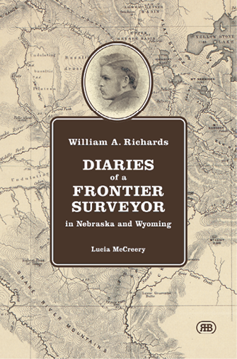
Enter Ms. Lucia Alice McCreery, the great-granddaughter of W.A.R. The nucleus of the information used to compile this work was collected from the family’s personal archives. These documents are the original diaries, or transcriptions compiled by W.A.R.’s daughter, Eleanor Alice Richards McCreery, who served as the private secretary of Governor Richards. The documents, records, and memorabilia subsequently found their way into the Wyoming State Archives, American Heritage Center, and Ms. McCreery’s possession.
Ms. McCreery earned a B.A. in history and has been a journalist. These credentials serve as an impeccable foundation to saunter into the maze of historical archives and confusing research venues exacerbated by poorly designed and implemented indices. Frequently, novice researchers are frustrated by the impediments presented for them to collect historical facts. From what has been incorporated in this publication it appears that Author McCreery has been quite successful in her research journeys. This fact is documented in the ‘sources’ and ‘footnotes. Serious historical researchers carefully inspect these sections as a potential grading tool for “the author doing his/her research.” After carefully inspecting the book’s “Sources and Notes,” this reviewer concludes that Ms. McCreery “did her homework”!
Inspection of the Table of Contents reveals definite planning and ordering of the volume’s contents. For the most part, the work is ordered chronologically. After the “Introduction” information the volume is divided into six Parts; “Sources and Notes;” and “Index.” Only Part 3 is not in chronological order of W.A.R.’s life. Part 2 contains the W.A.R. diaries written during the survey of the southern portion (1873) and western portion (1874) of the Wyoming Territorial boundaries. At this point, the reader has the opportunity to ‘catch their breath’ after reading about all the incidents, travails, and mishaps encountered in those two field seasons in the wilderness. Two incidents described by W.A.R. will highlight the ‘mundane’ life of a nineteenth century boundary surveyor. “The little black mule fell down a hill and landed heels up against a fallen tree – and if that had not stopped her she would have gone into the stream.” And, “We’re delayed by an accident to one of the mules (Dandy Pat) who tipped over backwards off a cliff forty feet high, made two complete revolutions lengthwise, and landed square on his back in the stream. Alighting upon the pack was all that saved his life, for it broke the force of the fall, also broke our large Dutch oven, busted a seamless sack containing sugar & 50 lbs. washed away, and smashed the pack saddle all to pieces . . . for I found that we must continue up this stream (which we now call sugar creek) . . .”.
W.A.R. started his surveying career in central-western Nebraska performing chores around the survey camp, clearing the surveyor’s sight lines, chaining, and other chores as assigned. It should be remembered that the areas being settled were devoid of any settlement, because Federal statutes outlawed settlement until the surveys had been executed and accepted in Washington. Therefore, a few teamsters hauling freight and wandering Native Americans hunting buffalo, migrating to seasonal camps, or occasionally looking to make mischief were encountered. Camps would be established and periodically moved to sites closer to where the surveyors were working. The field survey party was a self-contained organization containing a deputy surveyor, an instrumentman, chainmen, flaggers, a cook, and one or more roustabouts and wranglers. On smaller field parties, several of the assignments were simultaneously completed by single individuals.
Ms. McCreery has faithfully collected, transcribed, and presented W.A.R.’s prose in an easy-to-read format. Although W.A.R. did not have any post-secondary education, and this reviewer is unaware of the highest level of primary-secondary education completed, from the initial diary entry (1 January 1869), the entries show a fundamental command of the English language, grammar, and punctuation. At times, W.A.R.’s entries were slightly terse, but under the circumstances and field conditions encountered it is acceptable and not derogatory in concisely recording the events.
Part 3 is titled: “Surveyors Trek Back to the Boundaries, 1906 – 2019”. This is a welcomed interlude to the day-to-day field conditions encountered in 1873 and 1874. In a change of pace, Ms. McCreery has collected the stories of the search and recovery of the original multi-state corners (Colorado-Utah-Wyoming; Utah-Wyoming; Idaho-Utah-Wyoming; Idaho-Montana-Wyoming; and Montana-Wyoming). Ms. McCreery assignment was not to rummage through W.A.R.’s records, but to locate records and individuals in Colorado, Idaho, Montana, Utah, and Wyoming, who, over eleven decades launched campaigns to recover these corners for professional work and memorializing them for posterity.
Part 4: “Exploring and Homesteading in Wyoming’s Bighorn Basin: 1884 and 1885” is a vastly different experience for W.A.R. The economic conditions of that era hampered W.A.R. and his contemporaries in finding satisfactory employment to support themselves and their families. Ms. McCreery skillfully assembles and describes the personal conditions and the societal/economic conditions in California, Colorado, and Wyoming in the 1880’s. These four and one-half pages are well organized backdrops for the ensuing diary entries. This information was gleaned from letters W.A.R. saved and are now housed in the Wyoming State Archives. Ms. McCreery cited the value of these documents in filling in the details which were omitted in the diaries.
W.A.R.’s diary at this point is a mixed style of terse “bullets” and extensive narrative prose. Each style is acceptable to describe the encountered events and observations. Having spent several occasions in the Big Horn Basin and along the western slope of the Big Horn Mountains, it was relatively easy to follow W.A.R.’s travels and excursions throughout the region. In this Part, author McCreery has skillfully researched, written, and inserted “bottom of page footnotes” which the reader can quickly access/read to dispel any potential editorial ambiguities. Although there are not the hair-raising misfortunes that were encountered in the surveys in Nebraska and the southern and west boundaries of Wyoming, the information and daily routine required to carve out a homestead in the wilderness (Dessert Land Entry Claim Act) reminds the reader that pioneer life was quite different than the cinema and television depictions.
On page 208, we have a glimpse about train travel in the mid 1880’s. It reads: “Left Rawlins at 12:30 A.M. Reached Cheyenne at 10:00 A.M., Reached Denver at 3 P.M.” The UPRR distance between Rawlins and Cheyenne is about 150 miles. This would indicate an average speed of about 16 m.p.h.! However, undoubtedly, there would be a train stop at Laramie for passengers, refueling, and possibly a crew change. The trip would continue with a long, steep climb from the Laramie Plains (elevation about 7,500 ft.) up the west side of the Sherman Mtns. to their summit (about 8,250 ft.) in about 20 miles, which also is the highest point on the entire UPRR. With a possible one-hour layover in Cheyenne, the four-hour trip of 100 miles to Denver would average about 25 m.p.h.
Part 5 is “Related Letters and Stories”. The contents of this section are not diary excerpts, but a “sweet dessert” for a bountiful meal. Of the ten entries, eight were authored by W.A.R. about hunting, but the tenth is Gifford Pinchot’s recollection of a W.A.R. narrative. One story was published in Forest and Stream (1885); two stories were published in Recreation (1896) and (1897); and four stories published in various newspapers around the country (L.A. Times; The Pioneer, Bemidji, MN). This last group of stories describe were stories about hunting in Wyoming.
Part 6 is “Appendix”. To many historical authors, appendices are some form of literary after-thought or attempted explanation of material to be considered important but relegated to a “railroad siding” for those readers curious about the details. This appendix authors addressed surveying matters which took place in Nebraska and Wyoming.
Mr. Gene A. Thomsen, a Nebraska State Deputy Surveyor (retired), searched the State Surveyors’ Office in which are housed the original plats and field notes (and other administrative documents) of all the G.L.O. surveys and resurveys pertaining to Nebraska. Mr. Thomsen assembled six maps, which accurately depict the originally published information, and contain annotated information in various colored inks delineating various aspects of the Nebraska surveys of township boundaries and the subdivision of the townships. Furthermore, the associated text and illustrations’ captions clearly identify the appropriate diary entries to lay readers for a better understanding of the areal extent of W.A.R’s activities and the associated events.
Following Mr. Thomsen’s presentation are two and one-half pages describing the fundament instruments (instrumentation), not called ‘tools,’ employed on various aspects of the surveys. These pages are subdivided into “Instruments Listed in the 1873 Boundary Survey Field Notes” and “Instruments Listed in the 1874 Boundary Survey Field Notes.”
The remainder of this appendix addresses a number of technical topics concerning surveying procedures, instrumentation, etc., by Dr. Herbert W. Stoughton. Since the early 1960s, Dr. Stoughton has conducted historical research of G.L.O. surveys performed in Michigan (1815 – 1855); Southern California (1850 – 1900); Colorado (1880 – 1920); Montana (1880 – 1920); and Wyoming (1870 to present). One of his technical assignments was evaluating historical astronomical observations and being project manager for developing new astronomical instrumentation (while working for the Dept. of Defense). The topics addressed are titled: (1) “Flagstaffs, Stadia Rods, and Other Sighting Targets”; (2) “Classical Spherical Trigonometry”; (3) “Mound Building”; (4) “The Tangent-Offset Method for Surveying a Parallel of Latitude”; and (5) “Astronomical Azimuth Observations/Determinations”.
The ten pages of the “Sources and Notes” are clearly presented and conform to the highest standard of “scope of information.” If the reader decides to inspect the original source, adequate information has been provided to launch a search. Inspection and study of this section reveals to this reviewer that the author has expended an enormous effort providing the reader with primary and valid background information for follow-on study.
Interspersed throughout the volume are numerous illustrations. Some dating from the nineteenth century. One illustration which is very impressive is a portion of the map of the west boundary of Wyoming, between M.P. 142 and M.P. 170. On the left side is the actual map, with hachures depicting the topographic relief. On the right side is a profile of the terrain along the actual boundary. Along this profile are the reference “datum” elevations for various sections of the boundary (6,000, 8,000, and 7,000 feet (above sea level) ). Just south of M.P. 160, the elevation is 10,358 feet (about ten miles north of the Snake River). At M.P. 170, the elevation is 9,800 feet. Between those two locations, there are several “peaks” and “valleys” separated by differences in elevation exceeding 1,000 feet! Ms. McCreery has judicially selected supporting illustrations and has appropriately placed them throughout the manuscript.
Many times, works of this nature have been written to state a specific philosophy or agenda. From the first pages it is evident that this publication is a labor of love and documentary of factual events. In summary, this work is an invaluable contribution to both Wyoming history and historical Americana. It probably will not make the New York Times best seller list, but this work is a good read!
Dr. Herbert W. Stoughton, reviewer. Herbert W. Stoughton started his surveying career in 1959, earning BS, MS, and PhD degrees in civil and geodetic engineering at the University of Michigan. In his 65-year career he had surveying and mapping assignments with the U.S. Geological Survey Topographic Division, consulting firms in California, Michigan, and New York, and the Metropolitan Water District of Southern California. He has taught at the University of Michigan, SUNY Alfred A&T; and the Metropolitan State College of Denver. Dr. Stoughton served as the book review editor for the American Congress on Surveying and Mapping, authoring over 80 reviews. In his spare time, Stoughton has written over 75 technical papers and 25 technical volumes, and delivered over 40 technical seminars. In his spare time he collects historical technical literature related to the practice of surveying and mapping.