In 2022, Big Bone Baptist Church (B3) and students from the Cincinnati State Technical and Community College Land Surveying program began a project to better understand and document the B3 church cemetery, which has existed at the site since the early 1840’s. Members at the church have carried history of the church and cemetery forward for generations, and there is a renewed drive within the congregation to fully understand, manage, and preserve the cemetery, both for the history it contains, as well as to honor those buried there and to create a welcoming and peaceful environment for visiting family and friends of the deceased. The team of students—seniors in the surveying program conducting the work for the church as their Capstone project—worked to accomplish several goals: to perform a boundary retracement for the approximately 18 acre site owned by B3, to conduct a topographic survey of the oldest section of the cemetery, and to then make an inventory of the headstones on the site, for the purpose of providing general location information of each stone and the person it memorializes, as well as to supplement existing records maintained by the church. At the culmination of the project, students presented their efforts and results to the church and other interested parties in the community. [2022 Capstone Article].
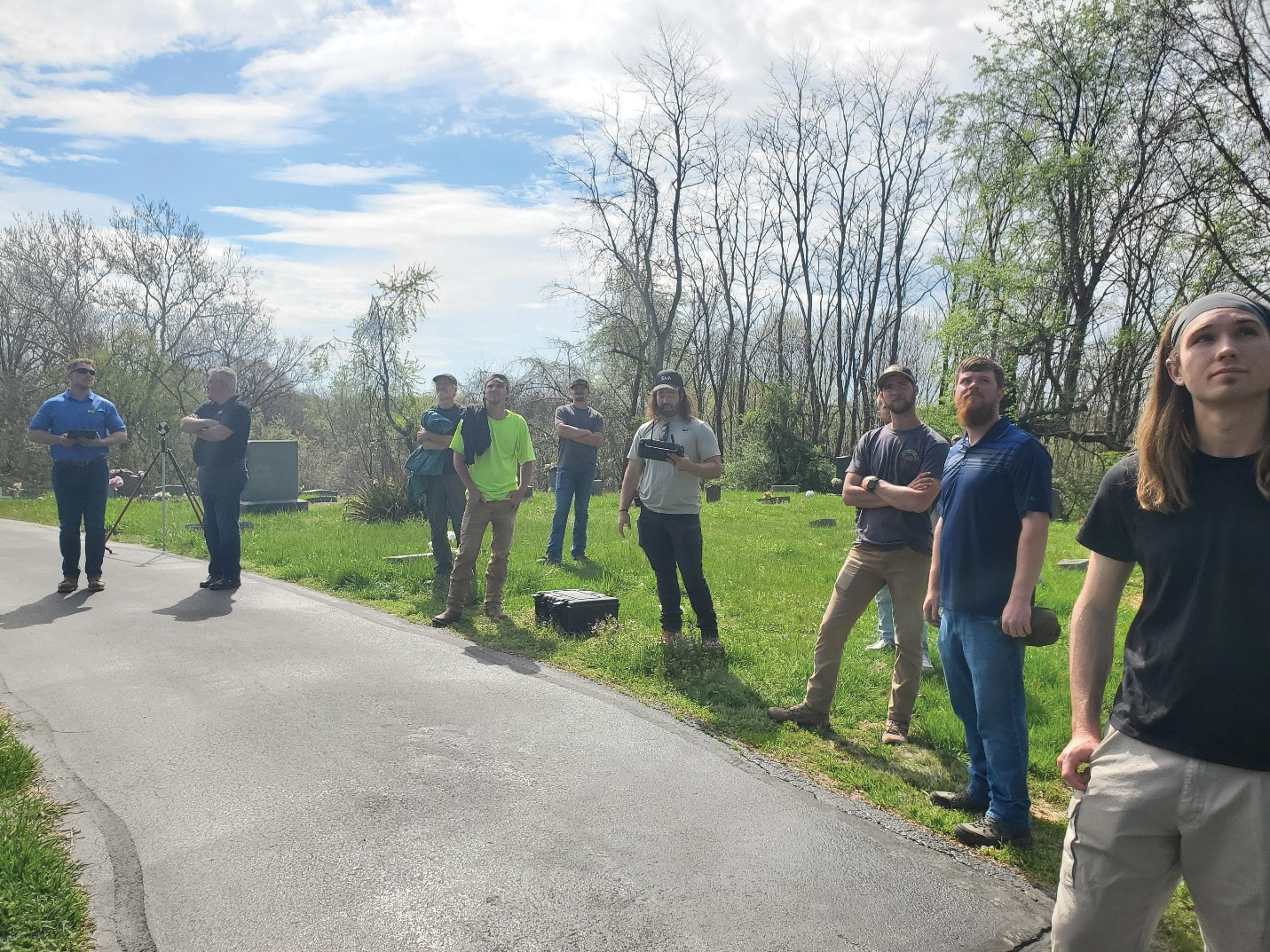
Capstone students observe the drone flight and photo capture, performed by Matt Dembo from Surveying and Mapping at the Big Bone Baptist Church Cemetery, April 14, 2023. Pictured left to right: Tyler Compton (SAM), Jim Elliott (SAM), Jim Decker (Professor, Cincinnati State), Alex Miller, Chance Moore, Matt Dembo (SAM—Drone), Noah Bonecutter (background), Micah McCain, Sean Reed (SAM—Ground Penetrating Radar), William Zwick
In January of 2023, a second Capstone class from the Cincinnati State land surveying program returned to B3 to pick up where the class of 2022 left off and close the project out for the church. Goals this year were the same as before, including the boundary work to give this year’s class the chance to work through the metes and bounds descriptions and try to make sense of the records. The primary difference this year was the area of the site for the topographic survey; whereas the previous class had focused on a several-acre portion of the cemetery across Gum Branch Road from the current church building, the class this year aimed to collect topographic information and all of the headstone/burial details in the area south of the church and west along the loop drive. [image 1].
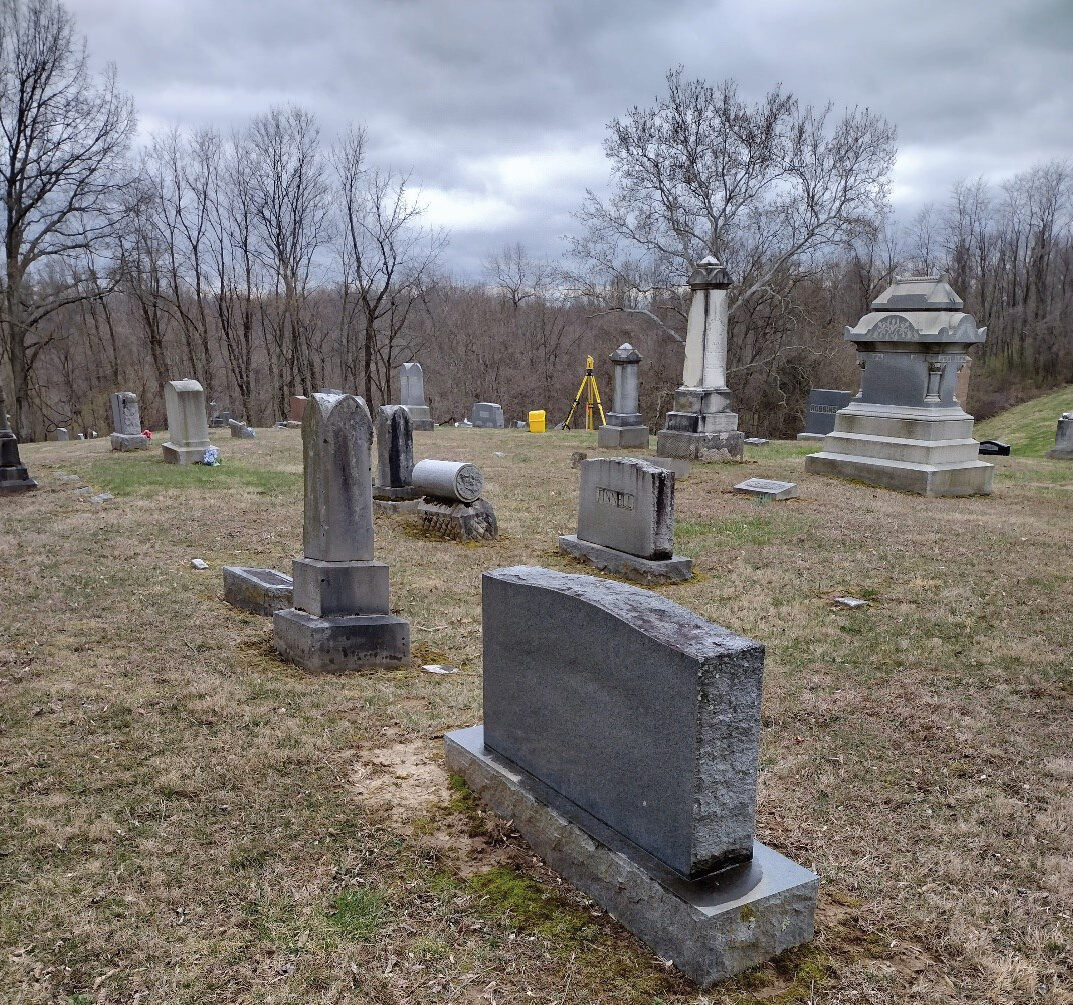
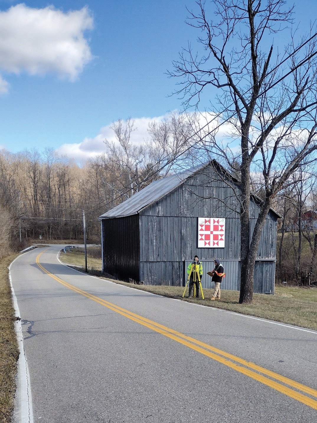
Topographic Surveying of headstones at Big Bone Baptist Church Cemetery 2023.
The process was similar to last year but was conducted completely independent of all work done previously. The first time the class met together was at Big Bone Baptist Church on the morning of January 20, 2023. Joined by Professors Jim Decker, P.S., and Carol Morman, EdD, P.E., P.S., of Cincinnati State, the Capstone class was introduced to the project site and specifics in a brief presentation compiled and given by Lisa Anglin, herself a member at B3 and the point person for all of the work being done at the cemetery. She explained the reasons for the work—how due to a series of unfortunate circumstances, many of the original documents, notes, and records of the cemetery had been lost in a fire and went on to share about her knowledge of the people buried at the site (including her parents). Of particular interest, Anglin shared her belief that there were unmarked graves of enslaved people in several areas of the property. The class last year had their site scanned with ground penetrating radar (GPR) in an attempt to delineate those areas within their work site. This year’s class would have the same in their portion of the site and would document any findings on the final plat. After the presentation and brief walk around the apparent boundary led by Prof. Decker (it was a breezy 34 degrees that day), the group began to lay out the weeks ahead and formulate a plan to meet their objectives.
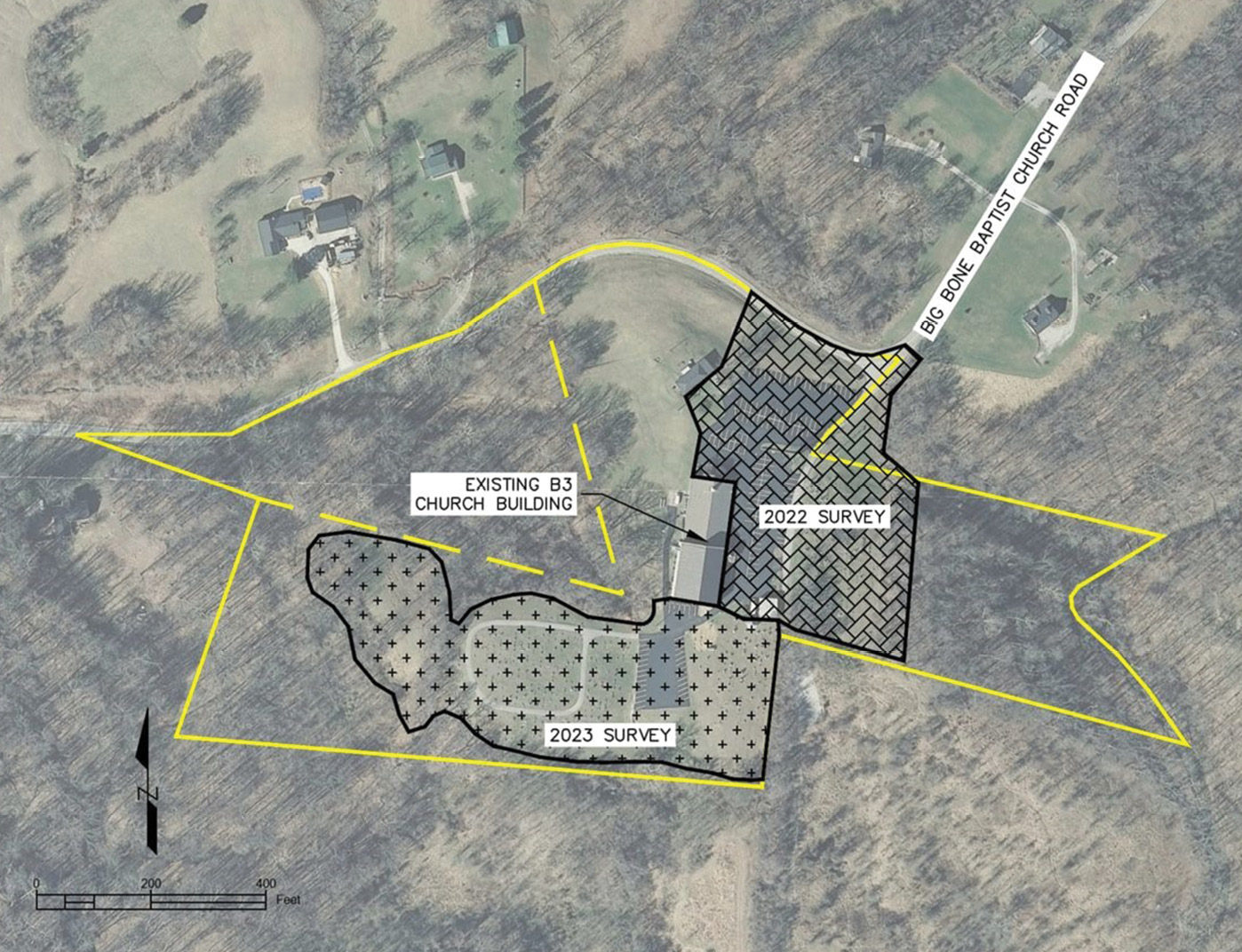
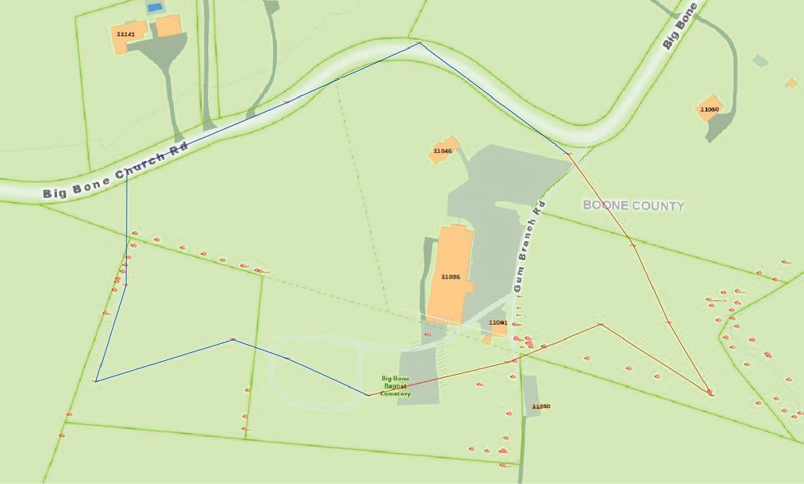
Project Location Map, Big Bone Baptist Church Cemetery, 11036 Big Bone Church Road, Union, KY 41091.
In the second week, the class worked through the process of drafting a contract for the work to be done and reconvened at the Boone County Clerk’s Office to begin the process of deed research. The church property itself consists of five tracts of land (and a potential sixth tract with unknown ownership) with a right-of-way for Gum Branch Road bisecting the property. It currently shows as two parcels in the county GIS, which provided an excellent starting place for deed research, but students learned quickly that the neat linework of the GIS was far more nicely arranged than the tracts described in the deeds themselves. The process of drafting a working graphical abstract to represent the site and its adjoiners proved to be challenging and required several repeat visits to the clerk’s office in search of more answers. In addition to the deed research, the class was fortunate enough to have Edwin Kirkpatrick, a seasoned professional land surveyor in Kentucky, who had himself performed a boundary retracement at the church property in 1991, come and speak to the work that he performed, the records he consulted, as well as his personal knowledge of surveying work in regional cemeteries throughout his extensive career.
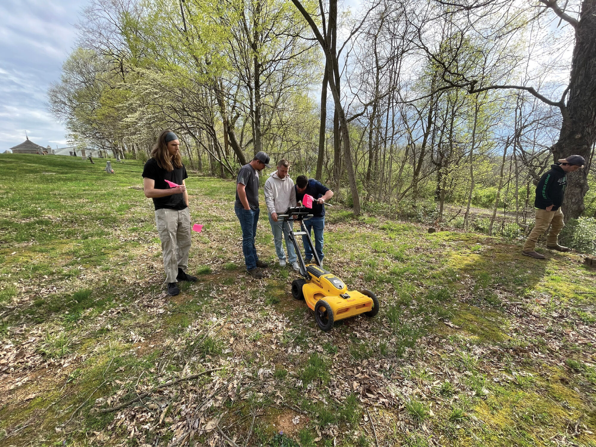
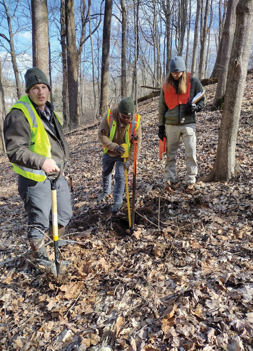
Students observe and help with GPR to find evidence of unmarked graves with assistance from SAM surveyors. From left to right: William Zwick, Chance Moore, Noah Bonecutter, Sean Reed (SAM), Alex Miller.
Once a rough graphical abstract was assembled, students spent the next several weeks establishing control throughout the B3 property. The process began with a three-wire level loop, which ran a total distance of approximately 1.4 miles from a Northern Kentucky Control Network benchmark disc west down Big Bone Church Road, back up the road to a found iron pin at the front of the church property. The loop to the site closed with a -.05’ error, which was acceptable for this project. While this loop was being performed, other students from the group, using the graphical abstract as a guide, searched for monuments along the church boundaries with a metal detector and shovel. Once the initial monument reconnaissance was completed, students began the process of laying out the traverse network for horizontal control through the site. In a bid to save time and, perhaps more importantly, provide everyone in the group with something to do, the traverse itself was run in two separate halves, with two groups beginning at the same point, then proceeding in opposite directions around the site, working through traverse points until the two crews met again at a common point in the rear of the site. [Image 2].
Two half traverse sections, beginning in the northeast corner of the site and meeting in the south center.
In addition to the confusion this caused, one group was setting traverse points as they went, rather than having laid them out beforehand. The process of running the two half-traverses around the site was accomplished in one field day, but ended up costing more time in the long-run than a traditional one-crew approach likely would have, as stitching those two halves back together for one complete loop to analyze and determine misclosure on took several weeks’ effort. The process that proved successful consisted of exporting the raw field data to a field book file, which was then carefully edited in Microsoft Notepad to reverse one of the loops, resulting in two halves that traveled the same direction. Stations names in the raw data had to be edited to create one system of increasing numbers, as well, and azimuths recorded by the total stations used to turn the angles for the traverse were reversed through one half of the loop. Ultimately, using Trimble Business Center and Civil 3D, one complete traverse was assembled from the two halves actually collected.
Capstone students performed a three-wire level loop to bring vertical control up Big Bone Church Road to a monument at the church property. Pictured: Micah McCain (Instrument), Noah Bonecutter (Notes)
Once the process of working through the traverse and computing misclosure was complete (misclosure obtained was 1:23728.61, which was acceptable for this rural Kentucky project), students returned to the cemetery to begin topographic data collection and come up with a method for documenting all headstones in this year’s area of the site. A second three-wire loop was run (by different students than the first) to bring the leveled elevation from the front of the site to the back and the area to be topographically surveyed this year. A mis-recorded sideshot led to the need to redo this second loop, and on the second attempt the obtained misclosure was .04’, again, acceptable for the work being done. While two groups of students proceeded with data collection using Trimble S3 Robotic Total Stations, the rest of the students flagged and labeled existing rows of headstones. Then began the task of handwriting notes documenting everything shown on each headstone, and assigning an alphanumeric name (for example, the first headstone of row 1 was to be documented as headstone 1A, then 1B, 1C, and so on) to each. Faced with rain and the overwhelming number of headstones to record, the initial handwriting approach was scrapped and replaced instead by students taking photos of each stone. Photos were then uploaded into a shared folder, and as time allowed, students would read and transcribe all listed information from the headstone photos into an Excel file.
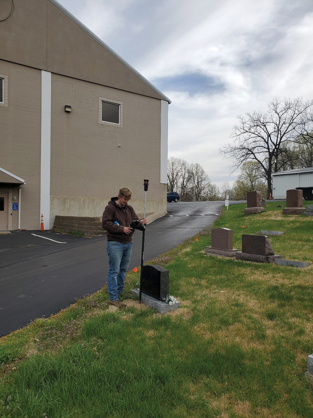
Headstone topographic data collection. Pictured: Douglas Bennett.
Data points from the topographic surveying were brought into Civil 3D, and a surface of the 2023 project site was created, using manually created breaklines to delineate tops of bank, toes of slope, edges of pavement, retaining walls, etc. Additional planimetric features such as fence lines, tree or woods lines, and parking lot striping were drawn into the file, but did not factor into the surface creation. The students also created description keys and a code list for data points collected in the field this project, as well as point groups in the drawing file, and those keys and point groups were used to populate symbols on the site plan. While this drawing was being compiled, other students in the class entered the headstone information into the Excel spreadsheet. In subsequent field days, a data point was collected at each headstone in the cemetery, with the topo point number appearing in the drawing file matching a column in the Excel table to link the two. As a final step, each photo taken of the headstones was renamed to match the data point number.
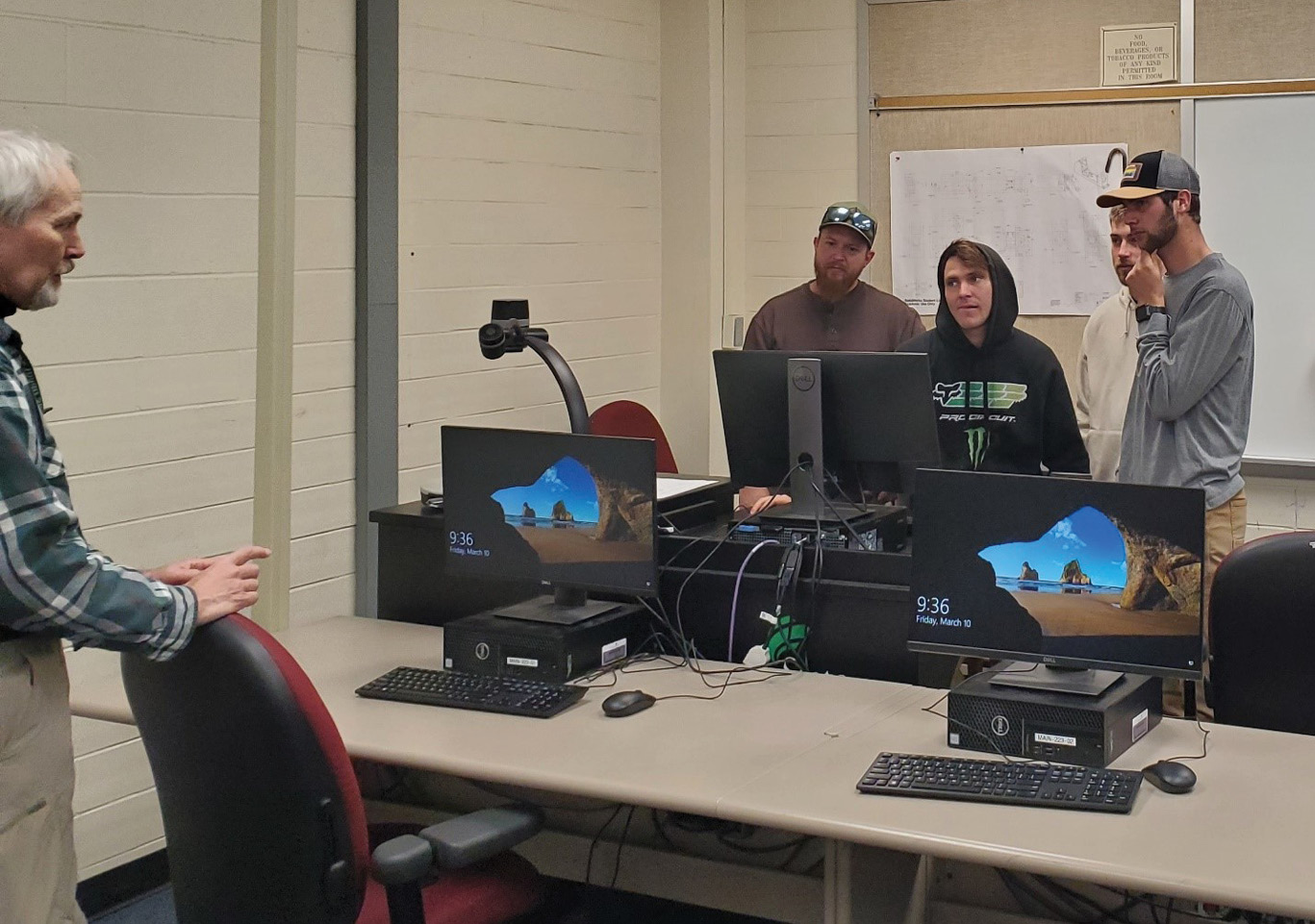
Capstone students discuss the possible methods to merge data files together to create one complete traverse loop. Pictured left to right: Professor Jim Decker, Clint Lutz, Alex Miller, Noah Bonecutter, Micah McCain.
As the project deadline drew close, students were connected through Prof. Decker to adjunct professor Lydia Thacker, PS, a retired professional land surveyor and an expert in GIS software. Familiar with the project, Thacker helped the students to create a QGIS database for all of the data and photos from the Capstone class. QGIS, free to download and use, and offering cross-platform as well as mobile capability, presented a unique opportunity for the data of the Capstone class to be displayed and given into the hands of Lisa Anglin and the Big Bone Baptist Church. As part of the final deliverable, a QGIS map, displaying interactive headstone symbols linked directly to the Excel spreadsheet and headstone photos, was compiled for transfer to the Big Bone Baptist Church computer network. Thacker will work with Anglin and others at the church in the coming weeks to further explain the program and equip the church to be able to maintain and modify the cemetery dataset, so that moving forward, all pertinent records can be backed up and maintained in-house by the church, without need for an outside consultant or expensive record-keeping subscription service.
Monument reconnaissance. Pictured left to right: Douglas Bennett, Clint Lutz, Will Zwick.
In the final weeks, as students tied up remaining field work and began writing up a report of the project and preparing for the final presentation, the Capstone class was joined by Surveying and Mapping (SAM) for a day of field exercises and demonstrations. Technicians and surveyors from SAM brought with them a GPR unit, a terrestrial scanner, and a drone system equipped for survey by photogrammetry. Each of these technologies are rapidly increasing in use in the surveying industry, and the visit from SAM afforded the Capstone students a hands-on and first-person experience with some of what these systems are capable of. SAM was not there purely for “show-and-tell,” however; data collected during the demonstration was used as a check for and, in the case of the GPR unit, complement to the data acquired through more conventional methods by the Capstone students.
Capstone students visited the Boone County Administrative Building in Burlington, KY in the early weeks of the project to perform deed research for use in creating a graphical abstract. The clerk’s office maintains all of the recorded deeds, plats, and other instruments necessary for the conveyance of land in the county. Pictured left to right: Alex Miller, Maximilian Paul, Will Zwick, Chance Moore, Noah Bonecutter, Clint Lutz.
The 2023 Capstone project concluded on May 5 with a formal presentation of the project from start to finish for members of the church, professors, and interested members of the public. Students prepared an hour-long walkthrough of the entire semester’s efforts, as well as a final plat, a page displaying the acquired topographic information, and a reference sheet displaying the headstone data points as located. Additionally, a new legal description for the boundary as determined by this year’s class was put together. The presentation, printed and digital materials, and a binder documenting all of the work will be kept as a record by the Cincinnati State land surveying program, and will be looked over by Tom Bushelman, PS, a land surveyor registered in Kentucky who helped to connect Cincinnati State with B3. Bushelman plans to set monuments and record a new plat of survey for the entire church property, based on the work done by these two Capstone classes. The 2023 Capstone students were excited and honored to take part in this unique project, and are sincerely grateful to Big Bone Baptist Church, and particularly Lisa Anglin, for this opportunity to work through a real project from beginning to end, as they prepare to graduate and continue the process toward licensure as professional surveyors.
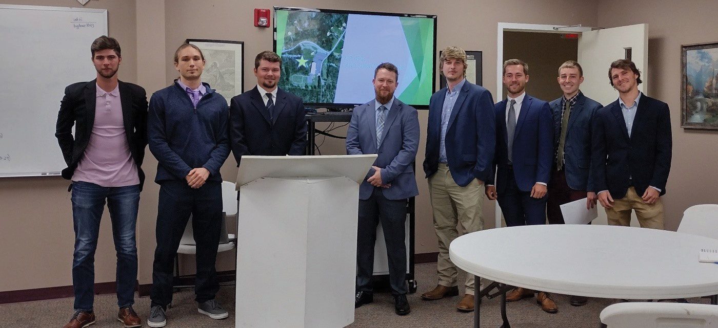
Capstone 2023 Class, final presentation. From left to right, Micah McCain, Will Zwick, Chance Moore, Clint Lutz, Douglas Bennett, Noah Bonecutter, Maximilian Paul, Alex Miller/.
This project was completed as part of the requirements of the Bachelor of Applied Science Degree in Land Surveying at Cincinnati State. The Surveying Capstone course is one of the final courses that students in the program take to show their proficiency in land surveying before graduation.
Carol Morman, EdD, PE, PS is Program Chair and a Professor in Land Surveying at Cincinnati State. She is a licensed land surveyor in Ohio and Indiana and a licensed civil engineer in Ohio, Indiana, and Kentucky.
Jim Decker, PS is a Professor in Land Surveying at Cincinnati State. Jim is a licensed land surveyor in Ohio.