Let’s talk wildfire, or more specifically, let’s talk about the effects on boundary monuments by wildfire. Even more specifically, let’s talk about heavy equipment making fire breaks before the fires start and heavy equipment scooping up the remains of devastated properties after the wildfire has gone through, and how those two activities can completely destroy critical survey monuments for a parcel, for a neighborhood, or for an entire community.
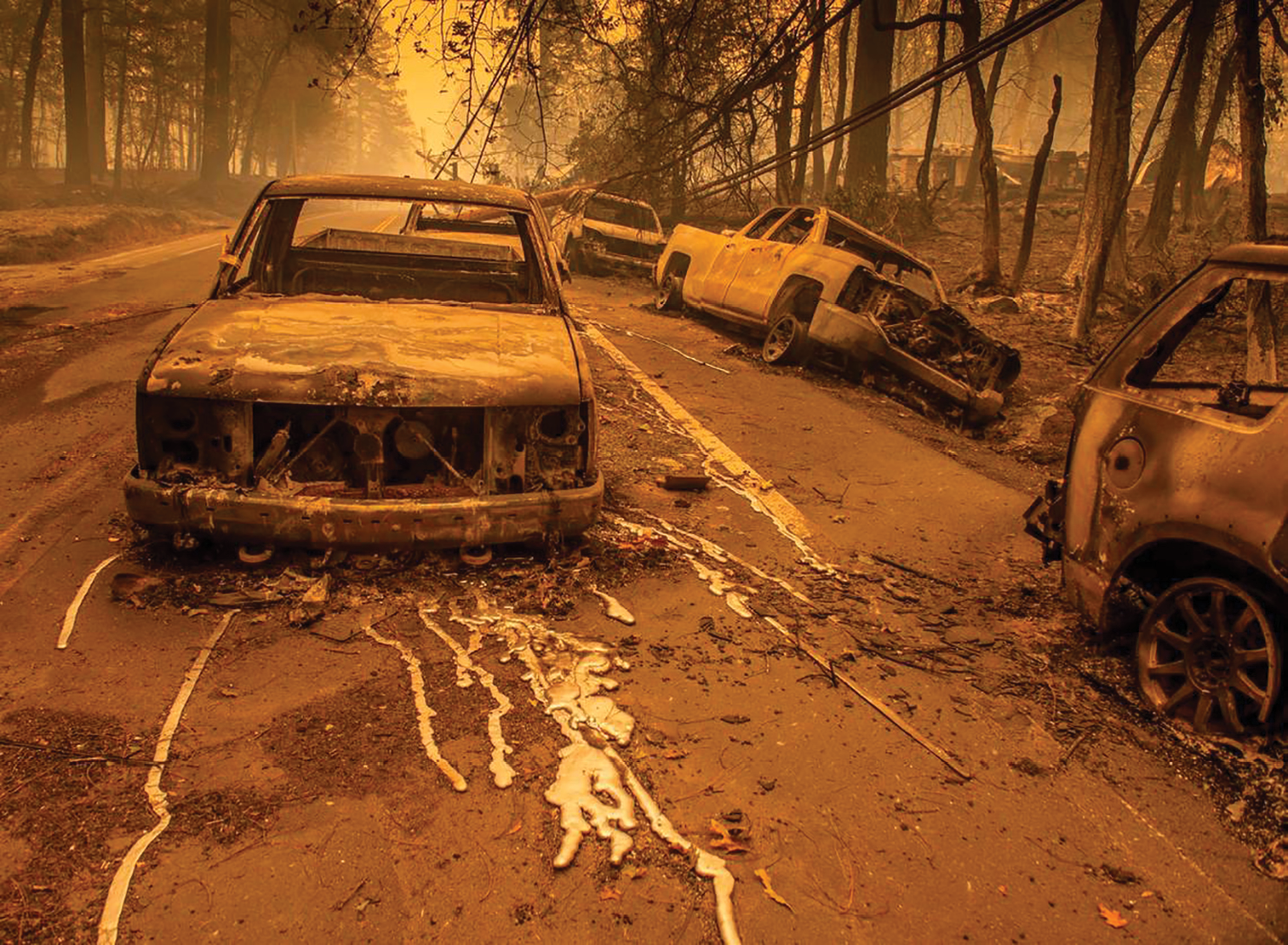
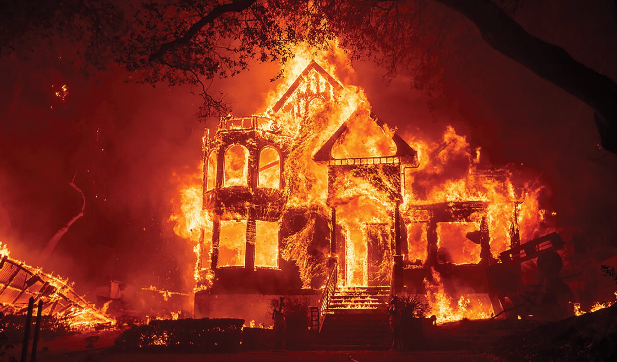
On Thursday, November 8, 2018 the Camp Fire ripped through the Town of Paradise,CA , destroying 95% of Paradise with a loss of over 18,000 structures and 85 casualties. 153,000+ acres were burned.
Why this is relevant to me: Having worked for 3 years in the Town of Paradise after the deadly Camp Fire, I can attest to the fact that the wholesale use of loaders and dozers to clean up in the aftermath are where the monuments were lost, not in the fire itself. My firm recovered some 5500 monuments prior to cleanup while working with a utility company to restore electricity to Paradise, neighborhood by neighborhood. In looking at the law in California, it appeared we were on the hook for 5,500 corner records documenting the position and character of each monument. As a matter of efficiency and of giving the most useful tool to the surveying community, we chose not to prepare corner records and instead filed a 64-sheet record of survey documenting these monuments with a control diagram, coordinates and descriptions, before they were lost during the protracted rebuilding process. Strangely, perhaps, the Butte County Surveyor was not involved in any way in these activities. While they were very grateful to receive the survey, it can easily be argued that a similar effort could and should have been done under their direction as an immediate reaction to the conflagration. But there is no plan or guidelines for this kind of situation and any county surveyor would need to think outside the box in such circumstances.
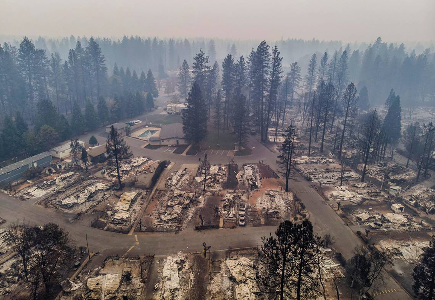
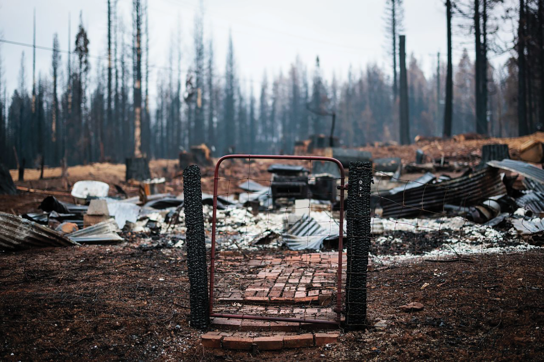
Cleanup in the aftermath of the Camp Fire involved wholesale scraping of parcels, resulting in many property corner monuments that had survived the fire being destroyed.
In 2021, in the aftermath of the North Complex Fire, Butte County did in fact release contracts for surveyors to establish and mark out the right of way lines for 40 miles of rural highways before tree felling could commence. The contracts were not directly targeting monument preservation but it would not be possible to reestablish these rights of way without recovering numerous monuments and so it was a happy by-product. In my firm’s ten-mile stretch we recovered well over a hundred section corners, quarter corners and property corners. We filed nine records of survey to document the results.
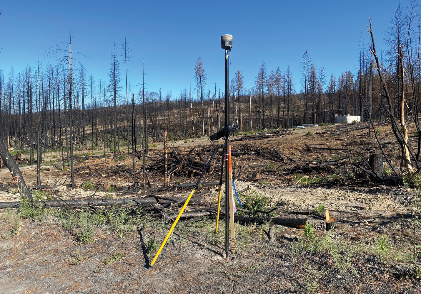
Monument recovery activities started right away, in an attempt to stay ahead of the cleanup activities.
In 2022 El Dorado County, in the aftermath of the Caldor Fire, issued a contract to our firm to go into the community of Grizzly Flats, while the embers were still hot and before tree falling and dozing began, to establish a permanent control network and recover as many monuments as we could in a two-week period. In the absence of any funding mechanism for the work, including FEMA disaster relief, the El Dorado County Surveyor spent discretionary funds out of his department’s account to get this done. And we donated some of our time and effort for the good of the community. We recovered about 450 monuments before FEMA blocked us from getting into the danger areas, and we filed an 18-sheet record of survey showing the network and the monuments. This operation should serve as a solid example of how a county can react after a catastrophe.
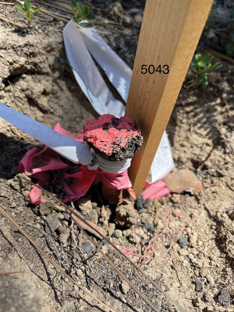
Many monuments were located and described and a Record of Survey perpetuating their position was filed.
Why this is relevant to you: Last year Oregon and Washington started generating wildfires in a way that was very reminiscent of California, and just this spring huge wildfires raged across Canada from British Columbia to Quebec. And wildfires are not the only disasters where this discussion is relevant. Hurricanes, tornadoes, catastrophic flooding, landslides, earthquakes, and volcanoes (in Hawaii, primarily) can all have dramatically deleterious effects on boundary monuments, as well. Taken altogether, there is precious little of the country where monuments are not subject to assault by natural forces.
Funding was made available to rebuild lost homes. Paradise just announced their 2,000th completed Certificate of Occupancy. There is a long way to go.
We cannot afford to think of these events as occasional, or as being limited to one region of the country, that they ‘can’t happen here.’ These days, natural disasters seem to have become a regular part of our lives, across the continent. Cities and counties will need to accept this new reality and start behaving in such a way that disaster prevention and disaster recovery become organized operations and not haphazard responses. Surveyors need to raise the awareness level of these agencies as to the critical nature of monuments with respect to land boundaries and the legal requirements to preserve or perpetuate them. And if the area you practice in does not have a legal requirement to preserve monuments, maybe your state society’s legislative committee needs to take this up, and soon.
How can we ensure there are monuments from which to rebuild?
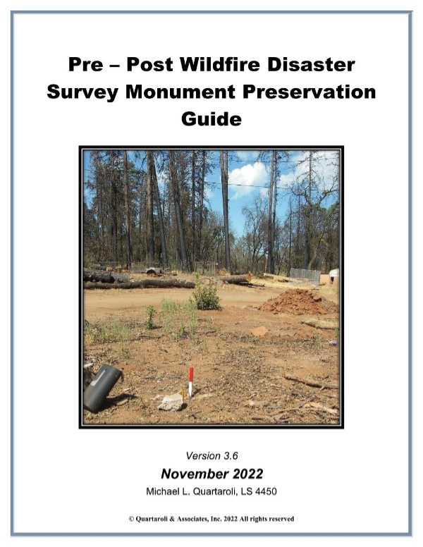
This guide, developed for California, can serve as an outline in your state.
Hereabouts, a longtime practicing California Land Surveyor from the Central Valley has taken this issue to heart. Michael Quartaroli has spent countless hours preparing and promoting a very succinct white paper on the topic of wildfire and monument preservation. To date, his has been a lone voice in the wilderness. California has strong regulations regarding monument preservation, but they were written in the context of construction and development activities and make no specific mention of the surveyors’ (or agencies,’ or contractors’) responsibility in the face of disaster prevention work, such as dozing wholesale fire breaks or buttressing slopes in danger of failure. While the law is clear enough that anyone should be able to see that conserving monuments must be an unavoidable part of any such operation, that fact may not be well known or understood in offices beyond that of the County Surveyor. As urgent as disaster prevention policy is with respect to monuments, it is even more urgent to establish a policy regarding disaster recovery. In all cases, the local agency should be prepared to dispatch surveyors in to recover monuments before clean up commences. Is there a funding mechanism for this? Probably not. But if that is true then the agencies should work on establishing one. Mike’s paper lays out responsibilities and strategies for monument preservation in fire country very well and could serve as blueprint for how to deal with this issue, whether for fires or any natural disaster, far beyond the borders of California. It can be obtained by emailing mike@quartaroli.com. I hope you will all download and review it and start a conversation about it at your local chapter!!