It’s the same story heard time and time again among surveyors. The story of how you found surveying. Other than the ones whose father or grandfather was a surveyor, it seems most people come into the profession by accident or happenstance. A friend’s dad needed a summer intern, or they saw an ad on the back of a match box in a bar promising a great adventure. That sense of adventure is what draws us in and keeps most of us here for a lifetime. My story is no different, although I am a baby compared to most. I had no idea where my adventure might take me.
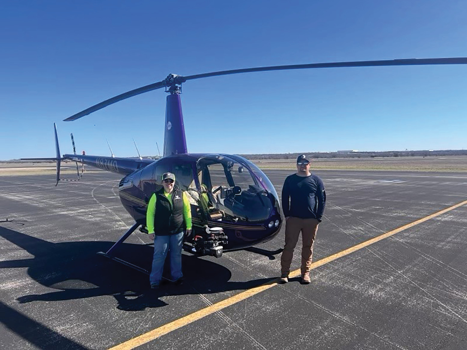
The aerial LiDAR collection team waiting for take-off.
Here I was a 20-year-old college dropout working at a smoothie shop. I was standing behind the counter, staring out into the distance, thinking to myself, “there has got to be something different for me than listening to these blades whirl all day.” Little did I know that I would still be hearing blades whirl, just a different kind.
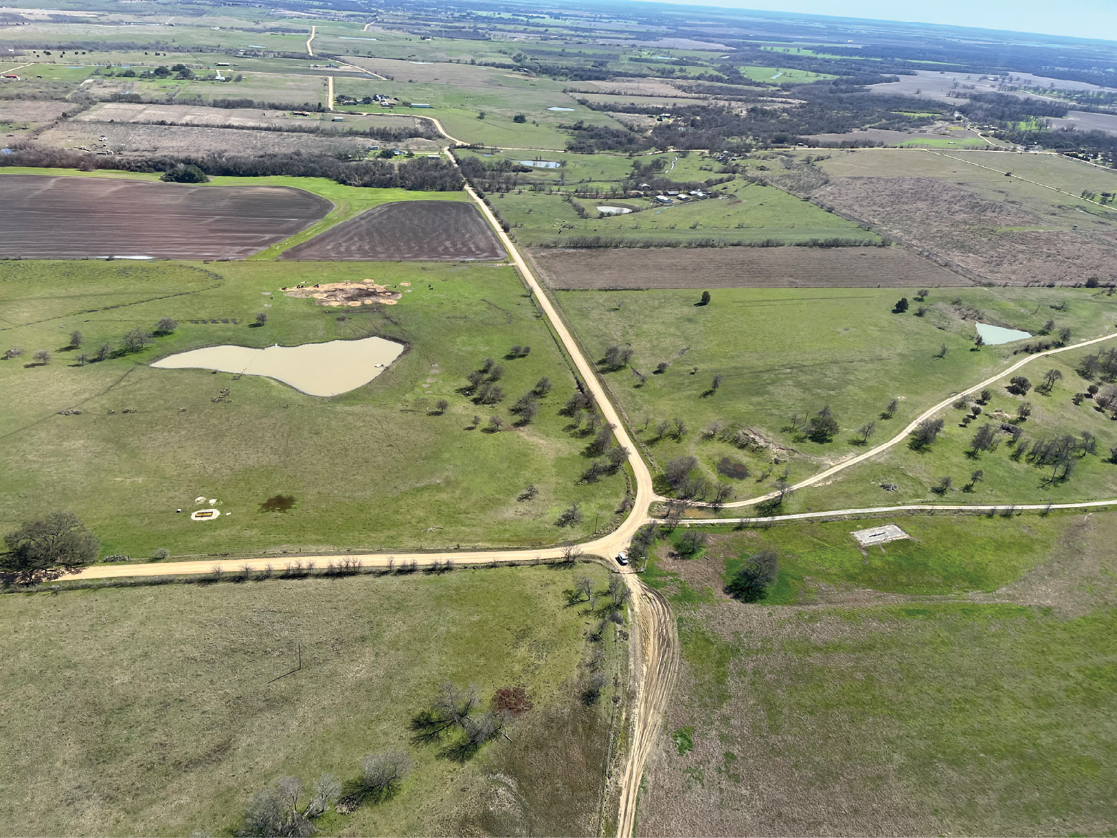
A first hand view from the helicopter of the collection area.
I left the smoothie shop that day and began to search. That’s when I found surveying. The diversity, the adventure, being outside one day and in the office the next looking at all the cool data we collected. I started working on a field crew staking subdivisions. Hot northern California summers and long days, but it was where I wanted to be. I would eventually leave the subdivisions behind and get a position in the surveying department at the City of Sacramento. Level runs, topos, right-of-way, more staking, and thanks to a couple of Licensed Land Surveyors who took me under their wings (pun intended) and really helped me along my journey, I learned to write legal descriptions and draft plats. It all was so fascinating.
After working at the City for 2.5+ years I left for a company with all the “cool” technology. Small unmanned aerial systems (sUAS) is what really got me excited. This would be the step up from the old blender blades I left behind. I tried to learn as much as I could about the sUAS, the sensors, techniques, processing, point cloud extraction, and final deliverables. I soaked up as much knowledge as I could and eventually was running the sUAS program at the company and had earned my Professional Surveyor License in California, Nevada, and Washington, again thanks to a few more Licensed folks helping me along the way, but there were still bigger blades to be had out there. That is when I left that company and started to work for David Evans and Associates, Inc., (DEA) a multidisciplined engineering and surveying company based in the Pacific Northwest. I packed up the family and headed to Oregon.
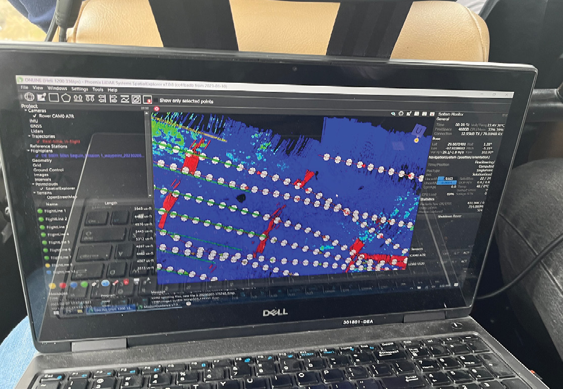
Real time view whole sitting in the helicopter of the LiDAR being collected.
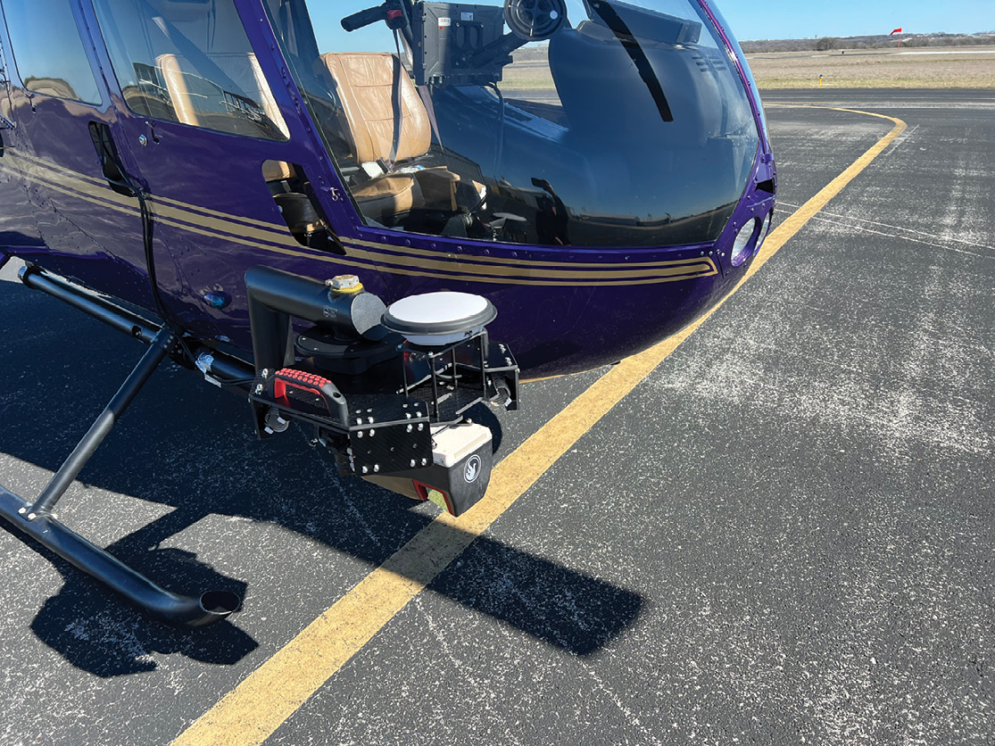
When I first started at DEA, I thought I would be working only with the sUAS system. It was quite a shock to learn that they had purchased a Riegl VUX120 with a Sony A7R camera as their sensor. Small enough to go on a drone, but powerful enough to be mounted to a manned aircraft. The VUX120 can collect up to 1.6 million points per second and the camera is 60 megapixels, making for a very data rich LiDAR point cloud and high resolution orthophoto. Thinking I was only going to continue down the path of flying sUAS, I was very surprised when I was asked if I could join my counterpart, Erin Radford from one our Idaho offices, to Texas to train for using the system mounted on a helicopter, and then fly the very first helicopter job DEA had ever done. Of course, I said yes!
The resulting processed LiDAR point cloud.
The training was provided by Phoenix LiDAR Systems, the company we purchased sensor combo through. The training was fun, exciting, and something I looked forward to. Strange to say because most other training I have had to set through usually aren’t…. Maybe it was the excitement of flying in the helicopter, a thing I had never done before… After the training it was time for the big job!
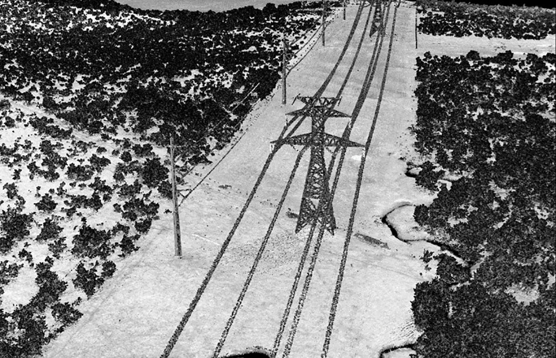
The resulting processed LiDAR point cloud.
Like every job, there were some hiccups to start off with. The mount that was supposed to show up a few days earlier to the helicopter charter company was caught up in shipping and wasn’t due to arrive until the day after the collection was supposed to happen. The weather was also hit and miss. We had a small window to find a new mount and get it on before the rain came back through. After crisscrossing the greater Austin, Texas area, we were successful. The sensor could be successfully mounted.
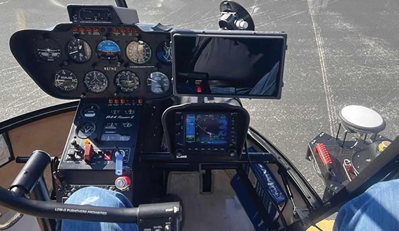
The pilot’s view of the ground and LiDAR unit.
The collection day was a glorious bright sunshiny day. The star must have aligned! We set out to collect our 6+ square mile area. Our aerial chariot was a Robinson R44 helicopter flown by Aaron Lewis of Kachemak Bay Flying Services. The advantage of the helicopter was we could cover a very large area, in a short amount of time, and get sUAS quality LiDAR point clouds and ortho-imagery. The helicopter is also very handy when it comes to overcoming the challenges of the Federal Aviation Admiration’s regulation for sUAS operations. We can fly over people, vehicles, and beyond what would be the visual line of sight. These are all very limiting factors when operating a sUAS.
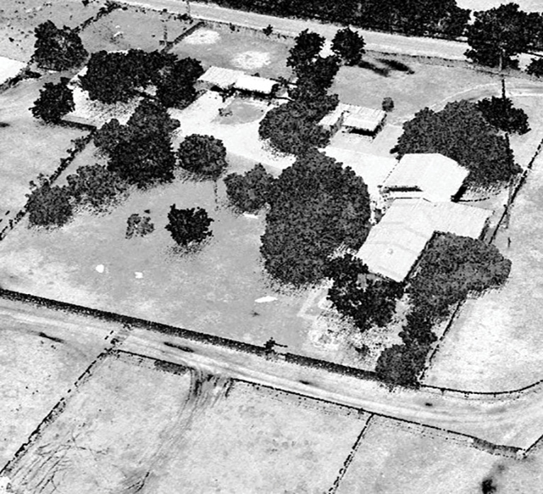
The data set we were able to collect with the system was a point cloud with 90+ points per square meter and an ortho photo with 0.20’ ground sampling distance. This data would be used to create a design level topo. It only took a few days of ground crews setting targets and 5.5 hours in the helicopter to cover an area of over six square miles.
Starting from a smoothie shop in Sacramento to flying around Texas in a helicopter, my surveying adventure has been very interesting. Blender blades to drone blades to helicopter blades… where will I end up next?
Jed Gibson is a Remote Sensing Project Manager at R.E.Y. Engineers based in Folsom, CA. He is a Licensed Land Surveyor in California, Nevada and Washington. He has been surveying since 2014 and has an extensive background in remote sensing, land surveying, and large-scale topographic mapping projects, including the Oroville Dam, the tallest dam in the United States.