In May 2021, the Land Surveying graduates at Cincinnati State Technical and Community College became the first students in school history to graduate with a 4-year Bachelor of Applied Science degree. With this graduation, a more intense Surveying Capstone course was required. Now the 2022 Land Surveying students will look to continue the trend of community service as they work towards completing their own Capstone project. In rural Boone County, Kentucky, nine students will descend upon the Big Bone Baptist Church to perform a boundary retracement and topographic survey over the semester as a culmination of the degree program.
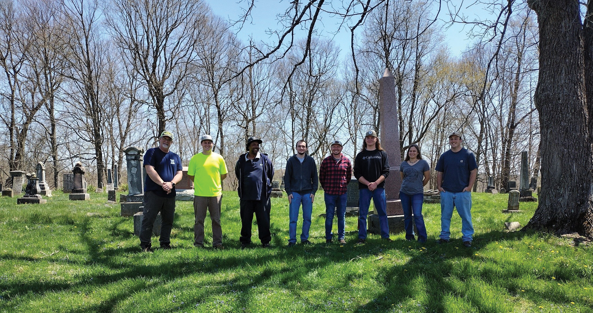
Left to right: Cincinnati State students Darrick Davidson, Macalister Keeley, Bryant Favors, Joseph Ernst, Levi Exline, Gunnar Seig, Jessica Lyttle, Shane Strotman. Not pictured: Jeff Kraus.
The project began in late January 2022. The group met with church member Lisa Anglin, the church representative leading the project and church leadership. The aim of the project was to determine the boundary of the church, the cemetery and to create a method to manage the graveyard. Over the course of the church’s lifespan, the older sections of graveyard had fallen into disrepair, and unmarked graves needed to be identified. To complete this task, the church needed to understand boundaries, locate marked and unmarked grave sites, and create a preliminary cemetery database for historical purposes. Over the course of the next few months, the students would be looking to accomplish the goals set forth by the church using the knowledge obtained during their time at Cincinnati State.
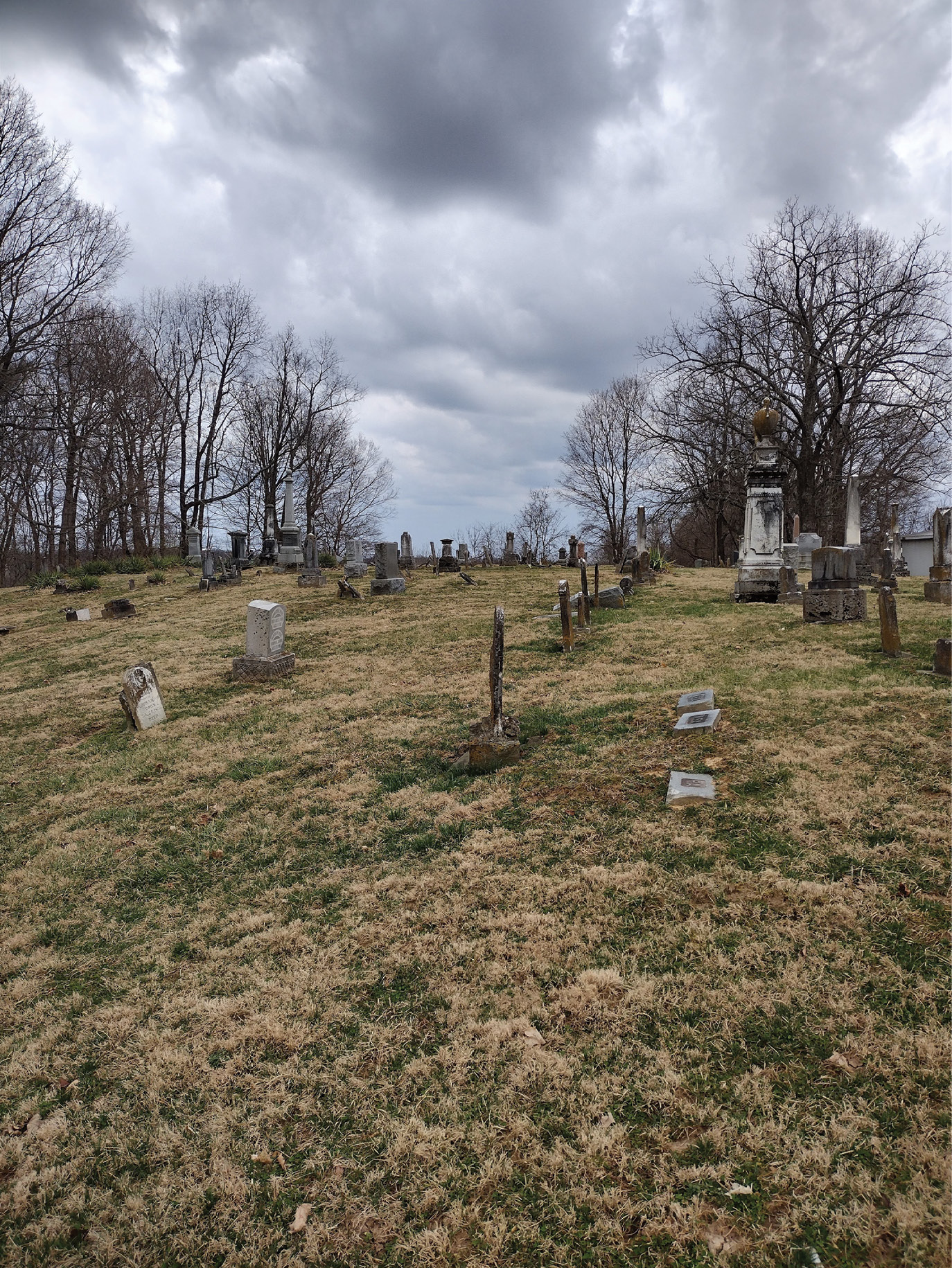
Big Bone Baptist Church Cemetery, Union, Kentucky. Site of the Cincinnati State 2022 Capstone Project.
Under the guidance of two professors, Carol Morman, Ed.D., P.E., P.S., and Jim Decker, P.S., the group started on the preliminary work. To perform the retracement and topographic survey, site reconnaissance and research was started. Deeds and prior surveys were collected at the Boone County Clerk of Courts and the data was collated into a graphical abstract. This was by far one of the difficult aspects of the project, and this is the result of how surveying was done through history. Much of the original survey work in Boone County was done through metes and bounds, unlike in many western states that follow the U.S. Public Land Survey System. Trees that may have marked a boundary decades ago may no longer be there. Older deed work doesn’t match well with newer equipment. One of the biggest hurdles in this project was finding the deed work for the entire southern section of our boundary. The property in question is a state wildlife preserve that did not match any of the deed work. The group would eventually learn that the preserve knew that they didn’t have correct legal descriptions on record, and the students would have to work around this complication.
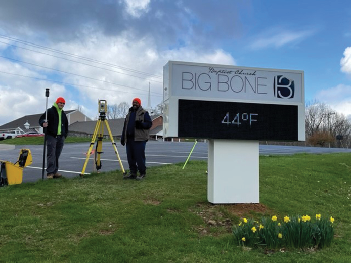
Students Macalister Keeley and Bryant Favors working on the topographic survey.
With the preliminaries out of the way, the group began the site work. Using located NGS and state benchmarks, elevations were established on the site using three-wire leveling and GPS Control methods. The biggest difficulty was coordinating the level-loop itself. Each workday, the class has a set time to complete work for the day. To run the level loop over the 18+ Acres property, the group divided into three parts and ran a section of the loop to complete it in the allotted time. Coordinating the three data sets the next workday created inconsistencies that made it necessary to re-run the level loop. Now with the objective in mind and a better plan of attack made, the group was able to get the misclosure of the loop within acceptable limits.
Big Bone Baptist Church Cemetery.
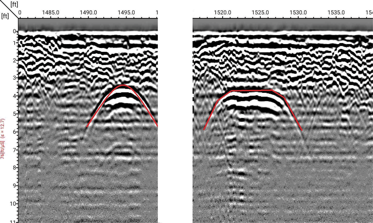
A random closed traverse was used for control points and a loop was established over the site using S3 Trimble total stations. Using the now complete abstract and monumentation already found, one group uncovered extra monumentation and created a boundary retracement, another used the elevation carried to the site to build a topographic survey of the oldest sections of the graveyard, while the final group began taking pictures for the graveyard database. The final phases of the project were accomplished with assistance from ESP Associates, Inc., and Drone Solutions. They provided a drone flyover and GPR for the site. The anomalies they detected with the GPR we would assume to be unmarked graves sites and we would locate these points for our final topographic survey.
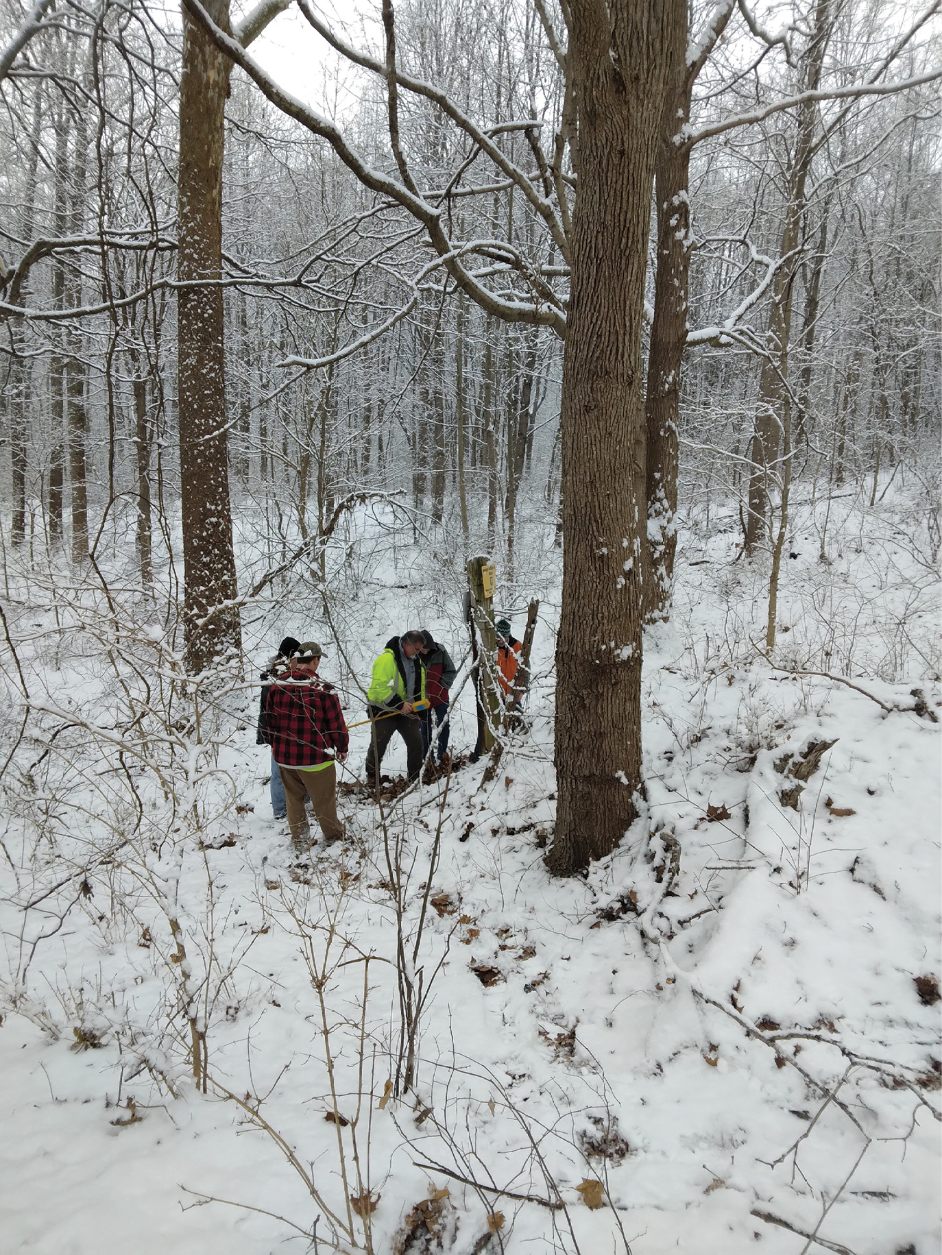
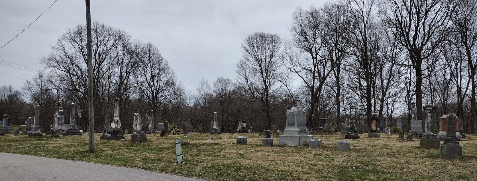
Snow made it difficult to find existing monumentation around the site.
Once we gathered all the necessary data for the scope of the project, the group prepared deliverables for the church. The group established a template for the title block and drafted the boundary and topographic survey plats. A legal description was also written. The deliverables were reviewed by Kentucky PLS, Tom Buschelman and Professors Carol Morman, PE, PS, and Jim Decker, PS to make sure they met Kentucky requirements for the listed survey work. While the final deliverables wouldn’t be submitted to Boone County, we made sure that the documents met the standards required. Finally, the group presented the work to Big Bone Baptist church and completed the project.
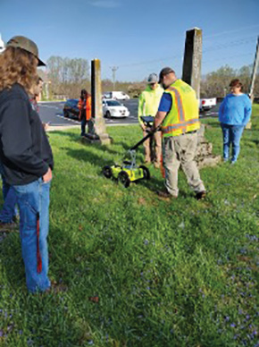
Jeff Tallent, ESP Associates, Inc. came up from North Carolina to demonstrate and explain Ground Penetrating Radar to the students.
The experience of performing the procedures and techniques we learned in the classroom has been a valuable asset for the development of Land Surveying Graduates. Boundary retracement and topographic location survey are foundational skills for any surveyor in the field. The process of client meetings and technical writing helped to develop interpersonal skills which are just as important to the technical side of the field. The Capstone has been a unique experience to truly understand how land surveying works.
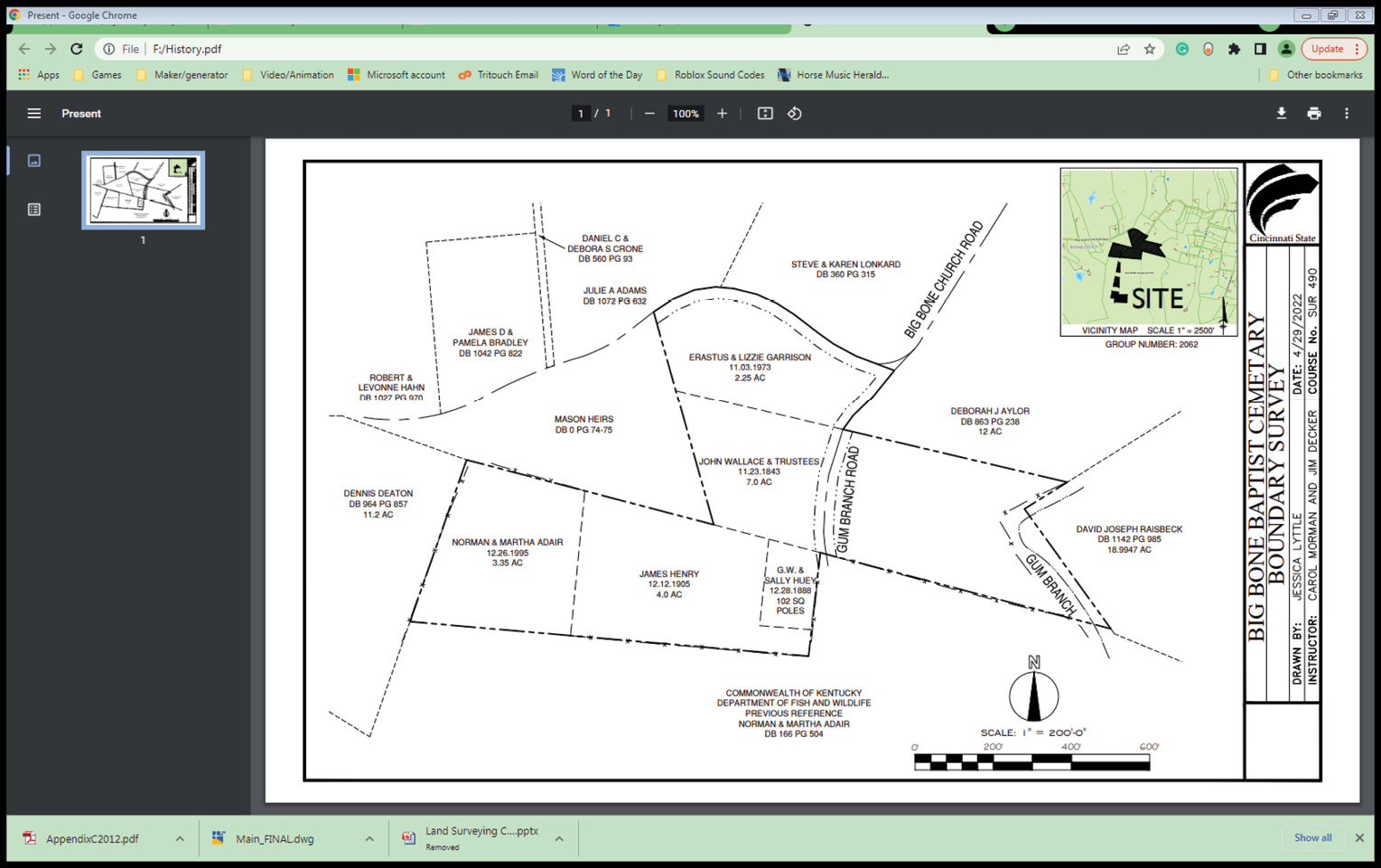
A map showing the individual parcels making up the church property.
This project was completed as part of the requirements of the Bachelor of Applied Science Degree in Land Surveying at Cincinnati State. The Surveying Capstone course is one of the final courses that students in the program take to show their proficiency in land surveying before graduation. For more information about the program, please visit cincinnatistate.edu/academics/degree-certificate/land-surveying-ls.
This year’s capstone students included Darrick Davidson, Joseph Ernest, Levi Exline, Bryant Favors, Macalister Keeley, Jeff Kraus, Jessica Lyttle, Gunnar Seig, and Shane Strotman.
Carol Morman, EdD, PE, PS is Program Chair and a Professor in Land Surveying at Cincinnati State. She is a licensed land surveyor in Ohio and Indiana and a licensed civil engineer in Ohio, Indiana, and Kentucky.
Jim Decker, PS is a Professor in Land Surveying at Cincinnati State. Jim is a licensed land surveyor in Ohio.