Not so long ago (relatively speaking), the stone’s lonely solitude within its submerged world was broken. For the first time in 75 years, a person (not a fish) paid a visit. To the stone, this visit amounted to a resurrection of sorts. The following story tells about a stone that had been removed from its native and natural horizontal state of repose. It was competently chiseled and carved to its present shape. It was then moved once more and placed vertically in a perfectly pleasant location. This is the story of Stone Number 46.
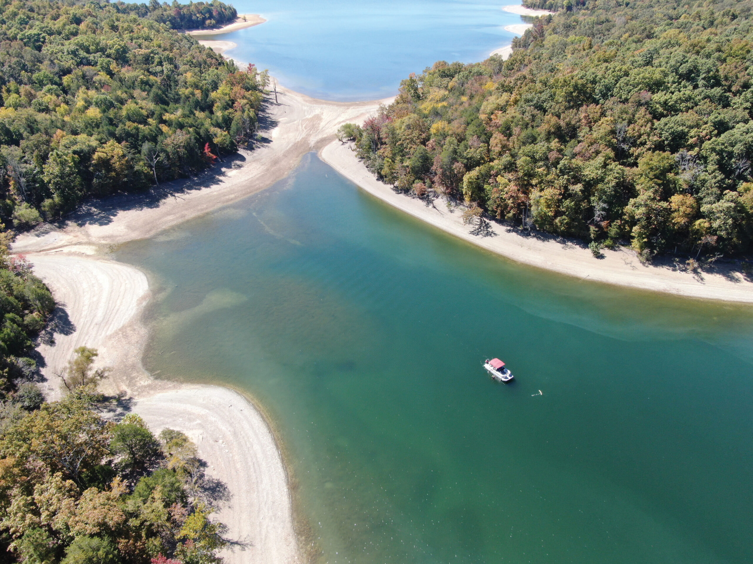
The dive boat is captured at anchor by Whittenburg’s drone. Cook (or Coop) Pass. Dale Hollow Lake, Kentucky/Tennessee
What we know about the stone’s history began in 1665. King Charles II of England decreed that the boundary between the Colony of Virginia and the Province of Carolina was “To run from the north end of Carotuck (sic) Inlet, due west to Wyanoke Creek, lying within or about the Degree of Thirty-six and thirty minutes of Northern Latitude and from thence West in a Direct Line, as far as the South Sea.” Imagine: a description with conflicting elements! To further complicate matters, this Wyanoke Creek was most probably in two different, distinct locations.
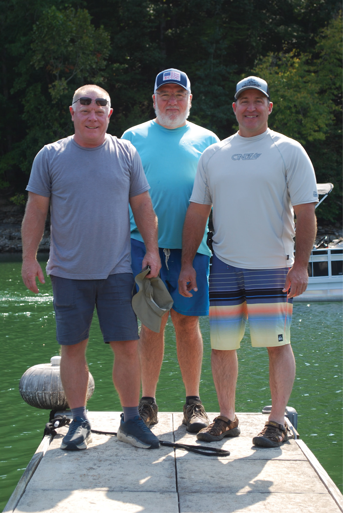
(L to R) Fisherman Mitch Robertson, Diver Tony Waters and Land Surveyor Charles Whittenburg. Now add the title “historian” to each.
People had already been settling in both territories. Complaints arose about where one lived and most importantly who gets the tax dollars. A field survey was in order.
Representatives, soldiers, Commissioners and surveyors from both interests met at Carotuck (sic) in March 1728 to begin what is known as the Byrd survey. While still at the inlet, Byrd writes “… but as comfortable as this lodging was, the Surveyors turned out at 2 in the morning to try the Variation by a meridian taken from the North Star, and found it to be somewhat less than three degrees West.” Byrd further states “At noon, having a perfect Observation, we found the Latitude of Coratuck (sic) Inlet to be 36 Degrees and 31 Minutes”. By the latter part of October (delayed for five months because of an overabundance of rattlesnakes), the survey had advanced 241 miles to Pedee (or Peters) Creek, this a tributary of the Dan River.
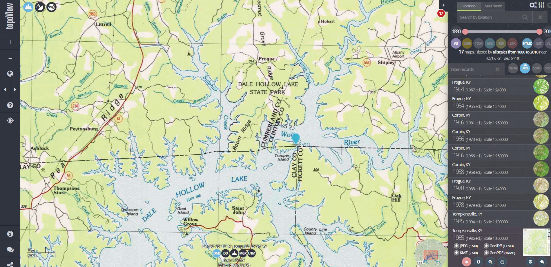
On modern mapping, Stone 46 is located at the intersection of the KY /TN state line and the line common to Clay County and Pickett County, Tennessee, now in Dale Hollow Lake.
20 years later, Peter Jefferson (Thomas’ father) and Joshua Frye extended the line another 88 miles to Steep Rock Creek. The final point on their survey is just east of the current Virginia/North Carolina corner.
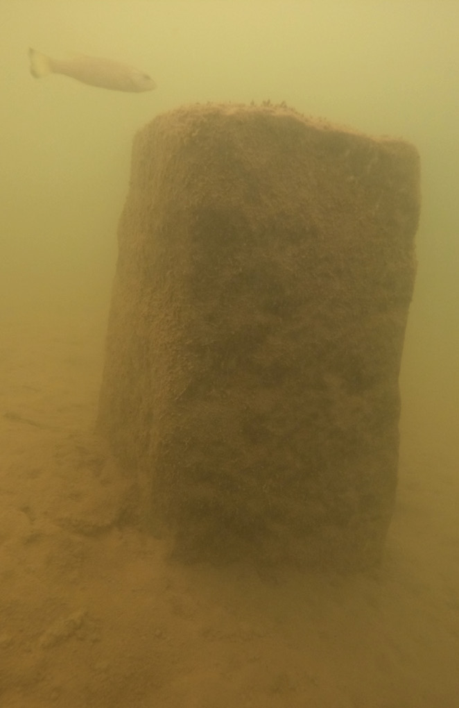
27 feet below the surface, Stone 46 is still in remarkable condition. Until recently, only fish knew this fact.
Word was spreading like a wild fire about the beauty and fertility of the western lands. Settlement was increasing. In October, 1778, the House of Delegates assembled in Williamsburg, Virginia passed an act that said in part “Whereas the inhabitants of this commonwealth and of the State of North Carolina, have settled themselves farther westward in the boundary between the said two states has hitherto been extended and it became expedient … that the same should be now farther extended and marked.”
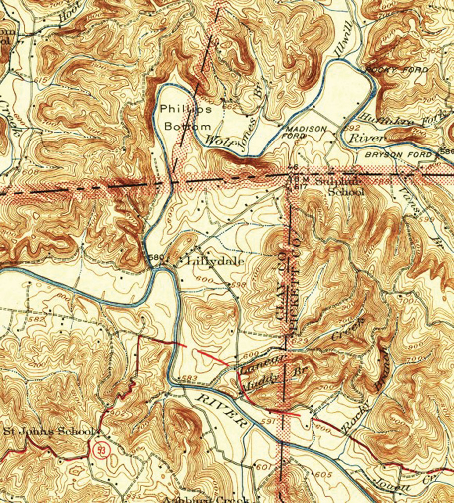
1929 quad sheet, reprinted in 1942 shows the ground under Dale Hollow Lake just one year prior to its flooding. Stone 46 is clearly shown just south of Madison Ford.
In the fall of 1779, Commissioners and surveyors from both states began the survey to extend the line. Following a disagreement in November about the location of the line, the Carolina group exited the field. Dr. Thomas Walker and Daniel Smith, both of Virginia, would complete the line westwardly to the Tennessee River. About this same time “due to the country being very mountainous and barren (just west of Cumberland Gap), not yielding a sufficient quantity of cane for the pack horses, it was judged best to leave off running the line here and go farther to the westward into a better country, whereby reason of many people being about to settle it might be of importance to run the line speedily.” The survey would recommence at the west bank if the eastern crossing of the Cumberland River (they later cross the river once again a few hundred miles to the west, in the vicinity of the Tennessee River). Walkers line now had a gap of about 100 un-surveyed miles.
It is within this gap that the Stone’s final resting spot lies.
Under the Articles of Confederation, Kentucky became a state (from the lands of Virginia) in July 1788. Under the U.S. Constitution, Tennessee became a state (from the lands of North Carolina) in June, 1796. In its first fourteen years of statehood, Tennessee grew from 85,000 people to over 250,000. Kentucky was growing at the same bullet velocity rate.

The map in yellow is a Corps of Engineers’ 1942 land acquisition map. Pauline Coop’s 7.4 acre farm and Stone 46 are clearly labeled. The blue in the background is mapping of the current Dale Hollow Lake. Whittenburg was able to establish a latitude and a longitude for the stone.
Not too long after Walker and Smith had put away their sextants and compasses, it became a very well known and recognized “secret” that the Walker line in its entirety was located north of the 36°30’ latitude (as much as 12 miles). The irony of ironies is that by hiring surveyors to resolve a problem, many times new problems arise that never existed before the survey. The primary problems now were jurisdiction and again, taxation. Meriweather Lewis, on his way back home from his western journeys, confirmed the mis-location of the line at the Cumberland Gap.
The secret was no longer once the line between the Tennessee River and the Mississippi River was completed. Alexander and Munsell ran a near perfect line generally along the 36°30’ line of latitude in 1819. Where this line struck the Tennessee River, Walker’s line was a good day’s walk north, if one is healthy.
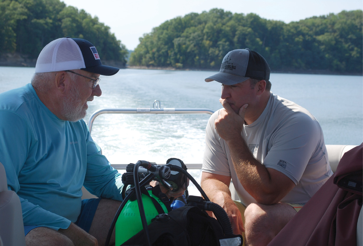
A quick diving lesson. Waters explains diving to Whittenburg on the ride out to the site. After some time in the water, Charles was diving pretty well. The bright green tank was reserved for him.
By 1820, Kentuckians demanded some sort of resolution. There were 2500 square miles of Kentucky “located” in Tennessee. Tennessee took the offense and sent two delegates to Frankfort, Kentucky. Following a short period of time, the negotiations resulted in the 1820 Kentucky-Tennessee Boundary Compact. The basic terms were that the line would remain in the current (1820) position, each state would participate in any future surveys of the line, any actual remaining properties that had not be sold between the Walker line and the 36°30’ latitude would become Kentucky’s possession with full right to dispose of in any manner Kentucky saw fit and that any disputes that may arise would be resolved by a two citizens outside of Kentucky and Tennessee acting as umpires. The description of the Walker Line included within the body of the compact gingerly dances all around the 100 mile gap.
In 1821, William Steel (Kentucky) and Absalom Looney (Tennessee) surveyed and marked the line overlooked by Walker and Smith in 1779, the 100 mile gap. With a few small exceptions the entire line was now complete and monumented.
Prior to the adoption of the rectangular system of survey, especially in the Colonial states, the vast majority of the property corners were described as being a tree with certain marks. Invariably, the first thing the new property owners do is timber his land, selling all the trees including the corner trees. Also, clearing was necessary to make the ground usable for agricultural purposes. In 1858, the two states agreed to “permanently” mark the entire line (321 miles) from the Mississippi River to the eastern boundary of Kentucky using stones.
Beginning in 1859, A.P. Cox (Kentucky) and Ben Peeples (Tennessee) marked the entire line as instructed: place stone posts five miles apart, each side of the stone to be plainly marked and they must be located in a clearing to be unmistakable as to their purpose.
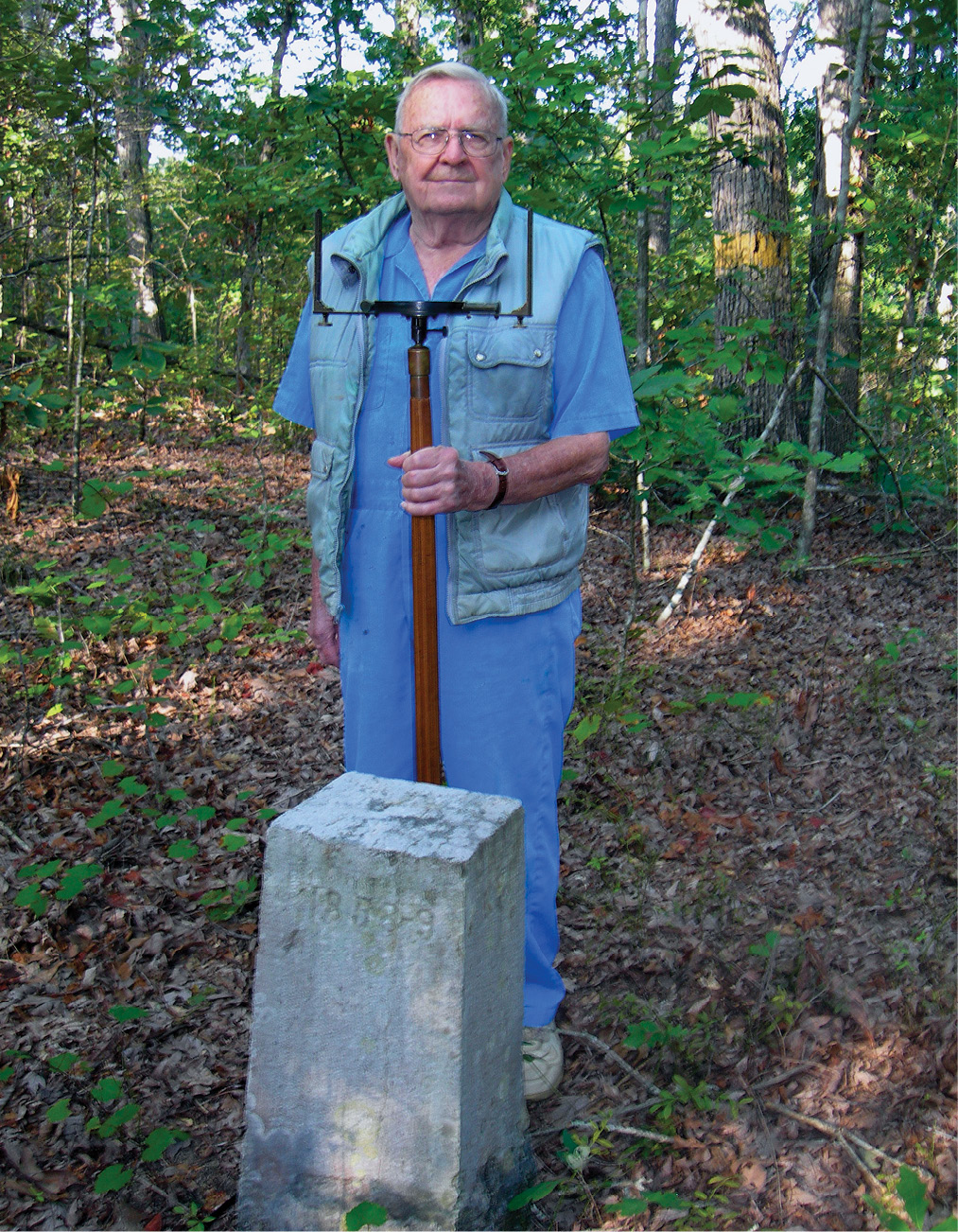
Preparing and placing the stones cost a sum “much larger than anticipated”. From Stone 1, at the Mississippi River to Stone 16, located between the Tennessee River and the Cumberland River, the stones are beautifully carved and lettered. (A photograph of Stone 16 can be seen in the Winter, 2009 edition of American Surveyor). The final report says that a certain number of stones had been prepared in Bowling-Green, Kentucky for $345. 21. These first 16 stones are believed to be from this procurement. The surveyors then hired a mason to prepare the stones. This mason “could or would do nothing; whether from want or capacity-one or both … However as he preferred to be unable to do anything to forward our work, we dismissed him.” After trying in Nashville and other places, they contracted Mr. S.W. Stanley of Warren County, Kentucky. Mr. Stanley agreed to both carve and place the remainder of the stones at $20/each.
A short distance from Cumberland Gap “Mr Stanley and two hands worked six days preparing a stone, then abandoned it; tried another one for days and abandoned it; another one day and leave it; another five days and abandon it; he then went across the mountain twelve miles and has gotten one which will take him six days to prepare and put it in the ground.”
It was Mr. Stanley that fashioned our old rock into a stone beautiful enough to be placed on the line between two of the earliest states in our nation. Number 46.
Mr. Stanley placed the stone in a clearing by Sulphur Creek, a tributary flowing north into the Wolf River. The road going northeast from Lillydale was in sight. If the atmosphere was just right the sounds of children playing at the Sulphur School could be heard.
Occasionally, the stone would be visited by surveyors bearing chains or thin steel tapes, the compass would eventually be replaced with a transit. The stone became the northern terminus of the line between Clay County and Picket County, Tennessee.
Starting around 1941, it seems the number of visits from surveyors increased dramatically. One of the adjoining owners, Pauline Coop sold her 7.4 acres to the Federal Government. Talk of Dale Hollow or simply the lake became common.
Sometime in 1943, the little creek began getting wider. It got so wide that it began to cover the road. In a matter of weeks, the stone, firmly planted in the earth, was completely inundated by the rising waters.
About 75 years later, a fellow with a strange mask on, exuding large volumes of bubbles was shining a light all over the stone. That fellow was Tony Waters, a diver with the Putnam County Rescue Squad Dive Team. He was swimming under 27 feet of water at the request of Charles Whittenburg, a Land Surveyor registered in both Kentucky and Tennessee.
In 1990, the Kentucky Association of Professional Surveyors (KAPS) and the Tennessee Association of Professional Surveyors (TAPS) together formed the Joint State Line Committee in order to recover and document the stones on the Cox and Peeples survey. They recovered 45 out of the 73 set. The results of their work were published in “Four Steps West” a compilation of historical research on the entire line prepared by James W. Sames III.
In 2005, now utilizing much more advanced technology, the joint committee was reformed to update the information on the line. Whittenburg was contacted in 2009 and he volunteered to work on the five stones in Picket County.
Stones 45 and 47 had been recorded in the 1990 work. Charles, with his parents acting as his crew, located both and prepared a thorough documentation. Charles noticed a strange occurrence. The distance between the two stones was 13 miles, not 10. He then calculated a search location 5 miles west of Stone 47. Curiously, it put him on the dividing line between Clay and Picket Counties. It then occurred to him that land acquisition maps for Dale Hollow Lake should be available through the Corps of Engineers. 84 years after being placed, the Corps maps clearly showed Stone 46 at the county/state line.
Charles then did a digital overlay using the Corps maps and his GPS locations. Then overlaying modern mapping, he discovered that Stone 46 was indeed in Dale Hollow Lake at Cook Pass (remember Pauline Coop?). Using the digital information, Charles then established a latitude and a longitude for the most probable location of the stone.
He then got in touch with his friend, Mitch Robertson, an avid Dale Hollow fisherman. Mitch would “recon” the site on his next fishing trip, using his fish finder. Fish finders are now using technology quite similar to lidar. Mitch navigated to the geodetic coordinates and in a matter of minutes, an anomaly appeared on the screen. In fact, there were two within feet of each other. Mitch definitely had found something of interest.
To positively confirm the find, the services of a diver were now in order. Tony Waters came highly recommended. Tony had always had a desire to use his diving skills to find some part of history. Within a matter of weeks for arrangements and preparation, Tony caught the first glimpse of Stone 46, the first glimpse by a person in 75 years. In Tony’s words “I actually came upon this big stump and thought ‘well, the scan saw the stump and thought it was the stone’, So I swam over to the stump and four feet on the other side, I saw the marker.” They surmised that the large stump had once been a witness tree. When it was cleaned, no marks were visible on the stone.
In September and October, 2022, the crew returned with the mission being to secure sharp and clean pictures of a stone in 27 feet of water with a silt bottom that is stirred simply by looking at it. On the September trip, Tony taught Charles how to dive the first half of the day. Tony assured the group that Charles got the bright green oxygen tank. That will make it easier to find the body.
In the final writing of this report, it can be said of this crew that there is a unique sort of excitement finding history. Stone 17 has never been recovered. If it still exists, it is at the bottom of the Cumberland River within the Lake Barkley Reservoir. Perhaps a crew can be assembled to follow the example of surveyor Charles Whittenburg, fisherman and pontoon boat captain Mitch Robertson and diver Tony Waters to recover another lost piece of history.
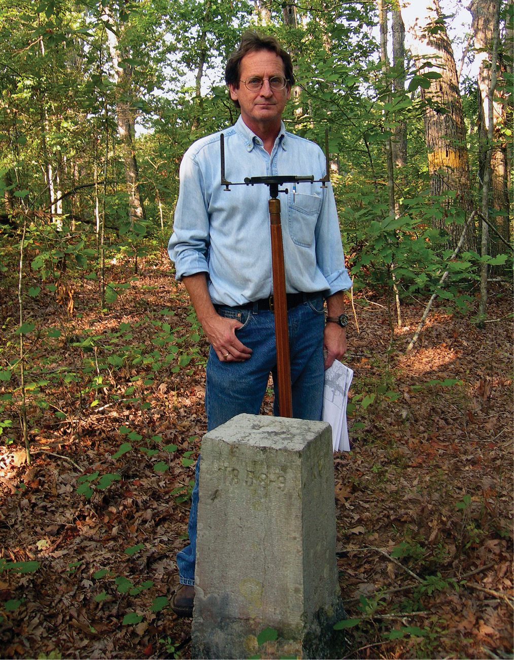
Originally appearing in the Winter, 2009 edition of American Surveyor, the author and his father (now deceased) spent a beautiful day walking to Stone 16, within Land Between the Lakes, part of the National Park Service. This stone is in great shape. Stone 17 is located in the Cumberland River or USACE Lake Barkley. Next history project: find Stone 17.
References
Four Steps West; James W. Sames III; 1992; KAPS and TAPS
History of the Dividing Line; William Byrd; c. 1730; reprints available online
Tennessee’s Coming of Age; Chapter Four; Tennessee State Library and Archives; Education Outreach Program
Article; Historical Monument Found Under the Lake; Picket County Press; November 8, 2018
Article: Deep History; Harald-Citizen; December 16, 2018