Establishing benchmarks, perhaps one of the most valuable, yet understated, services a surveyor performs, is a practice dating back to the 19th century. Its very name has worked its way into the vernacular as something by which other things are measured. In spite of all that, when a surveying firm works to establish a benchmark—even a series of them—it is typically seen through a lens of “all in a day’s work.” However, establishing an elevation bench run over a span of 17.1 miles of Orlando city streets, as Southeastern Surveying & Mapping Corp. (SSMC) did for Orange County, Florida, doesn’t just belie the mundane nature of the process—it borders on setting a benchmark for benchmarks.
SSMC is Golden
In the Florida surveying landscape, there are surveying companies and then there is SSMC. Founded a half-century ago, the company serves the needs of clients in roughly 80% of Florida as well as southern Alabama and Georgia. With more than 250 employees—of which more than 150 are surveyors—the company has established itself through a broad range of both general and specialized services, according to Edwin Muñoz, SSMC’s project manager.
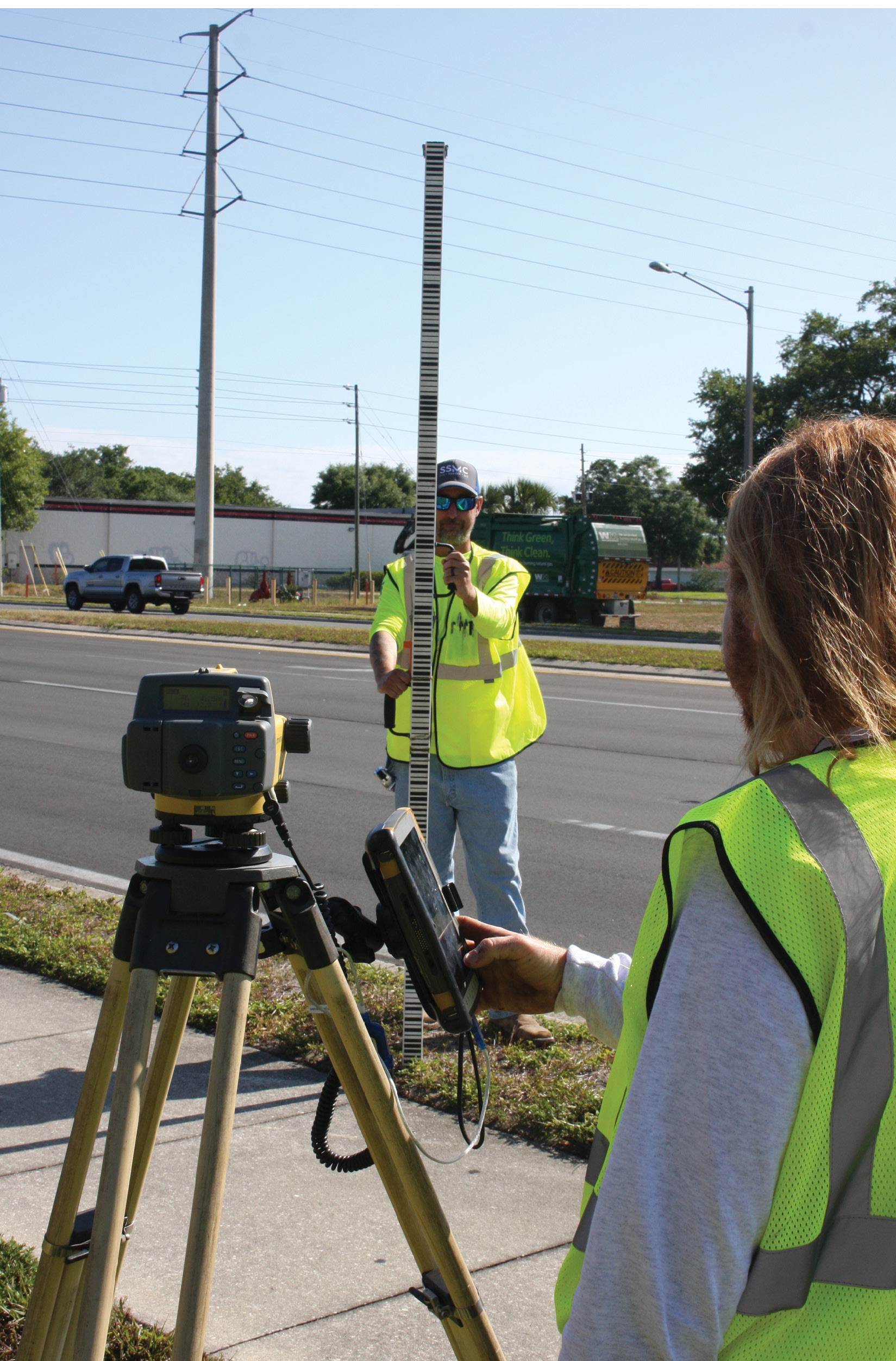
Field Crew Chief Chris Hollenbeck (left) mans the level rod while instrument man Eddie Harwell (right) collects a reading on the Topcon DL-502 digital level.
“We are one of the largest surveying and mapping firms in Florida and we provide basically every level of survey through three separate divisions in our company,” he said. “We offer a general survey aspect of our work, which can cover everything from Florida DOT projects to boundary/ALTA type work to design projects for right of way widening. We also do Subsurface Utility Engineering (SUE) work which focuses on underground projects, and then round it all out with a dedicated GIS division.”
Muñoz added that, because their various project managers bring so many specialties to the table, the company cannot be seen as really having a niche specialty.
“We are all well-versed in the gamut of survey areas,” he said. “But everyone does have their favorite areas. We even have a construction section in the organization that focuses on theme parks—specifically laying out for roller coasters—both here and internationally. There’s not much we can’t do.”
Gonna Leave a Mark
With a population of nearly 1.5 million and an economy largely driven by Orlando’s many theme parks, Orange County’s growth is steady and impressive. To ensure that developers, engineers, etc., have the tools they need to effectively maintain that growth, the county has been continually expanding its inventory of available control-ready benchmarks. And SSMC has played a huge part in that expansion.
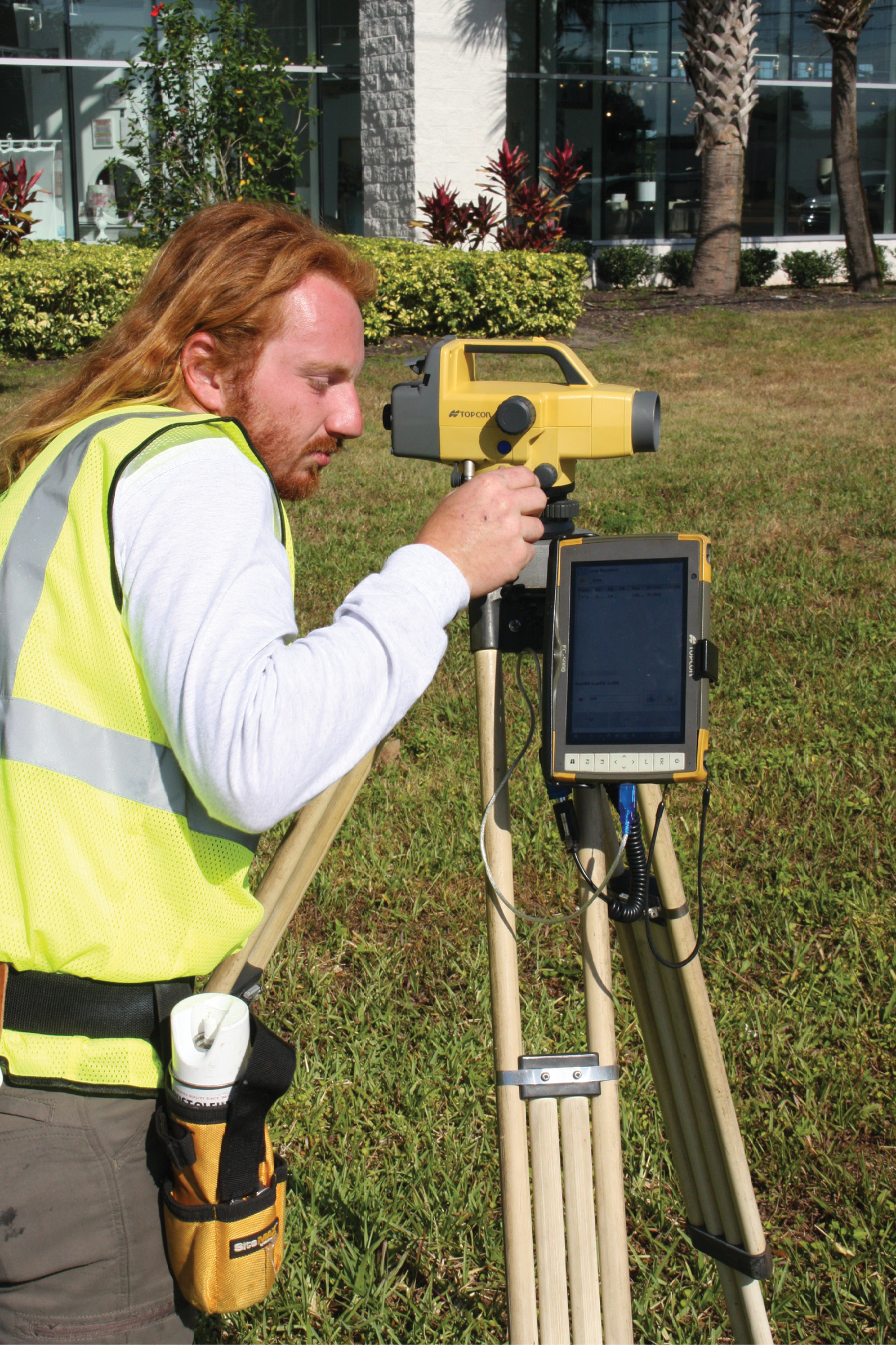
Southeastern Surveying’s Eddie Harwell lines up the Topcon DL-502 for a reading. The level, used here to sight a previously published benchmark, is key in starting the bench run process.
“This company has had a solid relationship with Orange County dating back to the ‘90s,” said Muñoz. “Because of that, and the list of strengths we bring, we’ve been able to work on a variety of projects for them; the 17.1-mile benchmark run is a good example of that. It utilizes all of our disciplines, starting with our SUE group who use ground-penetrating radar equipment to probe the area and ensure there are no underground utilities.”
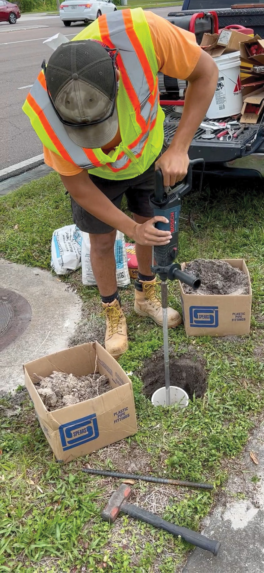
The process actually begins with SSMC selecting a basic location for each of the 29 monuments—they generally want them to be about ½ mile apart from each other—then working hand in hand with the county to determine a preferred route for the run. With that in place, the survey firm will identify locations in which the two different types of benchmarks can be set.
Determining where the benchmarks were going to be placed was actually one of the main challenges of the Orlando project, said Muñoz, since each marker must be placed in a position that is “invisible” to the general public, but easily locatable for those who need to use them.
“The ‘B’ or rod-type monuments that get driven to refusal are mostly tucked near the edge of the right of way limits,” said Muñoz. “This is a spot the public would generally not notice, but that a surveyor or engineer can find and dig up easily. The ‘C’ disks are usually set in an existing drainage inlet; people walk by them all the time, not knowing what they are for. On a project like this, we tend to alternate between each type of monument to be installed.”
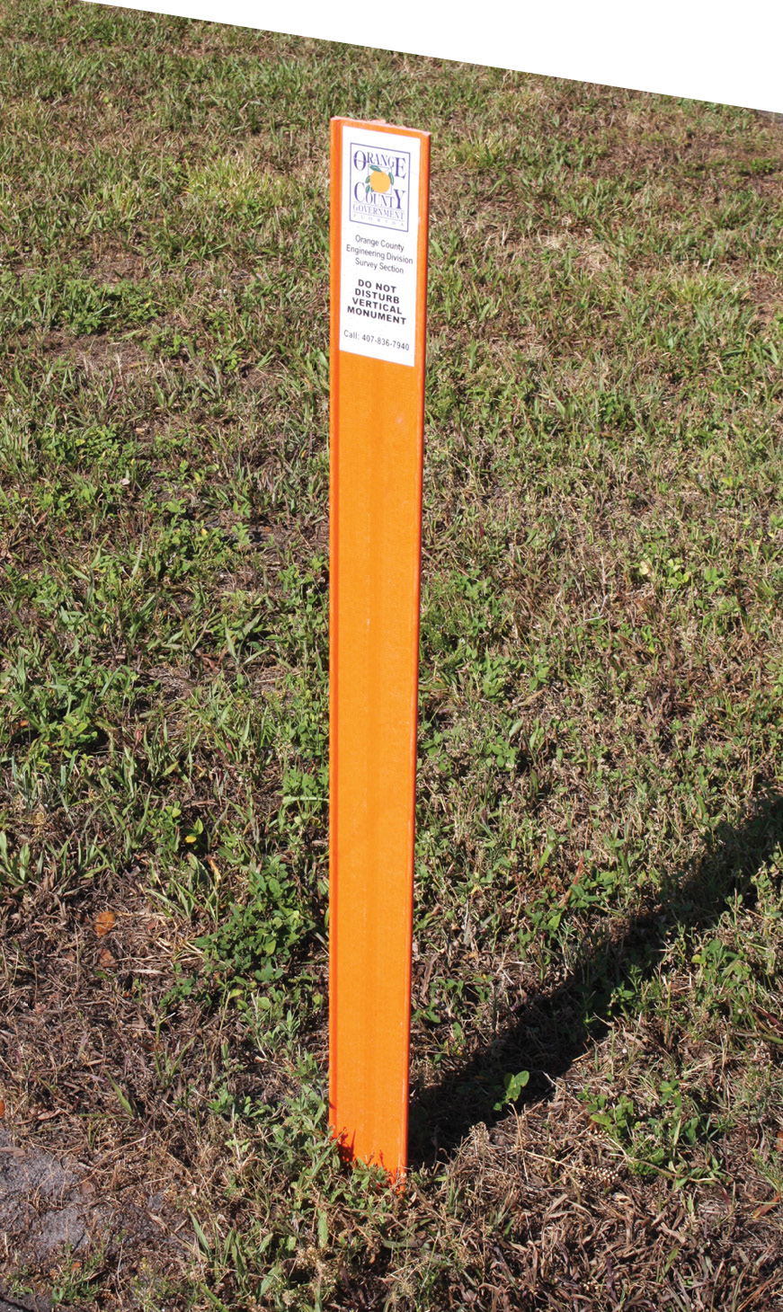
Upon completion of the installation, orange posts mark the spot for the “B” Vertical Control Monuments. Southeastern alternated between the two types of monuments along the 17+ mile route.
With a site selected, SSMC will put lath stakes in the ground and reach out to Orange County to verify that they approve of the location as well. If, for some reason, the county asks the firm to move it for one reason or another, SSMC will come back out, re-clear another area that the county selected, set the stakes, and have them recheck it. With sites finalized, markers are installed and subsequently verified for location and elevation.
Go the Distance
To deal with the imposing stretch of urban terrain, which they had to cover—roughly ٢/٣ of a marathon race—as well as to maintain tight constraints, SSMC drew upon the strengths of both GNSS and digital technology. Using a Topcon HiPer VR receiver easily addressed the horizontal demands of the job.
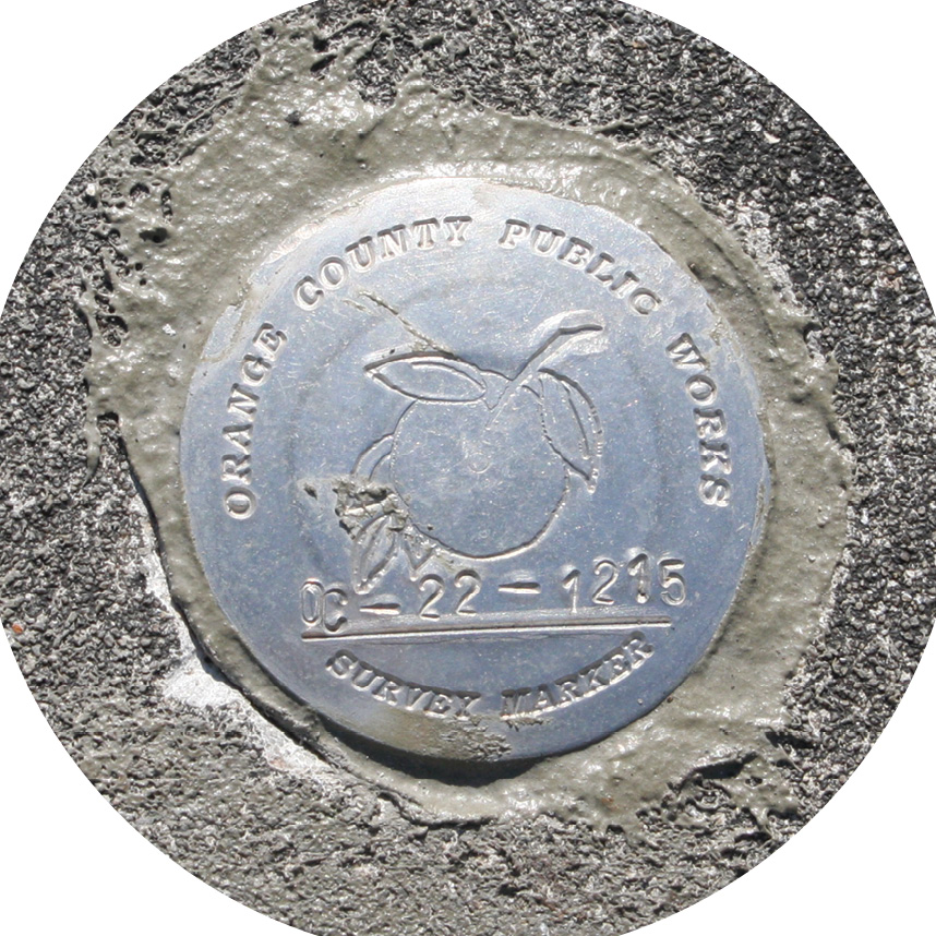
A freshly installed “C” Vertical Control Monument is shown here. To ensure ease of access, these monuments are generally set in the concrete surrounding drainage structures.
“The HiPer VR allowed us to quickly and accurately set northing and easting coordinates for every benchmark we set,” said Muñoz. “These highly accurate coordinates are added to our finished datasheet and will be a lifesaver for any person seeking out these benchmarks. For the vertical element of the process, we turned to our Topcon DL-502 digital level, which really helps us collect quality data more efficiently, more accurately and with less chance of human error.”
He added that, when they first started conducting elevation bench runs for Orange County, several outdated procedures dealing with location and installation were still in place. “Over the past five years, however, working together with the county, we were able to streamline many of those processes,” said Muñoz. “Having a better overall approach, coupled with superior equipment, has made a huge difference.”
Field Crew Chief Andrew Whittaker driving a segment of rod during a “B” monument installation. Southeastern used a Topcon HiPer V GNSS receiver to record accurate Northing and Easting coordinates in order to simplify future location efforts.
Muñoz and SSMC recognize that equipment is only as good as the support backing it. In that regard, SSMC has benefited from a solid, long-term relationship with Lengemann Corp, their Altoona, Florida-based Topcon dealer.
“Lengemann has been outstanding for us,” he said. “There are times when I will unexpectedly need to field an additional crew, leaving us short on gear. I know I can simply text Steve Terry or Mike Woodley, their sales reps, saying I need a base and rover for the week. Not only will they answer promptly—itself, somewhat rare these days—but they will have the instruments to us quickly as well. You can’t put a price on that.”
Data in Hand
At the close of the project, the main deliverable SSMC will provide to Orange County will be a datasheet, essentially a graphical snapshot of the benchmark, its name, number, the horizontal and vertical values for it and a description of how to find it. According to Muñoz, the ultimate goal is that, from that single sheet, anyone will be able to quickly and easily find the benchmark and its elevation.
“Along with that, we provide spreadsheet data, pictures of all the monuments for the Orange County archives, as well as a GIS-based map with each location that the county uses on their website.
“Any time construction or development takes place, survey is needed and the most important aspect of any survey is establishing control—both horizontal and vertical,” he added. “Having this vertical network all across Orange County and making it accessible to all surveyors, construction teams, engineers, etc., allows them to get those coordinates and that benchmark and get to work.”
Closing Time
The accuracies to which Muñoz referred earlier are impressive, indeed. Muñoz and his team ended up closing the benchmark run at 0.05’ well within their allowable error of 0.145’.
By way of an explanation, a link bench run like the one SSMC conducted, uses a starting benchmark and a different, ending benchmark—both with published vertical elevations. When the ending benchmark is reached, the published elevation is compared to the elevation obtained from leveling and the difference is noted. That final vertical observation is called “closing.”
“The great people we have involved in this project, coupled with the technology we have available, make those accuracies possible. Our team members already recognize that this is pretty good work. At the end of the day, however, to know you are doing something good for the