Klau Geomatics is releasing the Brumby LiDAR for the airborne geophysical survey market.
The system:
● captures an accurate, dense pointcloud of the terrain below the survey platform and sensors,
● highly accurate in determining position and orientation of the sensors,
● provides AGL altimetry data to supplement navigation systems, and
● is designed to be aircraft, helicopter, towed bird or EM array mounted
The Company Directors at Klau Geomatics bring a unique synergy of experience in airborne geophysics operations and geospatial technology development. With this understanding of ‘both worlds’, they have built a system that opens opportunities to collect better data, with higher precision, and produce more detailed intelligence from those data.
Brumby LiDAR offers a highly competitively priced system, designed and built in Australia.
Using some new technologies from leading geospatial companies, the integrated system produces an accurate, dense pointcloud swath. Point density is higher than previously achieved in airborne LiDAR, with very high absolute accuracy.
And this is achieved at typical airborne geophysical flight heights and speeds.
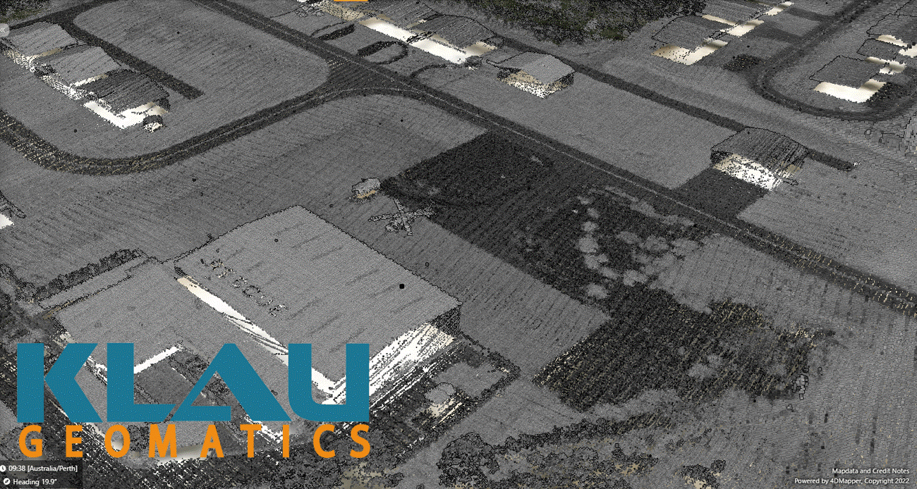
Compilation of 16 scans, from 4 directions, at heights from 100m to 200m AGL showing high precision over multiple captures.

Single scan from 100m AGL at 135 kn (70 m/s) ground speed.
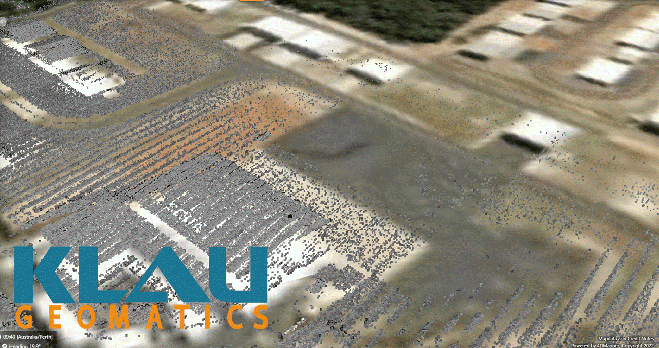
Single scan from 165m AGL at 135 kn (70 m/s) ground speed.
The Positioning System uses the latest technology from NovAtel (Canada), including an integrated SPAN INS and Terrastar-C Pro ‘RTK from the Sky’. This provides centimeter-level absolute accuracy, in real-time in most parts of the world.
Not only is this accuracy applied to the LiDAR scan, but other sensors on the aircraft can also benefit, with a high-accuracy position and orientation stream (lat, long, height, roll, pitch, yaw) fed to the devices or logged for later use.
Knowing the exact position and orientation of your sensors (eg. magnetic gradient systems, EM systems, etc) and their relationship to the terrain below lifts the quality of geophysics production to a new level. This is the value proposition of the system. With your existing aircraft and sensors, you can increase the quality, accuracy and fidelity of the products you produce for your customers.
Need another reason to consider the Brumby? We pull the center of the beam to produce AGL altimetry to supplement the navigation system on the aircraft, to help improve the pilot experience and add system redundancy (an additional AGL altimeter) to keep the capture in the desired terrain clearance.
The Brumby LiDAR system, fully integrated with NovAtel SPAN and Terrastar, is a contained unit, IP67 rated, ready to install into your aircraft. Klau Geomatics will help with the configuration, antennae installation, and any aviation-related requirements. We can work with you on custom integrations to your other sensors, DAS and FMS to ensure an outcome that improves your data product quality and value.
Please contact Brett Johnson at Klau Geomatics on +61 400 154 109 or email brett@geomatics.com.au
