In the ever-evolving world of construction, the need for surveyors to stay ahead of the technology curve is critical. New techniques for building, refurbishing, and enhancing the safety of America’s critical infrastructure calls for the use of new technologies. On most projects, a single form of measurement technology is deployed, but with new projects calling for more intricate tracking and modeling, a combination of methods of collecting data becomes a must. When Syblon Reid Construction needed to deploy a new type of coffer dam system for the Fordyce Dam Seepage Mitigation Project in the rugged terrain of the Sierra Nevada mountains in California, they called R.E.Y. Engineers, Inc. (R.E.Y.) to meet the challenge. R.E.Y. is a leader in the survey industry in developing and employing cutting edge technology. Having previously worked on complex projects with Syblon Reid, they knew they could rely on R.E.Y. to find the right solution for their unique problem.
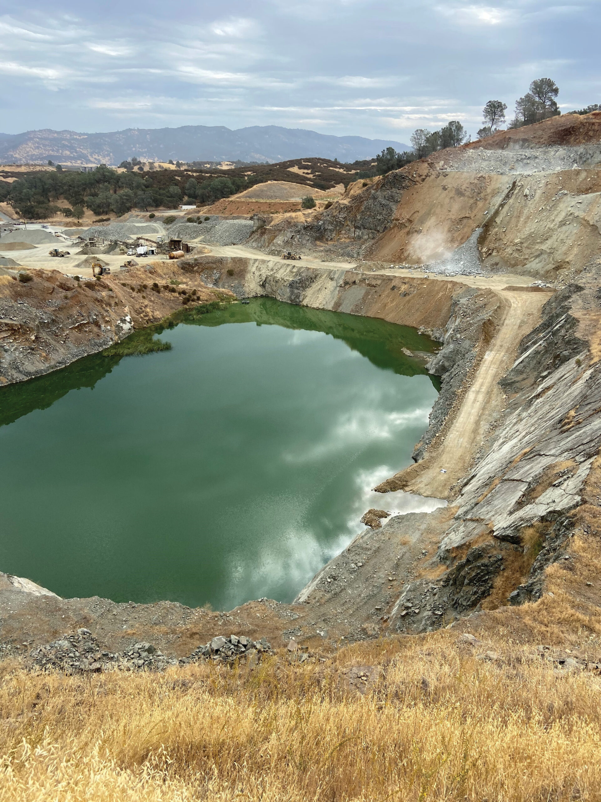
The task at hand was to assist Syblon in identifying a way to quickly assemble a new coffer dam system. Having little to no hands-on experience with the new system, they needed a way to develop best practices and techniques. This was not something they wanted to take on as “on the job” learning. They turned their attention to a quarry some 86 miles away from the site. This would become their “practice pit.” They planned to use the similar uneven and steep terrain to evaluate and prove the system before utilizing it on the actual jobsite. How could they build an accurate model of not only the terrain below the water surface, but up the steep hillsides and surrounding topography above the waterline? The solution that R.E.Y. employed was multibeam SONAR and Unmanned Aerial Vehicle (UAV) LiDAR together. The SONAR captured everything below the water level, and the UAV LiDAR gathered all the data above. Both datasets came together seamlessly and precisely to create a digital terrain model (DTM) of the entire quarry site.
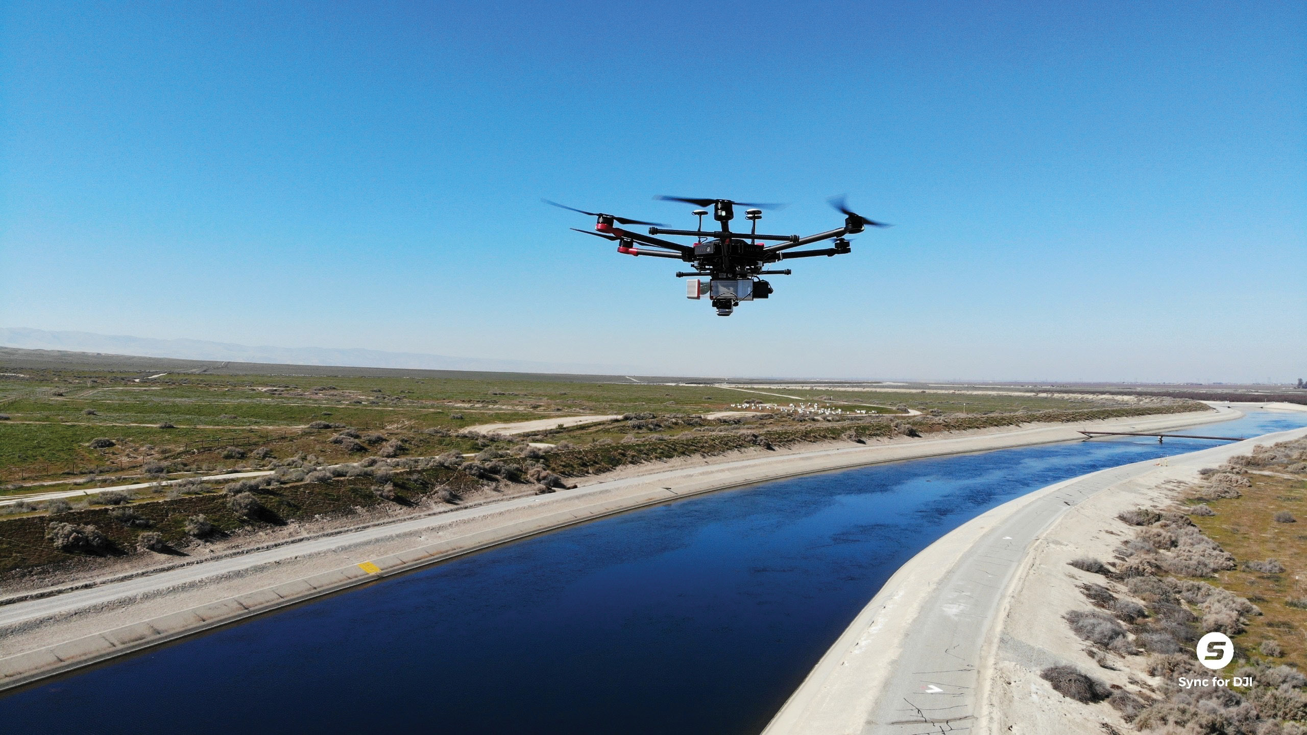
The R.E.Y. Matrice 600 with the LiDAR and photo payload overflying a portion of the California Aqueduct.
Syblon used this data to create their best practices for the construction of the new coffer dam system. Having the data of the underwater and surrounding terrain readily available allowed them to identify potential issues and develop solutions to employ when assembling the new coffer dam system.
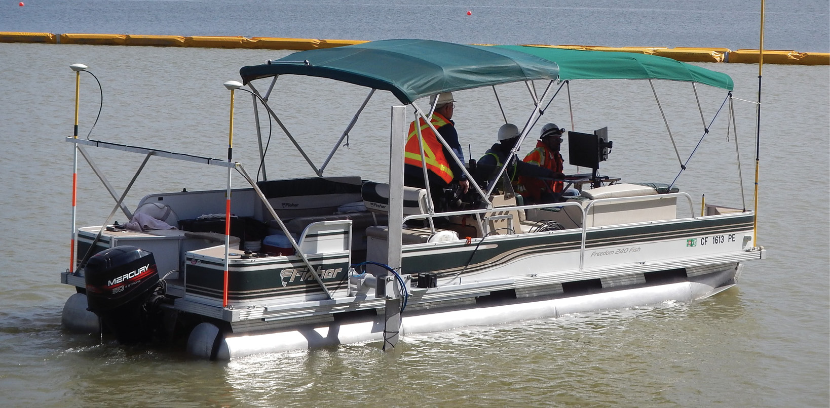
R.E.Y.’s multibeam SONAR watercraft collecting underwater data.
The data was collected on two different days using the same GPS base point and control to geo-reference both datasets to the same datum. After collection in the field, the data was processed and a seamless point cloud extending from below the water surface to the highest cliffside was created. Using UAV LiDAR, the uneven edges and sheer rock faces were easily collected, where traditional photogrammetry would have been able to map what could only be seen from straight above. Additionally, the terrain was covered in medium to thick vegetation, making LiDAR a sensible choice to identify the actual ground throughout these areas. When compared with fixed wing LiDAR (manned flight), such a small area makes for a quicker deployment and higher fidelity datasets from the UAV which can fly lower and slower over the subject area. From these combined datasets a single digital model could be created, and the part of the coffer dam system needing modification could be identified in the office. A plan could then be created prior to deployment, thus saving time and energy of the crews installing the new coffer dam system.
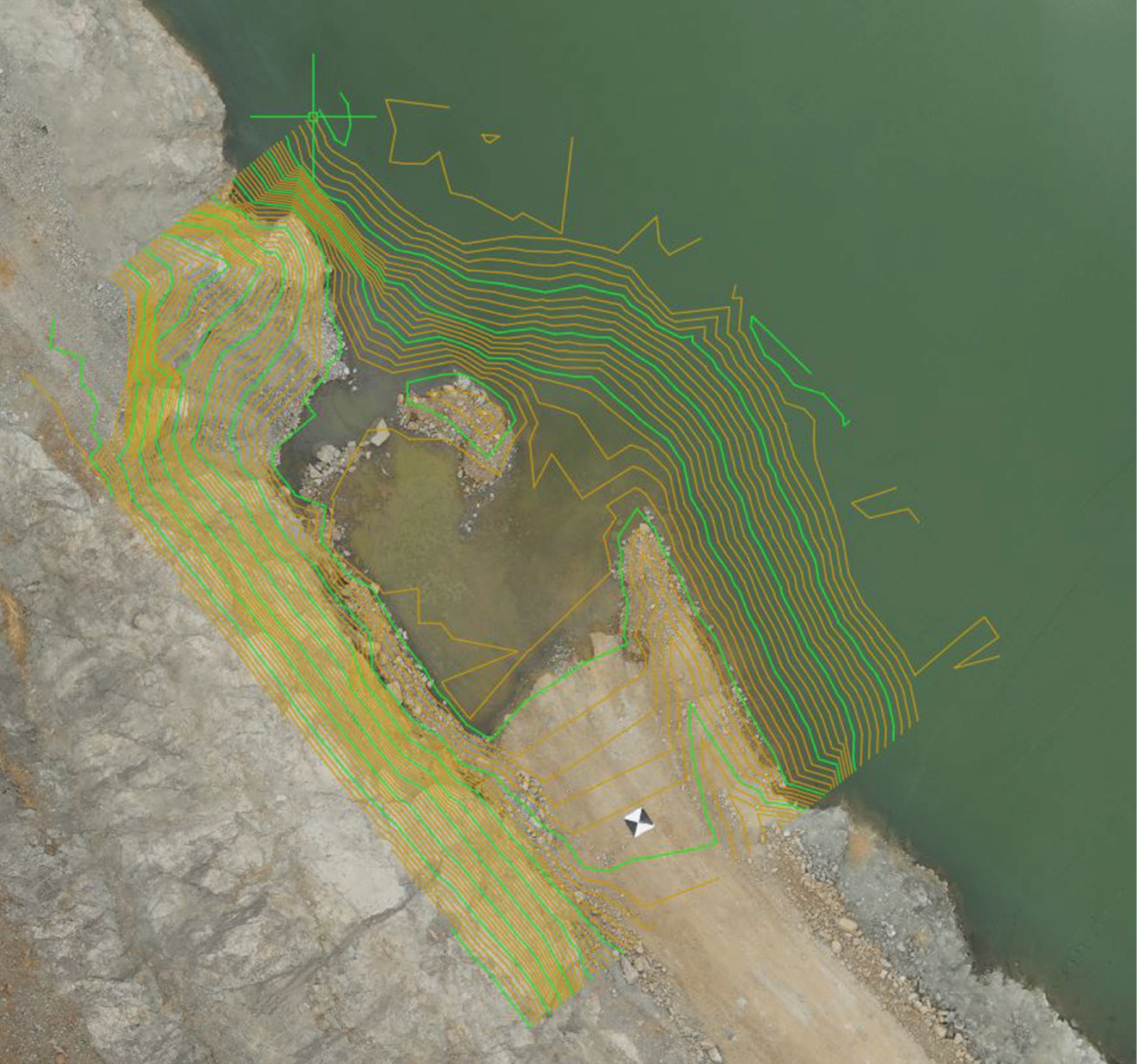
Another view of the DTM surface both above and below the water overlaid on the ortho-mosaic photo.
Along with the point cloud created from both systems, the UAV LiDAR system has a nadir mounted camera that simultaneously captures still photography. These photos are then stitched together and draped over the surface model to create a digital colorized orthophoto. The high-resolution photo can be used in the background of most design software as an updated aerial image. This greatly benefits the technicians in the office by giving them a snapshot of the site as the data was collected. It gives clarity to the lay of the land and helps identify an unknown object in the LiDAR. This imagery can also as be used by other disciplines as a way to inspect the site and identify potential issues.
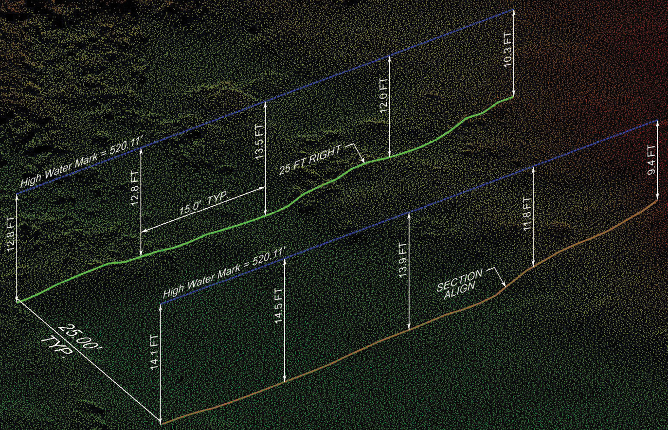
Detailed cross-section created from the under water SONAR data.
The combined dataset could also be used to create a base surface for future volume calculation of material moved either above or below the water surface at any point in the process. A second collection could be performed and the resultant digital terrain model (DTM) surface can be compared to the original. R.E.Y. surveyors have found the accuracy of these above water level surfaces are typically +/- 0.10’ in most cases, and +/-.25’ for the surface below the water. This is a great advantage for companies needing to accurately track the volume of materials moved on a periodic basis.
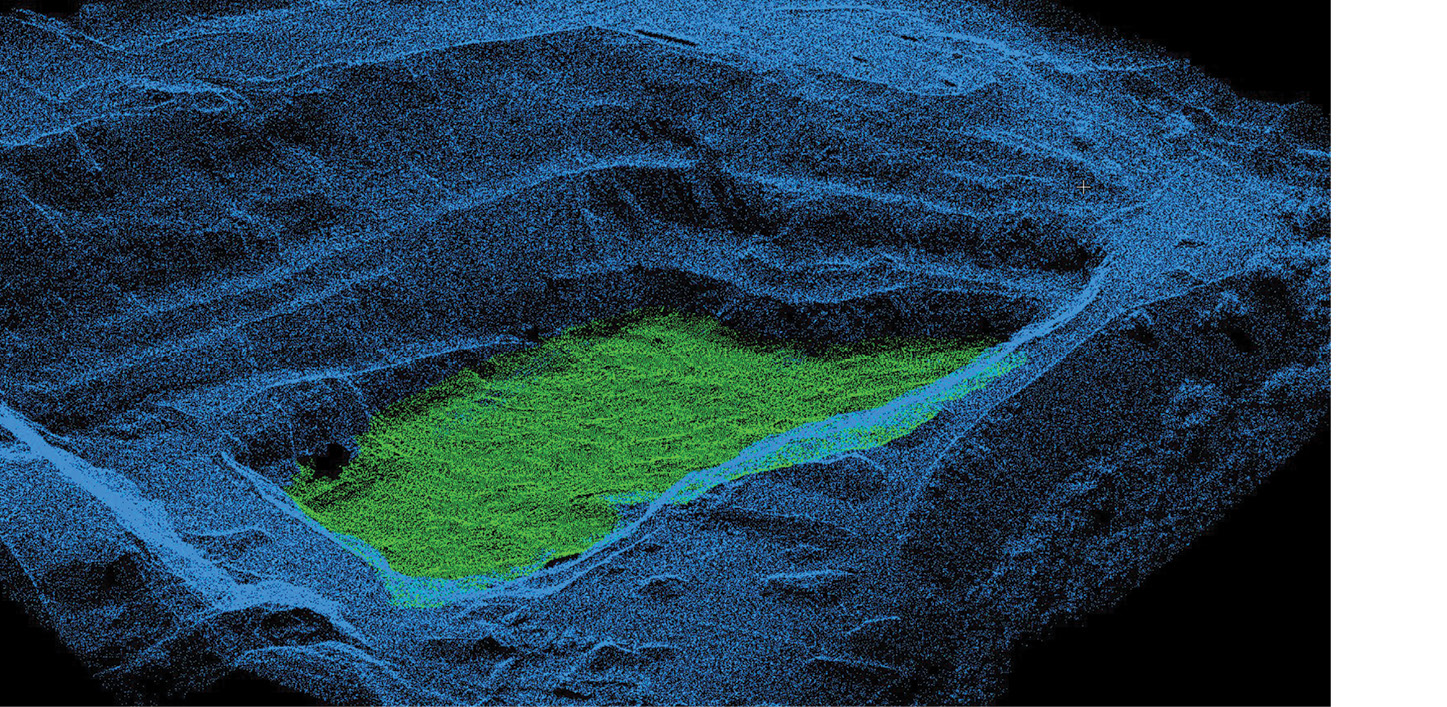
A point cloud of the two seamless dataset combined.
On most sites where this strategy is used, the bathymetric data is collected on a different day than the UAV LiDAR data. In most cases, these two surveys are done on consecutive days. The initial processing of the data is handled separately, using different software with the intermediate result being a point cloud for each. It is at this point that a knowledgeable and qualified technician merges the point cloud data for each survey and extracts the surface features using in a single software. This leads to a complete and seamless surface model. In addition to a richer and more accurate surface model, this workflow requires much less field time than a conventional survey. Working on steep slopes above a body of water always carries safety concerns. With the surface data being collected by UAV LiDAR, survey crews are not forced to ‘mountain goat’ their way around the site.
Advancements in construction will lead to more and more of these types of challenging projects combining different remote sensing platforms, with the UAV LiDAR being a critical component. R.E.Y. deploys not only UAV LiDAR and multibeam bathymetric survey equipment, but also vehicle and tripod mounted LiDAR systems. Surveyors will work closely with other engineering firms, public agencies, private developers, and contractors to understand what “tool” is best for the project and deploy as necessary to deliver an accurate and reliable finished product.
Jed Gibson is a licensed Professional Land Surveyor in California, Nevada, and Washington. He is the Chief sUAS/Geospatial Specialist at David Evans & Associates headquartered in Portland, OR. He has been surveying since 2014 and has an extensive background in remote sensing, land surveying, and large-scale topographic mapping projects, including the Oroville Dam, the tallest dam in the United States.