American Surveyor caught up with Frontier Precision Founder & CEO Dennis Kemmesat at Trimble Dimensions 2022 to discuss what’s working for today’s most progressive geospatial service providers and what it takes to support such a diverse group. Since co-founding the company in 1988, Dennis has seen a thing or two regarding surveyors and the infamous “technology adoption curve”. Today, technicians can drive, fly or walk a project, transitioning away from more static methods to working directly with models in the field. With clients realizing the value of geospatial data, there’s never been a more exciting time to be involved.
Frontier Precision, Inc., headquartered in Bismarck, North Dakota, is a supplier of hardware and software products and related services for customers in geospatial and adjacent markets across large areas of the US. It is best known as a Trimble distributor, but has grown to embrace offerings from multiple suppliers and extend beyond a purely geospatial customer base.
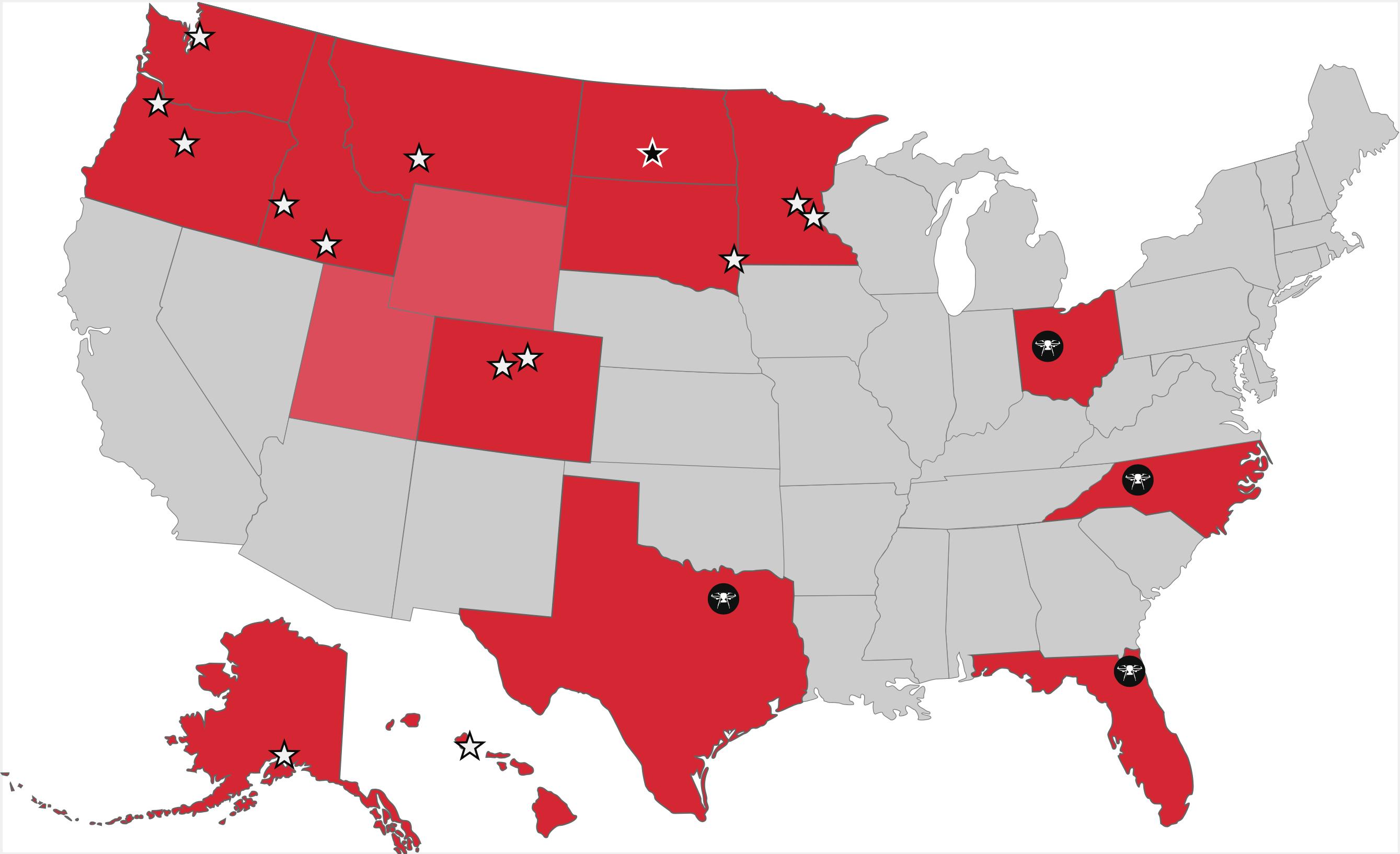
Frontier locations as of November 2022 including unmanned locations.
AS: Dennis, thanks for taking time to catch up with us. As we’re here at Dimensions, what’s on your mind?
DK: Each time we visit this event, we’re reminded of not only how far Trimble and the user community has come but how expansive the modern opportunity is. Incredibly, it feels like we haven’t even scratched the surface. You may have seen during one of the keynotes that an estimated 15 billion acres is in need of mapping, and the need is constant, from cities to remote locations, infrastructure and everything in between.
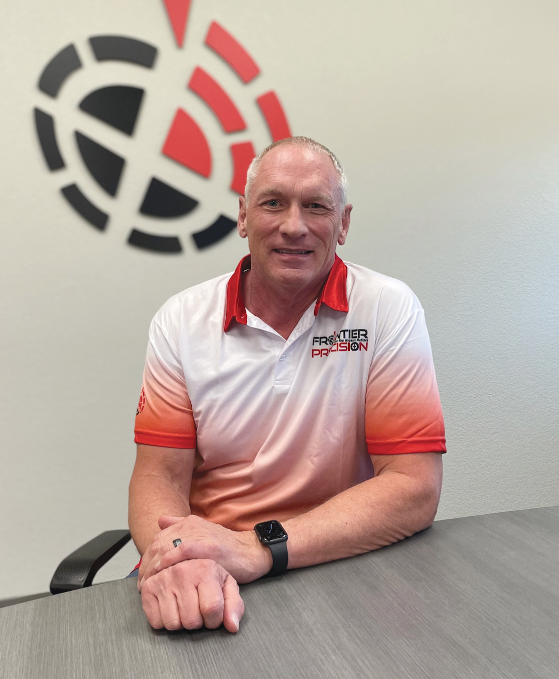
Frontier Precision Founder & CEO Dennis Kemmesat.
Years ago, when land surveying was the “simple” focus, it was exciting to see surveyors implementing GPS and then Real Time Networks. Since the first Dimensions back in 2003, this has become so much more, something that touches nearly every aspect of society (GeoTech, that is) and we’re proud to be a part of it. Trimble likes to say that their technology allows surveyors to bridge physical and digital worlds—we’re set up to support customers that are eager to do that.
AS: Can you talk about how they’ve brought it together for those that aren’t familiar?
DK: Survey is at the heart of so many industries. Trimble recognized this long ago and began developing applications in Trimble Access, vertically specific apps to be clear. For example, within DOTs (for inspectors); previously, a solution would’ve been survey focused but now it’s workflow specific. Or construction companies—years ago, construction firms had nothing to do with surveyors. Now they employ surveyors if not a survey department.
Trimble has changed the way we work. Stakeholders want more data so they can in turn make better decisions… Realizing that even a single technician generates a tremendous amount of information, solutions now exist to bring an entire jobsite or project to a planner’s desktop. Scott Crozier at Trimble likes to say that they’ve made survey chores enjoyable, that perhaps no geospatial professional is more skilled or capable of bringing the digital and physical worlds together (than surveyors).
AS: Indeed, they spoke today about the “data rich industrial metaverse”, working directly with models in the field. That and wanting their customers to connect and scale.
DK: Indeed, Trimble Cloud makes this possible and is driving industry transformation as they say. It’s also important to note that the fusion of various survey technologies is what allows this, not one single technology. As a premier distributor, we carry and support most all key product lines and can explain how and where they come together.
We see Trimble Business Center (TBC), Trimble Connect and Trimble Access as three legs of a stool. Thanks to these three tools, customers with data collection and/or management expertise can deliver the data needed to support BIM, smart cities, digital twin, etc.
Frontier Precision has the latest cutting-edge technology for accurately collecting geospatial data – geographically and topographically.
AS: The technologies are no doubt impressive but there’s still an obvious need for resellers. Where do you help clients most?
DK: 10-15 years ago, Trimble had perhaps 3x as many dealers as they do currently. Over time they realized that they were better off with bigger, better partnerships to help grow their business. In my opinion, they wanted groups with not just deep roots and a strong track record but insight, at the end of the day the means to be self-sufficient. When all is said and done it’s about a better end user experience which is what we aim to provide. That and the fact that I believe we’ve earned their trust which is the underlying reason for the success of most any partnership. We understand what they’re trying to do—ultimately, when they bring a solution, we’ll find them a (sales) channel.
AS: Please tell us about your territory if you could.
DK: Sure. We have just over 100 people. For our geospatial business we have 10 physical locations covering 11 states across the northern plains, mountain states, and Pacific Northwest including North Dakota, Minnesota, South Dakota, Colorado, Wyoming, Montana, Idaho, Oregon, Washington, Alaska, and Hawaii.
Frontier Precision Unmanned Division has personnel in several of our geospatial locations plus its own physical locations in Bend, Oregon, Fort Worth, Texas, and Jacksonville, Florida, with more being planned. We continually grow by acquisition.
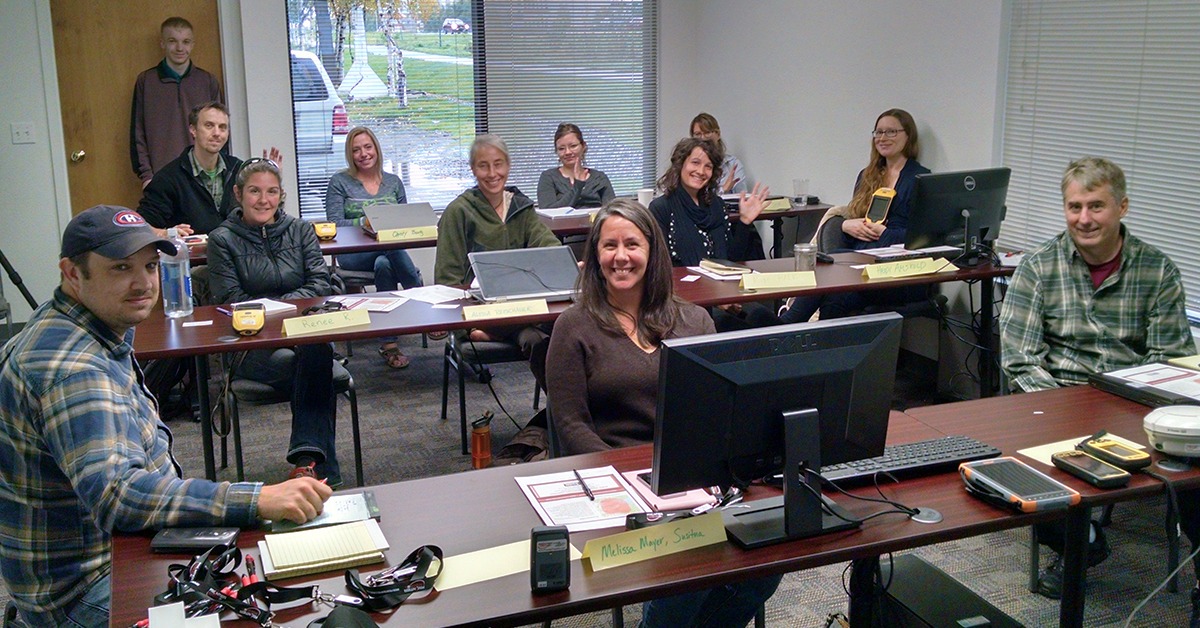
Technical Certified Training to get you up and running quickly — all backed by the most experience in the industry. Customized and technical training is provided on-site, online or in the classroom.
AS: Do most all of your locations house support and training facilities?
DK: Soup to nuts. Service and repair does not require territory the way equipment sales does so we’re able to rent and repair nationally. It’s important to note that gear comes to us, not Trimble.
As for rental, we offer of course the full complement of GNSS receivers, robots, scanners, and data collectors. In addition, many firms come to us for systems like the MX9 or MX50 mobile scanners. Rather than buy they hope to learn the tech (first) or get an idea of whether they can make money with it before making the leap. Whether renting or selling, I believe we’ve got the most knowledgeable folks in the industry when it comes to mobile scanning and lidar which brings a high level of comfort and confidence for our customers to make that leap into the mobile mapping world.
AS: Where do you see UAV/UAS technology headed from a surveying perspective? Is this technology essential to compete, moving forward?
DK: I foresee UAV technology becoming a standard tool for every surveyor, especially when it is coupled with high-res cameras for photogrammetry or with lidar. Of course the sensors are a small part of the equation: the back-end software is equally important – ease of use for photogrammetry processing or point-cloud processing is becoming more common with workflows that are easy to understand and learn. This was a hurdle early on for both photogrammetry and lidar—workflows were complicated and processing was time-consuming, requiring a lot of computing power. We now are seeing many cloud-based software platforms that are simplifying the whole process.
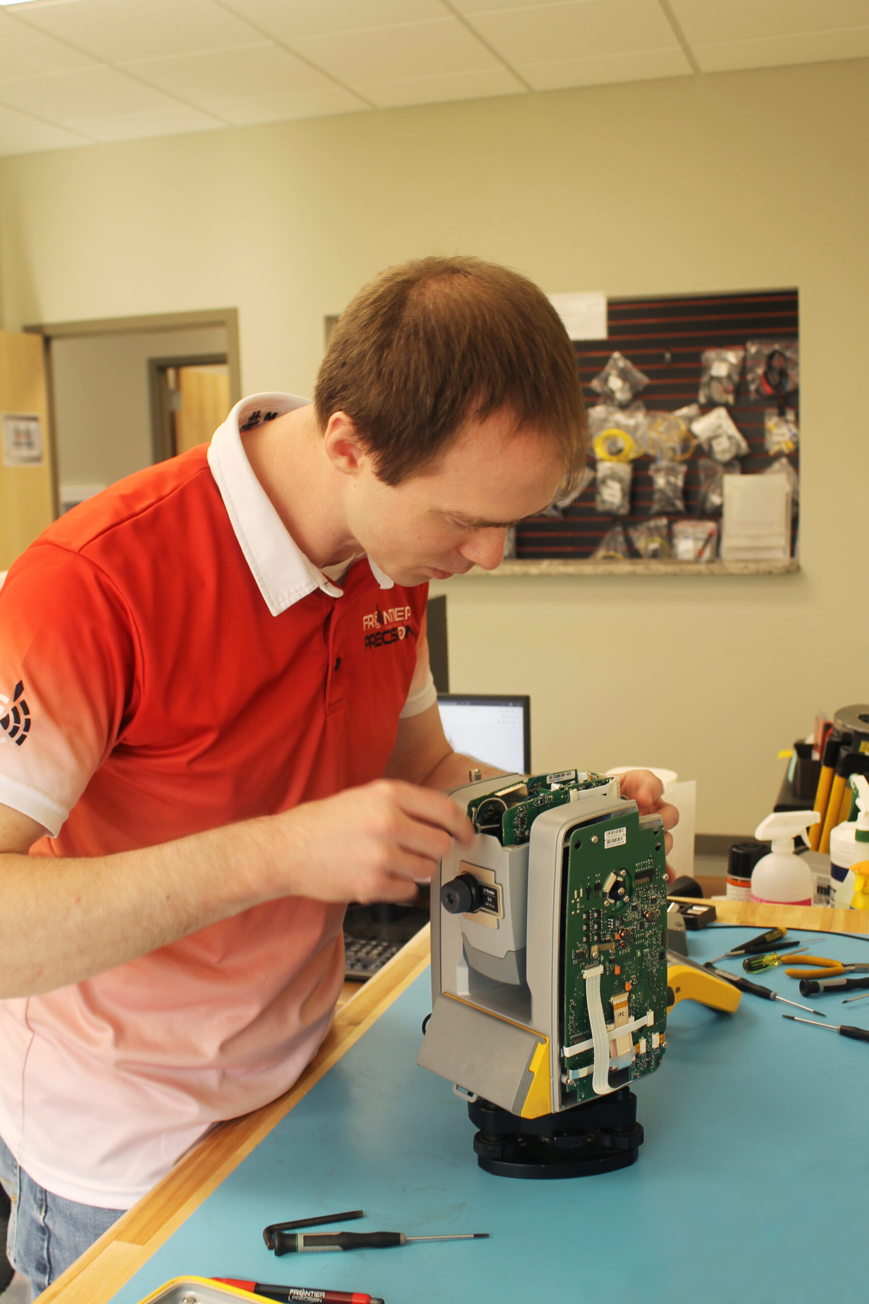
Frontier Precision has eight regional Trimble Certified Service Centers, staffed with Trimble and Nikon certified service technicians. With the latest calibration and alignment tools, Frontier Precision repairs your equipment to factory specifications.
AS: Lastly, if you were operating a land surveying or geomatics business today, what would you emphasize?
DK: Be an early adopter – not bleeding edge but leading edge. The maturity and efficiencies of technology in our industry simply cannot be ignored – companies in the survey/mapping and construction industries are either embracing and adopting it or finding it very tough to compete with companies that are. In the present state of our economy and workforce this also becomes important, as qualified workers are becoming harder to find every day. The efficiencies of today’s technology allow more work to be done faster with fewer people, so a company can scale without necessarily adding workforce and other overhead and maintain a healthy bottom line.
AS: Thanks, Dennis. The technology is exciting but easily overwhelming for many so the need for a group such as yours is obvious. Best of luck to you and your team.