 It had been two long days working in the remote Kings River canyon and finally the last flight was being prepared. The drone was sitting idle as it collected its five-minute GNSS preflight static session. I was stationed at the “high tech tail-gate desk” finalizing the flight plans and completing the necessary safety checklists. The other two crew members stood waiting for the timer to be up and the drone to take off, ready to collect LiDAR data and Nadir imagery. As I stood leaned up against the tail gate focused on the laptop, I started to feel dizzy and shaky. It had been a long 100°+ day and I thought to myself, “Did I drink enough water?” I turn and look at the other two crew members and ask, “Did you feel that?” They looked back at me puzzled looking and asked, “feel what?” I think, “ok I need some water, this heat is getting to me.” Before I could leave my “high tech tail-gate desk” a loud rumble comes crashing through the canyon and the truck starts violently shaking. There is nowhere to hide. We are on a small mountain trail of a road at the bottom of 1500’ of vertical relief of a granite rock face. This is not going to be good… The other two run for the non-existent cover and yell back to me, “Yeah! We felt that!” A 5.8 magnitude earthquake had struck some 70 miles away and we were definitely feeling the effects. So how and why did we get ourselves into this situation?
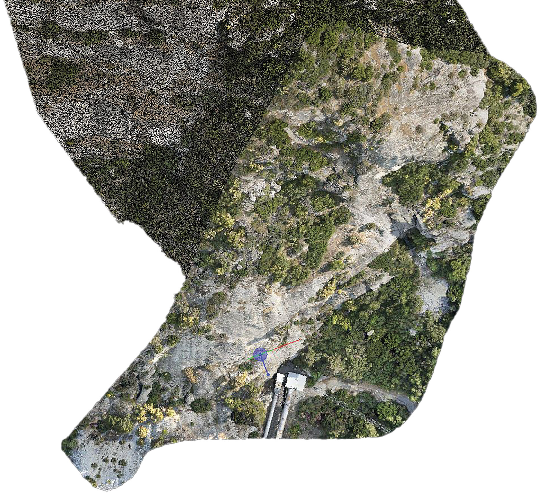
A plan view of the high density, colorized LiDAR point cloud collected
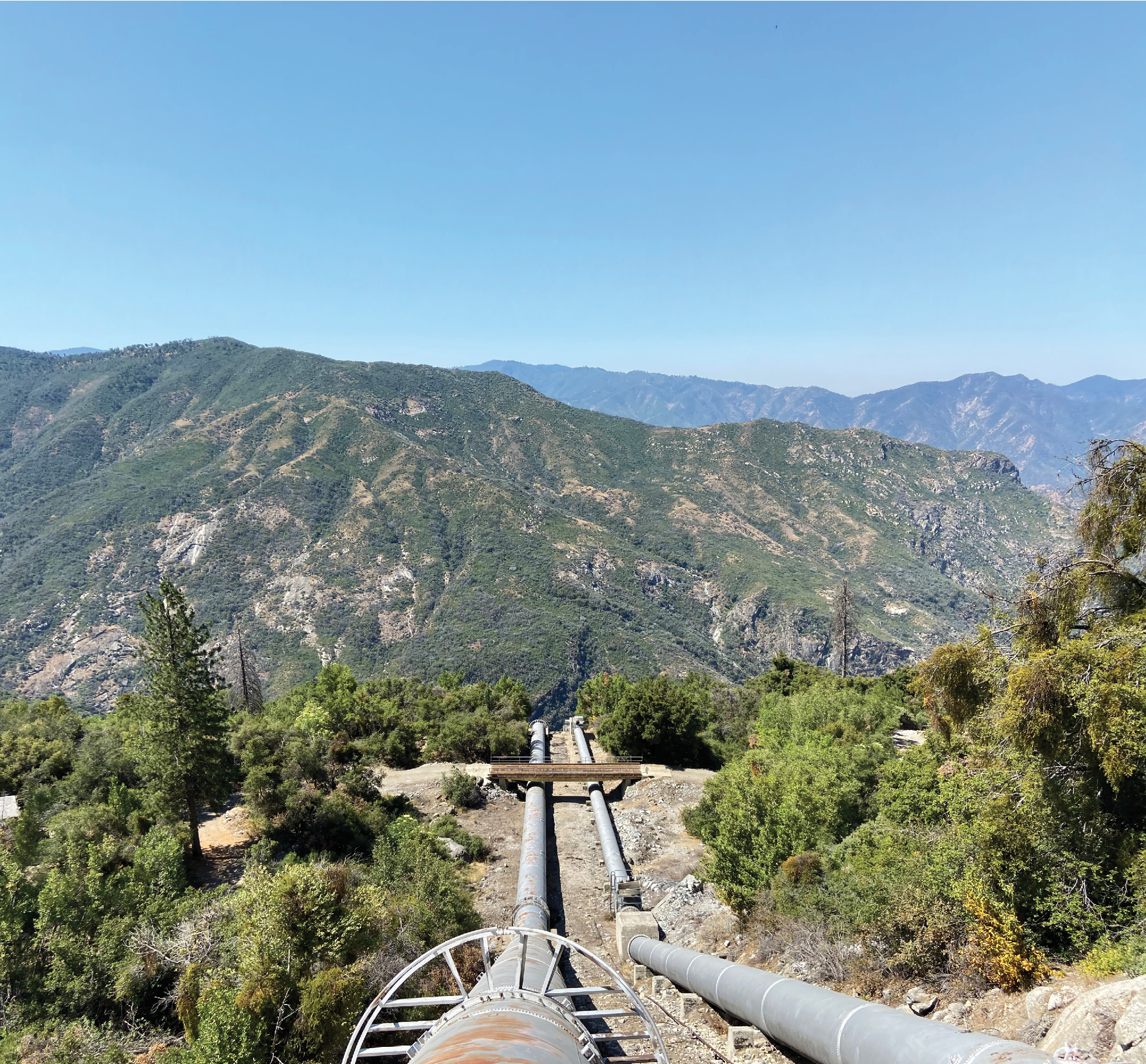
The R.E.Y. Engineers team was sent deep in the foothills of the Sierra Nevada mountains to collect high density LiDAR. Our client, a power company, was concerned about steep rock faces directly above a penstock that was feeding a powerhouse another 2300’ down to the base of the mountain. Having had a previous penstock destroyed by falling rocks, the power company’s engineers were looking to leverage new technology to identify issues and create solutions to hold the power of Mother Nature back. They needed as dense of LiDAR point cloud as we could provide with a minimum of 1 point per square inch. Traditional manned aircraft LiDAR would not be dense enough and using conventional LiDAR scanners would not feasible due to the extreme elevation difference, large area, and ruggedness of the rock face.
A view of the rock face in relation to the penstock below.
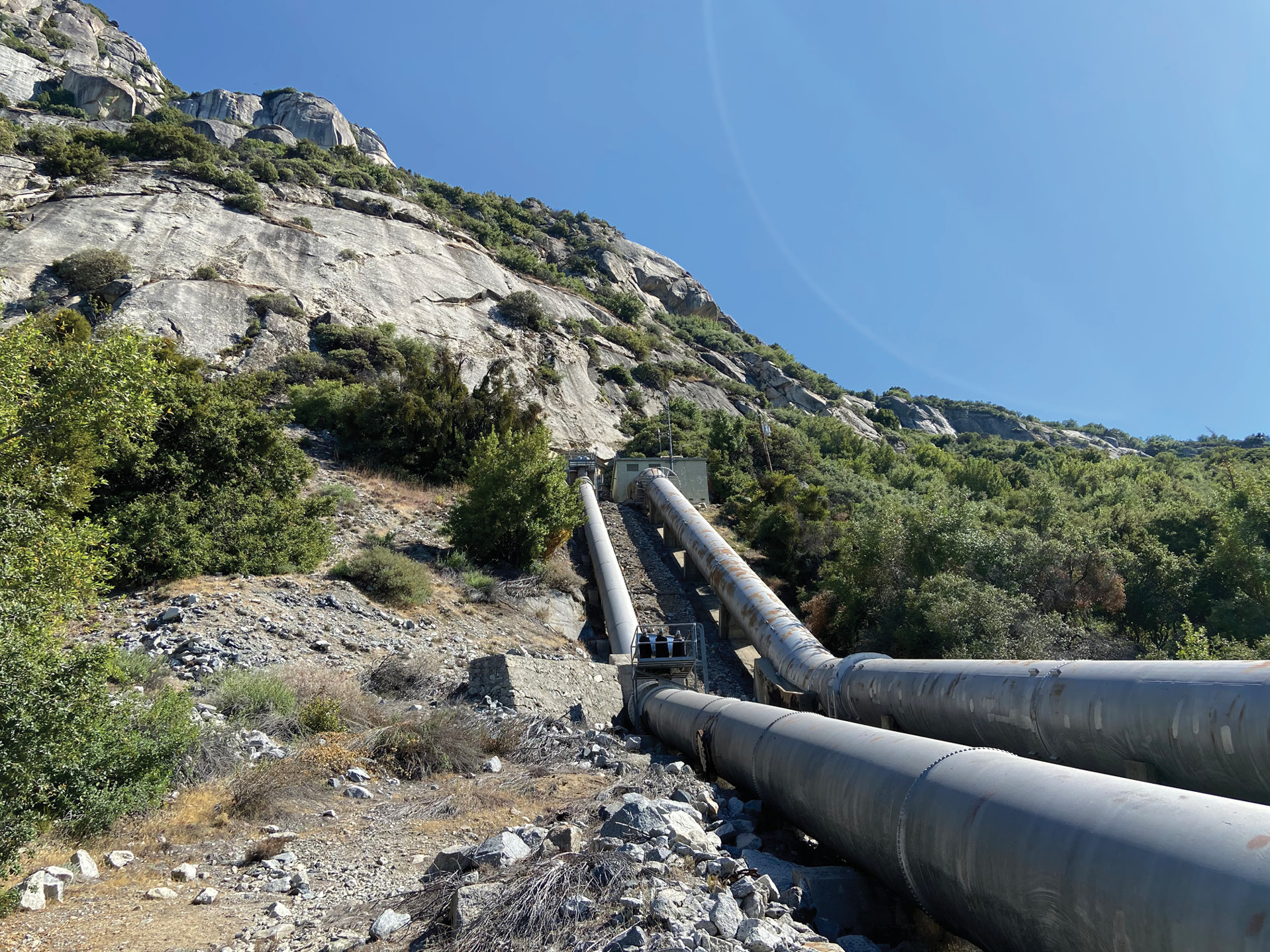
This is where the use of a drone was most ideal. R.E.Y. deployed the DJI Matrice 600 heavy lift drone with a Riegl Mini-VUX and a Sony A600 digital camera. The LiDAR unit is able to collect 100,000 points per second and the camera is set to capture an image every 1.5 seconds. The drone would have to travel up and over a ridge 1,500’ above the only reasonable launch and recovery zone reachable by truck. With the large area, steep relief, and high-density LiDAR point cloud requirement, this would not be a one flight mission. A series of 15 flights would be completed to cover the area. With the subject matter being multiple rocks of all shapes and sizes, and the LiDAR being an “in-line” scanner, the flight plans would have to be slightly offset and at different angles from each other. Having different angles and viewpoints to the rocks below, a full model of the rocks and terrain could be more accurately mapped, and less interpolation would be needed. The dense LiDAR point cloud could show large crevasses in the rocks along with any undercuts and areas where dirt had already started to slide.
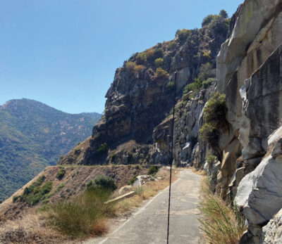
The “small mountain trail of a road” used to reach the survey area.
Once the onsite collection was completed, the data was processed and registered to our survey control. The point cloud was exported, and the extraction team went to work. Having collected nadir imagery along with the LiDAR, we were able to create an orthomosaic image and also colorize the point cloud. This was very helpful for the team to be able to distinguish between the bushy vegetation and the granite rock faces. They created a digital terrain model of the site and identified the large rock outcrops the engineers were looking to hold in place.
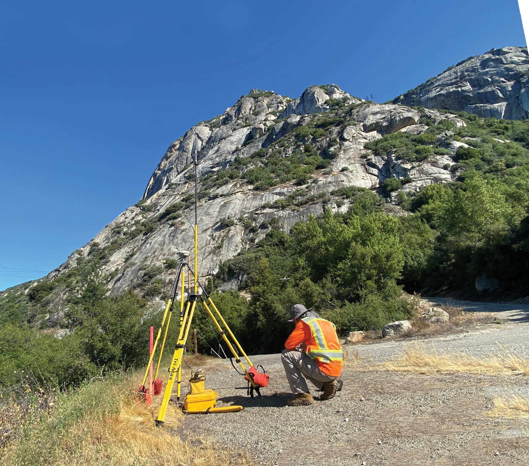
The GNSS base station and UAV flight crew looking up at the daunting sheer rock face.
Having a few years of experience flying drone-based LiDAR, I have found they don’t send us out to the easy and flat jobs right off a nice paved road. This is just one example of the many times we have been tested on some way off the beaten path difficult jobs. Just getting to the job was a challenge. Two hours driving a winding road all the way around the reservoir to reach the base camp. After reaching the base camp that is when it got really interesting. A road barely wide enough to fit a truck carved into the side of a sheer rock face. It is rock face on one side and sheer canyon on the other side with bridges built in areas where the ground just seemed to disappear.
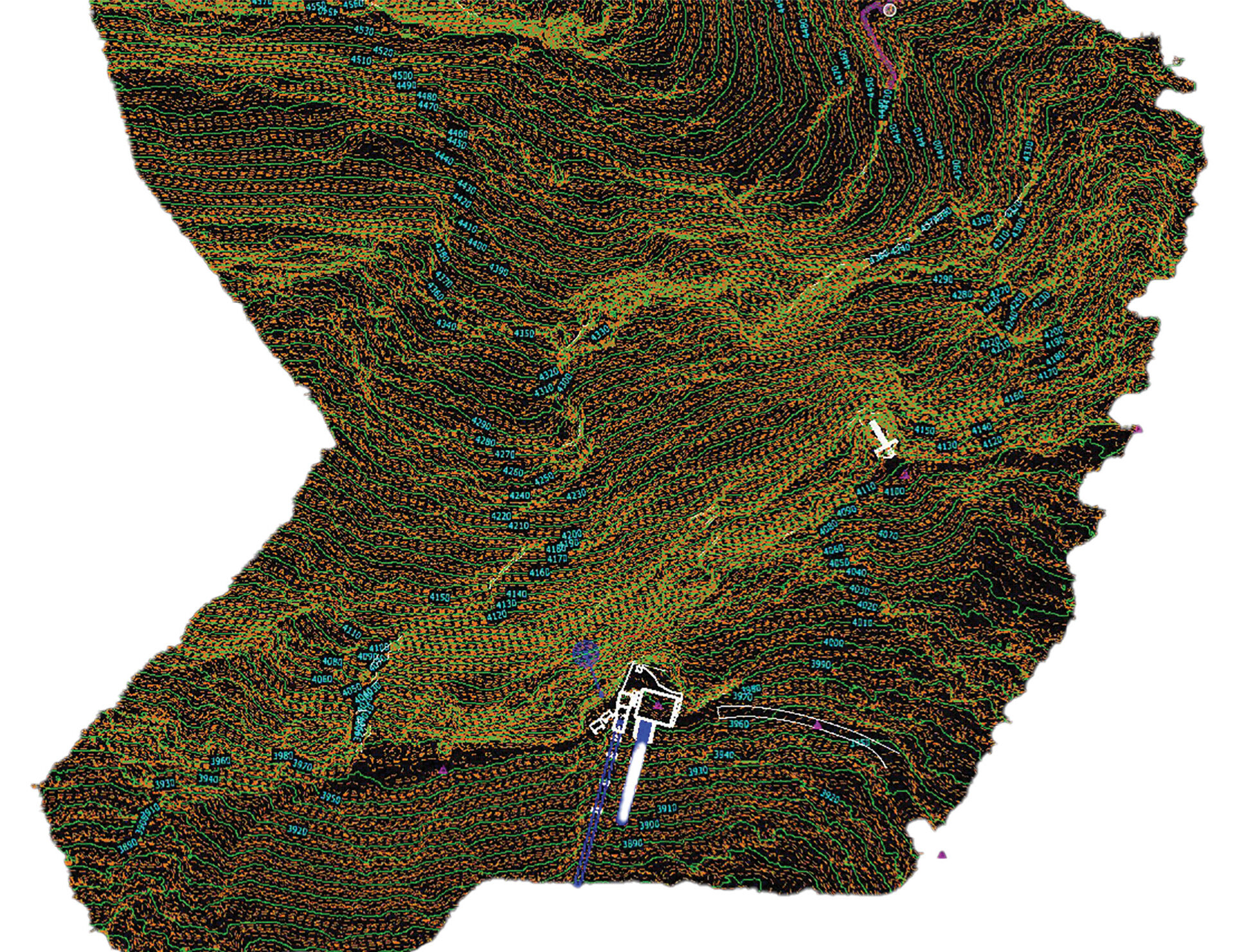
3D mapping and contours created from the high density LiDAR point cloud.
Although we had all the cool technology to see where and what needed to be deemed safe, I was able to attest to the soundness of the rocks from the hands-on experience of the earthquake, having stood at the bottom and faced it myself. It was just another day at the “high tech tail-gate offices” of R.E.Y. ◾
Jed Gibson is a licensed Professional Land Surveyor in California and Nevada. He is the Lead UAV LiDAR Pilot and Project Manager at R.E.Y. Engineers, Inc., headquartered in Folsom, CA. He has been surveying since 2014 and has an extensive background in remote sensing, land surveying, and large-scale topographic mapping projects, including the Oroville Dam, the tallest dam in the United States.