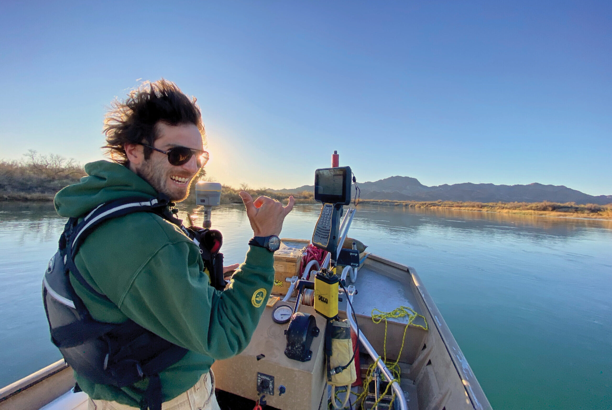
François Escorihuela, a river engineer with RiverRestoration, commands the vessel “SeaArk” on the Lower Colorado River.
When crews set off for an ambitious survey project of the lower Colorado River in late fall 2021, they were carrying an additional layer not normally included in their survey gear: heavy risk.
“We were tasked to provide precise bathymetric and sediment surveys of 342 miles of the Colorado River system between Hoover Dam and Mexico,” says Jason Carey, principal river engineer at RiverRestoration, a river engineering company based in Carbondale, Colo. “To perform these precise surveying processes, we’d need high-precision survey measurements, which would be extremely challenging as most of the project corridor was in a super remote area with no existing survey networks, communications, support or Internet access. In response to those challenges, we chose to deploy positioning technology we had not used before for a significant portion of this massive undertaking. That was a huge risk for our small company. However, we knew if it worked, the gamble would not only be worth it for this endeavor, it would establish a new workflow for the future.”
To support the aerial lidar topo-bathymetric survey, crews used Trimble R12s to collect clusters of submerged surfaces for bathymetric ground control shots. Precision Surveys
Fortunately for Carey and his project team, the uncertainty has proved a successful gamble.
With a combination of meticulous pre-planning and advanced real-time precise point positioning (PPP) technology, the RiverRestoration team is not only proving its multi-layered, data-fusion approach was a solid bet, it’s proving that PPP technology answers uncertainty with certainty, whether it’s across remote lands, open skies or vast rivers.
Troubled waters
One would be hard pressed to find a river more important to a region than the Lower Colorado.
It supplies drinking water for 40 million people and is vital to the United States’ food supply, irrigating millions of acres of farms and ranch lands. It’s reported that the Colorado River irrigates almost 90 percent of the nation’s winter vegetable crops. It supports a $1.4 trillion USD economy and hundreds of thousands of jobs.
And yet, in April 2022, the Colorado River was designated the most endangered river in the US—it had been on the endangered list since 2017.
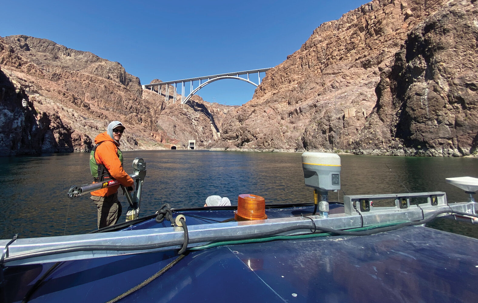
The vessel “Ducky” surveys the Mark Wilmer Pumping Plant intake channel using Trimble RTX positioning technology. RiverRestoration.org
Recognizing the waterway’s unique significance and impact, the US Bureau of Reclamation (BOR), the federal agency that oversees water resource management, has been implementing with increasing urgency mitigation and management strategies to sustain the river’s health. As part of that effort, in early 2021, the BOR Lower Colorado Region issued a request for solicitation to survey and collect bathymetric and sediment data on 342 miles of the river channel, including its reservoirs—data detail that would help them better understand erosion dynamics and their impact on the water capacity in the system.
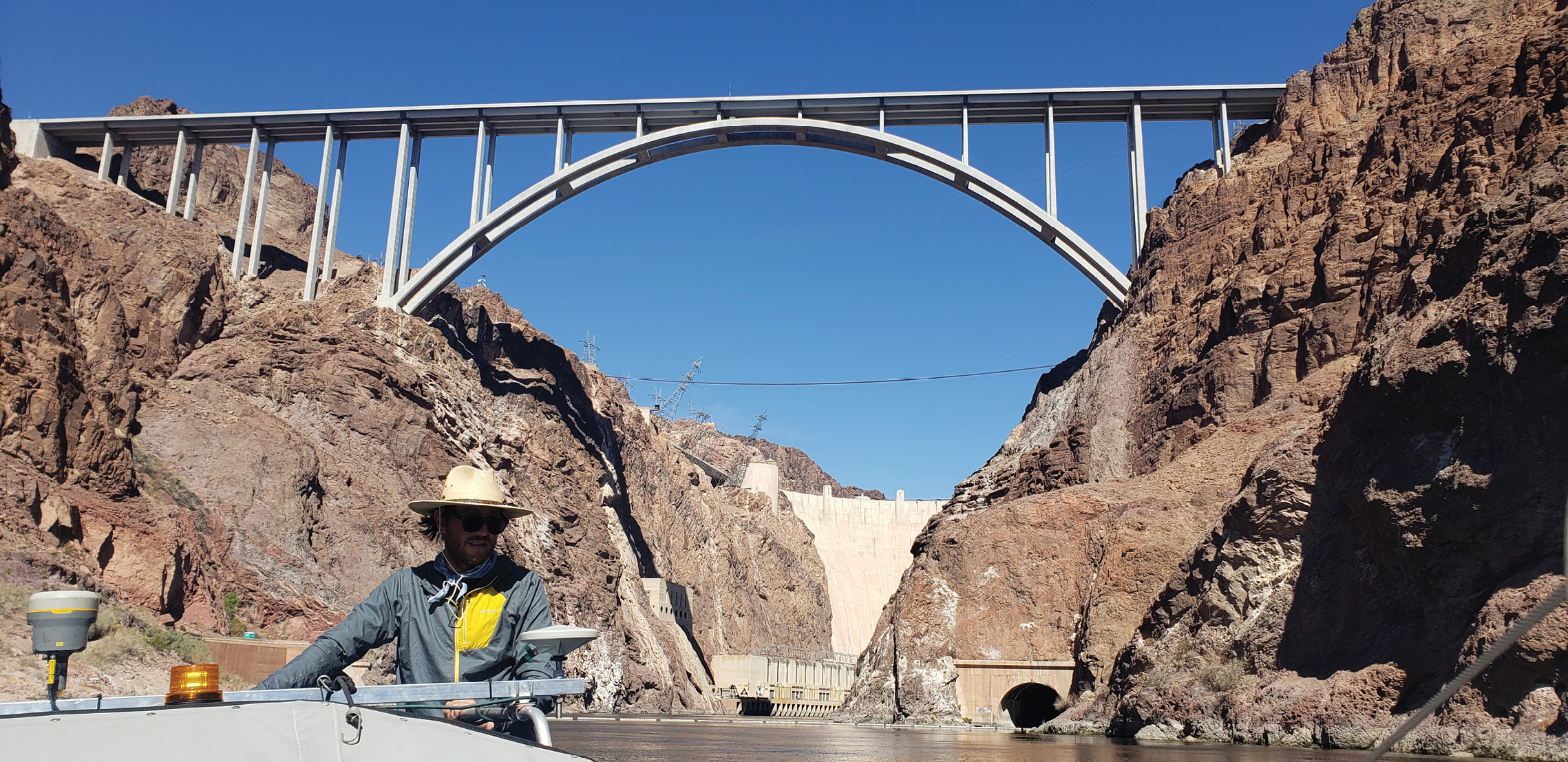
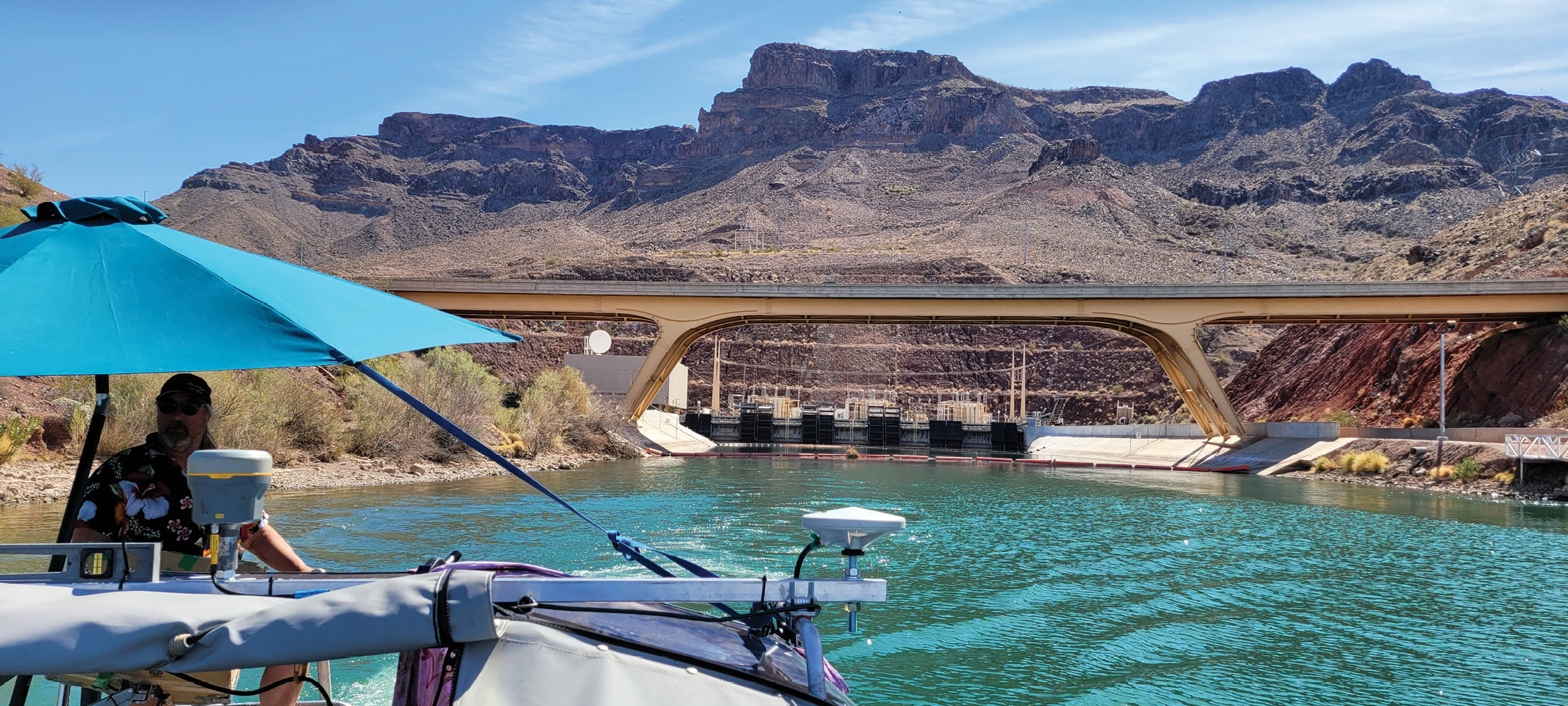
The vessel “Ducky” under survey of the Black Canyon below the Hoover Dam. RiverRestoration.org
RiverRestoration was awarded the contract and in June 2021 they launched the Lower Colorado River Assessment Project, a complex undertaking that would require diverse expertise in land surveying, aerial topo-bathymetric lidar, bathymetry, riverbed data collection, and Trimble® CenterPoint® RTX PPP technology. Of critical importance to the measurable success of the project was the ability to establish a ground control network accurate to 2 cm (0.06 feet) horizontally and 3 cm (0.1 ft) vertically to tie the whole 342 miles of distance together.
That arduous task went to Precision Surveys based in Albuquerque, New Mexico.
“Because the whole project team was going to rely on our control, we had to make darn sure that what we set was accurate,” says Larry Medrano, Precision Survey’s president. “The accuracy requirement was rigorous in itself, but it was particularly challenging for a project that long. In addition to choosing trusted Trimble technology for geodetic control, we wanted to test Trimble’s CenterPoint RTX PPP technology. Having used Trimble RTX before, we were confident it would be good, but we didn’t know it was going to be that good.”
The proof is in the numbers
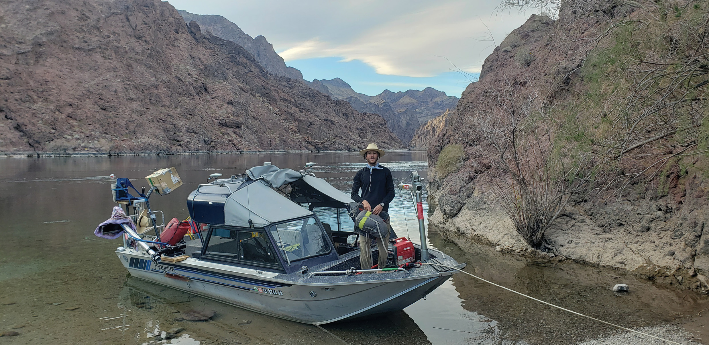
The vessel “Ducky” at Arizona Hot Springs camp. RiverRestoration.org
In October 2021, the Precision Survey team headed to Yuma, Ariz. to create the project control.
To achieve consistently high accuracy over such a long distance, six surveyors established the precise control network through primary static GNSS observations, stored for post-processing, and secondary differential base-rover RTK measurements while static data was recorded. Setting up on predetermined locations 10 miles apart, the crews installed #5 rebar with aluminum cap marks in the ground and set either a Trimble R10 or Trimble R12 GNSS receiver on the mark and acquired static observations for 1.5 hours. For redundancy, they raised their 2-m rod to 2.5 m and ran a second static session. Simultaneous to the static observations, they set up an R10 or R12 unit and established a secondary control point using their rover receiver a few hundred feet away, collecting RTK data for 3 minutes and then repeating the process at the elevated 2.5-m height for another 3 minutes. After acquiring both primary and secondary measurements, they took 30-second shots of each of the two control points with the Trimble RTX-compatible R10 and R12 receivers to have a quality control check for later comparison. Through this process, they gained confidence there was high fidelity between the static data, RTK data, and Trimble’s CenterPoint RTX observations.

The Trimble R12 records position data at Parker Dam. Precision Surveys
Once the morning control points were established, they moved north to their next locations and set two more control point pairs. To ensure they could tie the morning work to the afternoon work, one surveyor occupied a primary control point for the entire day. Covering about seven sites a day, the Precision Survey team established 62 control points across 30 sites along the river corridor—some of which they had to access by pontoon boat—in 4.5 days.
Every night the GNSS data was post-processed with Trimble Business Center (TBC) by Bob Green, the project’s survey coordinator and professional land surveyor with Bismarck, ND-based Frontier Precision. Once all the data was processed using the precise ephemeris, Green integrated available CORS data from the National Geodetic Survey and then used TBC’s network adjustment tools to perform a final processing of the static and RTK measurements. This created a geodetic control network precise to 2 cm horizontally and 3 cm vertically, both at a 95 percent confidence level. As a final step, he compared the real-time Trimble RTX correction data with his results, which he says “amazed” him.
“The CenterPoint RTX data was within a 1/2 inch horizontally and 3/4 inch vertically,” says Green. “I was a bit surprised by how accurate it was, particularly when you consider it took me over 24 hours to calculate the final control network and Trimble RTX’s real-time accuracy matched, if not bested, our results. It not only proved to us that Trimble RTX technology is a game changer in accuracy and efficiency, it gave the whole project team the confidence it needed to trust the real-time corrections going forward.”
Indeed, for the next two data collection phases, CenterPoint RTX played a far more central role.
Aerial Support

The aerial crew from NV5 Geospatial take flight for the aerial bathymetry survey. RiverRestoration.org
In November 2021, Precision Surveys returned to the field to support the aerial lidar topo-bathymetric survey, which included a Trimble AP60 GNSS-inertial system and a “green” lidar sensor with water depth penetrations of up to 30 ft. Originally, the plan was to acquire differential base-rover RTK measurements for ground control calibration, however, because crews were able to use their Trimble R12 receiver and CenterPoint RTX corrections to check in to the pre-established control monuments, they didn’t need to set up an RTK base station on control monuments.
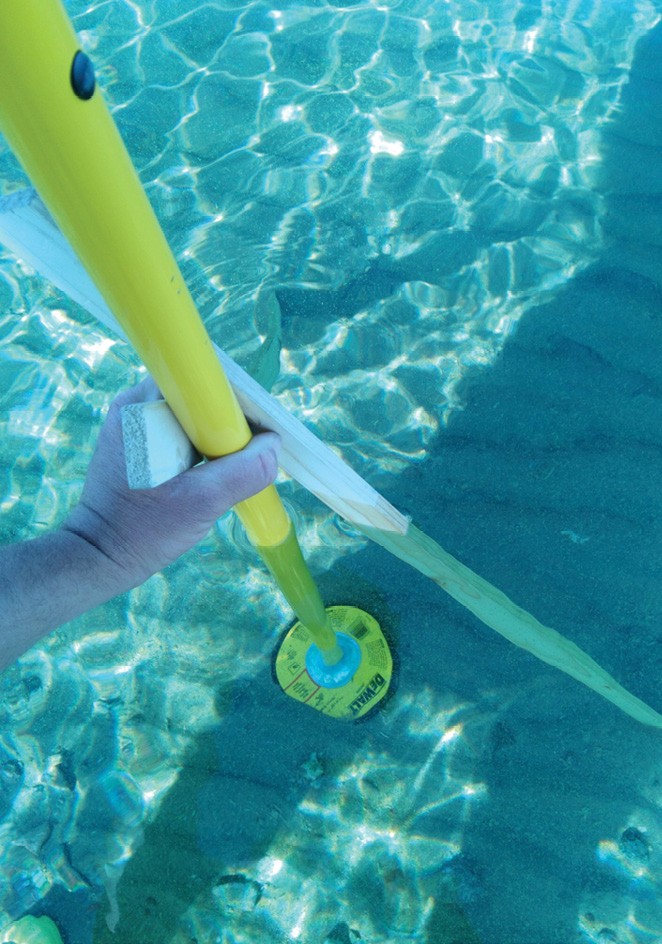
Prior to each of the 30 flights, ground crews first used their R12 to check into a ground control monument. They then either stood on docks or waded into the shallow water and collected a cluster of 10 submerged, hard surfaces like boat ramp corners or the tops of boulders for bathymetric ground control shots; each of the shots were spaced at least 1 m apart and at varying depths, while being careful not to stir up sediment that increases turbidity. They also documented riverbed attributes such as gravel, sand, or bedrock and photographed each point location.
The vessel “Ducky” under survey of the Black Canyon below the Hoover Dam. For redundancy, and for control checks, each of the three survey boats carried a Trimble R10 with real-time CenterPoint RTX. RiverRestoration.org
While the aerial crew from NV5 Geospatial were in flight, ground teams again used the R12 to acquire a minimum of five precise water’s edge shots at 1-m spacings, as well as attribute data and photos. The CenterPoint RTX-based water elevation detail coupled with the underwater depth measurements provided the data needed to calibrate the above-water and below-water lidar sensors.
“The positioning certainty of the real-time RTX greatly reduced our need to post-process the data, saving us substantial time back in the office,” says Carey.
Although the lidar acquisition did not include real-time GNSS corrections, the team used Trimble Applanix’s POSPac post-processed CenterPoint RTX internet-based service to post-process the GNSS-inertial trajectory. This service uses the same corrections as real-time Trimble RTX, but it’s integrated with inertial technology and optimized for mobile mapping and survey applications.
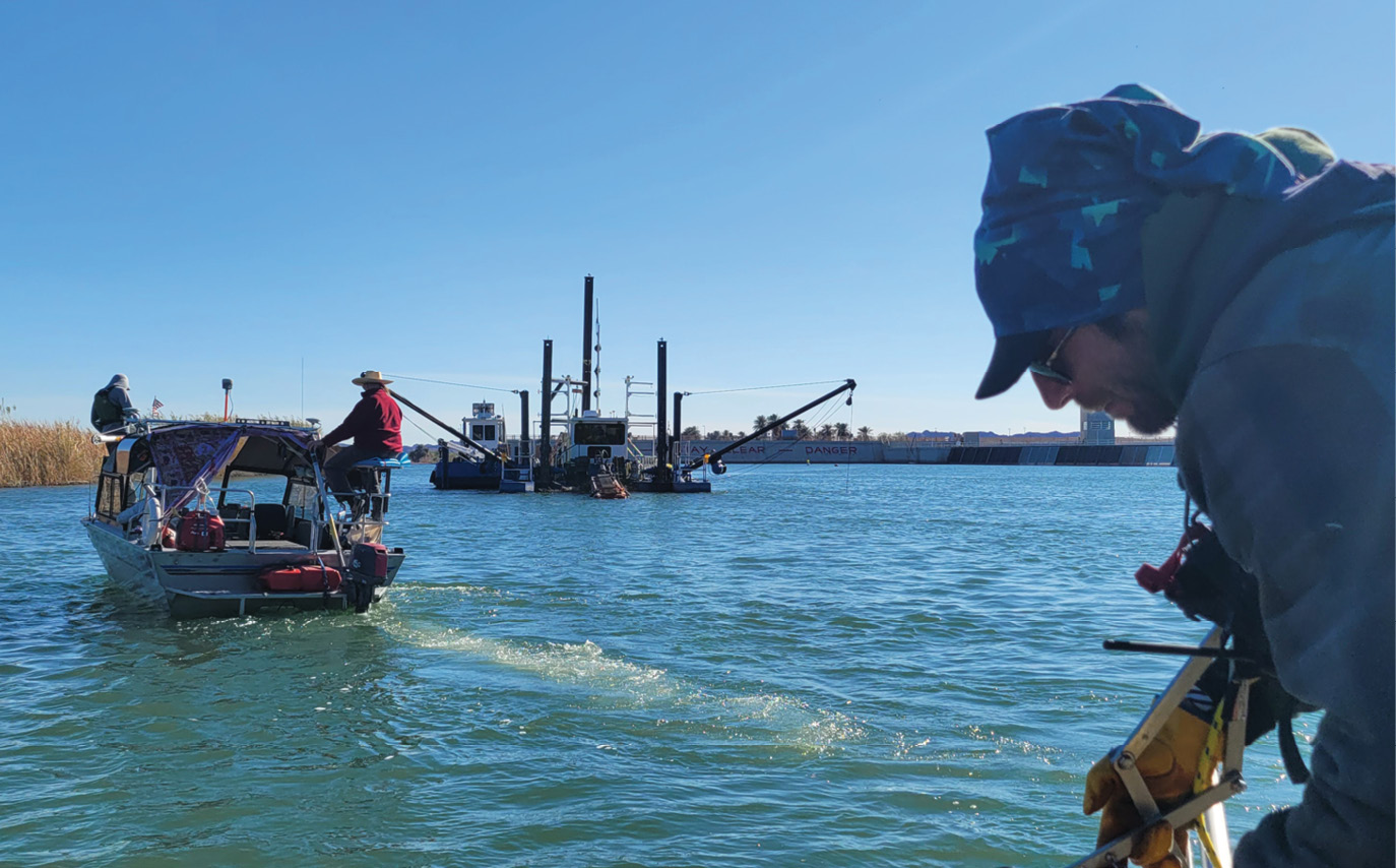
The team on the vessel “Ducky” sampling the Imperial Dam dredge workings with an RTX survey and Applanix Wavemaster II. RiverRestoration.org
With the corrected lidar data, an aerial “voids” map was developed for areas where the river was more than 30 ft deep and lidar returns were not accurate. Based on that map the RiverRestoration group defined and planned a vessel-based bathymetric survey to fill in the aerial survey voids.
Floating new technology
Between mid-February and early April 2022, vessel crews criss-crossed 60 square miles of the Colorado River—roughly two-thirds of the project area—to acquire bathymetric data and sediment samples.
Traditionally, boat surveys have required differential base-rover RTK surveying for real-time corrections, but given the environment and survey area, setting up base stations would have been extremely difficult and time consuming. So, they opted to float the risky proposition of using the beta version of Applanix’s POS MV WaveMaster II marine positioning solution with CenterPoint RTX real-time corrections.
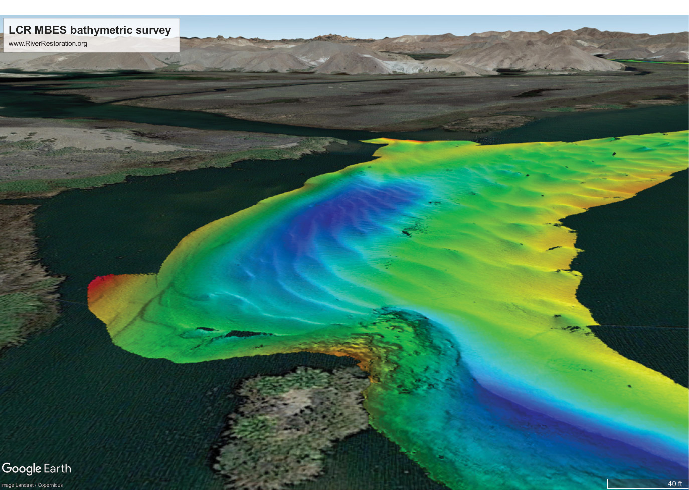
Multi Beam Echo Sounder bathymetry data of the Colorado River. RiverRestoration.org
“With RTK, we probably would have had to make a game day decision to rely on post processing positions and we wouldn’t have had reliable in field positioning to find the lidar voids,” says Carey. “That not only would have resulted in surveying about a 25 percent greater overlapping area at slower speeds, it would’ve also posed more risk to the crew’s and equipment’s safety.”
RiverRestoration equipped three boats with Multi-Beam Echo Sounder instruments that incorporate dual GNSS receivers for position and headings and the POS MV WaveMaster II. For redundancy, and for control checks, each of the three boats carried a Trimble R10 with real-time CenterPoint RTX. A fourth boat had a single beam solution with a Trimble R12i GNSS receiver, which has both Trimble RTX and an integrated inertial measurement unit. With all of the vessels capable of obtaining reliable real-time GNSS corrections the survey areas could be efficiently located, divided, and merged.
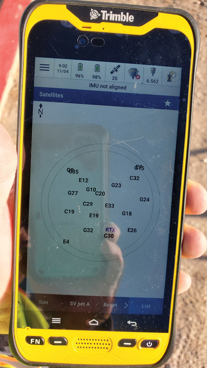
A quality control plot is displayed showing the available GNSS satellites during static data collection. Precision Surveys
Each morning they initialized the CenterPoint RTX corrections and checked into the pre-established control network to confirm the real-time data was accurate and functioning properly. Guided by the void maps installed on Trimble TSC7 data controllers, they navigated to each of the void areas, checking into control every 10 miles while maintaining speeds of about six miles per hour.
“At that speed, you can come up on a shoal really quickly and potentially damage the boat or equipment,” says Carey. “The ability to immediately know where we are with consistent positioning better than 0.1 feet, even in deep canyon areas, gave us the confidence to travel as fast as we could. The real-time corrections also enabled a crew from Survey Systems to conduct night surveying, which greatly increased our productivity.”
In total, the vessel survey campaign took about five months to complete. But Carey says that time commitment would’ve been significantly longer with RTK because they would’ve needed to repeatedly set up RTK base stations and potentially lose their radio signal about every half mile.
“With RTX, once it converged to an accurate position, we maintained accuracy throughout the entire day,” he says. “Not having to move a base station every few miles saved us countless hours in the field.”
Since finishing the boat survey, the project team has been processing the remote sensing lidar and echosounder data and stitching both datasets together to create a seamless, 3D map of the bathymetry of the Colorado River system from Hoover Dam to Mexico. Although BOR’s accuracy requirements for the bathymetric mapping is 10 cm RMS and 19.6 cm 2 sigma, Carey says preliminary results indicate their final data, when delivered in October 2022, will be more precise than requested.

The Trimble R12 GNSS receiver collects positioning data. Teams acquired primary and secondary measurements, and then took 30-second shots of each of the two control points with the RTX-compatible R10 and R12 receivers for quality control checks. Precision Surveys
“This was a massive, complex project, and one that I don’t think has ever been undertaken to this level of accuracy before,” concludes Carey. “CenterPoint RTX quickly proved to be the right solution for it. The accurate, real-time GNSS corrections reliably improved the safety, the production, and the coverage of this survey while reducing the effort that was anticipated with the more labor and equipment intensive radio link differential RTK base station method. The risk of deploying RTX corrections on this project proved to be a rewarding solution that we will implement in all future projects.”
Medrano also agrees that Trimble’s CenterPoint RTX technology will anchor their survey work going forward.
“We proved the validity of a real-time GNSS correction service to everyone and delivered measurement data at a 95 percent confidence level, as specified,” says Medrano. “For any contracts that I bid going forward I’ll no longer need to consider static surveys. I’m going to pull out our CenterPoint RTX receivers and we’ll be good to go. It’s a fantastic tool.”
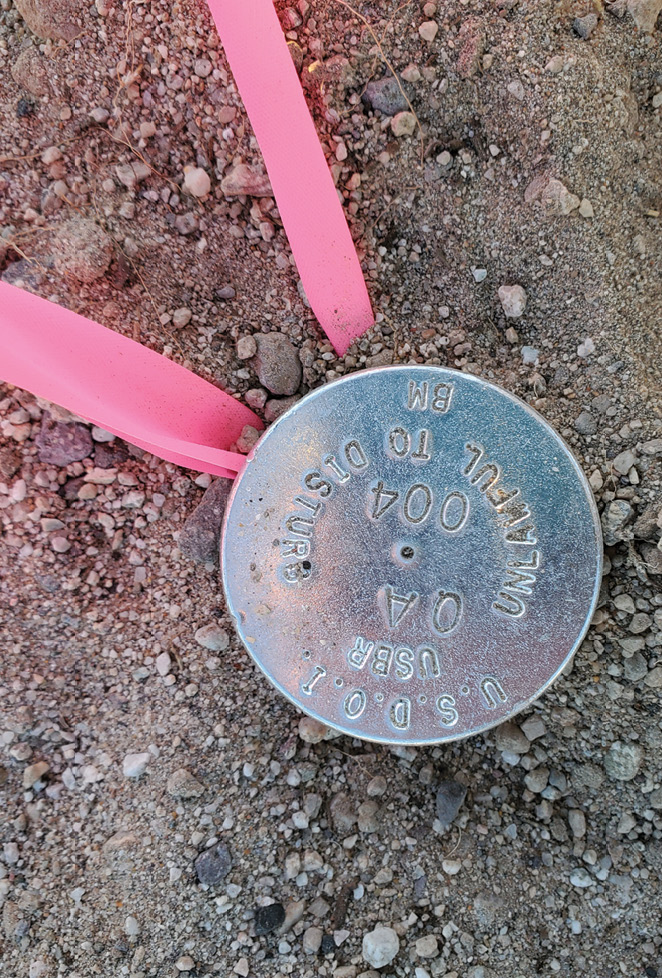
One of the 62 ground control marks established across 30 sites along the river corridor. Precision Surveys
Given the resounding success of this project, it’s a safe bet that for the next high-precision mapping project, RiverRestoration’s field crews won’t be carrying the same amount of uncertainty or risk.
Mary Jo Wagner is a Vancouver-based freelance writer with 25 years experience in covering geospatial technology. She can be reached by phone at: +1 604 221 4583; or e-mail: mj_wagner@shaw.ca