Surveyors and Engineers working with UAVs are finding it difficult to produce quality mapping as they are swamped with cheap drone hardware and software, driving them into the race to the bottom on what used to be a quality-focused profession.
While trying to keep initial costs down, the re-captures, heavy reliance on GCPs, and processing workarounds costs time and money, with lower accuracy, reliability and confidence in the outputs, affecting productivity and in some cases company reputation.
Klau Geomatics UAV software brings the quality and sophistication that professionals need. Even if you are using a DJI RTK drone, KlauPPK will produce the most robust, survey-grade positioning outcome possible. The latest release adds even more survey grade capabilities.
MakeItAccurate
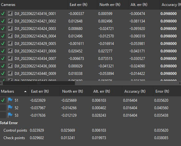
Camera coordinate accuracy from MIA on Stahly M300 data that would not otherwise process.
There was RTK, and PPK, now there’s MIA. KlauPPK desktop software has direct integration with MakeItAccurate to run drone data through a sophisticated cloud processing engine that applies satellite clock and orbit corrections and ground reference data to produce highly accurate camera positions. Customers find that MIA can save the day when the drone data or base station data is poor quality or not available. Large enterprise drone operations no longer need base stations, CORS access, placing GCPs and so on; just fly the drone.
“MakeItAccurate has turned our M300 into a surveying machine. We have experienced a vast improvement in accuracy using their PPP service compared to single-base PPK processing.” Ryan Harbach, Stahly Engineering, MT.
Coordinate Systems

Categories of supported coordinate systems and geoids in KlauPPK software.
Export your coordinates in any of the hundreds of supported coordinate systems in the KlauPPK software. Of course you can write WGS84 to EXIF, but if you want the State Plane coordinates that match your clients requirements, in metres, feet or international feet, they’re all there, along with systems for most countries of the world.
Your site may be on a Local Coordinate System, could be anything, XYZ aligned to the project, you can transform your camera coordinates to suit.
Geoids
So what about heights? Real world heights relate to physics not geometry, and geoids are how you bridge the gap. The height datum in your part of the world is modelled and represent by a geoid model, or possibly choices of many geoid models. KlauPPK software has 23 geoids to produce heights that are corrected to match the real-world heights of your survey area.
So, whether you are an engineer looking to get survey-grade results from your drone, or you just had a bad day and you’ve got no base station data, or you don’t want to know about survey complexity for your enterprise drone fleet, the Klau Geomatics software solutions will bring quality and efficiency to your business.
You can download a free trial of the KlauPPK software for DJI RTK drones here: cdn.geomatics.com.au/dji
Please contact the team at Klau Geomatics for more information. contact@geomatics.com.au
About Klau
Klau Geomatics is an Australian company building geospatial solutions for aerial mapping in UAVs and manned aircraft, including GNSS, INS, real time accuracy solutions, LiDAR and integrated aerial mapping systems.
