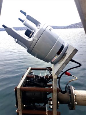
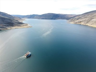
 Saint Germain en Laye (France), 20/06/2022 – Seaforth Geosurveys, a leading Canadian marine survey company, recently acquired iXblue new Gaps M5 USBL system to support data acquisition for marine geophysical survey projects, including one in the Canadian Arctic as well as multiple other projects such as support of sidescan sonar operations during lost and abandoned fishing gear (Ghost Gear) identification and retrieval efforts.
“Having rented the iXblue Gaps USBL systems for many years to conduct our subsea positioning operations, we were always pleased with the highly accurate results provided by the system for the tracking of subsea vehicles and towfish,” says Jonathon Randall, Technical Manager at Seaforth Geosurveys. “The system’s performance, as well as its ease of use thanks to its calibration-free feature, played a big role in our decision to purchase the iXblue Gaps USBL, as this can save an appreciable amount of time in the field. The Gaps M5’s simultaneous tracking capability further makes it the perfect fit for all applications requiring highly accurate and reliable tracking and positioning of multiple assets, such as the marine geomatics operations we run.”
 The latest addition to iXblue’s USBL product range, Gaps M5 has already been adopted by many companies worldwide. It offers accurate positioning and tracking of subsea assets and provides unrivaled horizontal tracking capabilities and high-precision geo-referenced positioning, especially in shallow waters where it has shown accuracy better than 0.5% up to 995m water depths. It is a medium-frequency ultra-short baseline (USBL) system combined with an Attitude & Heading Reference System (AHRS) based on fiber-optic gyrocompass (FOG) technology. With no calibration required, it can be easily deployed and operated from any vessel of opportunity. Free of export, the new Gaps M5 is quick and easy to ship anywhere in the world, saving even more operational time and offering efficiency on the field.
“We would like to thank Seaforth Geosurveys for being a long-time, valued customer and adopter of iXblue solutions and for trusting our Gaps M5 system to add to their arsenal. It is highly gratifying to hear from our customers about the Gaps M5’s accuracy, reliability and ease-of-use and that it is providing them value and operational cost savings in challenging conditions. Last, but definitely not the least, we appreciate tremendously the relationship we fostered along the way.” says Shayan Haque, Business Development Manager for iXblue Inc.
About iXblue:
iXblue is a global high-tech company specializing in the design and manufacturing of advanced marine, photonics and autonomy technologies. The group in-house expertise includes innovative systems and solutions devoted to inertial navigation, subsea positioning, underwater imaging, as well as shipbuilding and test & simulation. iXblue technologies support Civil and Defense customers in carrying out their sea, land and space operations with maximum safety, efficiency and reliability. Employing a workforce of 750 people worldwide, iXblue conducts its business in over 60 countries. www.ixblue.com
About Seaforth Geosurveys:
The Seaforth Geosurveys team, based in Dartmouth, Nova Scotia, has over 200 years of combined experience, both in Canada and internationally. Since its incorporation in 1994, Seaforth has provided innovative solutions for clients in various aspects of marine surveying, project management and UNCLOS consultation. In addition, Seaforth provides support services in marine geomatics data processing, interpretation and management. Seaforth Geosurveys offers innovative marine geomatics solutions ranging from general ocean mapping to comprehensive hydrographic, oceanographic surveys and geophysical & geotechnical site investigations in support of engineering and environmental projects. http://seaforthgeosurveys.com/
