 The NGS Coordinate Conversion and Transformation Tool is a one-stop solution for coordinate conversion and transformation. NCAT revamps and modernizes the Geodetic Toolkit. It allows users to easily convert between different coordinate systems and/or transform between different reference frames and/or datums, in a single step. NCAT incorporates the capabilities of many NGS computer programs, which originally were stand-alone products, such as VERTCON and NADCON.
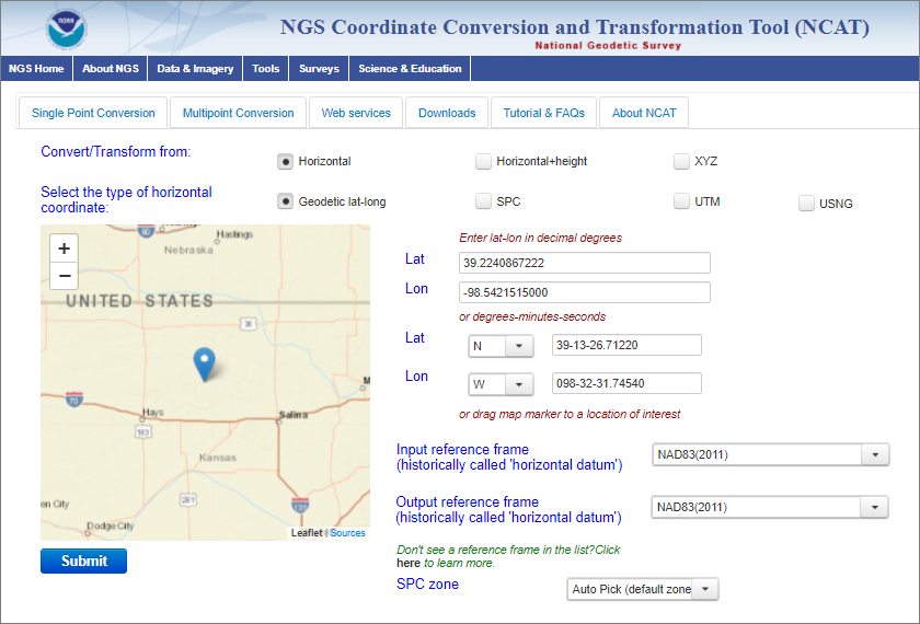
NCAT conversions and transformations can be done interactively using single or multi-point conversions directly on the NCAT page. NCAT is also available as a download or an API (application programming interface).
Version 2.1 adds:
- an option to specify units for heights,
- an option to customize data exported,
- more FAQs, and
- a link to the source code on github.
Video tutorials and in-depth Frequently Asked Questions lists are available online for surveyors and geodesists new to the software.
