The Problem:
 Over the past decade, there have been many cutting-edge surveying and mapping instruments introduced to the market with the ease of uses, more automation and increased precision such as new generation of total stations, scanners, and mobile mapping systems. However, those solutions specially the ones offered by the big players, are typically expensive and not very affordable for small size businesses. In addition, amount of the time required for establishing the equipment, site induction and safety measures add more complexities for conducting a typical survey job.
Another alternative, which has been widely adopted by most survey professionals is UAV-based mapping systems. However, regulations, maintenance, dealing with multi-software packages, including external photogrammetry and GNSS processing uncertainties, datum transformations, etc. can all pose a challenge in smooth and streamlined deployment of these solutions.
The Solution:
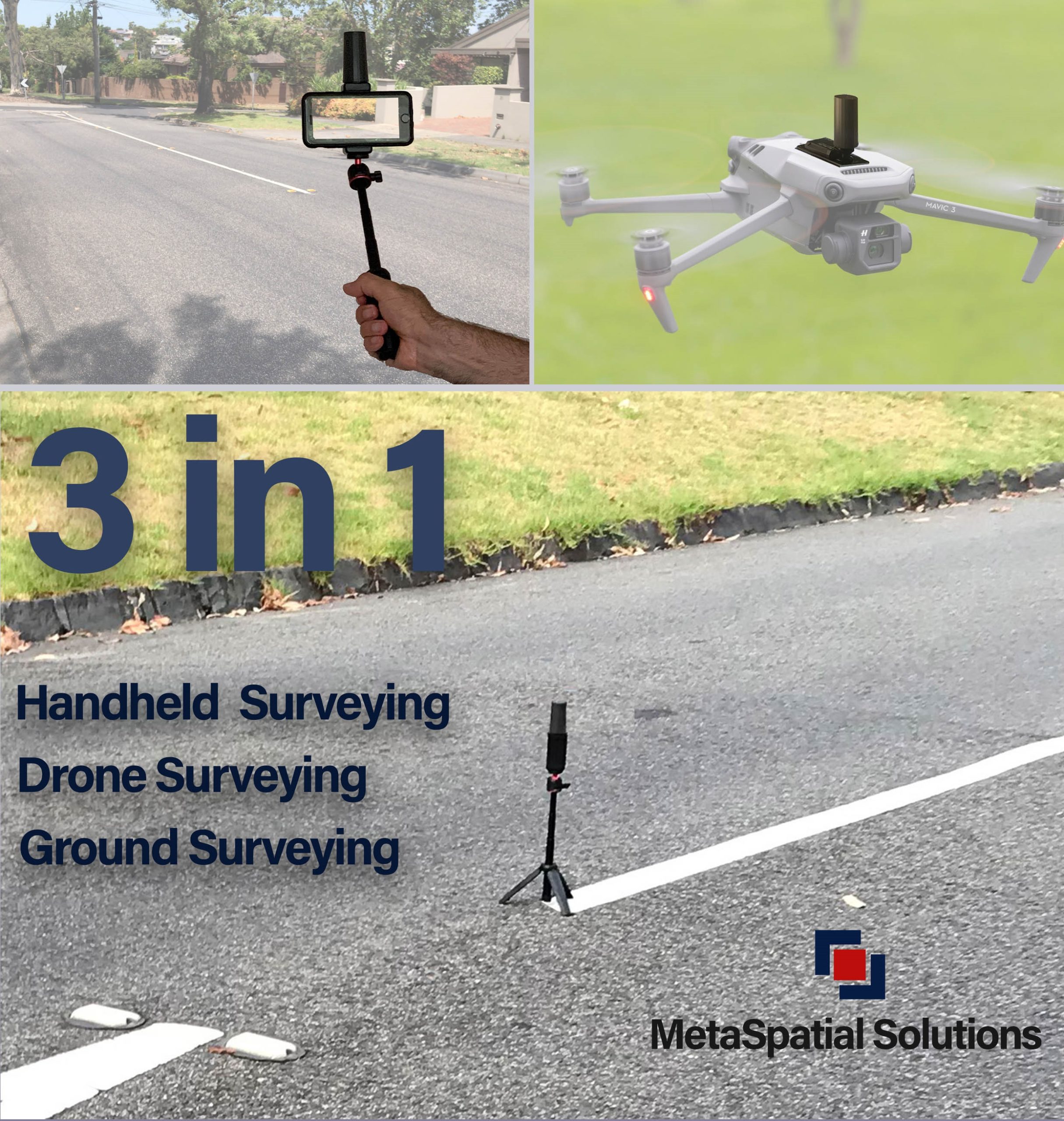
 MetaSpatial Solutions, a leading geospatial technology firm based in Australia, has revealed its SmartSurveyor system as a revolutionary and disruptive low-cost mapping and surveying alternative simply using the mobile phones. No site setup, no additional resources, no equipment maintenance and calibration, no complex workflows, it maps as you walk across the site with precise survey-grade accuracy. The solution is versatile and can be used as a handheld mobile mapping system, ground-feature surveying as well as unique capability of being mounted on very low-cost hobby-grade UAVs.
A Use Case:
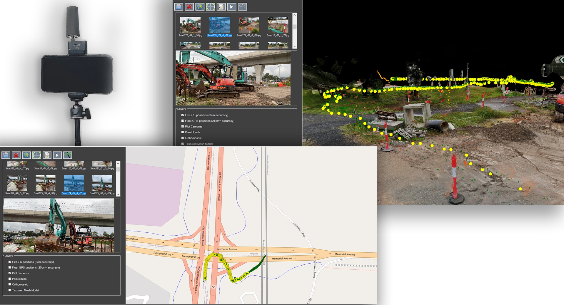
The SmartSurveyor system is being widely adopted by professional surveyors and mapping companies. As a great example, one of the government organizations in charge of maintaining public assets and road works in Sydney Australia have successfully used the SmartSurveyor in one of their busy highway maintenance projects. The site engineer has managed to collect survey-grade data in only 4 minutes walking along the site without any high-end surveying equipment, just using his iPhone11.
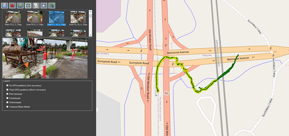
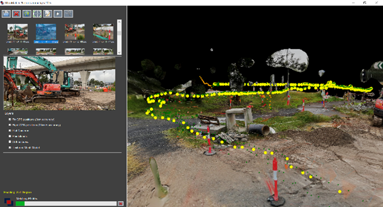
After collecting the data, it was processed in 20 minutes on a laptop computer onsite, using the UltraMatch software which comes as a bundle with the SmartSurveyor system to produce reality models and precise data with 3cm XYZ accuracy (0.09ft). According to the site manager, if the same size area meant to be surveyed with any other method it would have taken a few days to capture and produce the same quality data.
How it works:
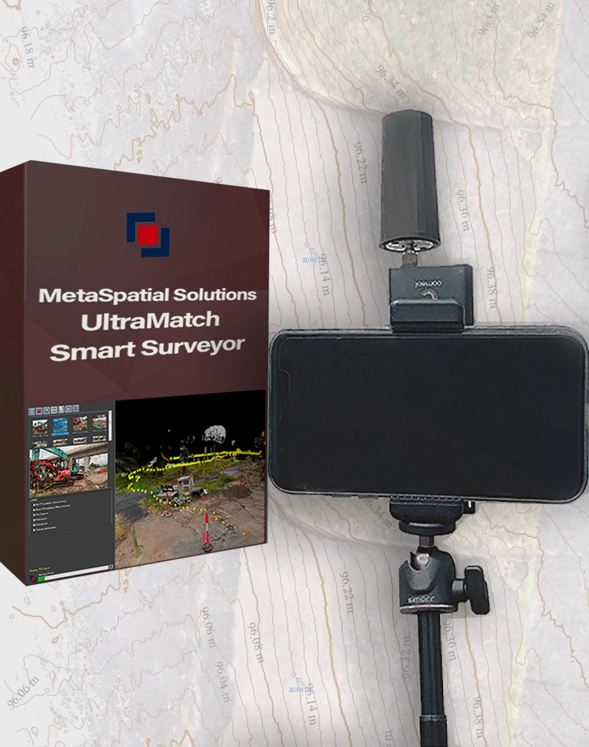 The way it works, is based on images captured autonomously using the SmartSurveyor camera controller on the mobile phone synchronized with the built-in GPS receiver in the phone or an external low-cost GNSS receiver attached to the phone. The collected data are seamlessly processed in the accompanying UltraMatch photogrammetry processing software with support for coordinate and datum transformation and processing other drone and airborne data. The SmartSurveyor supports both RTK (using the NTRIP corrections casted via the mobile hotspot internet connection) and the PPK for being post-processed after collecting the data. It can be operated with any existing GNSS receiver saving the cost of adding a new GNSS system to the flees. For projects without clear sky view, the system can be operated independent of the GPS and supports external ground controls marking to precisely geo-reference the collected indoor data.
For more details or get a trial access to the system visit our website or send us an email at contact@metaspatial.com.au
MetaSpatial_SmartSurveyor.mp4 from MetaSpatial Solutions on Vimeo.
SmartSurveyor_Construction.mp4 from MetaSpatial Solutions on Vimeo.
SmartSurveyorChurch.mp4 from MetaSpatial Solutions on Vimeo.
