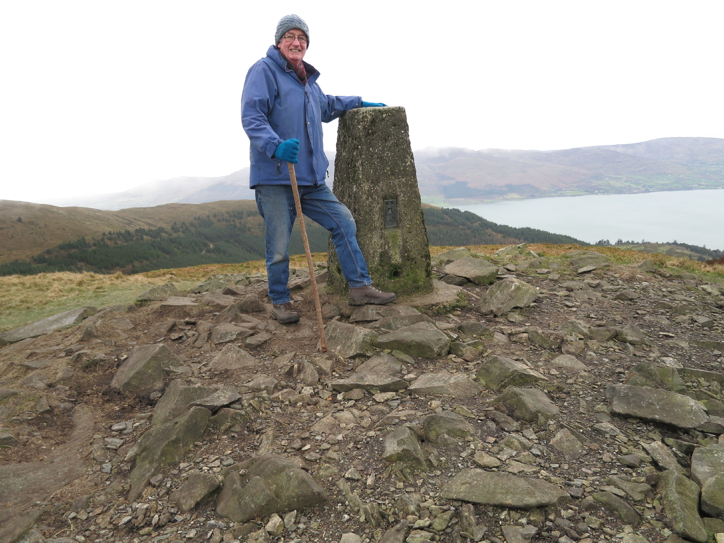
Me standing at the pillar on Slieve Martin above our house some time back. I observed from there more than 50 years ago. (I’m shocked)
I joined Northern Irelands Ordnance Survey in 1966. Truly it was an organisation that hadn’t changed for more than one hundred years. Hardly changed since June 1824. That was when the British Parliament approved the sum of £300,000 and charged Lt-Col Thomas Colby with the task of mapping the entire island of Ireland at a scale of six inches to one mile. His lieutenants were fellow officers Thomas Drummond and Thomas Lorcom. They had the foresight to recruit George Petrie a member of the Royal Irish Academy (an inspired antiquarian) his protégé George Du Noyer and the celebrated John O’Donovan one of the greatest Irish Scholars of all time.
Colby understood the importance of Irish involvement but the tirade by the imperious Duke of Wellington: ‘The Irish map cannot be executed by Irish engineers or agents. Neither science, nor skill, nor diligence, nor discipline, nor integrity, sufficient for such work can be found in Ireland’—influenced the training of low-grade army personnel that devastated Irelands own mapmakers putting them out of work. And on top of that there was the matter of hostility to men dressed in military uniform—unmistakable emblems of British occupation. It was only when the British Sappers widespread drunken illiteracy had begun to get on officers’ nerves that Irish ‘country labourers’ were employed’ And in a short time were to outnumber The Sappers by four to one.
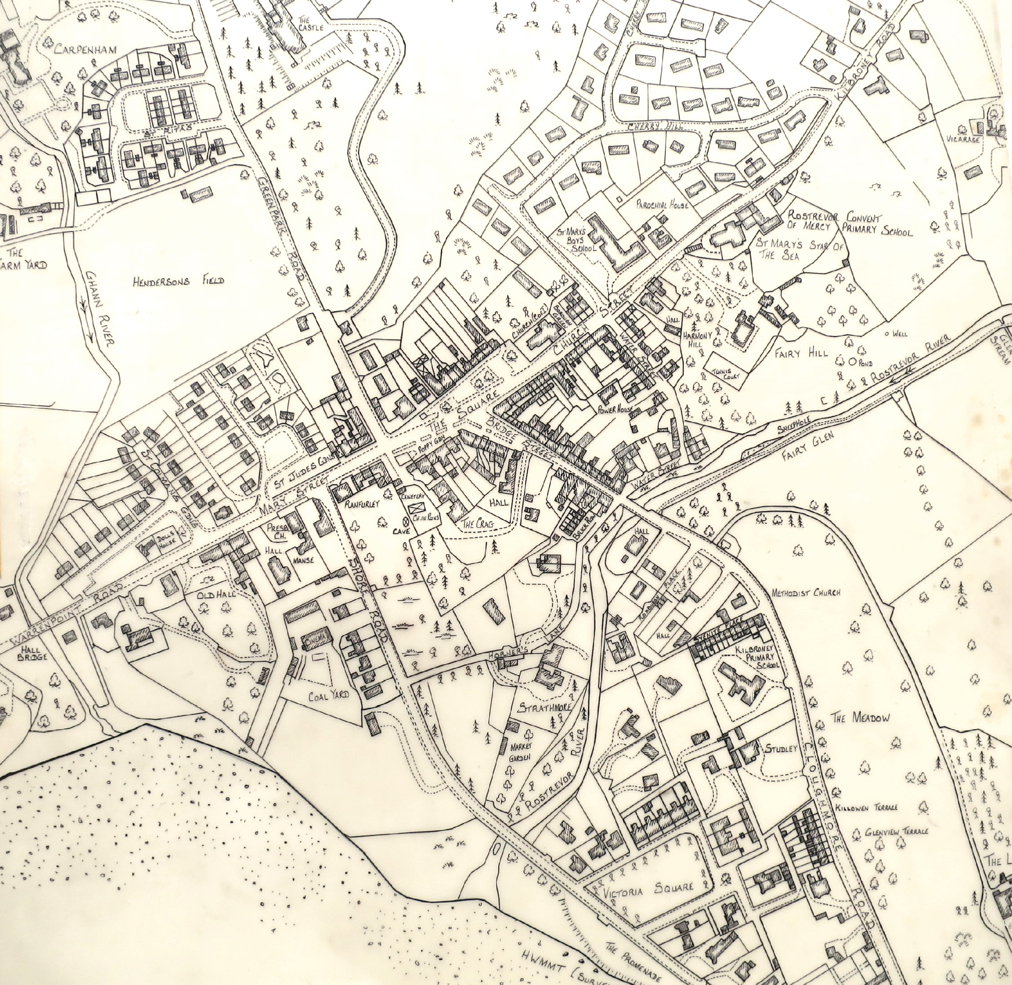
My 1.2500 Ordnance Survey field trace of Rostrevor—1978
By my time only the Chief Survey Officer was British and shortly after I retired (to my delight) the post of ‘Chief’ is held by a former colleague and friend of mine. My career started with a month in the office learning to draw with a rule pen and a further three months in Belfast’s Ormeau Park learning to ‘chain.’ Then to Newry to work on the 1:500 scale map. But only for a brief time because the re-triangulation of Ireland was in full swing. Colby had established a base line on the shores of Lough Foyle —7.89miles long—that for 60 days in the Autumn of 1827 occupied 70 men.
On this ‘perfect side’ the entire triangulation of Ireland was built. We were doing it again. Building pillars on mountain tops and burying blocks in fields. This time we had a theodolite and EDM and I was given a course in both. There was fifteen or more of us in the section portaging theodolite, Tellurometer, car batteries, lights, temperature, and pressure measuring equipment to Irelands most inaccessible points. In looking back, I find it amazing that at the time our only means of communicating with our colleagues on the other stations was by—flashing Morse code. Unbelievably that’s why we had the batteries and lights. When I see the perfusion of mobile phones now!
The pillar on Slieve Martin in front of our house has become the focus of many charity runs. Its purpose is long forgotten. To others it’s just a slab of concrete in a scatter of rocks. But to me it’s an altar that I put my hand on and remember communicating with all the other pillars, buried blocks, church spires and indeed lighthouses in every bailiwick in the land. For a couple of years, I had a wonderful time in the ‘Trig Section.’
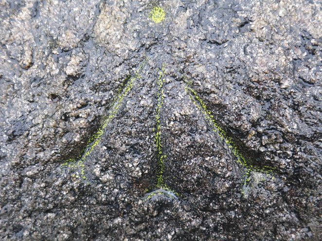
BM on step of church 1860s.
Moving from place to place; we played sport in the various parishes and drank in the local pubs. And then I was a Leveller. No nothing to do with religion or indeed finance I cut benchmarks and give them a value; a height above sea level linked to the national datum established (8 April 1837) at Poolbeg lighthouse in Dublin Port. On sights that were selected with a view to permanency, benchmarks were indeed written in stone. Cold chisels for cutting were sharpened and tempered in the local forge. At the height of the ‘The Troubles in Ireland’ I ran a secondary line more or less along the border between counties Armagh and Louth. It’s curious how in time we become accustomed to our plight. Often, we’d just stop for a while until the shooting subsided further up the road.
It was the practice to incorporate old levelling – marks cut by The Sappers into the new work. In Crossmaglen, (spade in hand) I was searching for such a mark when a lovely man came out of the house and said, ‘I’ve been waiting for you. You’re looking for the ‘crows’ foot’ arnt you. We had to move the stone’ he said. Whereupon he took me round to the side of his house where he had public spiritly relocated it in the wall.
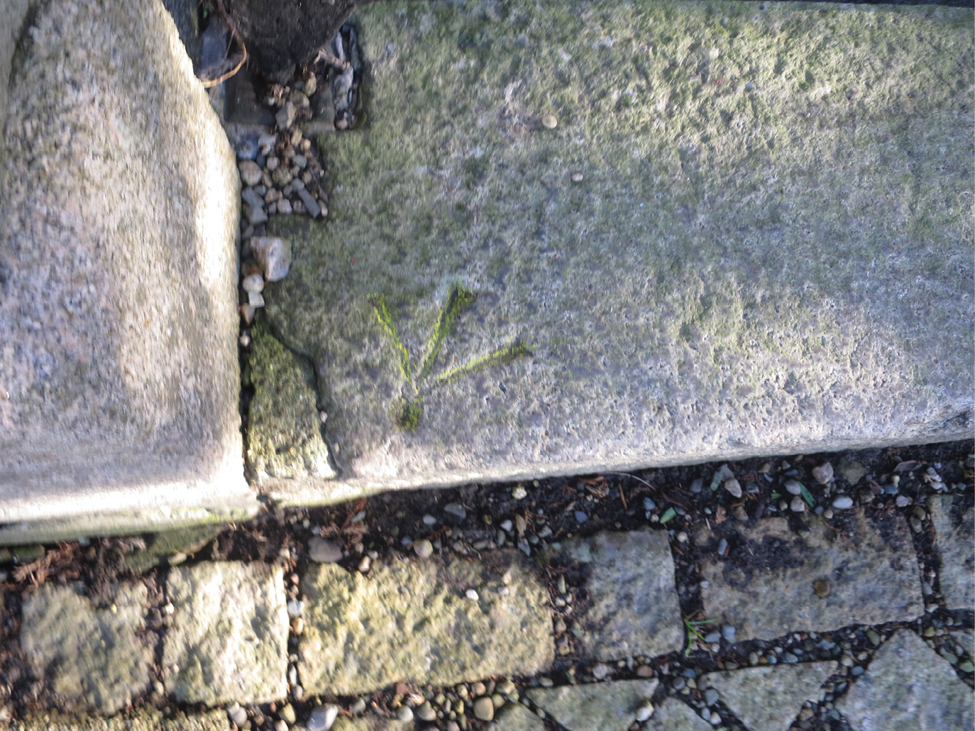
BM I cut on bridge over Kilbroney River—1970.
And away from South Armagh in The Mourne Mountains above Kilfeaghan I was levelling out on the mountain, cutting benchmarks every quarter of a mile or so on cropping rock. To each I’d give a value above sea level and draw a little sketch. Dan White was a shepherd there and I’d return each morning to find that with his own hammer and chisel he too had cut marks that were more or less indistinguishable. Little did I know that with the advent of Sat Nav —in what I consider a very short time—my work would become obsolete and Dan White’s benchmarks would be just as ‘important’ as mine.
Over the years I worked in every discipline of The Ordnance Survey. Rural Ireland is truly steeped in archaeology. Raths, cranogs, souterrains. Newgrange!—even to a great elliptic earth work sweeping right across the country known as the ‘Run of the Black Pig.’ And of course, myths. It’s the field surveyors’ job to note anything that may be of interest. So, here’s a one-off. There’s a field in Killowen looking directly across the Lough into Carlingford; that has a pile of stones in the corner (a possible cairn). In a bungalow at the bottom of the field the woman of the house was baking bread. She was a sonsy no-nonsense woman and through the open kitchen window I asked her did she know anything about the pile of stones. “I do,” she said. “Every year on the night of the 7th of August two teams of small black men come up from under those stones and play a game of football in the field. Then they run back to the corner; and go back down.” She told me this in the most matter of fact way as she continued to prepare the dough for her griddle of bread.