
Nikoline Bohr examines the northern Meridian Stone on Nantucket Islands historic Main Street. Image courtesy of Chris Berkenkamp
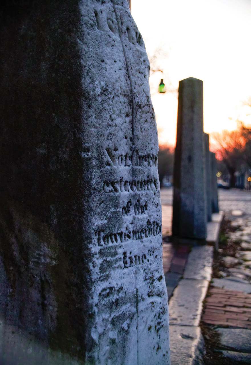
In 1840 the astronomer and surveyor William Mitchell erected two white marble obelisks on perpendicular sidewalks in the Town of Nantucket, Massachusetts. These two stones are set in an astronomic north-to-south alignment and are commonly known as the Meridian Stones. The two historical stones have seen better days. Both stones have on multiple occasions been struck by carelessly driven vehicles. The southern stone was knocked to the ground numerous times during the early 1900s (. To protect it from further damage two large concrete-filled iron bumpers have been erected on either side of it. The Northern stone has been struck several times during recent years and as a result, several marble chunks were gouged off of its surface. At this point, there are no established barriers positioned to protect the northern stone from yet another destructive vehicle impact.
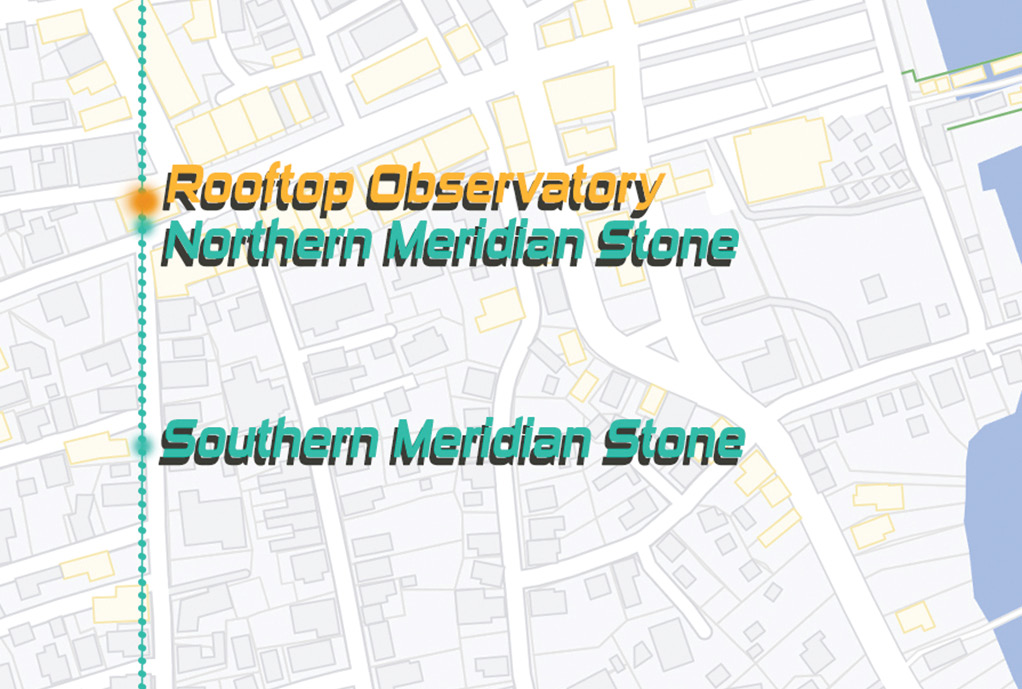
Figure 1: Map view of the meridian stones placement in relation to the Pacific Bank.
Last February I began a research project focused on understanding just what Nantucket’s Meridian stones are. It quickly became clear to me that these stones were once far more influential than they are currently believed to have been. Time has taken its toll on the stones and on the historical records of the stones. Over the course of nearly 200 years, most fact-based knowledge of their original purpose has been lost. The current perception is that the Meridian Stones were placed with the intent of being used by land surveyors as compass stones (Strelnitski 2009). Other suggested but until now unsubstantiated theories include that William Mitchell erected the Meridian Stones to aid him in rating chronometers, that ship captains would visit the Meridian Stones in order to correct their compasses and safely navigate the oceans, and that the Meridian Stones had no functional use other than being a monument to surveying and astronomy (Strelnitski et al. 2006; Orr 1995). Based on my research it seems each of the suggested uses, at best, provides a partial understanding of what the Meridian Stones are and how William Mitchell intended for them to be used. I suggest the Meridian Stones join the terrestrial with the astronomic, mark the Town of Nantucket’s first primary astronomic baseline, guided Mitchell in establishing Nantucket Mean Time, facilitated the determination of Nantucket Islands’ true geographic position, and mapped the way for safer nautical navigation.
The sun rises over the northern Meridian Stone. Image courtesy of the author.
To better understand how William Mitchell used the Meridian Stones we must realize the significance of their exact location. The northern meridian stone is positioned beside the Pacific National Bank. The southern meridian stone is positioned a few hundred feet away and is in a clear line of sight from both the northern stone and from the bank’s rooftop. Thus, if one draws a straight line passing through the center of the tip of the two Meridian Stones, the line will pass directly through the Pacific National Bank (Figure 1). In 1840 the Pacific National Bank was the location of William Mitchell’s nautical rooftop observatory (H. Mitchell 1889).
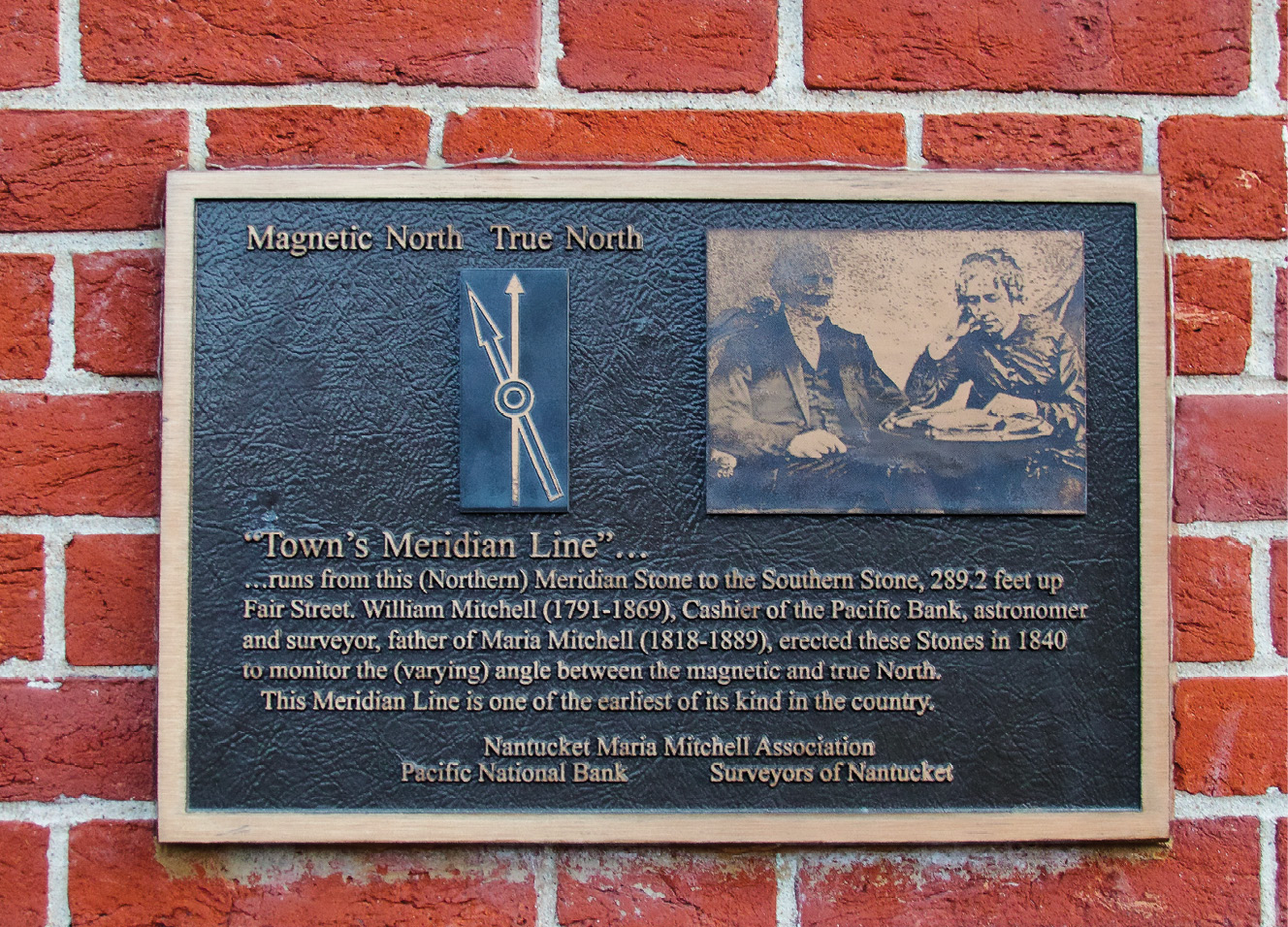
The Meridian Stones dedication plaque mounted on the Pacific National Bank. Image courtesy of the author.
The line indicated by the two Meridian Stones is a longitudinal line spanning from astronomic north to south as observed from the bank’s rooftop. This line passes through the Pacific National Bank and through the heart of William Mitchell’s rooftop observatory. Such a line is called a meridian line. It reaches from astronomic north to south and often passes through the position of an observer. In the mid-1800s, astronomy was still in its early stages, observatories were of experimental makeshift construction, and time and place were not yet unified global measures. The early astronomers spent much time dedicated to measuring the globe. Timekeeping and cartography were a primary focus. Astronomers such as Mitchell would align their telescope to the meridian of their observatory in order to accurately and precisely observe the transit of planets and stars as they crossed over the meridian line. It is from these observations one can accurately calculate local mean time, determine relative local latitude and longitude, and chart the sky, the land, and the ocean. It should furthermore be noted that during the mid-1800s large international observatories, including the Greenwich Observatory and the Cambridge Observatory of Harvard University, not only established meridian lines but also erected meridian sight marks on their meridian lines (Pond 1833; Lovering and Bond 1846). These sight marks were used by the astronomer to align the micrometer hairs of a telescope’s sight with a mark on the respective meridian sight mark thus ensuring the telescope would always be perfectly in line with the meridian line. It seems likely Mitchell similarly aligned the sight of his telescopes to the vertical markings on the southern meridian stones, thereby suggesting the Meridian Stones are meridian sight marks. In essence, the Meridian Stones are the grounding markers of Mitchell’s astronomical observations. But let’s look a little closer at how this applies to the current and past perception of how William Mitchell used the Meridian Stones.
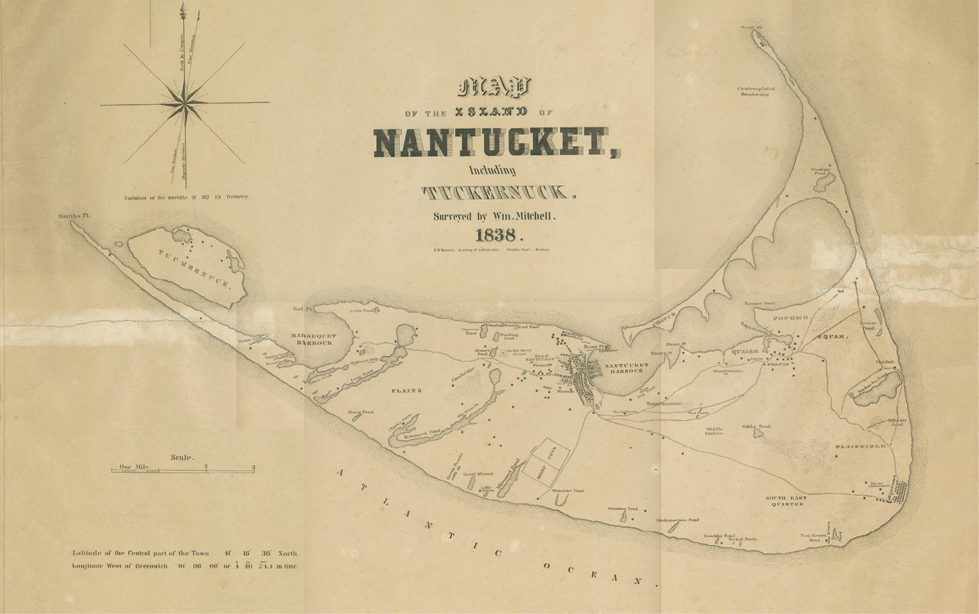
Figure 2: Map of the Island of Nantucket, Including Tuckernuck, William Mitchell, 1838, in the Map & Chart Collection, Nantucket Historical Association.
Calculations in William Mitchell’s astronomical journal indicate he calculated the position of the Meridian Stones in 1836 from the rooftop of the Pacific National Bank (W. Mitchell 1845). Their latitude and longitude appear to be the same as the latitude and longitude of the Town of Nantucket as presented on the first accurate map of Nantucket town, as surveyed by William Mitchell, and printed in 1838 (Figure 2) . Thus, it appears the Meridian Stones represent a surveyor’s baseline. Compass Stones are one of several types of land surveyors’ baselines. They are set in local astronomic north-to-south alignment and are intended to aid surveyors in accounting for the influence of the earth’s magnetic field variations on their compass needles. Mitchell knew accounting for magnetic field variations was essential when one wished to make consistent and repeatable land measurements. If Mitchell erected the Meridian Stones for this purpose, it seems likely there may once have been a third stone placed between the northern and the southern stone.
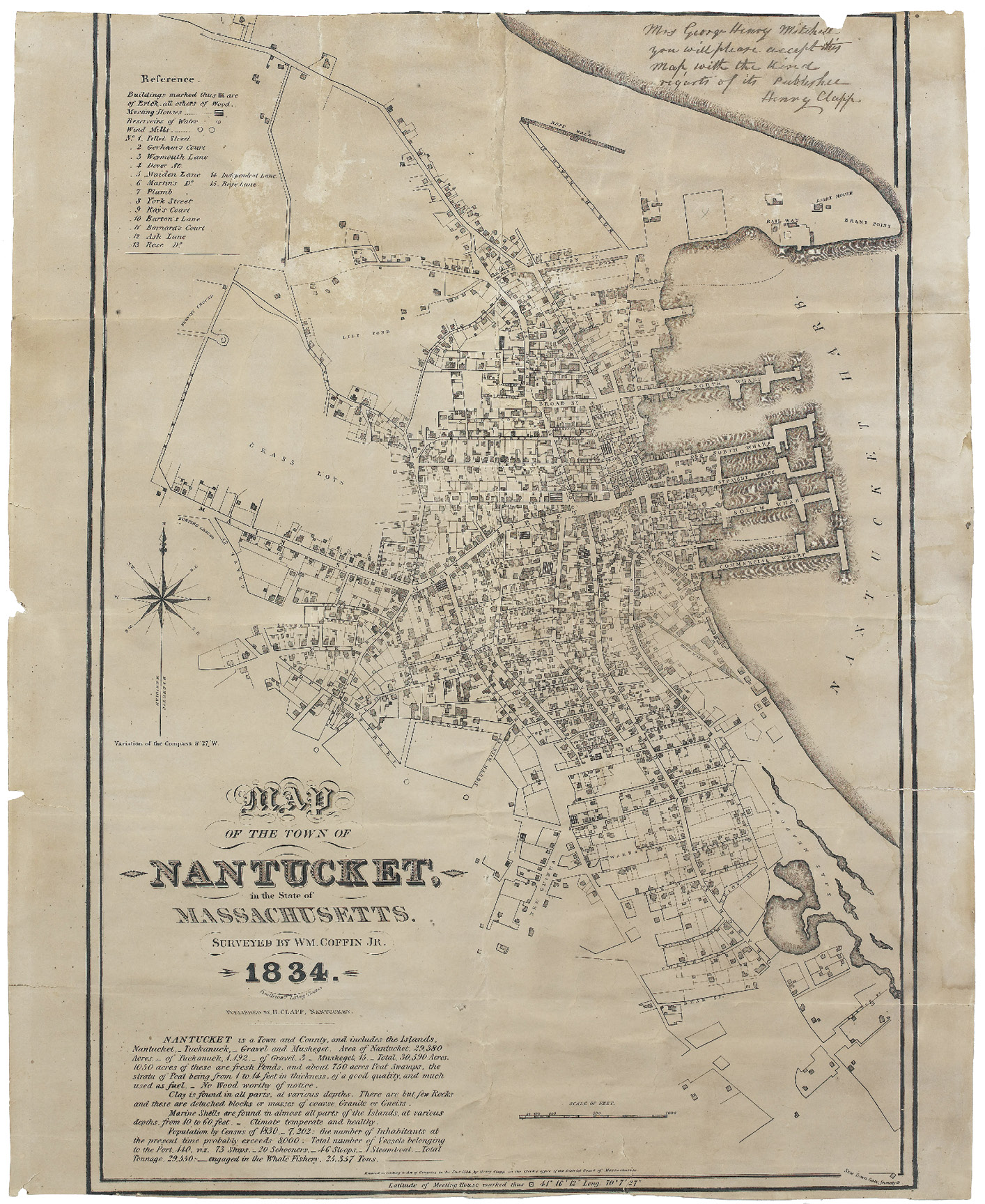
Map of the Town of Nantucket in the State of Massachusetts, William Coffin 1833, in the Map & Chart Collection, Nantucket Historical Association.
Chronometers are seafaring clocks designed to withstand the harsh conditions of a long ocean voyage while continuing to maintain a dependable and consistent time. Before modern navigational technology, a ship’s captain would have depended on accurate chronometers in order to determine the latitude and longitude of a ship while at sea. It is nearly impossible to safely navigate shallow ocean waters without knowing a ship’s exact geographic position. We know William Mitchell rated chronometers for ships captains long before he established his nautical rooftop observatory. A chronometer is rated by comparing the passage of time given by the chronometer to a known local mean time. This must be repeated over the course of several days, at the same exact time every day. The goal is to obtain a set value for how much time the chronometer gains or loses each day. By establishing a rooftop observatory, Mitchell was able to calculate Nantucket Mean Time far more accurately than before. With this consistent and dependable local reference time, he was capable of rating chronometers far more precisely. This is reflected in his astronomical journal where one will find Mitchell rated chronometers to Greenwich Mean Time prior to 1840 and at later dates began rating chronometers to Nantucket Mean Time (W. Mitchell 1845). Thus, the Meridian Stones directly assisted Mitchell in rating chronometers to the highest standard.
The sun rises over historic Main Street. Image courtesy of the author.
Assuming the Meridian Stones are compass stones, it seems plausible ship captains would have visited the stones to check the local magnetic field variation. By doing so a captain would be able to more accurately read local nautical maps depicting Nantucket’s near-lying treacherous shoals. During the mid-1800s the shoals off of Nantucket’s coast were a deathtrap for many a large seafaring vessel. The geographic location of the shoals was poorly documented and to further complicate the task of safely navigating in and out of Nantucket Harbor, Nantucket’s known geographic position was also of questionable accuracy. Mitchell recognized the dangers of Nantucket’s shoals and brought this to the attention of the Coast Survey. His suggestion to map Nantucket’s near-lying shoals was taken seriously by the Coast Survey who responded immediately. One of the first tasks at hand would be to determine the exact geographic location of Nantucket Island. This task was appointed to William Mitchell (Bache, U.S. Congress. House, et al. 1845). Thus, Mitchell continued to track the stars as they transited the meridian line of his observatory in order to determine Nantucket Islands’ exact geographic position and assist the Coast Survey in accurately charting Nantucket’s treacherous shoals.
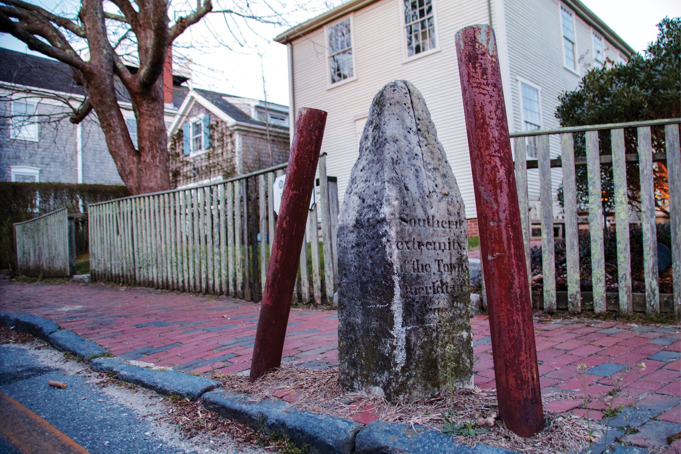
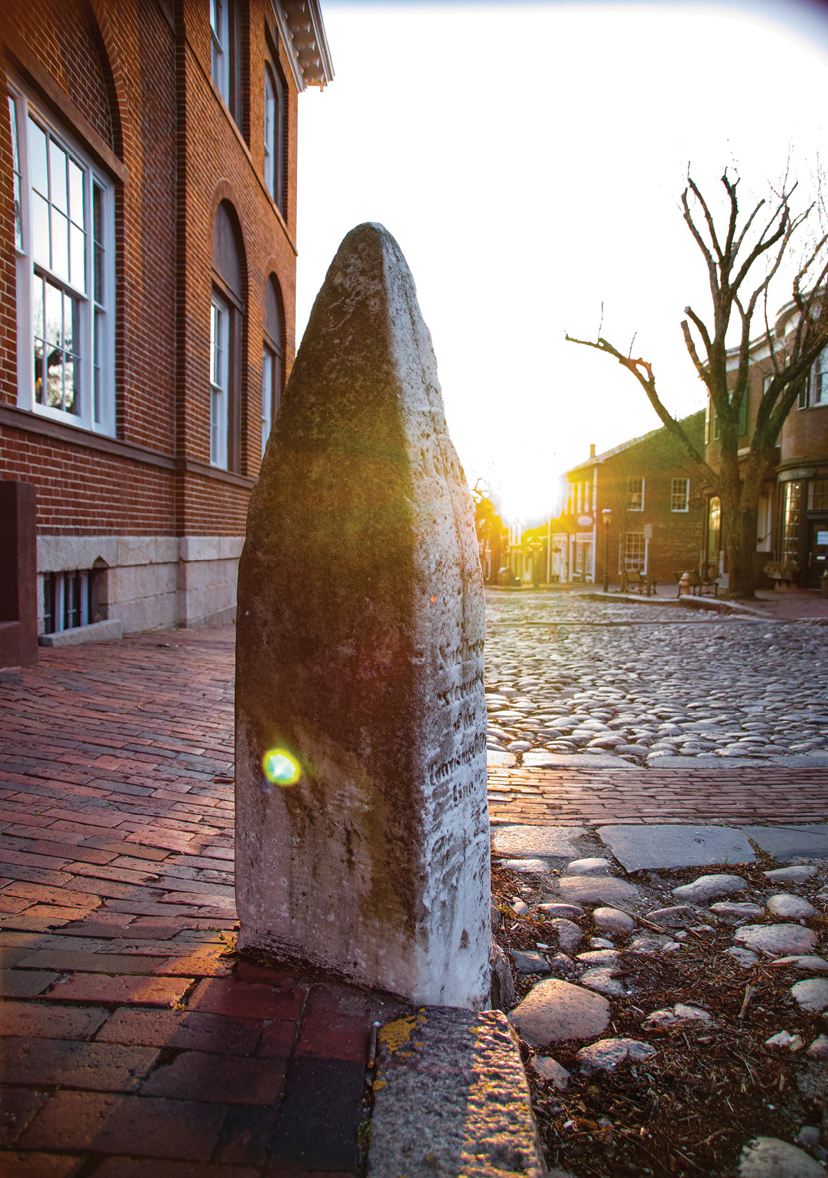
The southern Meridian Stone as it currently stands on Fair Street. Image courtesy of the author.
With respect to the notion that the Meridian Stones were erected simply as a monument to science, this can hardly be considered accurate. However, as the stones still stand today, they are a reminder of past scientific advances and a monument to William Mitchell. It seems only right to recognize the Meridian Stones for what they truly are and to protect them from further damage in order to honor Mitchell’s vision and his significant contributions to the advancement of seafaring safety.
Please visit www.meridianstones.com if you would like to protect William Mitchell’s Meridian Stones and help save a significant piece of New England’s history.
Nikoline Bohr is a scientist, a historian, a treasure hunter and an artist. She has a BS in Physics from Rensselaer Polytechnic Institute. With a scientific core and a treasure hunters taste for adventure Bohr explores our collective past with hopes of aiding a brighter future. Her current work focuses on preserving Nantucket Islands complex and fragile history for coming generations to appreciate and learn from.
This article is a just summation of my initial research on the Meridian Stones.
Forever dedicated to my beloved and wise grandmother Dorothy Hesselman.
I would like to extend a thousand thank-you’s to the Maria Mitchell Association for granting me access to William Mitchell’s journals and letters, and to the Nantucket Historical Association for providing a wealth of historical documents to browse.
—————————————————————————
———. 1845. “Astronomical Journal 1847 with Letters.” Nantucket Maria Mitchell Association. Mitchell Family Papers, Series The W. Mitchell Family a. William Mitchell, Box 2, Folder, 4,. Nantucket Maria Mitchell Association.
The Inquirer and Mirror. 1921. “Damage Leads to Queries.,” January 1, 1921. https://bit.ly/3HpwGeZ.
———. 1964. “Summer Visitor Notes Meridian Stone Twist,” July 30, 1964. https://bit.ly/3pnsh6j.