Carlson Software has greatly expanded its product line over its 38-year history, and recently has introduced two new products that represent technology breakthroughs: Carlson PhotoCapture and the Carlson Mini Locator 2 (xML2).
The Recent Evolution of Survey Technologies
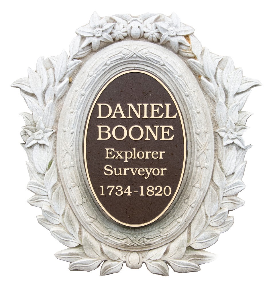
 Measurement technology for surveying and mapping rest today on 3 pillars: GNSS and the real-time kinematic (RTK) engine, image-based (pixel-based) mapping and laser-based measurement. Many of us can recall measurement by steel tape back in the 1970s, in association with horizontal and vertical angles from theodolites. This method of measurement existed since the time of Daniel Boone and George Washington and lasted for hundreds of years.
Then along came lasers in the late 1970s giving us total stations. Then GPS arrived initially from Trimble, and through the genius of the late Javad Ashjaee, the survey world obtained the RTK engine for instantaneous positioning. Then in the last 15 years, image-based mapping from drones made its debut. Carlson Software offers all three of these fundamental technologies in the form of laser-based products provided at present primarily for mining applications, image mapping through PhotoCapture, GNSS through the highly popular Carlson BRx7 and now Carlson introduces combined image/GNSS technology in the form of the xML2 trench mapping solution.
Carlson Photo Capture (CPC) and the xML2 “Mini Locator”
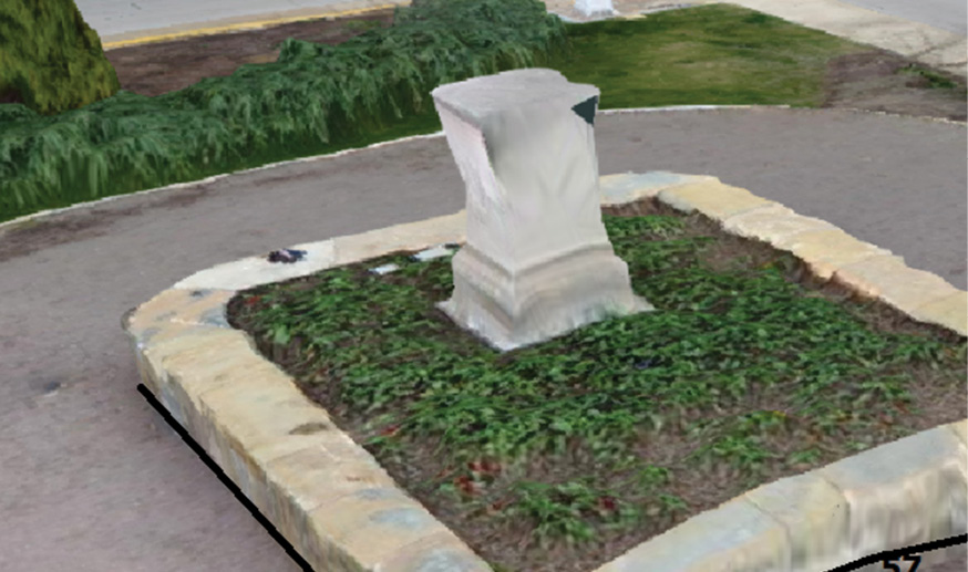
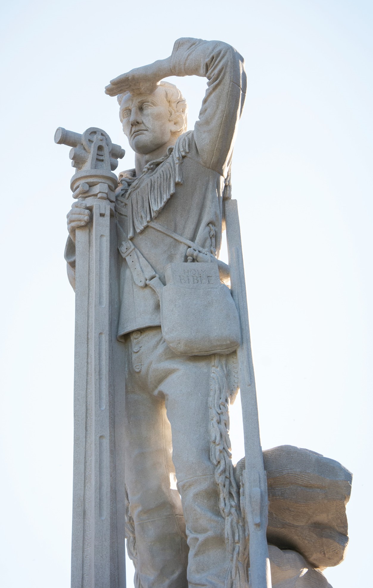
Pedestal for Daniel Boone, mapped in 3D by PhotoCapture. Pick on map using Polyline option at right, then draw to CAD. Note “Bare Earth” feature, where tree branches are flattened to ground level.
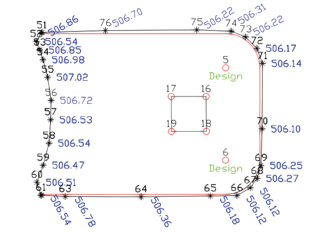
Example 1: Design in Red, As-built CPC-drafted Line of Daniel Boone Statue Island in black, in CAD
In order to understand the technology used in the xML2 Mini Locator solution, it is important to begin with CPC and image processing. Although the 4 main competitors (Pix4D, Drone Deploy, Datumate and Agisoft) were first on the scene, Carlson PhotoCapture offers a unique and seamless integration of this rare pixel analysis technology with the highly popular Carlson SurvPC, Carlson Survey and Carlson Point Cloud product offerings. SurvPC is used for ground control, then Carlson Survey and PhotoCapture combine for powerful field-to-finish symbol and linework mapping and finally, the Carlson Point Cloud module takes over for feature extraction ranging from paint stripe mapping, 3D tree/pole detection, 3D curb and gutter mapping and building perimeter identification. These in turn lead to precise, high-quality contouring of as-built sites.
Mapping of Trenches with xML2 and CPC
Example 2: Draw EOP (road edges) in 3D within PhotoCapture
Trenches are complex. There are issues of pipe clearance (as below).
Regulations have to be strictly followed. The time is right for accurate trench measurement, at low cost, using high technology. The time is right also for “technology fusion” to accomplish this task. With xML2, an Android phone or Android tablet, costing as little as $100, can be used with Carlson Layout to snap photos as you walk the trench. No drone is involved. As each photo is taken, a GNSS (GPS) satellite reading is taken at the same time, georeferencing the photo. The Carlson RTK engine in Layout is computing the position instantaneously from the GNSS receiver in the xML2 unit. Heights and tilts are computed, and relative accuracy is 4 to 5 cm on the entire ditch in terms of excavation depths and alignments. With 2 or more ground control points taken by photo, with known position, absolute accuracy can reach centimeter level. Trench alignments and widths in this way can be archived for all-time, confirming satisfaction of regulations and proper bedding and alignment.
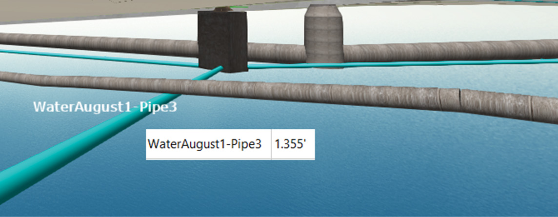
Sanitary Sewer Lines in blue underneath Water Lines and alongside Storm Sewer Lines
The xML2 collects the GNSS signal by the helix antenna and communicates to the Android phone running Layout by Bluetooth. Photos are taken from the Android phone by the press of a handheld button. The georeferenced images are then fed into PhotoCapture, and processed into final maps and 3D images that can be delivered to CAD and GIS solution platforms.
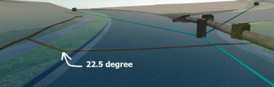
Regulations even govern pipe deflection angles between pipe segments, and allowable fittings
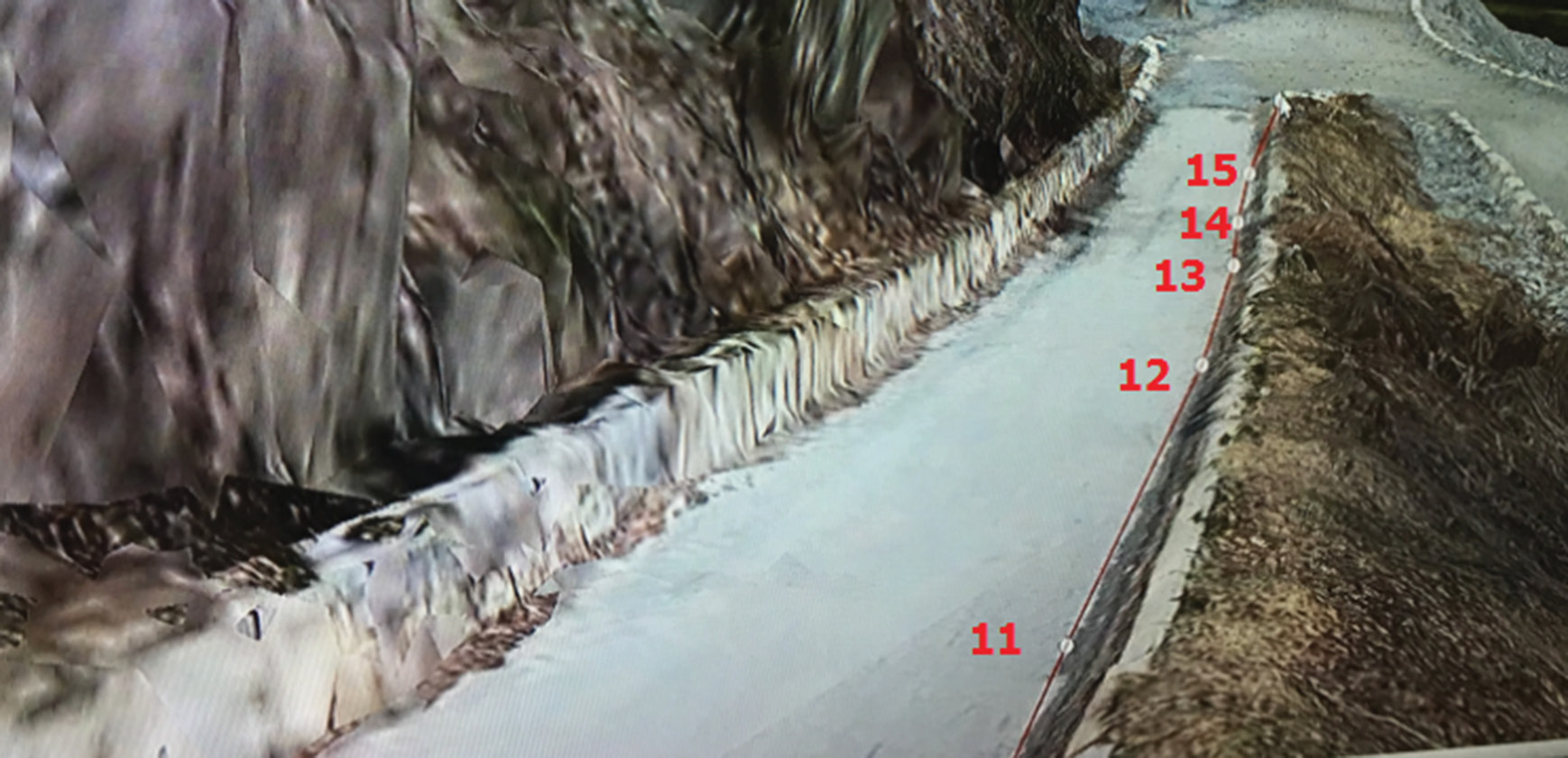
The trench below illustrates a fully georeferenced 3D map of multiple utilities placed in a trench, archived for all time. Note the presence and recording of 6 different utility pipes and conduits of two distinct types, separated by concrete block, meeting regulations in this case. The mapping can be stored in CAD form as plan and profile and also archived in 3D form. Trench mapping can be conducted at all stages of construction: initial trench excavation as above, then after bedding is placed, then with pipes in place as below, and finally with full backfill applied to the trench.
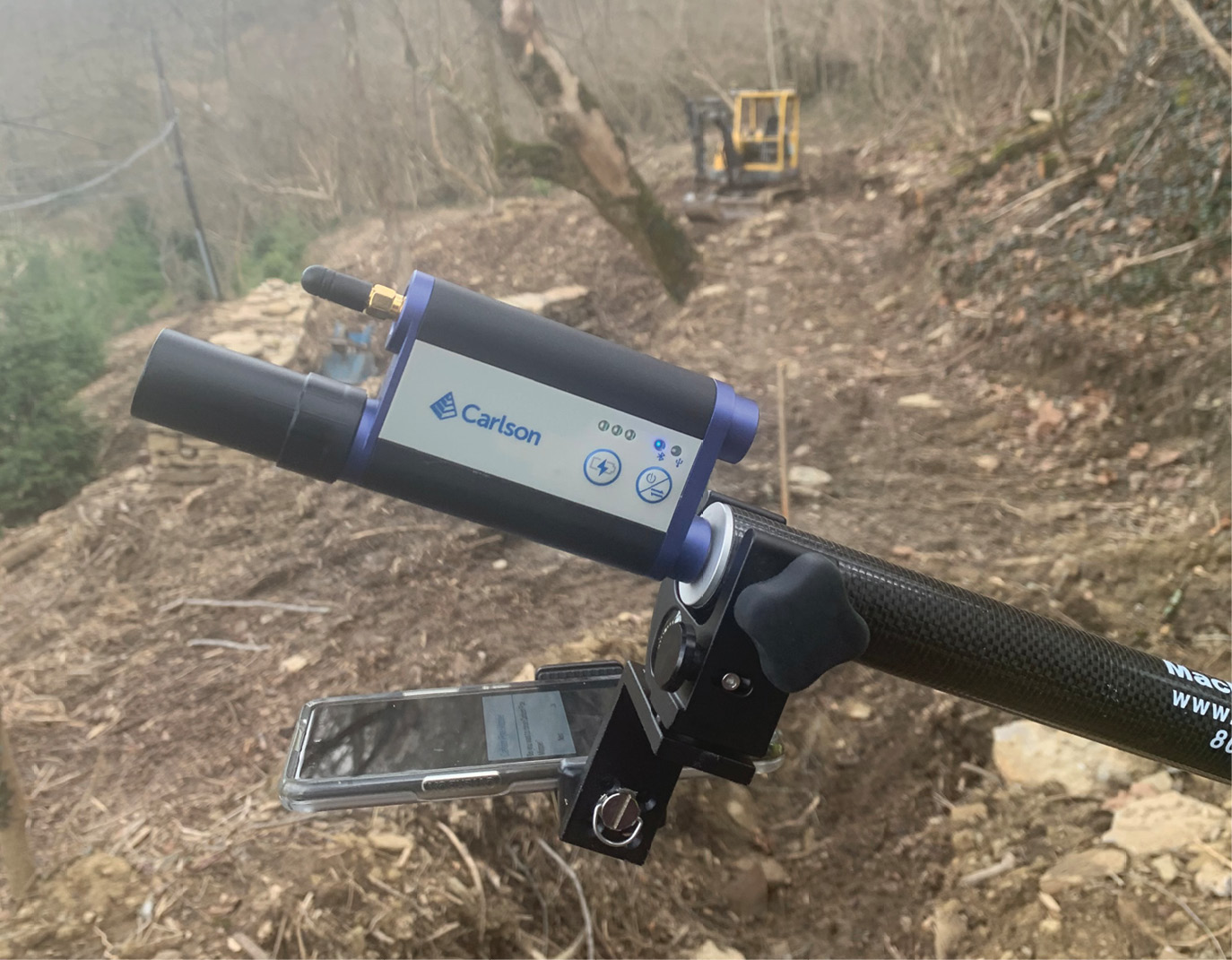
The Carlson xML2 system consists of any Android phone with photo capability mounted as shown, along with the top- mounted xML with buit-in GNSS. Carlson Layout on Android provides the RTK engine. No cables or wires are involved.
All across the globe, utilities are going underground, and the mapping and recording of pipe and utility locations is becoming critical to record keeping, GIS mapping and pre-construction site analysis. With xML2, and the processing of PhotoCapture, trench mapping becomes highly automated, and the process of mapping becomes as easy as walking alongside the trench, snapping photos, using the extremely effective xML2 system.
It took the convergence of multiple new technologies, including GNSS-based measurement and image-based processing, with links to CAD and GIS, to make this possible at low cost. Happy trench mapping!