 Maysville, Kentucky, USA (December 30, 2021)– Carlson’s latest releases of Survey, Civil, Hydrology, GIS, CADnet, Construction and Point Cloud provide time-saving features for common tasks.
In Carlson Civil and Hydrology 2022, updates to the Utility Network command now provides the ability to run collision checks, check surface model clearances, and label clearances, providing an automated workflow for identifying and labeling possible interference points.
ParkingNET’s features have been expanded to include designing along a polyline or centerline alignment file with support for angled parking, as well as the creation of islands and corner options.
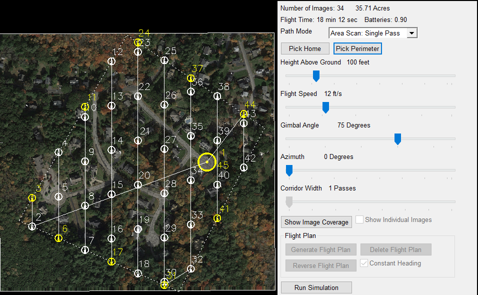
In Carlson Survey and GIS 2022, GIS now features an updated and improved user interface. The new Drone Mission Planning that lets you create and upload your drone flight plan directly from your desktop.
Input/Entry Distance Scale Factor is designed to allow users to specify a combined scale factor that converts line segments from grid to ground or ground to grid, as they are entered. Updated processing in the Edit/Process Raw Data editor that stores lat/long and RMS values as attributes for each point, allowing quick review of GPS records.
Automatic TIN (surface model) creation directly from the Draw Field to Finish command now lets users produce points, lines, symbols, annotations, and contours with a single click, while the enhanced Field to Finish Pipe Feature that allows settings by code and works directly with the hydrology module to create pipe profiles. There’s also an updated option to screen pick points for Deed Correlation making data entry much easier.
Carlson Point Cloud 2022 introduces several powerful new features including the identification and extraction of overhead power lines as polylines. Also new is the ability to create separate Bare Earth and Above Ground clouds, and the new ability to perform feature extraction on point clusters in an Above Ground cloud, including curb breaks, paint stripes, buildings, fences, poles, and trees.
Along with Carlson Survey, Civil, Hydrology, GIS, CADnet, and Point Cloud, Carlson Software is also releasing the 2022 versions of Carlson Carlson GeoTech, Carlson Trench, Carlson Construction, Carlson Mining, and Carlson Natural Regrade, all featuring their own industry-specific improvements.
Lead the field with Carlson 2022, now available for upgrade or new purchase. Bundle these modules together and save through the customizable Select Suite (carlsonsw.com/purchase) or the Carlson Civil Suite (carlsonsw.com/civilsuite). For more information about other enhancements in this new release, visit the Carlson 2022 webpage, (www.carlsonsw.com/2022).
About Carlson
Founded in 1983, Carlson Software Inc. specializes in CAD design software, field data collection, laser measurement and machine control products for the civil engineering, surveying, GIS, construction, and mining industries worldwide, providing one-source technology solutions for the entire project cycle. Carlson Software is headquartered in Maysville, Ky., U.S.A., with branch offices in Boston, Mass.; Almere, The Netherlands; Brisbane, Australia; Ottawa, Canada; and York, England.
