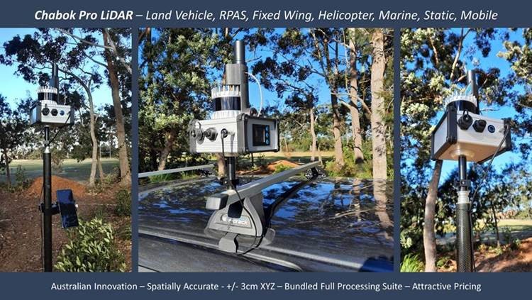
 Chabok Pro LiDAR
Chabok Pro – Chabok Pro MLS (LiDAR) – First System Sold,
Land Vehicle, Boat. Aircraft and RPAS Integration, +/-3cm XYZ, GNSS/IMU/Software Bundle, accepts different scanner units, Ouster, Velodyne, Reigl, Hesai, Quanergy etc – High Acquisition Speed! Australian Integration and Software…
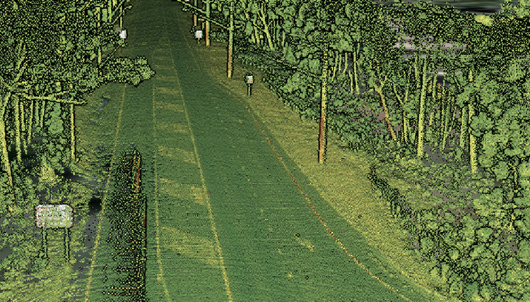
Ssx Inlet LiDAR Data Example
Make It Accurate
Klau Geomatics has launched a hybrid PPK/PPP processing service. The processing engine is accessible via a pay-per-use web interface or API.
Make It Accurate | GNSS IMU Processing
 KLAU PPK – RPAS and Light Aircraft/Helicopter GNSS+
The Klau Geomatics PPK hardware and post-processing software has been in development for over 4 years and is regarded as the most sophisticated, accurate and reliable solution in the industry.
KlauPPK | PPK PPP Positioning Systems
4DMapper
4DMapper is a cloud platform to manage, visualise and collaborate with geospatial data. We have also grown to an powerful Enterprise version with a patented CAN solution for larger organisations, offering enhanced security, connectivity, and software interoperability.
4DMapper | Geospatial Framework
