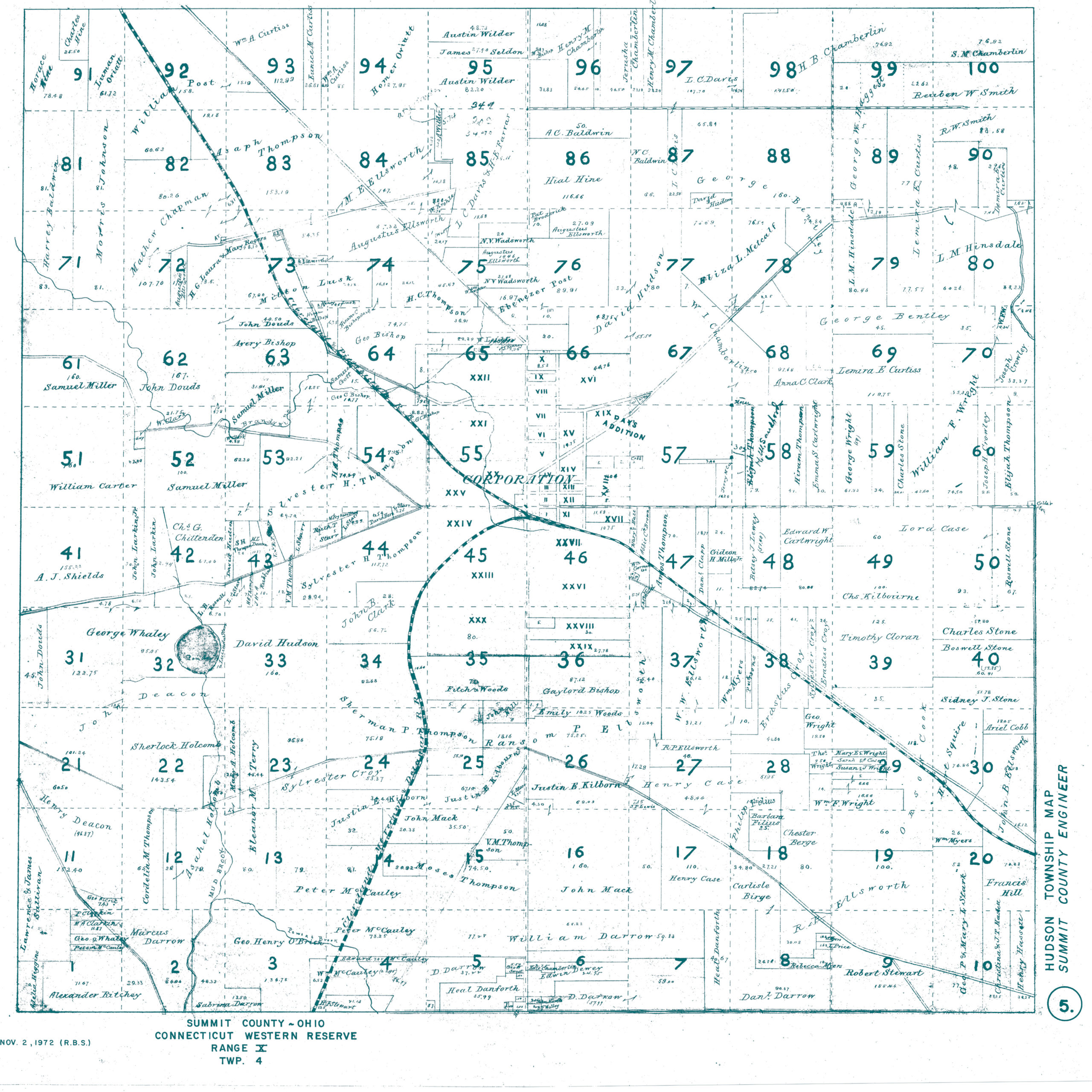
Plat of Hudson Township. Courtesy of the Summit County Engineer, Akron, Ohio.
On Monday, April 13th, 2020, I was granted an offer letter from the University of Akron for a full-time faculty position. I was given the opportunity to give back and teach at the great University who gave me the surveying education I worked so hard for 20 years prior. The decision was a difficult one, a life changing one. We had three small children, a large farm, and a new house. We had great jobs and great friends. We chose to walk away and start fresh leaving our jobs, our friends and the State of Michigan. I chose to abandon my commute which crossed not only the current Ohio/Michigan State Line, but the old one as well. We chose to settle in Hudson, Ohio—the land of surveyors, explorers, astronomers, and a passing President.
David Hudson
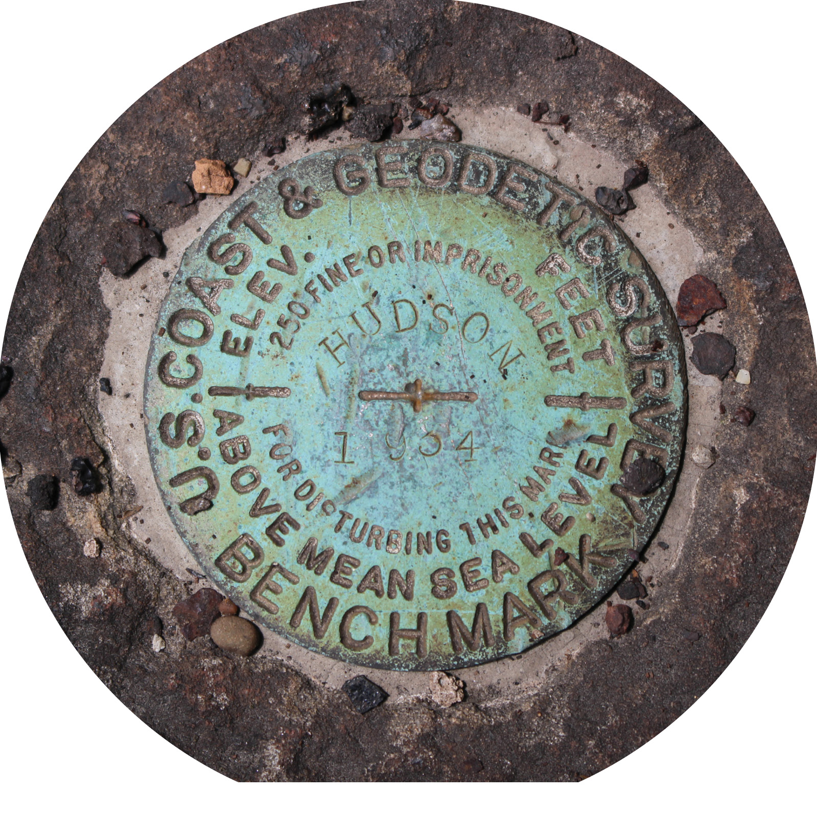
U.S. Coast & Geodetic Survey Benchmark Designation Hudson 1934, PID MB1083. Photo by the author.
David Hudson left Goshen, Connecticut in April of 1799 to survey, settle, and found Hudson, Ohio. Alongside, Birdsey Norton, and others, they purchased thousands of acres of land in the newly formed Connecticut Western Reserve. Although technically in Northeast Ohio and part of the Northwest Ordinance, the land was reserved for Connecticut. This land was sold to the Connecticut Land Company and comprised roughly 3 Million Acres. From there the land was further surveyed and subdivided in five-mile square townships with the Meridian being the West line of Pennsylvania and the Baseline being the 41rst degree of North Latitude. Connecticut’s claim was about 71 miles wide and extended 120 miles West of Pennsylvania. The remainder was ceded to the Federal Government for relinquishment of debt after the Revolutionary War, as their original claim extended West to the Pacific Ocean. The West line of Pennsylvania (Meridian) was surveyed by legends like Andrew Ellicott, David Rittenhouse, and others. The South line of the Connecticut Western Reserve (Baseline) was intended to lie on the 41rst parallel, but surveyor Seth Pease introduced some error and did the best he could at the time. Prior to settlement and subdivision there were also groups of initial surveyors sent to explore the new territory. This included names like Moses Cleaveland (City of Cleveland) and Joseph Tinker (Tinker’s Creek). Tinker drowned while piloting a boat on an early surveying expedition in late 1797.
When Hudson, and others, first left Goshen they followed Indian trails on the most direct route to Irondequoit Bay on Lake Ontario, present day Rochester, New York. This was roughly a 300-mile journey. They then took flat row boats across Lake Ontario, portaged Niagara Falls and across Lake Erie to the mouth of the Cuyahoga River, now present-day Cleveland. During this time, they encountered massive ice floes, rolling waves and thieves. They paddled upstream until the Cuyahoga became ankle deep by Brandywine Falls. Hudson then traveled by foot, heading Southeast, and searched feverishly for the Southwest corner of Township 4 North, Range 10 West, later to become Hudson Township. This corner was set by Nathan Redfield in July of 1797 during the subdivision of the Reserve. Hudson found the corner on June 17, 1799 and proceeded to the center of his township. Although each township in the Reserve was further subdivided differently, this township was divided into 100 square lots. The village of Hudson was chosen to lie within lot 55 and 56 in the dead center of the township. Hudson surveyed the area and laid out the village in typical New England style with an extensive village green, or town center, with roads radiating thereafter. This closely resembled the towns surrounding Goshen like Branford, Litchfield, Winchester and Warren. Hudson traveled back to Connecticut that November and quickly returned with his family and an allotment of settlors eager to start a new life in the West. David’s wife soon gave birth to their eighth child, being the first white child born in Summit County, Ohio. Furthermore, David’s original 1806 house still stands and is the oldest structure in Summit County. Hudson continued to grow and became home to the Western Reserve College, also known as the Yale of the West. Today, the remarkable City of Hudson is home to a vibrant residential, commercial and industrial community that is highly sought after in Northeast Ohio.
Elias Loomis
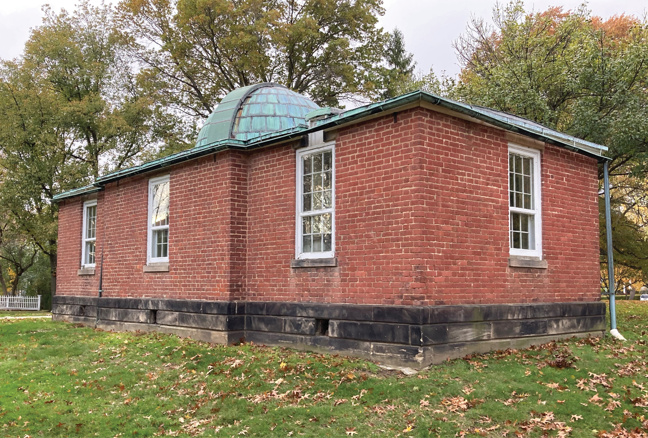
The 1838 Loomis Observatory on the Campus of Western Reserve Academy, Hudson, Ohio. Photo by the author.
David Hudson was instrumental in bringing the Western Reserve College to Hudson. He petitioned the State of Ohio long and hard to have the University built in Hudson. Hudson himself donated 160 acres in his township that would be sold to jumpstart the school. The school was architecturally designed and built after Yale, especially the Old Brick Row. To meet the high standards of Yale, the administration had to hire the best. They hired Elias Loomis. Loomis was a genius; he was the best. He attended Yale at the age of 14 and excelled. He was hired away from Yale to be the new chair of Mathematics and Natural Philosophy. The College sent him to Europe to study astronomy and purchase the necessary supplies to build a world class observatory. Loomis bought a transit, equatorial telescope and a sidereal clock. When he returned, he designed and had built an astronomic observatory with his equipment in mind. It is a quaint brick structure, designed by the same architects that aided with the original College buildings. The building measures 37 feet long and 16 feet at the widest portion. It has a sandstone foundation and one-foot thick brick walls. The transit room, with its 15-inch wide opening in the roof, lies to the East end. It has a massive cut piece of sandstone in the center of the room lying six feet below grade. The block of stone is totally detached from the building itself.
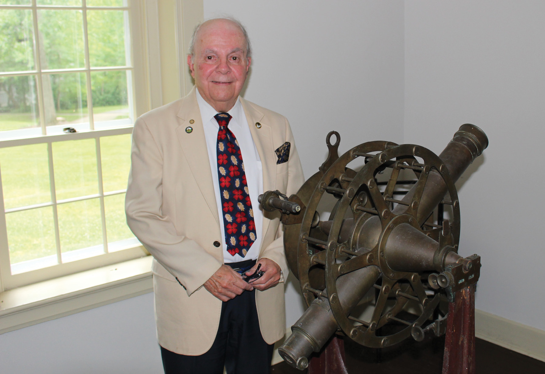
Western Reserve Academy Archivist & Historian Tom Vince with the 1837 Troughton & Simms Transit. Photo by the author.
At the time of its installation the transit had an unobstructed view of the night sky. The transit has a 30-inch focal length and was purchased in London. The center room, under the copper dome, is a 5.5 feet focal length equatorial telescope atop a ten feet diameter raised sandstone column, also six feet below grade and detached from the building. Both instruments are from London and are Troughton and Simms. The clock was also purchased in London and was built by Robert Molyneaux. The clock was visible between the walls of the East and center room so it could be used with both instruments. Loomis thought of everything here and spent the next seven years of his life observing the stars in this small building. He determined, with the greatest precision, the latitude and longitude of the instruments.
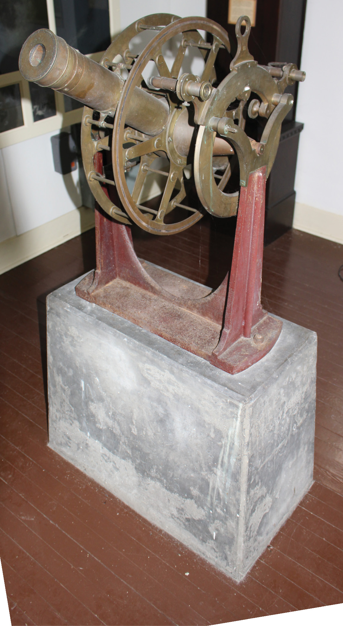 At this time measuring Longitude by Telegraph was not an option, as he had to rely on the clock. He calculated that he was 5 hours, 25 minutes and 42 seconds West of Greenwich. Currently there is a first order position on the center of the equatorial telescope as established by the National Geodetic Survey (PID MB2757) in 1977. The published Latitude by Loomis is perfectly accurate, and the longitude differs by 44 seconds, which equates to only 3 seconds in actual time and is well within explanation for an sidereal clock in 1838. Loomis went on to publish multiple textbooks on algebra, geometry and trigonometry, selling upwards of 600,000 copies. One of his most famous was Elements of Plane and Spherical Trigonometry with their applications to Mensuration, Surveying, and Navigation. The little observatory is still there today and is oldest observatory in the United States still standing on its original foundation. Hopkins Observatory at Williams College, Massachusetts was the first by three months but has been relocated multiple times.
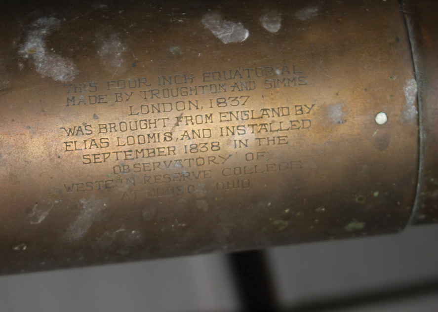
Engraving on the 1837 Troughton & Simms Equatorial Telescope. Photo by the author.
The College was politically acquired in 1882 and relocated to Cleveland and eventually renamed Case Western Reserve. Western Reserve College became Western Reserve Academy, an independent, coed, boarding and day school. In 1903 the Academy closed due to financial difficulties. It was not until 1916 that the doors reopened thanks to local coal multi-millionaire James Ellsworth. It would be his son, Lincoln, who would go on to be a Polar Explorer—hence the school’s symbol—the Hudson Explorers.
Lincoln Ellsworth
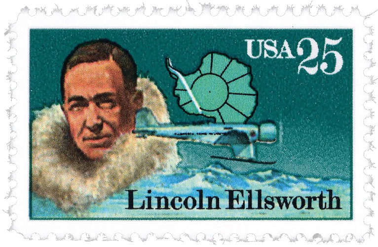 Lincoln Ellsworth was born in Chicago but grew up in Hudson. One of his early idols was Ernest Shackleton for his polar explorations. He grew to become a railroad surveyor in Canada and then surveyed in his father’s coal mines. At first his father refused to entertain the idea of Lincoln being a Polar Explorer, but later in life donated $85,000 to fund his first, failed, polar expedition. Alongside Roald Amundsen and crew, Ellsworth attempted to fly over the North Pole in a pair of Donier-Wal flying boats, named N24 and N25, but due to mechanical issues were later rescued. Ellworth would not give up though. After his father’s passing, Lincoln dedicated his large inheritance to Polar Exploration. His next mission he successfully flew the airship Norge over the Arctic Ocean and the North Pole. Later, he would retrace the steps of Polar Explorer Richard Byrd and explore the Antarctic. Ellworth bought a Norwegian ship, renamed the Wyatt Earp, and a new plane named the Polar Star. After multiple attempts he flew over Byrd’s Little America and then landed and placed an American flag in the snow and claimed Ellsworth Land. He continued flying and landing, for a total of almost 2500 miles and being the longest transantarctic flight in history, at the time. Lincoln was awarded multiple prestigious metals, mostly for discovering two mountain ranges and helping the United States claim 350,000 square miles of Antarctic Territory. Today the Antarctic Ellsworth Mountains and Lake Ellsworth are named after him as well as the former Antarctic base Ellsworth Station. The Ellsworth Mountains are the highest mountains in Antarctica and Lake Ellsworth is a hidden, natural freshwater subglacial lake only recently discovered in 1996. The Polar Star was brought back to New York on the Wyatt Earp and rests today at the Smithsonian National Air and Space Museum in Washington, DC.
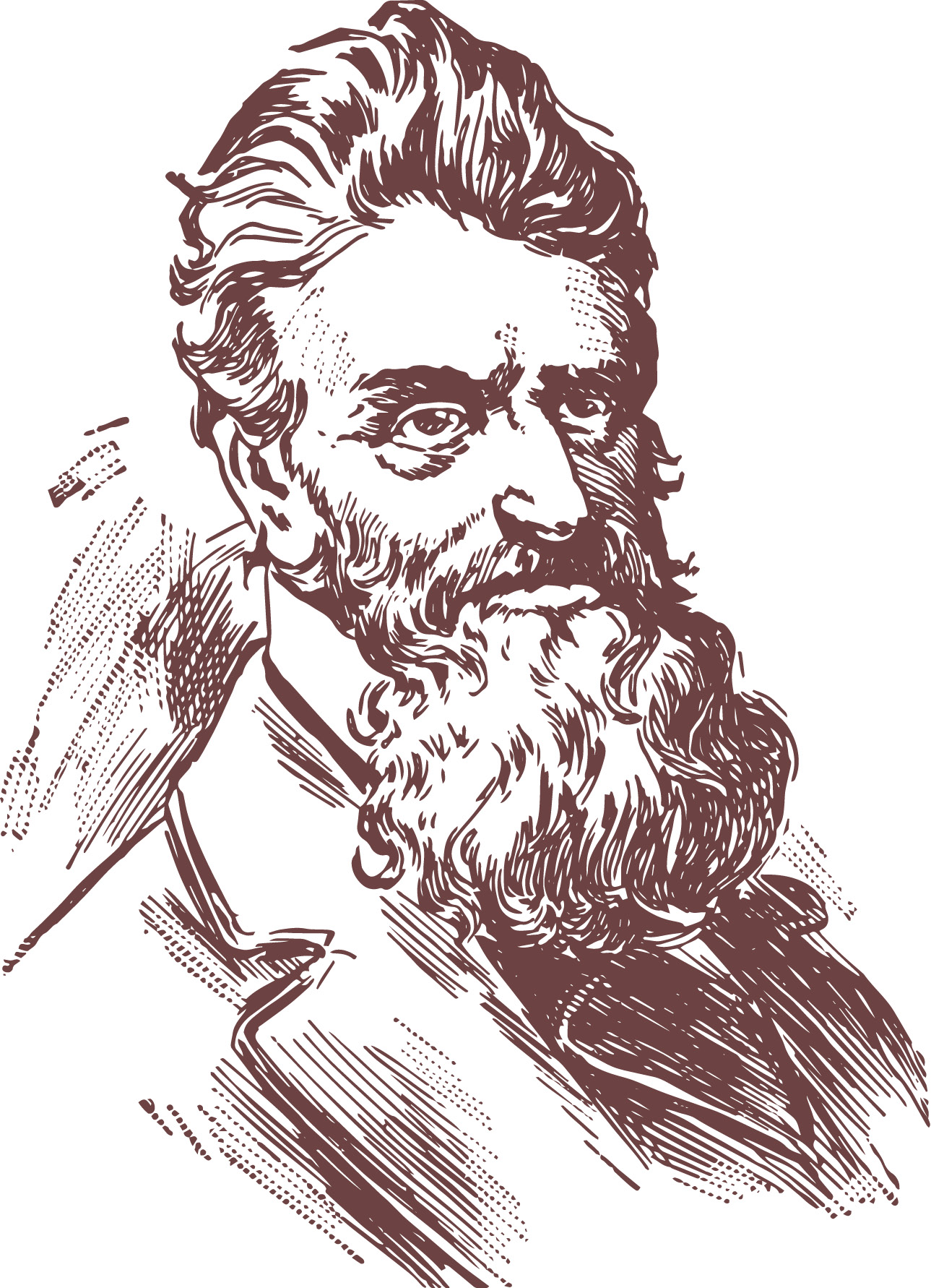
John Brown
John Brown. shutterstock.com ©Morphart Creation
John Brown came to Hudson with his parents when he was five years old. As a teenager, John taught himself how to survey by reading Abel Flint’s A System of Geometry and Trigonometry, with a Treatise on Surveying. In the early 1850’s he moved to Kansas employed as a land surveyor to gain knowledge of pro-slavery movements. At this time government surveyors were assumed to be pro-slavery, so this let John in as a spy. Sparked by the assault of abolitionist Charles Sumner on the floor of the U.S. Senate, Brown and his sons brutally murdered five pro-slavery men on the banks of the Pottawatomie Creek. This incident led to the “Bleeding Kansas” period between both sides of the slavery movement. Brown was good friends with Henry David Thoreau and they met and wrote extensively up to John’s raid on the Federal Armory in Harper’s Ferry, West Virginia. John was captured, tried for treason and subsequently hanged soon thereafter. His radical beliefs of violence against the pro-slavery movement, and his death, no doubt changed the opinion of many. Lincoln at the time watched Brown cautiously. Although they both agreed on the same end goal, they had far different ways of going about it. Some say that John Brown started the war that ended slavery and that President Abraham Lincoln finished it.
Abraham Lincoln
The views of Abraham Lincoln were clearly tainted not only by John Brown, but by the story of Captain James Riley in Sufferings in Africa, the Incredible True Story of a Shipwreck, Enslavement, and Survival on the Sahara. Riley’s narrative was one of Lincoln’s favorite books as a child. Lincoln was elected President of the United States in 1861, less than two years after John Brown was hanged. Lincoln was a well-known, and well-respected surveyor in his early career. Aboard the Lincoln Inaugural Train, on the Cleveland and Pittsburgh Railroad Line, Lincoln stopped in Hudson, Ohio on February 15, 1861 to give a speech to around 6,000 on lookers. Lincoln did not say much in Hudson, as he was ill and hoarse, but to the people of Hudson it meant everything.
Conclusion
The Cleveland and Pittsburgh Railroad tracks are now long gone, but the rail bed lies literally visible across the street from our new home. There is no doubt we chose the right place to live. The rich history of President Lincoln going by on a cold February day in a snowstorm brings me warmth. As I walk past the Loomis Observatory, I think of Elias take observations all night long in that tiny building. As I drive down Owen Brown drive, I think of John Brown and his radical ways that impacted our young country. As I pick up my young son up at Ellsworth Hill Elementary, I think of Lincoln who defied his father and chased his dream of being a Polar Explorer and placing hundreds of thousands of square miles of ice on the map. Lastly, I compare myself to David Hudson, who picked up his family and left it all behind to pursue bigger dreams, dreams that include a long career at the University of Akron teaching the next generation of surveyors. I am proud to live in Hudson, Ohio—the land of surveyors, explorers, astronomers, and a passing President.