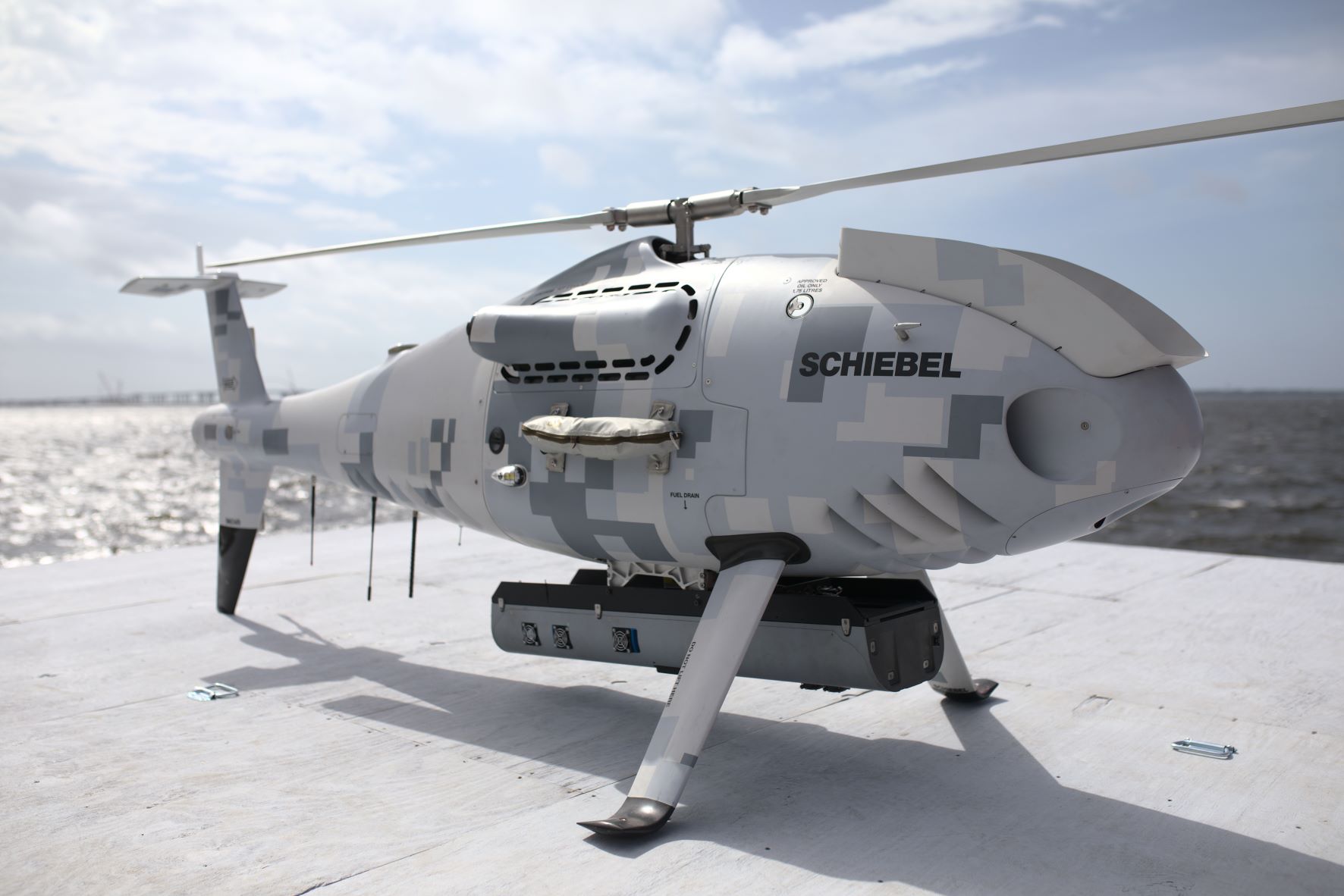
Fugro RAMMS has been successfully integrated into a Schiebel CAMCOPTER® S-100 uncrewed aerial system (UAS) for safe and fast remote coastal mapping.
Houston, Texas, US, 9 August 2021 – Fugro RAMMS, the world’s smallest and lightest ‘deepwater’ airborne lidar bathymetry (ALB) system, can now be deployed from vessels of opportunity using a Schiebel CAMCOPTER® S-100 uncrewed aerial system (UAS). The specialised UAS incorporates vertical takeoff and landing (VTOL) technology, making it an ideal nearshore and coastal mapping solution in areas that lack aviation infrastructure. Fugro technology partner and RAMMS co-developer Areté Associates proved the capability during a recent demonstration project for the US Navy in Florida. Fugro supported that effort, acquiring vessel-based bathymetry over the test site for validation of the field trial data.
In addition to extended geographic reach, the RAMMS/CAMCOPTER S-100 solution provides significant sustainability gains. With low fuel consumption, high in-air endurance and rapid rate of data collection, the new approach reduces carbon emissions by 98 % compared to large, legacy ALB systems. Other important benefits include reduced operational risk by eliminating the need for flight crew, and improved feature detection with no limits on data resolution given the system’s ability to hover over areas of interest. The RAMMS/CAMCOPTER S-100 solution is also well suited for mapping waters in high-relief areas, like canyons and fjords, where crewed, fixed-wing operations can be both difficult and dangerous.
“The ability to safely and efficiently map remote areas of the world is critical to managing the impacts of climate change and sea level rise,” said Mark MacDonald, Hydrography Director for Fugro in the Americas. “We’ve had a lot of success using RAMMS to address nearshore and coastal mapping needs in places that can support traditional airborne operations and we are thrilled to now have a truly global solution that can access more remote and challenging locations with a high degree of accuracy and in a safe and environmentally friendly manner.”
About Fugro
Fugro is the world’s leading Geo-data specialist, collecting and analysing comprehensive information about the Earth and the structures built upon it. Adopting an integrated approach that incorporates acquisition and analysis of Geo-data and related advice, Fugro provides solutions. With expertise in site characterisation and asset integrity, clients are supported in the safe, sustainable and efficient design, construction and operation of their assets throughout the full life cycle. Employing approximately 9000 talented people in 61 countries, Fugro serves clients around the globe, predominantly in the energy and infrastructure industries, both offshore and onshore. In 2020, revenue amounted to EUR 1.4 billion. Fugro is listed on Euronext Amsterdam.
