 22 June 2021 – Between the worlds of high cost commercial manned aerial mapping and professional UAV mapping, lies an alternative of affordable and accessible large scale aerial mapping option.
Using drones to capture long stretches of highway or vast expanses of detailed mapping, takes weeks of UAV survey crew time, hundreds of battery swaps, 10s of thousands of photos to manage and weeks of processing.
Commercial manned aerial mapping systems, operated by large aerial imaging companies, carry cameras and IMUs worth hundreds of thousands of dollars, capture massive volumes of data, accurately and efficiently.
Light aircraft such as a Cessna’s can be set up for aerial mapping, to achieve far greater productivity than UAVs while being simpler and less expensive than a true commercial manned aerial system.
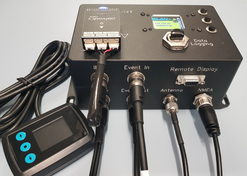
The KlauPPK gives you the ability to integrate with existing equipment, connecting to whatever cameras/ sensors and IMUs you already have. Including as standard a Pixhawk IMU integration to compute the lever arm correction. This applies aircraft tilts to the offset between the GNSS antenna and camera for each photo to get the highest possible accuracy. The system logs IMU data with full constellation GNSS logging, which means more data for better accuracy and reliability.
With the KlauPPK, the issue of proximity to CORS stations is eliminated, using high accuracy hybrid PPP/PPK post processing. Other user-friendly aspects include a remote display and menu controls for pilot visibility and compatibility with external flight management systems to share GNSS data. Another cost saver is the upgrade pathway for existing customers, where early units can be brought up to this full new spec.
With or without a gimbal, a high spec DSLR with the right lens can capture high quality data with their large sensors at a GSD often comparable to that of a UAV survey. You can carry any sensor or cluster of sensors you like, there’s no weight limit or calculation of minutes of flight time between battery swaps. Just fly.
About KlauPPK
Klau Geomatics PPK hardware and post-processing software has been in development for over 6 years and is regarded as the most professional, accurate and reliable solution in the industry. The modular hardware is drone and camera agnostic and can be moved between platforms, enabling the greatest cost effectiveness for fleets of various aircraft. Compatible with manned aircraft, drones from DJI, Intel and other custom drones, and handheld and terrestrial camera systems. KlauPPK Software is the most sophisticated PPK processing software on the market. See full details of the KlauPPK Positioning system at www.KlauPPK.com
About Klau Geomatics
Klau Geomatics is an Australian geospatial innovation company. With its roots in geodetic, mapping and exploration surveying and R&D, Klau Geomatics has a long history at the forefront of technology in the geospatial sector. See www.klauppk.com for product information.
