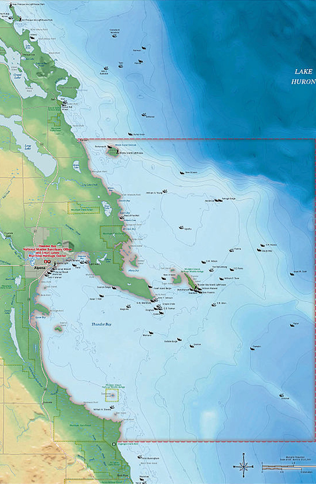
 This week’s Record of the Week brings us to Thunder Bay, Michigan. Thunder Bay in Lake Huron is famous for being in one of the most dangerous locations for sailors and earned the nickname “Shipwreck Alley.”
Township 31 North Range 8 East of the Michigan Meridian was approved by Surveyor General Ezekiel S. Haines on February 12, 1841. As the story goes, Haines contracted four deputy surveyors to survey areas of Alpena and Cheboygan counties as well as Presque Isle. The surveyors departed Detroit in the spring once waters were navigable and traveled by steamship to Presque Isle just north of this survey.
One of those surveyors was John Hodgson, who was assigned to begin in Township 31 North Range 4 East. From there, he and his team worked their way east to the shore of Lake Huron where they surveyed this Range 8 East.
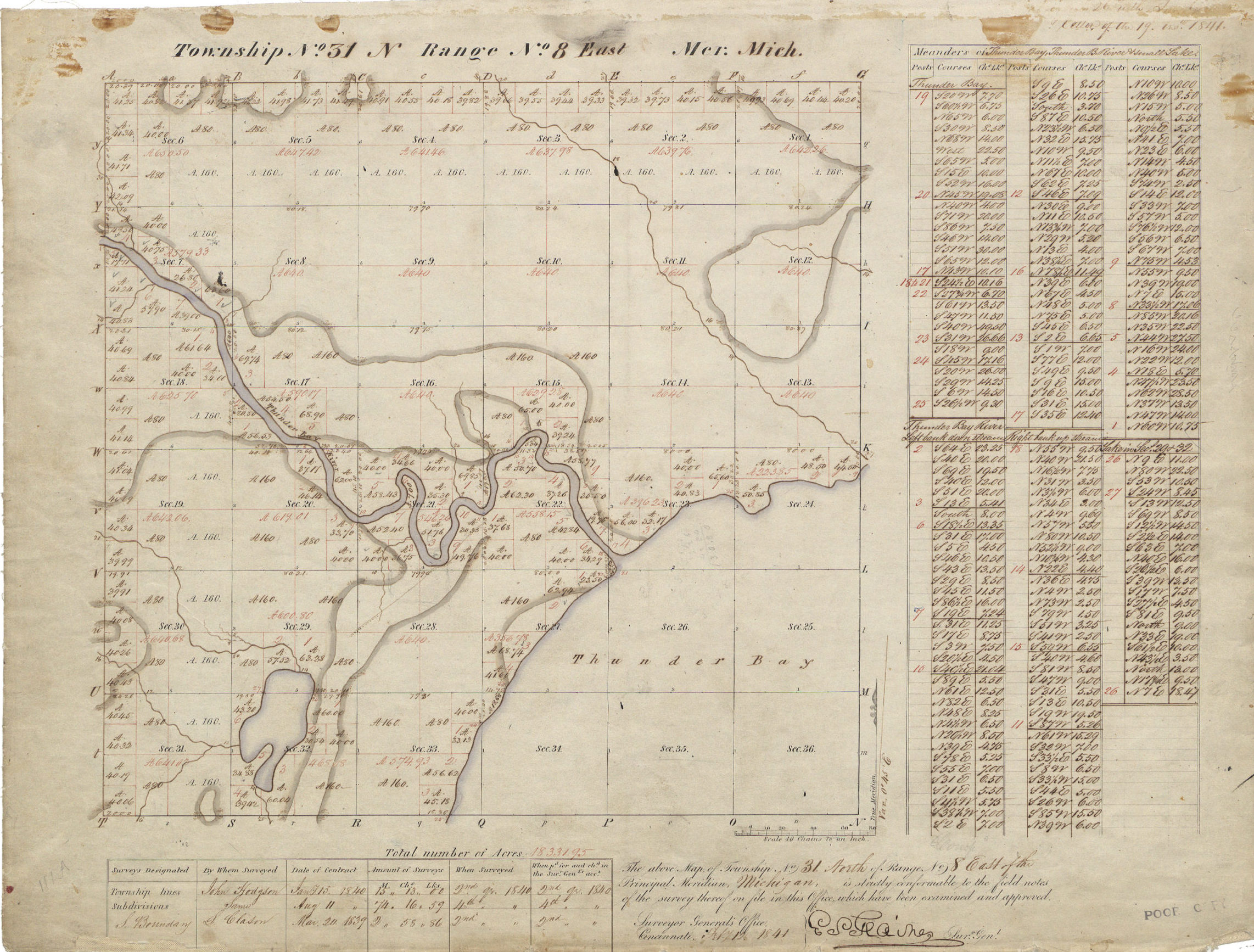 While surveying the area around “Thunder River” seen here, the surveying team encountered the Thunder Bay band of local Indians. They were not welcomed warmly at first, but once the team’s compass-man began to speak their language, the locals permitted the crew to continue their surveys and even fed them a dinner of boiled sturgeon.
The twisted nature of the Thunder Bay River resulted in the creation of numerous government lots. Seen here notated in red ink, government lots are often created as a result of meandering rivers such as this and contain acreages that are irregular from standard sections.
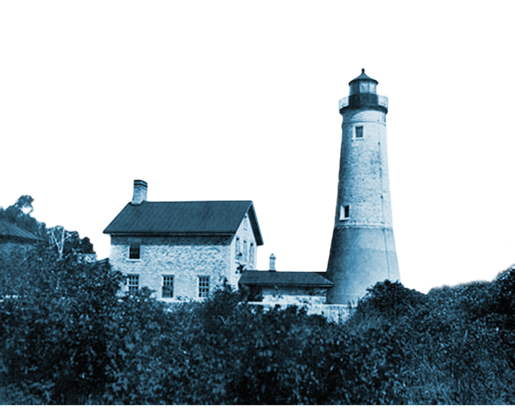 This part of Lake Huron is known as “Shipwreck Alley” for good reason; nearly 100 shipwrecks can be found in the waters surrounding Thunder Bay. To help ships navigate the rocky shores and reefs of the bay in dangerous weather, a lighthouse was constructed on Thunder Bay Island in 1832. In 1846, the first store in Alpena County was built here. That same year the community of 160 people harvested 12,000 barrels of fish.
Today, Thunder Bay Marine Sanctuary is the United States’ only freshwater marine sanctuary.
Explore an interactive map https://bit.ly/3wI57JF created by the National Oceanic and Atmospheric Administration and view all of the known shipwrecks in the Thunder Bay area.