March 22, 2021 – Rome, NY- “Down to Earth,” a surveying reality series that shows how real surveyors collect data and turn it into real deliverables, despite challenging conditions, rugged terrain and hidden dangers, is set to premiere 3 new construction oriented episodes Wednesday, March 31, 2021. Viewers can register to watch at either 9am ET, 6pm ET, or 9am CET at the following link: CLICK HERE
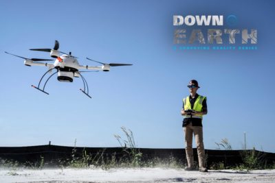
The next 3 episodes of Down to Earth, venture into “Cougar Country” where we join the Southwestern Florida Cougar Companies as they use Drone LiDAR Surveying Equipment to provide more detailed topographic surveys. However, they have to contend with the unpredictable Florida weather as they try to collect data, confirm fill quantities, and stay on budget. Watch as the Cougar Companies fly ahead of their competition and use drone LiDAR technology to provide a more thorough picture of sites both pre and post-construction.
This premiere will feature the 3 episodes of Down to Earth, Cougar Country, along with exclusive behind-the-scenes mission planning, data capture and analysis of the final deliverables narrated by the professionals involved in the project.
The first episode introduces Adam Murphree, Director of Technology for Cougar Companies, and explains how he’s using drone Lidar Technology to the companies’ advantage.
“Drone LiDAR gives you the ability to get through trees and still get data from the surface, and it does it in a fraction of the photogrammetry processing time,” Murphree said. “That’s huge. A dataset that might take half a day to process with photogrammetry is done in 10 to 15 minutes with LiDAR.”

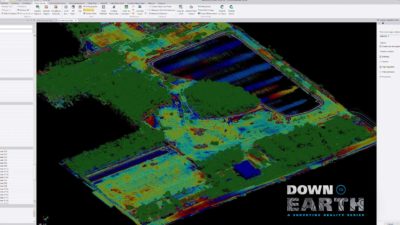
Data collected helps to visualize a LiDAR point cloud of the Construction site to help calculate fill quantities.
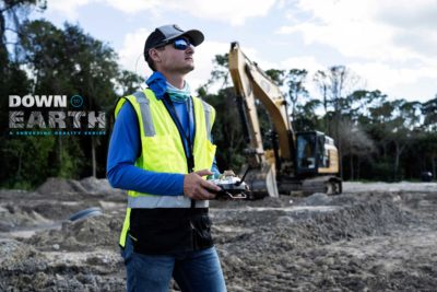
For Episodes 2 and 3 you’ll follow Adam as he contends with heavy equipment, active construction sites and the gusty winds of Florida to get the job done.
“These next episodes of Down to Earth show how the Cougar Companies are taking advantage of drone Lidar technology to not only be more efficient, but to win more projects and grow their business,” said Microdrones Marketing Director Bret Burghdurf. “Being on site at the various construction jobs give you a much better sense of the scope and size of the projects that the Cougar Companies are dealing with and how drone surveying equipment from Microdrones gives them an edge on their competition. But, producing these episodes definitely wasn’t a breeze, thanks to some blustery conditions. Dealing with the Florida weather made for some exciting episodes of Down to Earth.”
Find out if the Cougar Companies can deliver in circumstances that try even the most experienced pilots.
About Microdrones
Microdrones grew out of the collaboration between the German inventor of the world’s first commercial quadcopter and a determined surveying payload and software developer in North America. The result is a global aerial mapping technology company that delivers complete and reliable mapping systems specifically developed for the surveying, mining, construction, oil & gas and precision agriculture industries. Microdrones Integrated Systems are industrial tools addressing specific complex mapping challenges for professional customers, relying on a fully integrated geospatial workflow that enables cutting-edge software technology from Microdrones to transform raw data collected in the field by Microdrones survey equipment into valuable high-quality survey-grade data. Microdrones is widely recognized for its LiDAR technology leadership. Microdrones has engineering centers and manufacturing facilities in Germany, Canada, France, China and the United States, as well as a sales, support and distribution network spanning six continents. Microdrones serves markets around the globe. To learn more about Microdrones, visit www.microdrones.com or follow @Microdrones on Facebook, LinkedIn, or Twitter.


