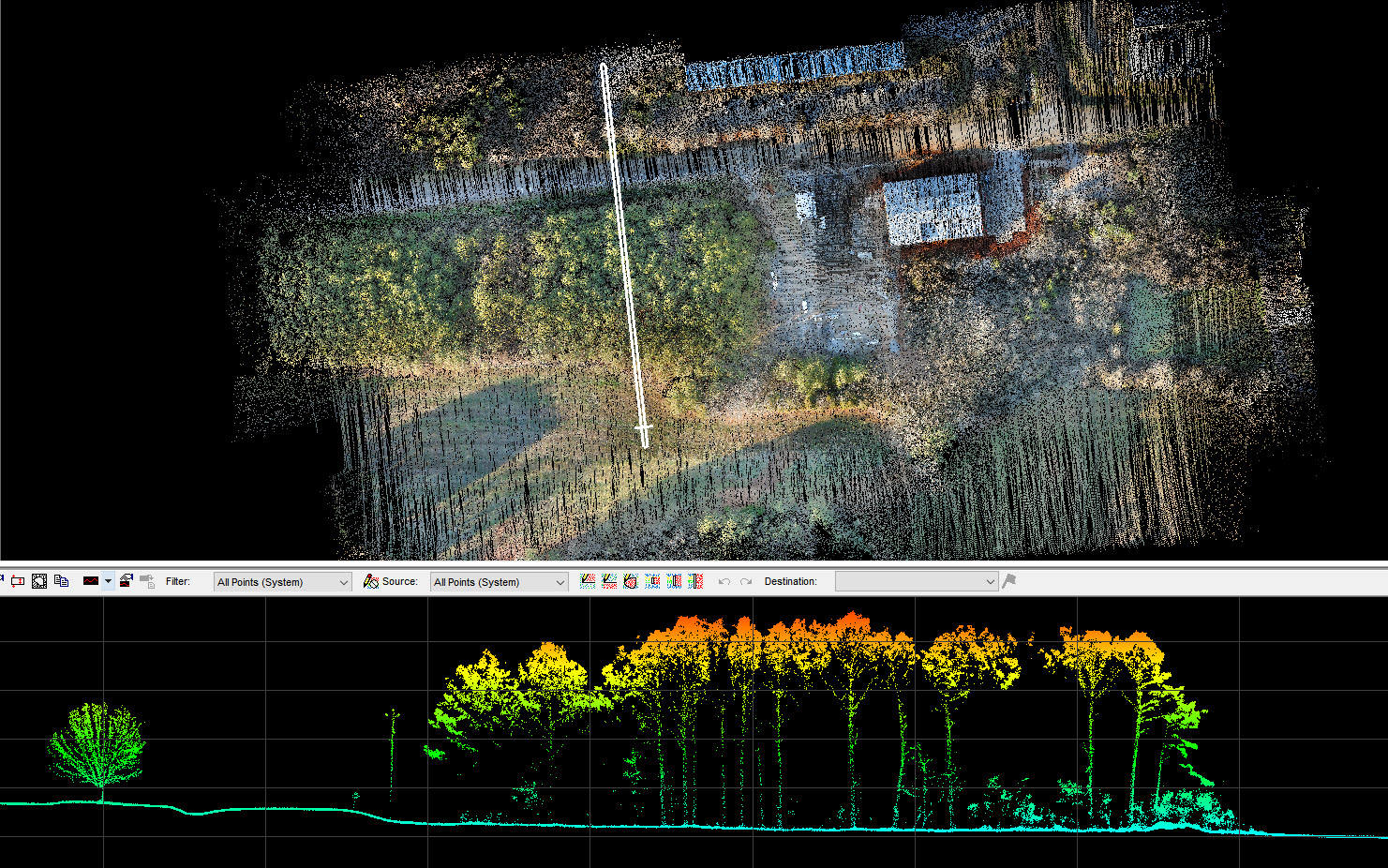
True View 515 Ground Image_ fly height 75 m AGL
Huntsville, AL – February 10, 2021 – GeoCue Group announces the release of their latest addition to their 3D Imaging Systems (3DIS®) series, the True View® 515. This compact, affordable 3D Imaging System has significantly better sensitivity compared to other sensors in its class, resulting in remarkable analytic data. True View 515 will redefine LIDAR wire extraction and dense vegetation penetration applications for all-purpose sensors. GeoCue is excited to bring this state-of-the-art 3D imaging system to the market.
GeoCue changed the drone LIDAR/Imaging market in 2019 with the creation of a 3D Imaging Sensor/System approach to drone mapping. Unlike conventional drone LIDAR systems with tacked on cameras, a True View 3DIS® couples a laser scanner with tightly integrated and calibrated photogrammetric cameras. The included post-processing software generates RGB colorized point clouds from the source images. Unlike the flat colorization from ortho images seen in other systems, the True View 3DIS® renders 3D colorization for spectacular, high accuracy data sets.
GeoCue’s True View 515 is unlike any sensor in its class. The True View 515 series is an all-purpose grade 3DIS® designed for small Unmanned Aerial Systems. The system includes full post-processing software that generates a ray-traced 3D colorized point cloud and geocoded images. GeoCue’s True View 3DIS®product series is an inclusive hardware and software offering providing users with a complete acquisition to deliverables workflow.
“Our True View 410 3DIS® has created a new standard for fused LIDAR and imagery in an affordable, easy to use package and our RIEGL miniVUX-based systems are really the best available drone sensors for survey grade projects ” said Lewis Graham, President/CTO of GeoCue. “However, in discussions with our customers, we kept hearing about the gap between these two products; clients wanted to collect transmission wires and see through heavy vegetation and would accept accuracies/precision slightly below survey grade. After testing many high beam count sensors, we were able to achieve spectacular results with the True View 515 configuration. There is simply no drone LIDAR/Imaging system under $100,000 that will produce data comparable to the True View 515.”
True View 515 3DIS® is equipped with Hesai’s PandarXT-32 laser scanner integrated with dual GeoCue photogrammetric cameras and Applanix APX-15 positioning system. The True View product line gives surveyors and mappers the ability to collect and deliver high quality data. These deliverables are generated using workflows and tools within the included True View EVO post-processing software.
Examples of derived products include break line enforced models, profiles and cross sections, topographic contours, volumetric analysis, classified ground model and more. Every True View 3DIS® includes all the software needed to flow from raw collected data to product deliverables; True View EVO, Applanix POSPac and True View Reckon post-deployment data management portal.
GeoCue’ s True View 3DIS® are designed to create point cloud data that have been colorized with Red-Green-Blue (RGB) camera data via a rigorous point by point tracing algorithm. One of the biggest advantages of a True View 3DIS™ is the speed with which these data can be produced; a 15-minute data collect can be processed to a colorized point cloud in about 10 minutes!
GeoCue invites you to their unveiling of the True View 515 in an informative webinar on February 24th @ 10AM CST as they provide their system overview and workflow demonstration with collected True View 515 3DIS® data.
The True View 515 3DIS® will be available for shipment late February 2021. GeoCue Australia and designated resellers are readily available to assist and deliver your True View 3DIS® needs. Check out GeoCue’s reseller page to find a True View reseller near you.
About GeoCue
GeoCue is the largest supplier of kinematic LIDAR processing tools in North America and LP360 is one of the world’s most widely used tools for exploiting point cloud data. In 2014, GeoCue Group started a division focused on using small Unmanned Aerial Systems for high accuracy mapping. Leveraging our expertise in production, risk reduction, and point cloud processing tools, we are continuing to bring new services and products to market to provide surveyors and other geomatics professionals exciting tools for geospatial data extraction using low cost drones including our True View® drone camera and 3DIS® systems product line. To learn more, visit www.geocue.com.
