 Athens, Greece (February 1, 2021) – A two-person Astrolabe Engineering survey team using a single SP60 GNSS receiver recently completed the entire land and sea route for the world’s longest and deepest alternating current (AC) cable.
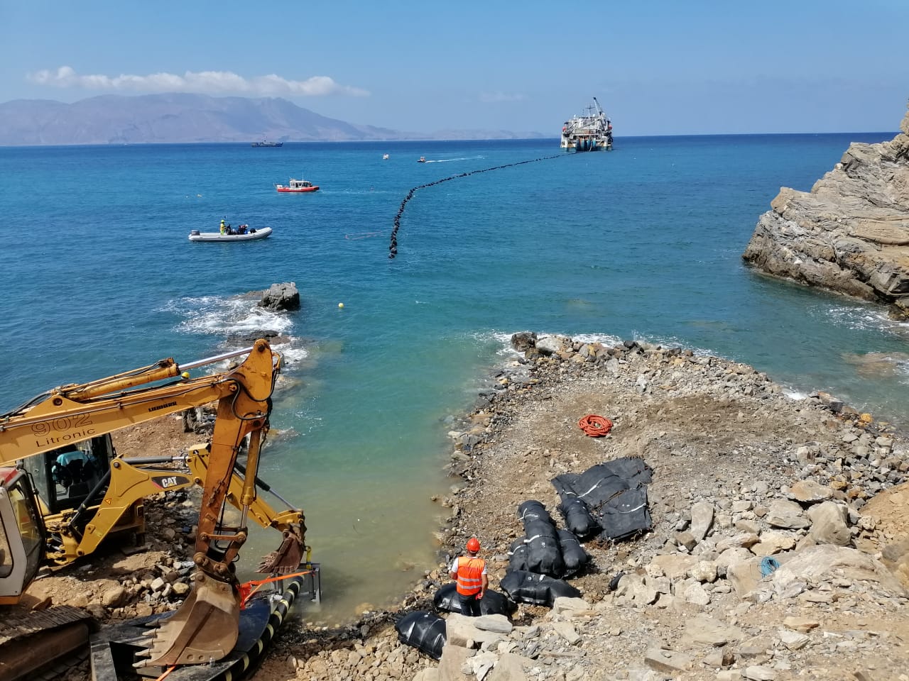
Linking the island of Crete to mainland Greece, the 174-kilometer-long interconnection, of which 132 kilometers are on the seabed, became fully functional last month. Connecting Megalopolis in central Peloponnese with Heraclion, the biggest city on the island, the cable is expected to meet more than a third of the island’s electrical power demand and enable the island to permanently close its most polluting power plants.
 The European Union funded project, managed by Independent Power Transmission Operator (IPTO), selected AstroLabe Engineering to perform the survey. The land portion was a topographic survey stake-out of the center line and boundaries of the corridor to be trenched as well as a topographic record of the trench depth and exact cable location in the trench. The marine portion was marked using Differential Global Positioning System (DGPS), survey lines and markers with buoys close to shore on both the mainland and Crete. During backfilling an additional topographic survey recorded the profile of the installed cable.
 Astrolabe reported the SP60 performed very well in all areas. Especially appreciated was its performance in areas with obstructions, including those adjacent to the steep slopes found in the landing areas. The versatility of the SP60 made for efficient work on land and sea. JGC Geoinformatics Systems, a Spectra Geospatial distributor, provided the SP60 and support services to Astrolabe.
About AstroLabe Engineering
Astrolabe Engineering, headquartered in Athens, Greece provides high quality consulting engineering services, for public bodies and organizations, local government organizations, as well as private bodies and companies worldwide. AstroLabe uses the SP60 exclusively for both land and marine machinery positioning guidance and surveying support.
About JGC Geoinformatics Systems
Headquartered in Athens, JGC offers the Greek market the most technologically advanced geoinformation systems to meet the high demands of the applications of modern engineering.
About the Spectra Geospatial SP60
The SP60 is an extremely versatile GNSS receiver offering a high level of flexibility to cover any demand from GIS all the way up to sophisticated RTK and Trimble RTX™ capable solutions. Combining the unique all-signals tracking and processing Z-Blade GNSS-centric technology and L-band capability for satellite-delivered Trimble RTX correction services, the SP60 receiver provides the most reliable measurements and the highest possible accuracy under any conditions anywhere in the world.
About Spectra Geospatial
Spectra Geospatial is an established brand known for delivering quality products to the survey, GIS and construction markets. Focusing on the specific needs of the conventional surveying market, the Spectra Geospatial brand offers a complete product portfolio, including Global Navigation Satellite Systems (GNSS), optical total stations, data collection hardware, field and office software, as well as a wide range of construction tools. Spectra Geospatial surveying equipment is an economical choice that utilizes advanced technologies for optimal efficiency. With convenience and reliability as the foundation of the Spectra Geospatial brand, it is an ideal choice for value. The Spectra Geospatial brand is backed with the strong technical support that users have come to expect from a quality name in surveying and construction.
