 Nairobi, Kenya (October 6th, 2020) – The Mau Forest Complex in the Rift Valley in Kenya is the largest indigenous montane forest in East Africa. A hunter-gatherer community lives sustainably in the forest. However, encroachment and illegal allocation of the forest has left large parts cleared for settlement, agricultural use and logging. This illegal activity has decimated more than a quarter of the forest complex over the last 45 years. It has greatly impacted the Mara River and Mara ecosystem that is home to the spectacular annual Wildebeest migration, an 8th Wonder of the World. To assist in efforts to remove illegal settlers and settlements and to rehabilitate the forest complex, Survey of Kenya (SOK) demarcated the Mau Forest boundaries to precisely delineate forest cut lines and solve the problem of fuzzy boundaries that have contributed to human encroachment.
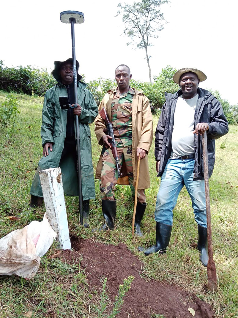
To more safely perform the survey in disputed lands and difficult hostile terrain, SOK relied on the Spectra Geospatial SP80 GNSS receiver. The multi-constellation SP80 has the speed, accuracy, low-weight and ease-of-operation that enabled the SOK survey team to work quickly and reduce survey time in disputed areas.
The SP80 with its Z-Blade technology, which allows any combination of GNSS satellite signals to be used together, delivered strong and fast signal acquisition even in the hills and valleys of the dense forest. Additional efficiency was achieved because the radio range of the SP80 often exceeded 4 kilometers. Combined with the easy-to-use interface of the MobileMapper 50 data collector and MobileMapper software, the SOK survey team was able to complete the work and swiftly exit dangerous areas. On a very tight schedule during June and July, the SOK team staked and placed boundary beacons at 100-meter intervals over more than 30 kilometers.
“The impressive performance of the SP80 in this application is exciting and made even more so since its successor, the SP85, features 600 channels — fully two and a half times more channels for even greater speed” said Jarret Fraser, Spectra Geospatial product manager.
Oaker Services Ltd. provided the SP80 and MobileMapper 50 sales support and technical training to the SOK survey team.
About Survey of Kenya
Survey of Kenya (SOK) is the common name for the Department of Survey, which is the official agency of the government of Kenya on all matters affecting land surveys and mapping.
About Oakar Services Ltd.
Oakar Services Ltd. is the Spectra Precision distributor serving Eastern Africa with headquarters in Nairobi. Oakar Services provides comprehensive after-sales support and training ensuring clients optimize usage of their hardware investment.
About the SP80 GNSS Receiver
The SP80 GNSS receiver is a powerful, rugged and easy-to-use system designed for everyday surveyors. The SP80’s Z-Blade GNSS-centric technology delivers fast and reliable GNSS positioning utilizing all available GNSS signals to produce the optimal solution even in challenging environments. GPS-only, GLONASS-only or BeiDou-only positioning modes are available when necessary. The SP80 has most recently been succeeded by the even more powerful SP85.
About the Mobile Mapper 50
The Mobile Mapper 50 has most recently been replaced by MobileMapper 60. The MobileMapper 60 runs the latest Android™️8.0 and features a 2.2 GHz processor, 4 GB of memory and 64 GB of storage.
About Spectra Geospatial
Spectra Geospatial is an established brand known for delivering quality products to the survey, GIS and construction markets. Focusing on the specific needs of the conventional surveying market, the Spectra Geospatial brand offers a complete product portfolio, including Global Navigation Satellite Systems (GNSS), optical total stations, data collection hardware, field and office software, as well as a wide range of construction tools. Spectra Geospatial surveying equipment is an economical choice that utilizes advanced technologies for optimal efficiency. With convenience and reliability as the foundation of the Spectra Geospatial brand, it is an ideal choice for value. The Spectra Geospatial brand is backed with the strong technical support that users have come to expect from a quality name in surveying and construction.
