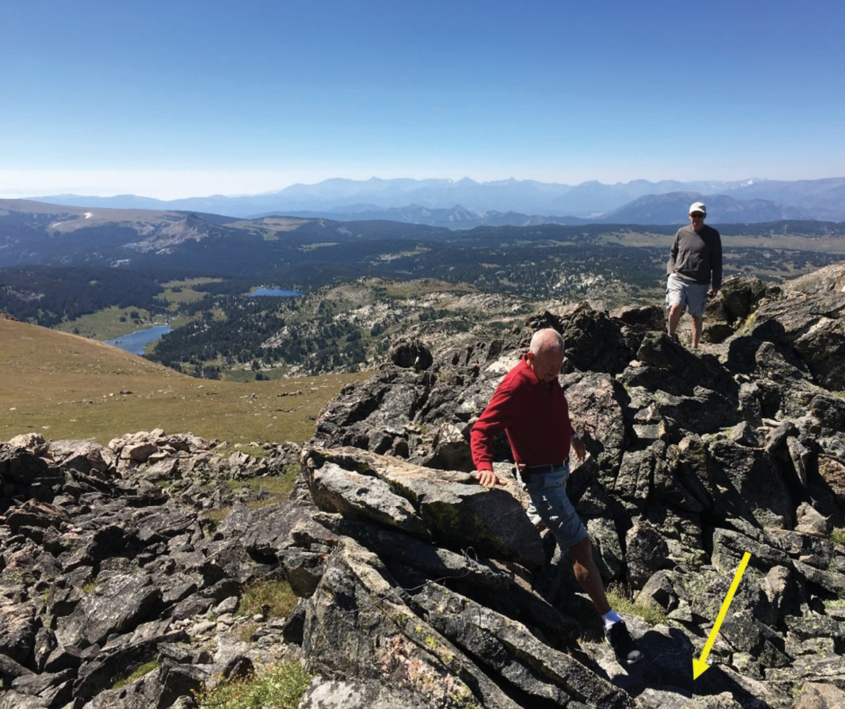
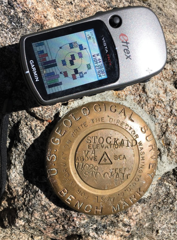
Members of America’s Boating Club recover marker STOCKAID (PID PX 0413, left) on an unnamed peak located in Beartooth Wilderness, Wyoming. The mark is at elevation 11029 feet and was last reported on in 1947 when it was monumented.
The National Geodetic Survey defines the official geodetic datums for all federal mapping activities in the U.S. and its territories as part of the National Spatial Reference System (NSRS). NGS, in an effort to maintain updated records on more than 800,000 marks around the country, encourages the public to submit current recovery information on the geodetic marks.
 The most likely source of these recoveries would be from the public sector who uses the information, such as the surveying profession. Over the past few years an unlikely ally has emerged to provide recovery information to NGS. This ally is America’s Boating Club®. One may ask why this is an unlikely ally to NGS. America’s Boating Club is just that. An organization promoting safe boating by providing educational courses to the public. The only link to using the geodetic markers would be for tidal markers used in providing tide information to boaters. However, one aspect of America’s Boating Club is to provide community services. As a National organization the membership covers the entire country including Puerto Rico.
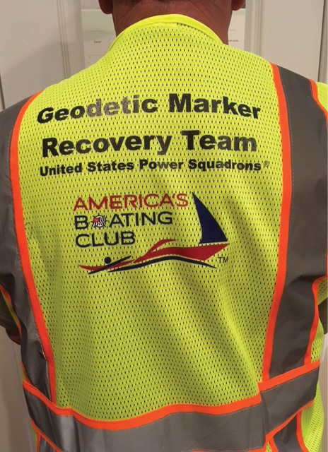
Member-designed safety vest.
The Geodetic Mark Recovery program is part of the organization’s Cooperative Charting program. This program encourages members to search for and recover geodetic markers to be filed with NGS to update the database. The National Cooperative Charting committee has established Standard Operating Procedures (SOP) for the program. These procedures provide the guidance and instructions for the members on how to participate in the program. Members are instructed on how to search the database for markers in their areas, recover the datasheets, organize the search, and record the information for processing. To control the quality of the information submitted to NGS the National Committee has also established various procedures for the members to follow.
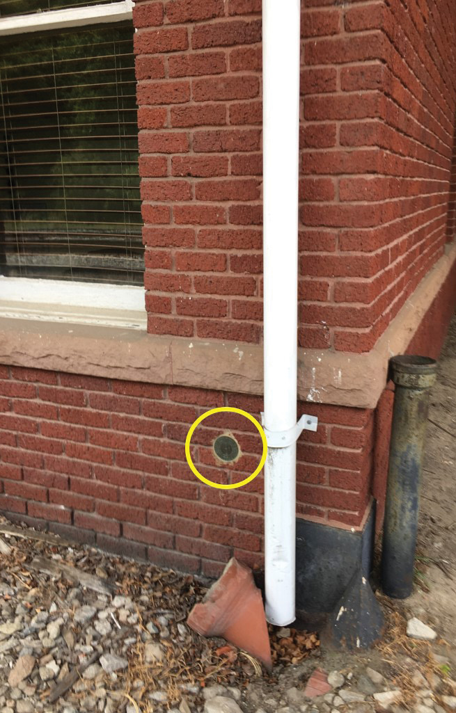
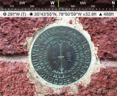
APEX RM (PID EZ 6068 below) located in wall of old Apex Railroad Station now Apex Chamber of Commerce in Apex, NC. Marker was originally set in 1918.
Members are instructed to use one of various methods to find marker datasheets in their area of search. The most used method is to search on the National Geodetic Survey Data Explorer. The committee also has found other useful websites and apps for cell phones that will provide the marker history. Once this data is obtained the member organizes his field search using a form to keep notes of the recovery. An important part of the search procedure is the requirement the member obtain a photograph of the recovered mark or of the reported location if the mark is not recovered. Per the established SOP this photograph must include a time and date stamp on the date the observation was made. In addition, the photo must contain the latitude and longitude of the mark. This information may either be displayed on the photo or embedded in the photo properties. This information is used by the reviewing committee member as a check the member was at the correct location and on the date the recovery was made. Although most of the methods used to obtain this photo (photo of mark next to handheld GPS or cell phone photos) does not provide sufficient accuracy for surveyors it may provide more accurate location than that scaled from the quad sheets. It is important to note America’s Boating Club does not recommend location information be revised based upon our recovery information. This information is provided to allow NGS to determine if the data sheet needs appropriate updating.
 When the member has completed his recovery, the information is entered into a website form designed by the National Committee specifically for Geodetic Recovery. This site and information are for internal use by the committee to review the information on the recovery prior to submittal to NGS. If the data is incomplete or there are questions on the recovery the form is returned to the observer for corrections. Once the data has been determined to be acceptable by the reviewing committee member the information is uploaded by the committee member to NGS. The committee member also has the option to upload the photos if deemed to be of value to NGS. After uploading the recovery information, the committee member will issue credits for the recovery base upon procedures developed for the program. These credits are based upon date of last recovery and if the mark was previously not recovered. Participating members achieve Honor Roll status based upon specific established criteria. The top individuals are also recognized for their achievements.
Since the program started in 2016 to the end of the 2019 calendar year America’s Boating Club members have submitted recovery information on over 8800 Geodetic Marks. The organization takes great pride in providing this public service to assist in the maintaining and updating the National Geodetic Survey database for the future. ◾
Jim Strothers is a Professional Engineer and Professional Land Surveyor residing in Ft. Myers, Florida. As a member of America’s Boating Club of Sanibel Captiva Jim currently serves as Assistant Chairman of the National Cooperative Charting Committee.
America’s Boating Club® is a registered trademark of the United States Power Squadrons®